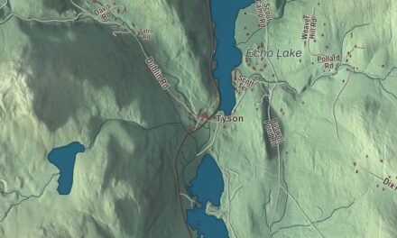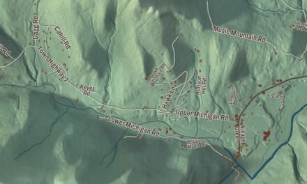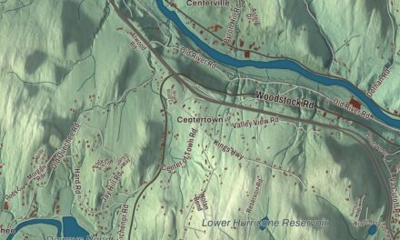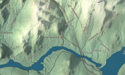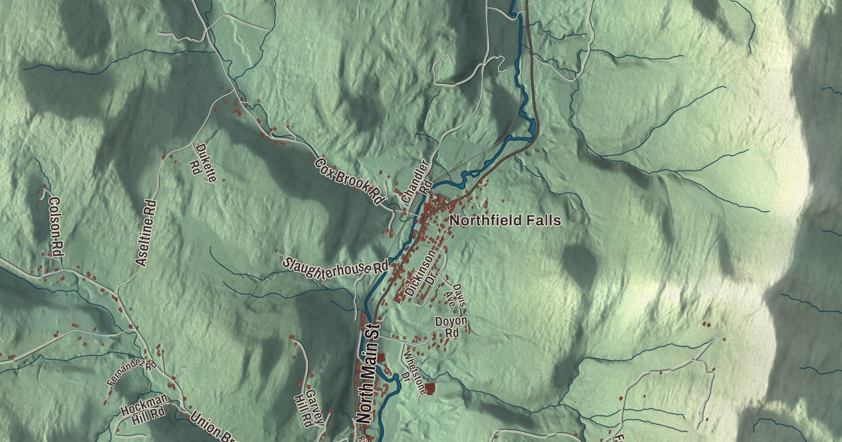
Northfield lies in a valley in the Green Mountains, home to Norwich University since 1866 and to five covered bridges, three of them within a quarter mile on one road. This map prints South Main Street, East Roxbury Road, North Main Street, Main Street, Pearl Clark Road and Rabbit Hollow Road, with Northfield Falls and Northfield Center.
Northfield is a town in Washington County, Vermont.
KNOWOL made this map in 2026 from public survey data and gave it the look of an old county atlas, shading the hills from United States Geological Survey elevation data and drawing the roads and town line from the Census Bureau. The town covers 43.6 square miles, and 5,918 people lived here at the 2020 census, more than half of them in the village of Northfield. The geographic center of Vermont lies inside the town, and markers for the geographical and magnetic centers stand on the university campus. Click here to purchase a print of this map for your wall.
Four villages
Vermont granted the town on November 6, 1780, and chartered it on August 10, 1781, naming it after Northfield, Massachusetts. Yankees from Connecticut, Massachusetts and older Vermont towns settled it between 1785 and the 1820s, and the town organized on March 12, 1794; it belonged to Orange County until Washington County was formed in 1811, and Amos Robinson was its first representative, from 1801. Four villages grew up. South Village, with its many small businesses, was the first to have an identity of its own. Center Village followed, with the first post office, the town clerk’s office and the churches, and became the town’s social and political center. Factory Village, named for the woolen mill, came next and is now the village of Northfield, and Northfield Falls was doing well by the late 1820s.
The Paines and the railroad
Potash making thrived until about 1814, and then Elijah Paine’s woolen mill became a major employer. His son Charles Paine ran the mill until it burned in 1848, built Paine’s Meeting House for the mill workers in 1835, and served as governor of Vermont from 1841 to 1843. As founder and first president of the Vermont Central Railroad, Charles Paine put its headquarters in his hometown of Northfield despite the hilly ground, and engines and cars were built and repaired in its yard; in the early 1850s the railroad changed hands and its headquarters moved to St. Albans. The railroad’s arrival in the 1840s had made Factory Village the local hub, and its residents petitioned the legislature for a village of their own, incorporated on November 14, 1855. The brick depot on Depot Square, built in 1852, is believed to be the oldest surviving railroad station in the state. Across South Main Street, which is Route 12, the four-story Mayo Building of 1902, built for Dr. William B. Mayo, a physician here for 50 years, is the tallest building in the business district. Charles Paine’s home, at 75 South Main Street, now holds the Northfield Historical Society and connects to the Brown Public Library.
Slate, granite and socks
Slate quarrying gave the town a lift in the 1860s and 1870s. The first granite shed went up in 1889, more followed, and by the outbreak of World War I more than 525 people worked in the granite sheds; by 1954 only the Rock of Ages plant was left, and the last plant, Cetrangolo Finishing Works, closed in 1999. In 1978 Marc Cabot bought and rebuilt a vacant mill in Northfield for Cabot Hosiery Mills, which began making its Darn Tough socks in 2004 and had about 200 workers by 2016. The weekly Northfield News and Transcript was founded in 1878 by George Richmond.
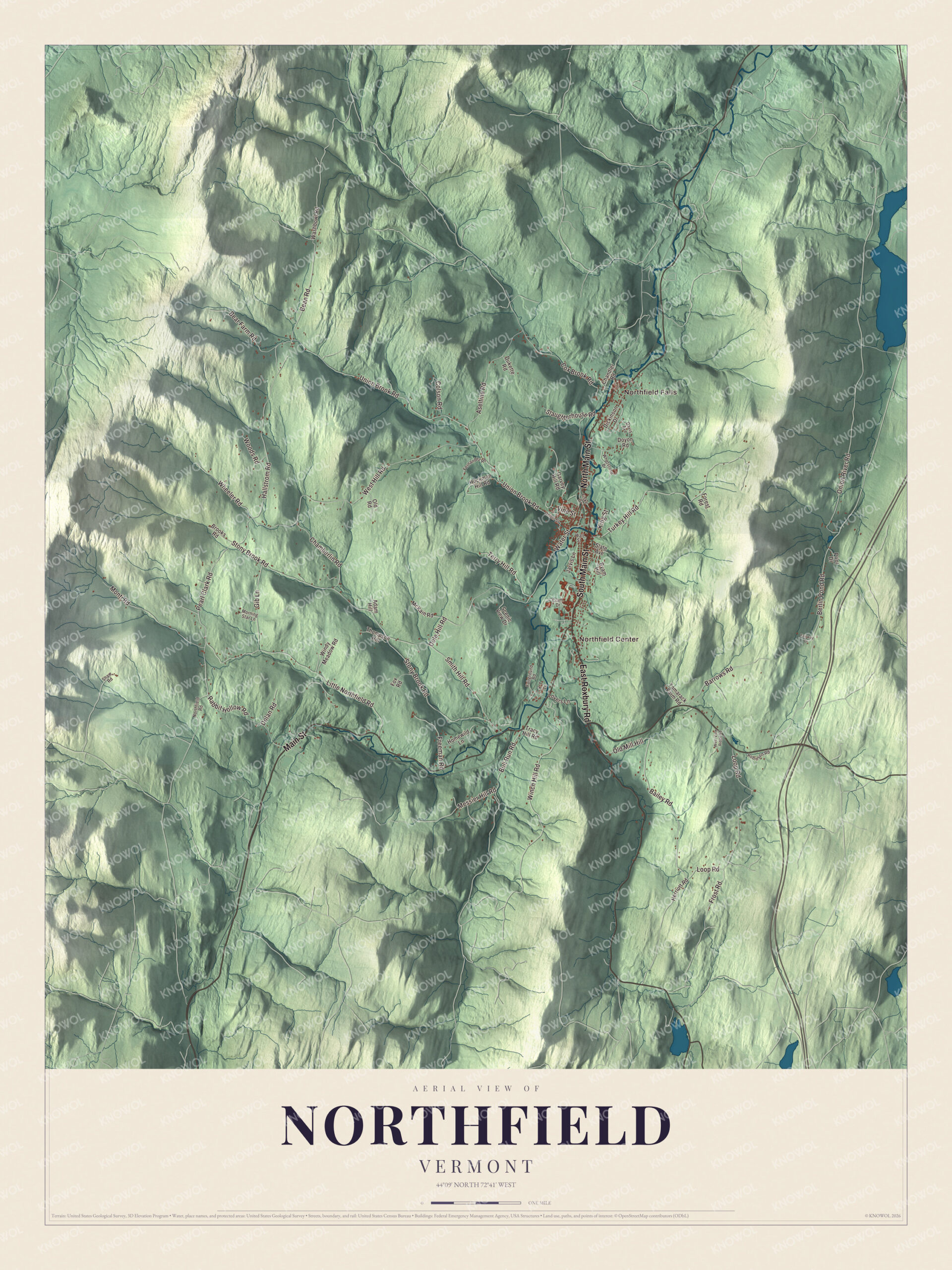
Click to explore a larger preview. The digital watermark does not appear on printed maps.
Names on this map
These names are printed on this map.
Places: Northfield Falls and Northfield Center.
Streets and roads: South Main Street, East Roxbury Road, North Main Street, Main Street, Pearl Clark Road, Rabbit Hollow Road, Bean Road, Bailey Road, Loop Road, Frost Road, Berlin Pond Road, Union Brook Road.
More street names, A to Z
Adam Hill, Aseltine Road, Barrows Road, Bear Farm Road, Brooks Road, Bull Run Road, Byam Hill, Chamberlin Road, Chandler Road, Colson Road, Cox Brook Road, Cram Drive, Davis Avenue, Dickinson Drive, Dolan Road, Dole Hill Road, Doyon Road, Dukette Road, Fairground Road, Fairway Drive, Fernandez Road, Fiske Drive, Forest Road, Fox Road, Freeman Road, Garvey Hill Road, Gib Lane, Hallstrom Road, Herriott Road, Hockman Hill Road, Homewild Lane, Jarvis Lane, K-T Lane, King Street, Little Northfield Road, Lovers Lane, McKain Road, Messier Hill Road, Monti Road, Morning Star Lane, Northfield Road, Old Mill Hill, Old Road, Onion River Road, Prior Drive, Robinson Road, Scenic View Drive, Shaw Road, Slate Avenue, Slaughterhouse Road, Smith Hill Road, Stony Brook Road, Tamarack Farm Road, Terry Hill Road, Thompson Hill, Tracy Hill Road, Turkey Hill Road, Union Street, Vine Street, Wall Street, Washbowl Road, Water Street, West Hill Road, West View Ridge Road, Wheeler Road, Whetstone Drive, Winch Hill Road, Windy Meadow Road, Woods Road.
See it on a wall
The Northfield map as a framed print. Swipe for more.


Norwich University
Norwich University moved to Northfield in 1866, after a fire destroyed its old barracks in the town of Norwich, and Northfield welcomed the struggling school. Its first building here, Jackman Hall, is named for Alonzo Jackman, a Norwich professor and a general of the Vermont militia during the Civil War, who died at his Northfield home in 1879. Dewey Hall, finished in 1902, honors Admiral George Dewey, who studied at Norwich from 1852 to 1854. The university is the oldest of the six senior military colleges, the Department of Defense recognizes it as the “Birthplace of ROTC,” and in 1974 it began admitting women to its Corps of Cadets, two years before the federal service academies did. It’s the town’s largest employer.
The covered bridges
Three of the town’s five covered bridges stand within a quarter mile of one another on Cox Brook Road near Northfield Falls. The Northfield Falls Covered Bridge, also called the Station Covered Bridge, carries the road across the Dog River on a Town lattice truss 137 feet long, built in 1872. Just a few hundred feet west, the Lower Cox Brook Covered Bridge of about 1872 crosses Cox Brook, and its page calls this the only place in Vermont where you can see a historic covered bridge over one stream from another over a different stream. The Upper Cox Brook Covered Bridge, a queen post truss, is the westernmost of the three. The Slaughterhouse Covered Bridge of 1872 crosses the Dog River on a dead-end road just outside Northfield Falls, and in the south of town the Stony Brook Covered Bridge of 1899, also called the Moseley Covered Bridge, is believed to be the last king post truss bridge built in Vermont’s historic covered bridge era. Near South Northfield, at Route 12 and Lovers Lane, the Old Red Mill of 1898 still holds a nearly intact water-powered grain mill.
Northfield people
Frank Plumley practiced law in Northfield and was elected to Congress in 1909, and in 1905 France and Venezuela chose him as umpire of their mixed claims commission, which sat in Northfield. His son Charles A. Plumley, born in Northfield, graduated from Norwich in 1896, ran the town’s schools, later served as a president of Norwich University, and represented Vermont in Congress from 1934 to 1951. Ida A. T. Arms, born in Northfield in 1856 and schooled here, went to Chile as a missionary, served as principal of Concepción College and led the Woman’s Christian Temperance Union there, and she’s buried in Elmwood Cemetery.
On the map, start at Northfield Falls and Northfield Center, then follow South Main Street, East Roxbury Road, North Main Street, Main Street, Pearl Clark Road and Rabbit Hollow Road across town. Northfield dates to 1781.
This map of Northfield is made for everyone who calls Northfield home, and it shows the town as it looks today, from Depot Square to the bridges at Northfield Falls. Hang it in an office, library or den, or use it to teach children the geography and history of their town. It’s printed on museum quality archival paper. Zoom in on the preview above to explore the details, then click here to get your copy of the Northfield, Vermont map.

Sources
- Northfield, Vermont, Wikipedia
- Town histories and representatives, N towns, Vermont Legislature
- Charles Paine, Wikipedia
- Elijah Paine, Wikipedia
- Northfield station (Vermont), Wikipedia
- Mayo Building (Northfield, Vermont), Wikipedia
- Cabot Hosiery Mills, Wikipedia
- Norwich University, Wikipedia
- Alonzo Jackman, Wikipedia
- Northfield Falls Covered Bridge, Wikipedia
- Lower Cox Brook Covered Bridge, Wikipedia
- Upper Cox Brook Covered Bridge, Wikipedia
- Slaughter House Covered Bridge, Wikipedia
- Stony Brook Covered Bridge, Wikipedia
- Old Red Mill, Wikipedia
- Frank Plumley, Wikipedia
- Charles A. Plumley, Wikipedia
- Ida A. T. Arms, Wikipedia