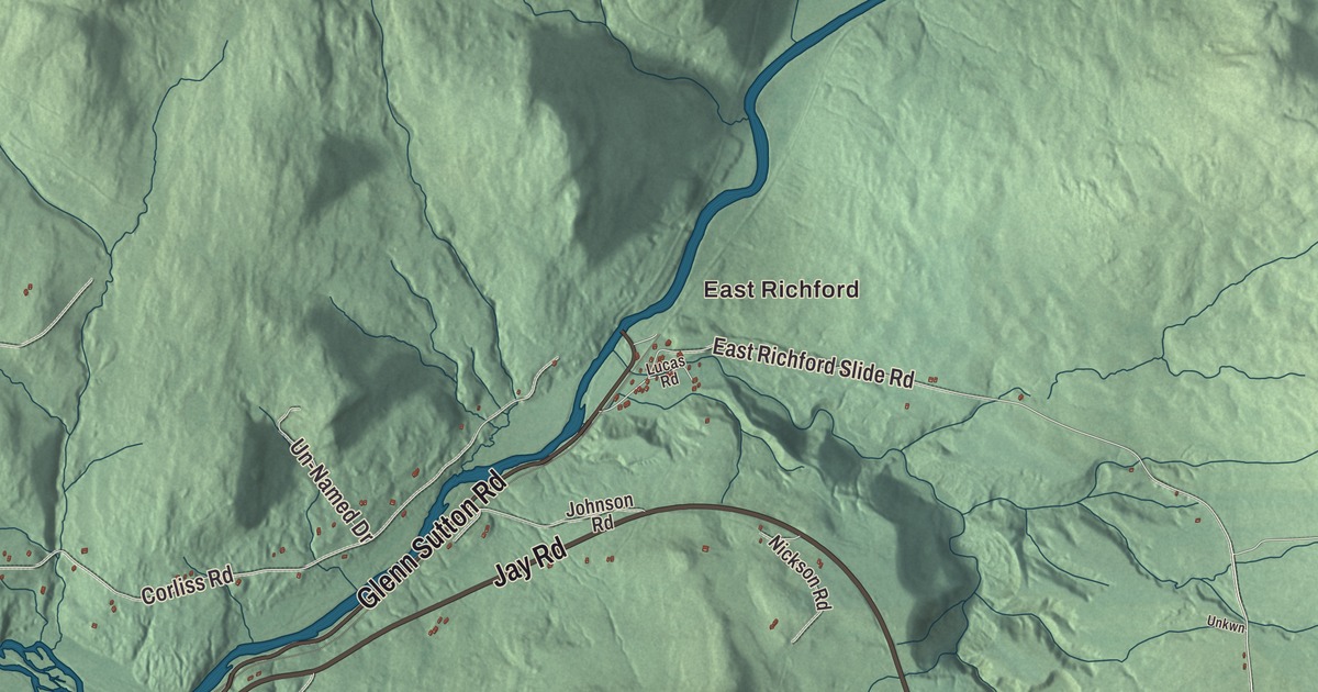
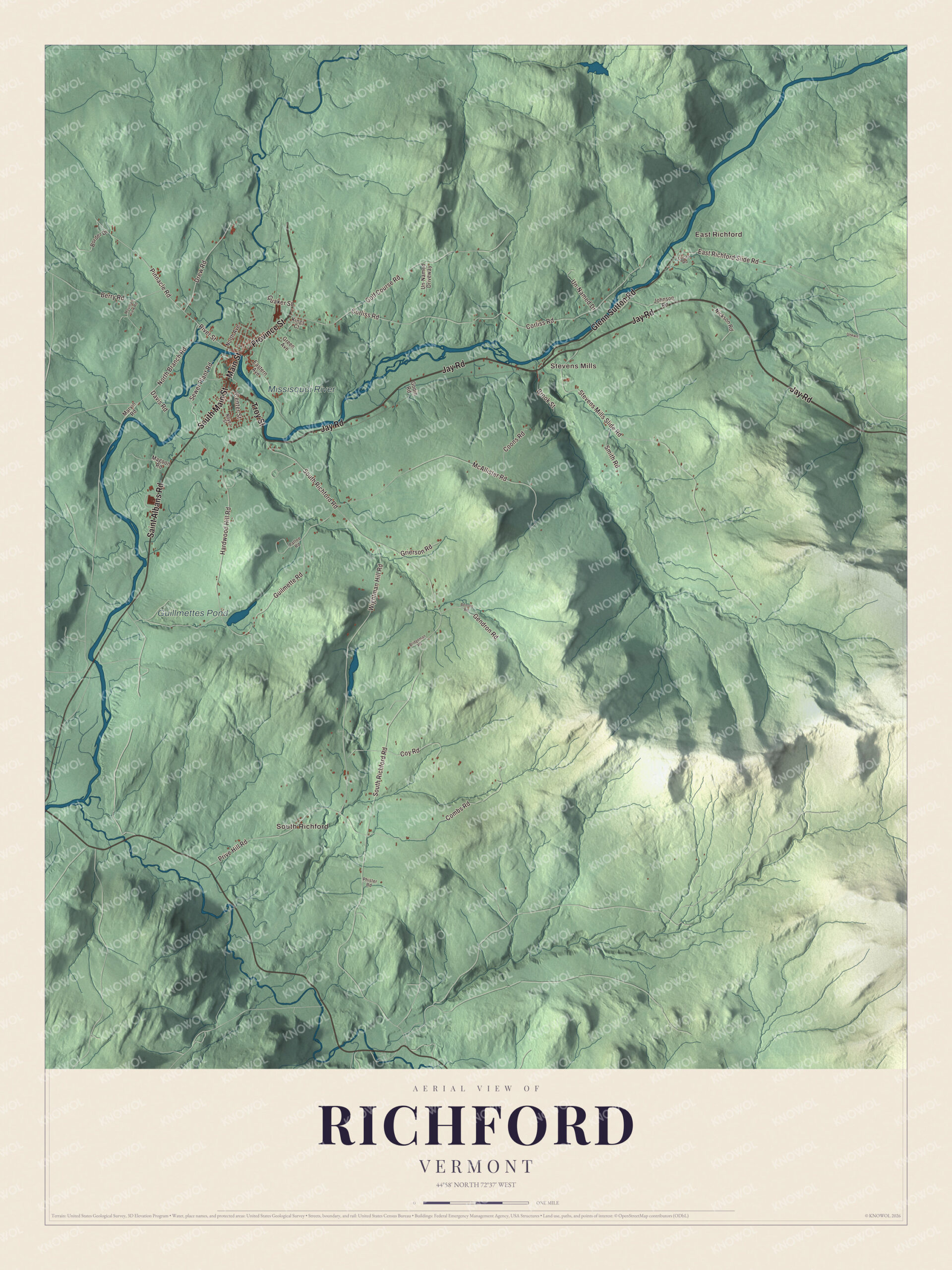
Richford sits on the Quebec border where the Missisquoi River comes back into Vermont, and its village grew up around the falls, with Main Street crossing the river and Province Street heading north to the border. This map prints Main Street, Province Street, Troy Street, Jay Road, Saint Albans Road and Glenn Sutton Road, with East Richford, South Richford, Stevens Mills, Guillmettes Pond and the Missisquoi River.
Richford is a town in Franklin County, Vermont.
KNOWOL made this map in 2026 from public survey data and gave it the look of an old county atlas, shading the hills from United States Geological Survey elevation data and drawing the roads and town line from the Census Bureau. The town covers 43.3 square miles, and 2,346 people lived here at the 2020 census. Click here to purchase a print of this map for your wall.
Mills at the falls
Vermont granted Richford on March 13, 1780, and chartered it that August 21. Benjamin Barnet went to the legislature for the town in 1796, and Richford organized on March 30, 1799. The village grew up in the late 1790s around a series of falls on the upper Missisquoi, where the first settlers built sawmills and gristmills. In the 1850s lower tariffs on trade with Quebec opened a market for the area’s goods and brought French-speaking immigrants, and Richford became a commercial and industrial center for the region, with the mills on the south side of the falls and the stores on the north. The Central Vermont Railway’s line to Richford was built in the 1870s as the Missisquoi Railroad.
The Downtown Richford Historic District, listed in 1980, is centered where Main Street meets River Street, with brick commercial blocks built between 1880 and 1920 in Italianate and Queen Anne styles. Main Street crosses the river on a pony truss bridge of 1928, which replaced a crossing washed away in 1927, and on the south bank stand the concrete block factory buildings the Sweat-Comings Company built in 1908. On River Street, at number 122, the Sheldon Boright House, also called Grey Gables, was built around 1890 for a Canadian-born businessman from a Palliser pattern book design; its page says it may be the only house built from a design shown on the cover of one of that company’s books. A block north of the business district, St. Ann’s Episcopal Church went up in 1883 facing Town Street and was turned ninety degrees in 1903. The brick Richford Primary School of 1903 on Intervale Avenue taught children until 1968, and on Intervale Street the photographer F. W. Wheeler built a Queen Anne duplex in 1904.
Click to explore a larger preview. The digital watermark does not appear on printed maps.
Names on this map
These names are printed on this map.
Places: East Richford, South Richford, Stevens Mills, Guillmettes Pond and Missisquoi River.
Streets and roads: Province Street, Troy Street, Jay Road, Main Street, Saint Albans Road, Glenn Sutton Road, South Main Street, River Street, Pinnacle Road, North Branch Road, East Richford Slide Road, Wightman Hill Road.
More street names, A to Z
Benson Road, Berry Road, Border Drive, Bridgeman Road, Brook Street, Center Street, Combs Road, Coons Road, Corliss Road, Coy Road, Davis Road, Drew Road, Eastern Avenue, Gendron Road, Godin Road, Golf Course Road, Green Avenue, Grierson Road, Guilmette Road, Hardwood Hill Road, Johnson Road, Kings Court, Lucas Road, Magoon Road, Marvin Road, McAllister Road, Mountain View Road, Nickson Road, North Avenue, Noyes Street, Pattee Road, Phister Road, Prive Hill Road, Quaker Street, Sewer Plant Road, Smith Road, South Richford Road, Stevens Mills Slide Road, Un-Named Drive, Un-Named Driveway, Unkwn.
See it on a wall
The Richford map as a framed print. Swipe for more.


Two border crossings
Route 139 runs north from the village as Main Street and Province Street to the Richford-Abercorn crossing, where a United States border station has stood since at least 1926 and the present brick station dates from the 1930s. In the northeast corner of town, near East Richford, Route 105A follows the Missisquoi to the East Richford-Glen Sutton crossing. There the border itself lies on the Missisquoi River Bridge, a steel truss the state built in 1929, and the American station of 1936 is still in use. Both stations and the bridge are on the National Register. Route 105 runs the other way out of the village along the river as Jay Road, and across the Green Mountains to North Troy. Richford is also the eastern end of the Missisquoi Valley Rail Trail, which follows the old railroad bed 26.1 miles from St. Albans.
Richford people
R. G. LeTourneau was born to a farming family in Richford in 1888. He became an inventor of earthmoving machinery with 299 patents, his factories supplied nearly 75 percent of the earthmoving equipment the Allied forces used in World War II, and with his wife, Evelyn, he founded LeTourneau University in Longview, Texas. John Blaisdell Corliss, born in Richford in 1851, became city attorney of Detroit, wrote the city’s first complete charter and served in Congress from 1895 to 1903. Percival L. Shangraw grew up in Richford, graduated from Richford High School in 1916, practiced law with an office in town and served as chief justice of the Vermont Supreme Court from 1972 to 1974.
On the map, start with East Richford, follow Province Street, Troy Street, Jay Road, Main Street, Saint Albans Road and Glenn Sutton Road across town, and look out toward South Richford and Stevens Mills. Guillmettes Pond and the Missisquoi River are printed as well. Richford dates to 1780.
This map of Richford is made for everyone who calls Richford home, and it shows the town as it looks today, from the falls on Main Street to the Quebec line. Hang it in an office, library or den, or use it to teach children the geography and history of their town. It’s printed on museum quality archival paper. Zoom in on the preview above to explore the details, then click here to get your copy of the Richford, Vermont map.

Sources
- Richford, Vermont, Wikipedia
- Town histories and representatives, R towns, Vermont Legislature
- Downtown Richford Historic District, Wikipedia
- Missisquoi Valley Rail Trail, Wikipedia
- Sheldon Boright House, Wikipedia
- St. Ann’s Episcopal Church (Richford, Vermont), Wikipedia
- Richford Primary School, Wikipedia
- F.W. Wheeler House, Wikipedia
- Vermont Route 139, Wikipedia
- Richford-Abercorn Border Crossing, Wikipedia
- East Richford-Glen Sutton Border Crossing, Wikipedia
- Missisquoi River Bridge, Wikipedia
- Vermont Route 105, Wikipedia
- R. G. LeTourneau, Wikipedia
- John Blaisdell Corliss, Wikipedia
- Percival L. Shangraw, Wikipedia