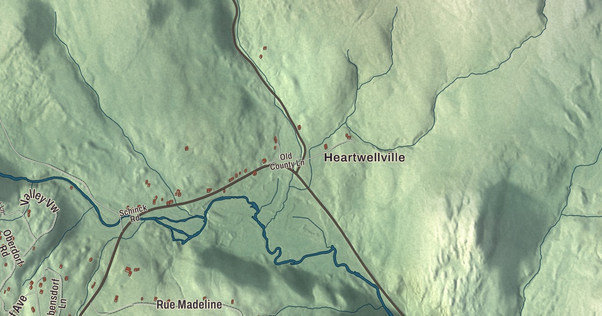
Readsboro village sits in the southeast corner of town on the west bank of the Deerfield River, with Route 100 running through it as Main Street and up the West Branch to Heartwellville. This map prints Main Street, East Main Street, Tunnel Street, Harriman Station Drive, King Hill Road and Potter Hill Road, with Heartwellville, Readsboro Falls, Howe Pond and the West Branch Deerfield River.
Readsboro is a town in Bennington County, Vermont.
KNOWOL made this map in 2026 from public survey data and gave it the look of an old county atlas, shading the hills from United States Geological Survey elevation data and drawing the roads and town line from the Census Bureau. The town covers 36.5 square miles, and 702 people lived here at the 2020 census. Click here to purchase a print of this map for your wall.
Three grants and a name
Readsboro was named for John Reade, a landholder. New Hampshire made two grants covering parts of the town on July 4 and August 11, 1764, and New York’s grant of April 24, 1770, called Readsborough, took in both the present Readsboro and Searsburg. The town organized in 1786, and Samuel Thayer represented it in the legislature in 1793 and 1794. Throope Chapman was one of the founders, and his grandson Welcome Chapman, born in Readsboro in 1805, became an early leader of the Latter-day Saints who led the settlers at Manti, Utah, from 1854 to 1862 and helped broker peace with Chief Wakara’s people.
The town sits in the southeast corner of Bennington County, with Monroe, Massachusetts, to the south and Whitingham and Wilmington to the east. Route 100 runs through the village and east to Jacksonville. To the northwest, at Heartwellville, it meets Route 8 at the headwaters of the West Branch of the Deerfield River, and the two roads run together southwest through Stamford toward North Adams.
Paper mill, railroad and music hall
A narrow-gauge railroad was built 11 miles up the Deerfield valley from the Hoosac Tunnel in Massachusetts to Readsboro by 1885, and in 1892 it was extended another 14 miles to Wilmington as the Hoosac Tunnel and Wilmington Railroad. Its popular nicknames included “the Hoot, Toot, and Whistle.” More than 40 miles of narrow-gauge logging lines ran in the woods near Readsboro and Wilmington, and the railroad hauled material for the Harriman Dam in 1924. The line north of Readsboro was abandoned in 1937, and the rest in 1971.
The opening of a paper mill and the coming of the railroad brought a period of growth, and in 1891 Elmer J. Bullock, who ran a general store, put up the E. J. Bullock Block at 7012 Main Street. It’s a three-story Second Empire building with a tower over its center bay and a mansard roof, with shops on the ground floor, offices on the second and an open hall on the third. Known at first as the Music Hall, the top floor drew regional and national performers, the local Masonic chapter leased it from 1908 until about 1968, and the building was listed on the National Register in 2021.
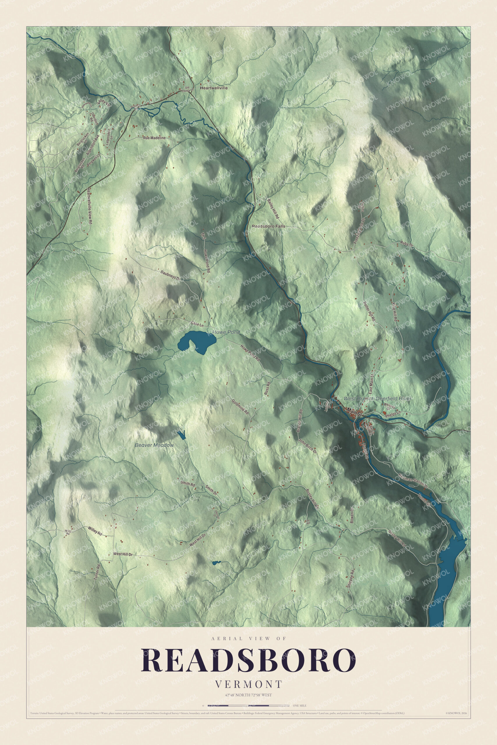
Click to explore a larger preview. The digital watermark does not appear on printed maps.
Names on this map
These names are printed on this map.
Places: Heartwellville, Readsboro Falls, Howe Pond, Beaver Meadow and West Branch Deerfield River.
Streets and roads: Main Street, Harriman Station Drive, East Main Street, King Hill Road, Potter Hill Road, Tunnel Street, West Hill Drive, Bosley Hill Road, Howe Pond Road, Phelps Lane, Goldmine Road, Branch Hill Road.
More street names, A to Z
Alpendorf Avenue, Alpenwald Lane, Bailey Hill Road, Bergrucken Lane, Bergrucken Road, Bergwelt Lane, Bowen Drive, Case Lane, Collins Drive, Daubneys Drive, Freezing Hole Drive, Heartwellville View Road, Jarvis Hill Road, John Birch Drive, Lebensdorf Lane, Lee Road, Lemaire Drive, Oberdorf Road, Odonnell Drive, Old County Lane, Ross Road, Ruba Drive, Rue Madeline, Schinck Road, Shippee Road, Smith Drive, Smith Road, Th 5, Turner Road, Valley Vw, Whitney Drive, Wiley Road, Willey Road.
See it on a wall
The Readsboro map as a framed print. Swipe for more.


Readsboro people
Josephine C. Lawney grew up in Readsboro and worked in a chair factory to pay for her education before earning her medical degree in 1916. As a Baptist medical missionary she taught at the Women’s Christian Medical College in Shanghai and became its dean, and in 1948 her hometown church in Readsboro dedicated a plaque to her work. Arthur P. Carpenter, born in Readsboro in 1867 and raised on his father’s farm, taught school around town before becoming a lawyer and serving as United States Marshal for Vermont from 1914 to 1922. The gardeners and writers Wayne Winterrowd and Joe Eck moved to Readsboro and made North Hill, a 7-acre garden on cleared hillside where they planted as many as 100,000 daffodil bulbs, and it drew visitors from around the world.
On the map, start with Heartwellville, follow Main Street, Harriman Station Drive, East Main Street, King Hill Road, Potter Hill Road and Tunnel Street across town, and look out toward Readsboro Falls. Howe Pond and the West Branch Deerfield River are printed as well. Readsboro dates to 1764.
This map of Readsboro is made for everyone who calls Readsboro home, and it shows the town as it looks today, from Heartwellville down the West Branch to Readsboro Falls. Hang it in an office, library or den, or use it to teach children the geography and history of their town. It’s printed on museum quality archival paper. Zoom in on the preview above to explore the details, then click here to get your copy of the Readsboro, Vermont map.

Sources
- Readsboro, Vermont, Wikipedia
- Town histories and representatives, R towns, Vermont Legislature
- Readsboro (CDP), Vermont, Wikipedia
- Welcome Chapman, Wikipedia
- Vermont Route 8, Wikipedia
- Hoosac Tunnel and Wilmington Railroad, Wikipedia
- E. J. Bullock Block, Wikipedia
- Josephine C. Lawney, Wikipedia
- Arthur P. Carpenter, Wikipedia
- Wayne Winterrowd, Wikipedia