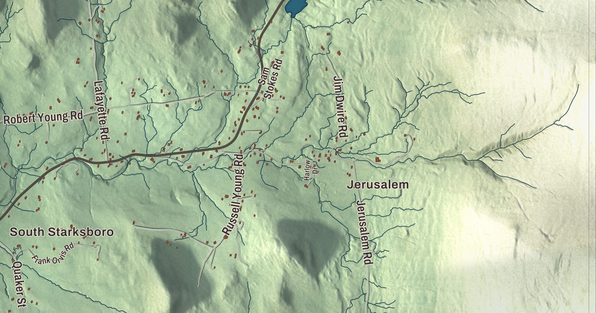
Starksboro fills the northeast corner of Addison County along the western edge of the Green Mountains, with Route 116 running north through the village toward Hinesburg. This map prints Jerusalem, South Starksboro and Rockville, Big Hollow Road, Hinesburg Hollow Road, Jerusalem Road, Shaker Hill Road, Ireland Road and Carp Cole Road, and Baldwin Pond.
Starksboro is a town in Addison County, Vermont.
KNOWOL made this map in 2026 from public survey data and gave it the look of an old county atlas, shading the hills from United States Geological Survey elevation data and drawing the roads and town line from the Census Bureau. 1,756 people lived in Starksboro at the 2020 census. Click here to purchase a print of this map for your wall.
Named for the hero of Bennington
Vermont granted the town on November 7, 1780, and chartered it two days later, on November 9. It was named for John Stark, the New Hampshire militia officer known as the “Hero of Bennington” for his service at the Battle of Bennington in 1777. Years later, too unwell to attend a reunion of Bennington veterans, Stark sent a letter that closed “Live free or die,” words that became New Hampshire’s state motto in 1945. Starksboro moved from Chittenden County to Addison County in 1794 and organized in March 1796, and John Ferguson is the first representative the Legislature lists, in 1798.
The Starksboro area was one of the earliest places in Vermont to be settled by Quakers, drawn here by Joseph Hoag, who had set up a meeting at Danby. Hoag also built a gristmill in the 1790s in the gorge of Lewis Creek in the northwest part of town, and the mill’s two-story stone base still stands on State Prison Hollow Road beside the Knight House of the 1820s. In southern Starksboro, on Dan Sargent Road, the South Starksboro Friends Meeting House was built in the 1820s for a meeting first organized in 1799. It’s the oldest Quaker meeting house in Vermont, and most of its half-acre lot is a cemetery with burials from the early 1800s to the 1970s.
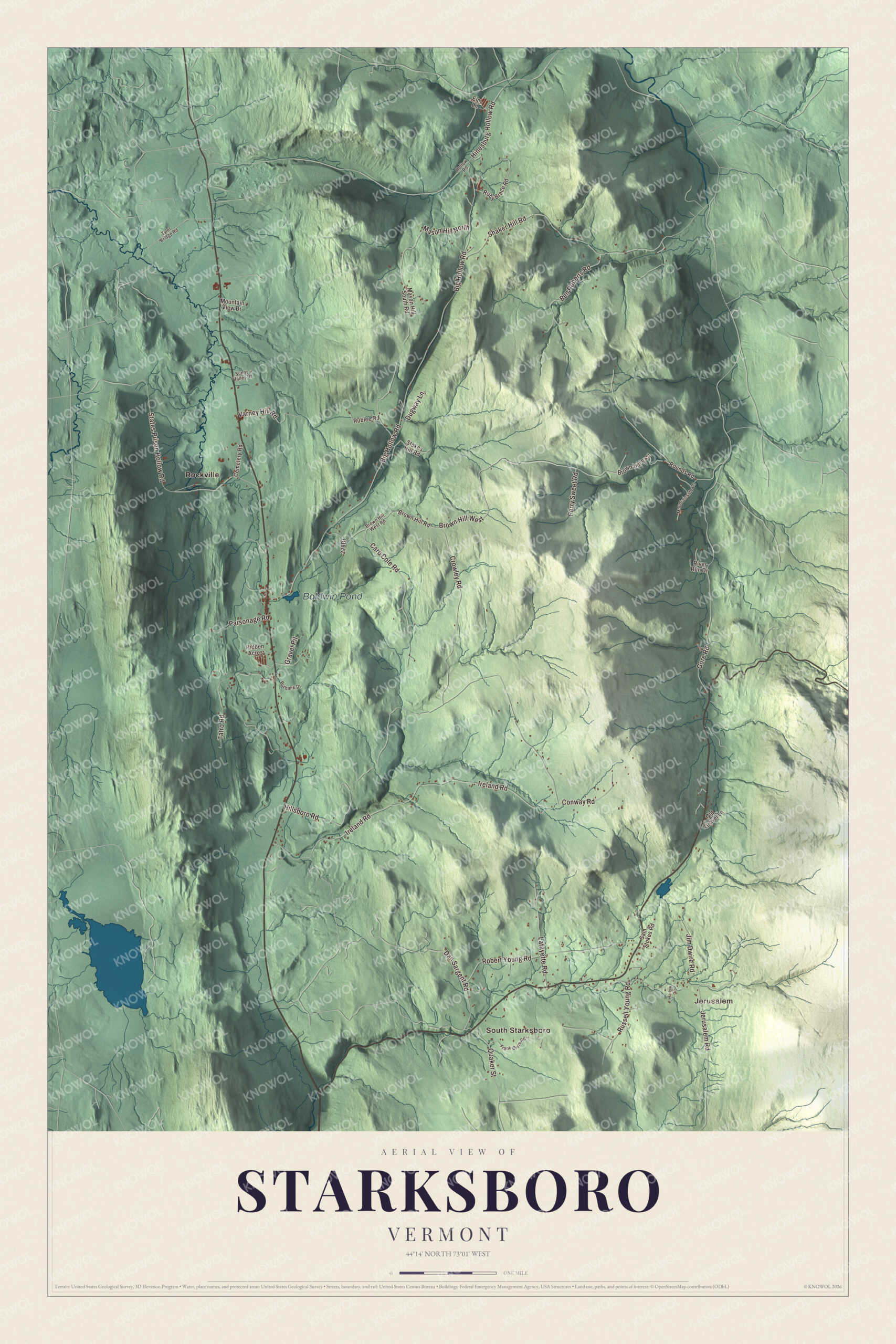
Click to explore a larger preview. The digital watermark does not appear on printed maps.
Names on this map
These names are printed on this map.
Places: Jerusalem, South Starksboro, Baldwin Pond and Rockville.
Streets and roads: Brown Hill West, Carp Cole Road, Mason Hill North, Hinesburg Hollow Road, Big Hollow Road, Ireland Road, Shaker Hill Road, Jerusalem Road, Robert Young Road, Crowley Road, States Prison Hollow Road, Tatro Road.
More street names, A to Z
Ben Roberts Road, Brown Hill East, Brown Hill Road, Brown Hill West Road, Burbank Drive, Cemetery Road, Conway Road, Dan Sargent Road, Dugway Lane, Elm Lane, Frank Orvis Road, Gore Road, Gravel Pit, Harlow Drive, Hidden Acres, Hillsboro Road, Hollow Road, Jim Dwire Road, Lafayette Road, Mason Hill South Road, Mountainside Lane, Mountain View Drive, Old Gravel Lane, Parsonage Road, Perry Sweet Road, Quaker Street, River Run Drive, Rounds Road, Rublee Road, Ruby Brace Road, Russell Young Road, Sam Stokes Road, Stokes Hill Road, Sunny Valley Drive, Tyler Bridge Road, Varney Hill Road.
See it on a wall
The Starksboro map as a framed print. Swipe for more.


The village and its meeting house
In the village center, on the west side of Route 116 a short way south of Big Hollow Road, stands the Starksboro Village Meeting House. Before it was built, town meetings were held in the schoolhouse and the Methodist, Free Will Baptist and Christian congregations met in members’ homes. In 1838 the three churches and the town agreed to build it together, and it was finished in 1840, a Gothic Revival building with a two-stage bell tower and tall pointed windows, with the town meeting room in the basement. The town moved to its present town hall in 1910, and since 1957 the Starksboro Village Meeting House Society has cared for the building. All three of these places, the gristmill, the Friends meeting house and the village meeting house, are on the National Register of Historic Places.
South of the village, Route 17 crosses the southern part of town, leading east over the Green Mountains to Mad River Glen and Waitsfield and west to Bristol. Phineas D. Ballou, born here in 1823, served as mayor of Burlington from 1868 to 1870, and Amos Hoag, born here in 1805, served in the Iowa House of Representatives from 1860 to 1862. Barbara Ann Cochran, who won the slalom gold medal at the 1972 Winter Olympics in Sapporo by 0.02 seconds, the smallest winning margin in Olympic history, makes her home in Starksboro.
On the map, start with Jerusalem, then follow Carp Cole Road, Hinesburg Hollow Road, Big Hollow Road, Ireland Road, Shaker Hill Road and Jerusalem Road across town. Then look outward toward South Starksboro and Rockville. Baldwin Pond is printed too. Starksboro dates to 1780.
This map of Starksboro is made for everyone who calls Starksboro home, and it shows the town as it looks today, from Jerusalem and Big Hollow Road to South Starksboro and Baldwin Pond. Hang it in an office, library or den, or use it to teach children the geography and history of their town. It’s printed on museum quality archival paper. Zoom in on the preview above to explore the details, then click here to get your copy of the Starksboro, Vermont map.

Sources
- Starksboro, Vermont, Wikipedia
- Town histories and representatives, S towns, Vermont Legislature
- John Stark, Wikipedia
- Hoag Gristmill and Knight House Complex, Wikipedia
- South Starksboro Friends Meeting House and Cemetery, Wikipedia
- Starksboro Village Meeting House, Wikipedia
- Vermont Route 17, Wikipedia
- Phineas D. Ballou, Wikipedia
- Amos Hoag, Wikipedia
- Barbara Cochran, Wikipedia