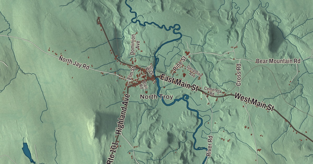
Troy is a border town with two villages on the Missisquoi River: Troy village, where Routes 100 and 101 meet, and North Troy, a little over a mile south of the Canadian line. This map prints North Troy along with East Main Street, West Main Street, Highland Avenue, North Jay Road, River Road and Bear Mountain Road.
Troy is a town in Orleans County, Vermont.
KNOWOL made this map in 2026 from public survey data and gave it the look of an old county atlas, with hills shaded from United States Geological Survey elevation data and the roads and town line drawn from the Census Bureau. The town covers 36.1 square miles, all of it land, and 1,722 people lived here at the 2020 census. Click here to purchase a print of this map for your wall.
Missisquoi first, then Troy
Vermont chartered two tracts here in October 1792, Avery’s Grant and Kelly’s Grant. On October 28, 1801, the state joined them into one town named Missisquoi, after the river. The town was organized in March 1802, sent Alpheus Moore as its first representative that year, and took the name Troy on October 26, 1803. The Missisquoi runs through the town. It flows north along the east side of Troy village and past North Troy into Quebec, then turns west around the north end of the Green Mountains and comes back into Vermont on its way to Lake Champlain. In the early years Troy was an iron town, and it once turned out more than 400 short tons of cast iron a year.
In the winter of 1799 a small party of Native people, led by their chief, Captain Susap, built their camps on the river near the settlers and stayed until spring, making baskets, birch-bark cups and pails. One of them, a woman the settlers knew as Molly Orcutt, became well known among the settlers as a healer. Later, before the Civil War, Dr. Levi Moore and A. J. Rowell of Troy were agents on the Underground Railroad.
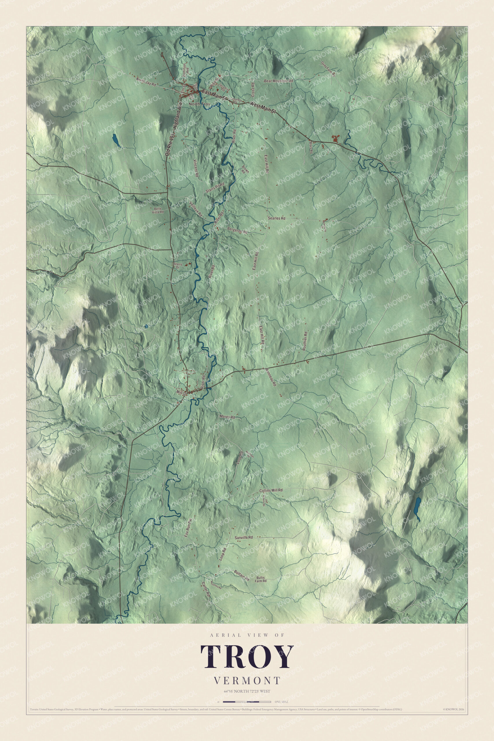
Click to explore a larger preview. The digital watermark does not appear on printed maps.
Names on this map
These names are printed on this map.
Places: North Troy.
Streets and roads: East Main Street, Highland Avenue, West Main Street, Old Route 101, North Jay Road, River Road, Bear Mountain Road, Brittain Road, Loop Road, East Hill Road, Vincent Road, Searles Road.
More street names, A to Z
Belle Vista Road, Bergeron Road, Blair Road, Blais Road, Bonneau Road, Boudreau Road, Bowenville Road, Brown Road, Bullis Farm Road, Carter Road, Cemetery Road, Collins Mill Road, Cross Road, Dominion Avenue, Elm Street, Fox Run Pvt, Geraldine Avenue, Guay Farm Road, Hill Street, Joe Roberts Road, Mill Street, Morey Road, Pine Street, Routhier Road, Sanville Road, Starrs Drive, Starrs Pit Road, Veilleux Road, Wursthorn Road.
See it on a wall
The Troy map as a framed print. Swipe for more.


North Troy and the border
North Troy is the town’s incorporated village, with 631 people at the 2020 census. From 1940 to 1942 it held winter carnivals with dog sled races and ski jumping, and 4,000 people came to the one in 1942. Until 2007 the village had a police force of its own instead of relying on the town constable or the county sheriff.
Route 243 runs from North Troy to the border crossing with Highwater, Quebec, following the general course of the Missisquoi. The first formal United States border station on the site was built in 1937, when the government was tightening the border in the years of the automobile and Prohibition. A new station replaced it in 2009, but the 1937 building still stands about 150 feet to the south. It’s one of ten surviving 1930s station buildings in Vermont and was listed on the National Register of Historic Places in 2014. Amasa Tracy had taken command of the old Vermont Brigade at the Battle of Cedar Creek and received the Medal of Honor for leading it in the assault. After the war he served as a customs agent at several Vermont border points, North Troy among them, and lived in North Troy for at least six years as a deputy collector of customs.
On the map, start in North Troy, then follow East Main Street, West Main Street and Highland Avenue, and head out along North Jay Road, River Road and Bear Mountain Road. Troy dates to 1801, when Missisquoi became a town.
This map of Troy is made for everyone who calls Troy home, and it shows the town as it looks today, from North Troy to River Road and Bear Mountain Road. Hang it in an office, library or den, or use it to teach children the geography and history of their town. It’s printed on museum quality archival paper. Zoom in on the preview above to explore the details, then click here to get your copy of the Troy, Vermont map.

Sources