This historic map of Appleton, Wisconsin was created in 1867 by Albert Ruger, a prominent 19th century map maker. The map shows a bird’s eye view of the area as it once was, including street names and old landmarks.
Landmarks on the map include Flouring Mills, Rake Factory, Woolen Mill, Machine Shops, Hubb & Spoke Factory, Stave Factory, Saw Mills, Paper Mill, Sash & Door Factories, Chair Factory, Tanneries, Breweries, Lawrence University, Chicago & Northwestern Railroad, various churches, and more.
This vintage bird’s eye view of Appleton has been restored and colorized by KNOWOL. Reproductions of the restored map are available here.
Historic Old Map of Appleton, Wisconsin from 1867
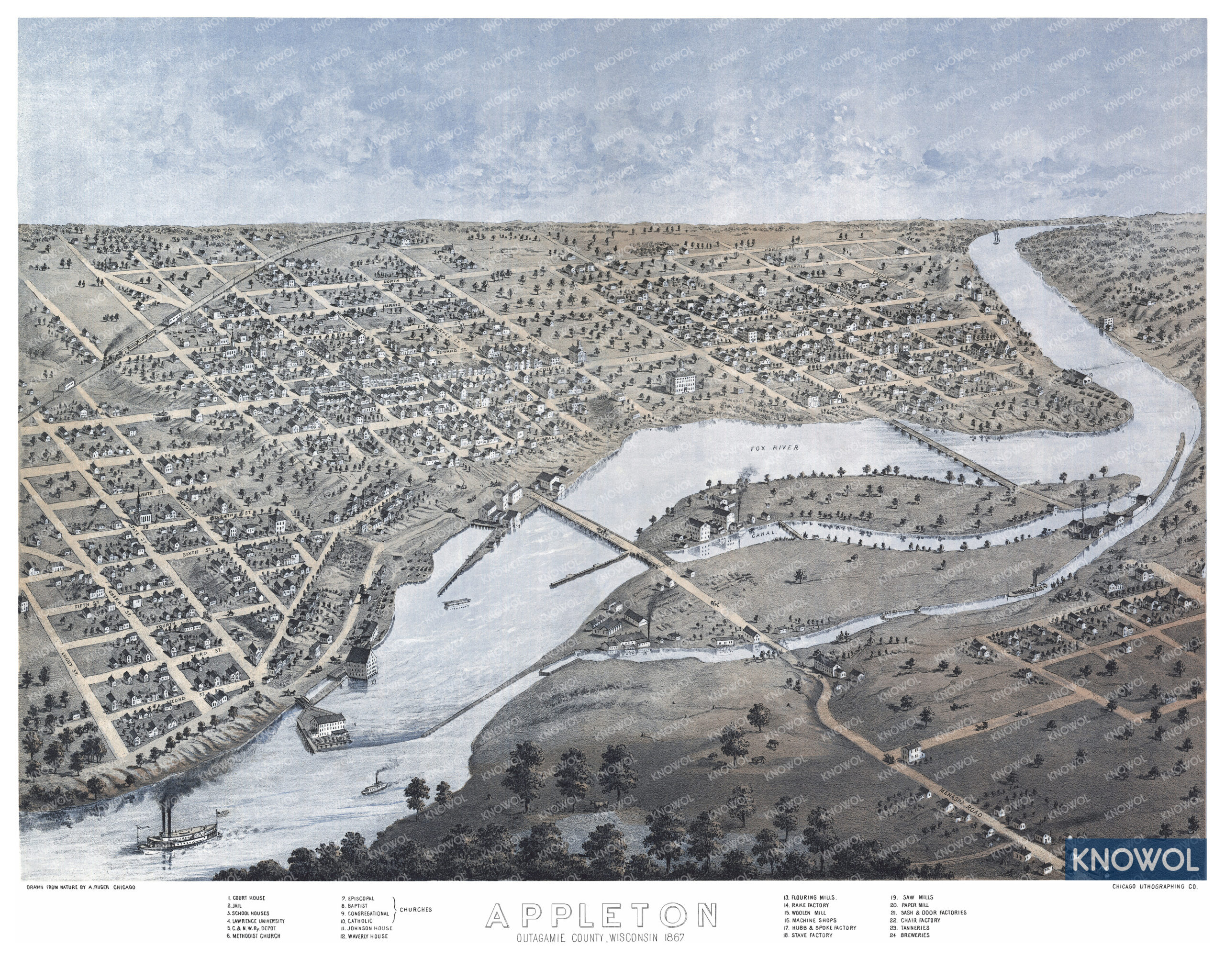
This beautifully restored map of Appleton will make an attractive addition to your office, library, or den and can even be used to teach children the geography and history of the area. When you’re done exploring, click here to get your copy of the map!