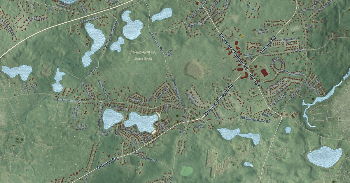
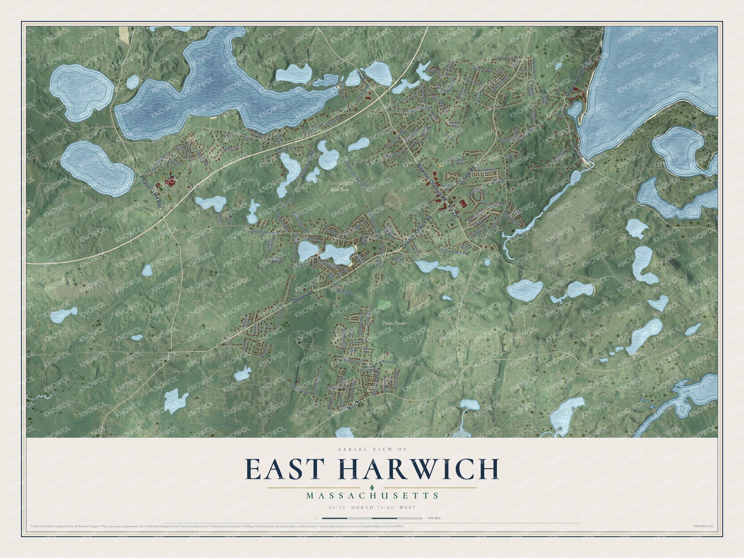
This beautifully detailed map of East Harwich, Massachusetts was created in 2026 using aerial imagery combined with modern topographical, census, street and landmark data. It's a modern aerial view of East Harwich in Barnstable County, Massachusetts, that combines modern data with a vintage aesthetic. The roads feature printed names, and if you look closely you can find your exact house accurately shown in its correct location.
Explore an aerial view of East Harwich, Massachusetts
On this map you'll find Hawksnest State Park, Town Forest, Orleans Road, Orleans-Harwich Road, Brewster-Chatham Road, Orleans-Chatham Road, Main Street, Pleasant Lake Avenue, Long Pond Drive, Long Pond Road, Queen Anne Road, Spruce Road, and more. Each red shape is a building, so zoom in on the preview and look for yours.
East Harwich is a community in Barnstable County. The Census Bureau counted 5,250 people here in 2020. The map prints the town name in its title panel, with the coordinates below it.
Take a closer look at the East Harwich map
Names on this map
These names are printed on this map.
Places: Hawksnest State Park and Town Forest.
Streets and roads: Orleans Road, Orleans-Harwich Road, Brewster-Chatham Road, Orleans-Chatham Road, Main Street, Pleasant Lake Avenue, Route 137, Long Pond Drive, Long Pond Road, Queen Anne Road, Spruce Road, Water Road.
More street names, A to Z
Abigail Avenue, Acorn Drive, Aladoe Farm Lane, Auston Road, Bay Pine Road, Bay Road, Blue Heron Landing, Brothers Lane, Bucks Pond Road, Buttonwood Road, Cahoon Road, Captain Scott Road, Captian Bearse Lane, Cemetery Road, Charlene Lane, Charles Road, Chatham Road, Chestnut Lane, Christopher Way, Church Street, Clearwater Drive, Continental Drive, Cottonwood Road, Courtney Road, Cranberry Hollow Lane, Depot Road, Driftwood Lane, Dundee Circle, Eagle's Nest Road, Echo Woods Road, Ellis Drive, Elm Drive, Farmedge Lane, Fernwood Circle, Georgia Lane, Glen Road, Gomes Way, Great Woods Road, Grist Mill Road, Gull Way, Halls Path, Happy Way, Harding Lane, Harwich Pines, Haskell Lane, Hawksnest Road, Hillside Road, Holmes Road, Idle Way, Indian Trail, Jasper Moore Trail, Jesse Eldredge Road, John Joseph Road, Kendrick Road, Kent Road, Keri Way, Kettle Pond Drive, Kimberly Way, Lakeview Drive, Lakeway Lane, Lakewood Drive, Lazy Lane, Little Lane, Lovers Lane, Mariner Drive, Marthas Lane, Mary Beth Lane, Mary Willet Court, McGuerty Road, Mello Lane, Middle Road, Mini Road, Mohawk Lane, Nathan Walker Road, Nor'east Drive, Oak Street, Obed Brooks Road, Old Blind Road, Olde Homestead Way, Old Queen Anne Road, Partridge Lane, Periwinkle Lane, Perrys Way, Pine Orchard Road, Pleasant Bay Court, Pleasant Bay Road, Quaker Lane, Rainbow Way, Raptor Road, Ridgevale Road, Robert Road, Round Cove Road, Route 28 Head of the Bay Road, Sadies Way, Samoset Road, Sandy Lane, Scotlin Way, Seth Whitefield Road, Shady Drive, Sheila Way, Sherwood Road, Sidney Road, Simmons Road, Sou'west Drive, Spruce Grove Road, Standish Woods Circle, Sterling Road, Sugar Hill Drive, Tern Road, Tuckers Way, Vacation Lane, Ve Trail, Walden Way, Wales Road, Washburn Way, Wayside Road, Whelan Road, Whidah Drive, Williamsburg Avenue, Wilmas Way.
See it on a wall
The East Harwich map as a framed print. Swipe for more.


Created by KNOWOL in 2026. The buildings are small red shapes, the roads carry their printed names, and shaded relief shows the shape of the land. The title panel reads "AERIAL VIEW OF EAST HARWICH, MASSACHUSETTS" with 41°42' NORTH 70°02' WEST.
It looks right in a kitchen, an office or a den, and it's a gift for anyone who grew up in East Harwich or moved away. Open the preview and find your street. See sizes and frames for the East Harwich map.