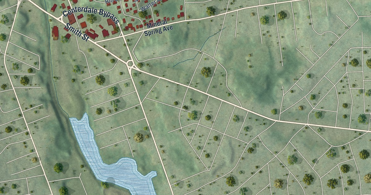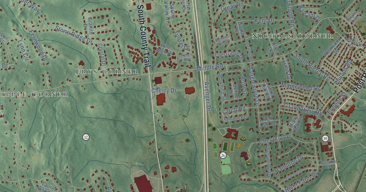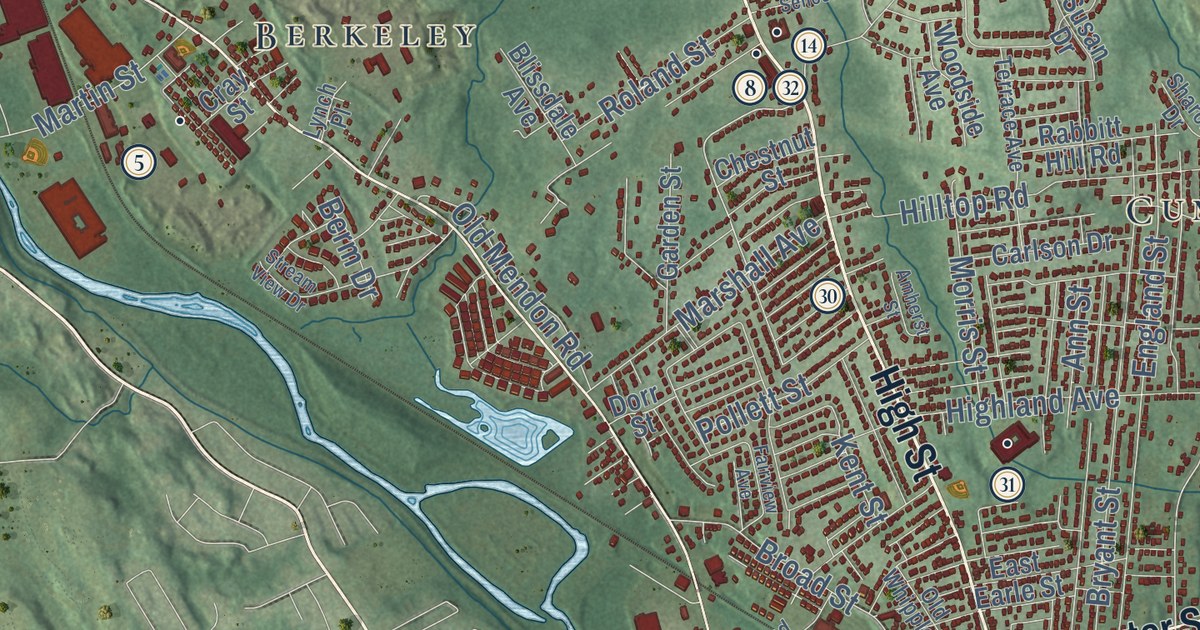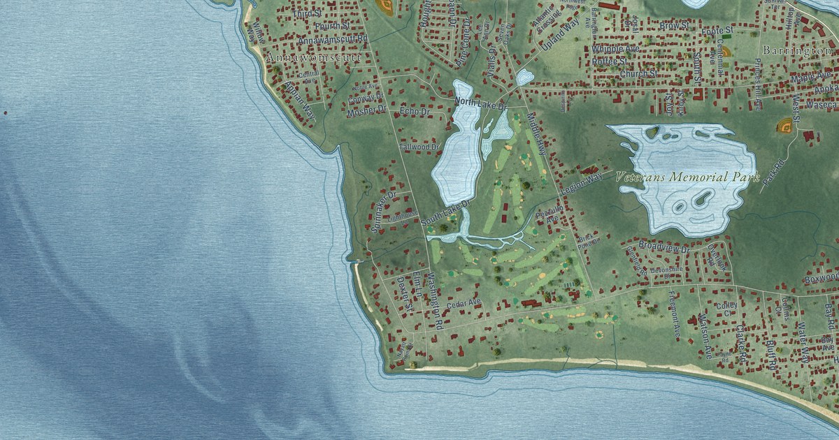
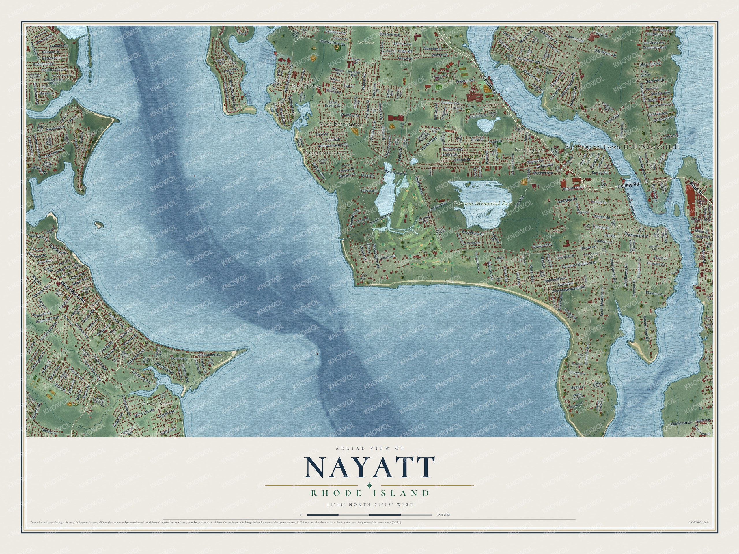
This beautifully detailed map of Nayatt, Rhode Island was created in 2026 using aerial imagery combined with modern topographical, census, street and landmark data. It’s a one-of-a-kind view of Nayatt that combines accurate data with a vintage aesthetic. The map shows every building in its true location, many of the roads carry their names, and the shaded topographic relief shows the shape of the land.
Explore an aerial view of Nayatt, Rhode Island
On the map you’ll find Barrington Town Hall/Nayatt Hall, Tall Cedars, Veterans Memorial Park, River View, Annawomscutt, Bay Spring, West Barrington, and Barrington, along with County Road, West Shore Road, Main Street, Point Avenue, and more. If you look closely you can even find your house accurately drawn in its correct location. Zoom in on the preview to look for yours.
Did You Know?
From Internet Archive: "Two guard houses were established in the town, one at Nayatt, at the house of James Brown, and the other at Rumstick, at the house of Nathaniel Smith."
Nayatt is a community in Bristol County.
Take a closer look at the Nayatt map
Names on this map
These names are printed on this map.
Places: Tall Cedars, Veterans Memorial Park, River View, Annawomscutt, Bay Spring, West Barrington and Barrington.
Streets and roads: County Road, West Shore Road, Main Street, Point Avenue, Prospect Street, Hawthorne Avenue, Eton Avenue, Anderson Avenue, Nayatt Road, Washington Road, Middle Highway, Rumstick Road.
More street names, A to Z
Adams Avenue, Adams Point Road, Agawam Road, Alfred Drowne Road, Algonquin Drive, Allard Street, Allen Avenue, Alpine Street, Americo Drive, Anchorage Way, Annawamscutt Road, Ann Mary Brown Drive, Anoka Avenue, Anthony Road, Appian Way, Apple Tree Lane, Arden Court, Ardway Avenue, Arvin Avenue, Aspinet Drive, Atlantic Crossing, Audubon Road, Baker Street, Barrington Avenue, Barstow Road, Barton Avenue, Bay Avenue, Bay Road, Bay Spring Avenue, Beach Avenue, Beach Road, Beach Street, Beatrice Avenue, Bellman Avenue, Belt Street, Belvedere Avenue, Bend Street, Blake Street, Blanding Avenue, Bloor Street, Blount Circle, Bluff Avenue, Bluff Road, Bosworth Street, Bourne Lane, Bowden Avenue, Bowen Street, Boxwood Court, Bradford Street, Brentonwood Avenue, Briarfield Road, Brick Pond Drive, Bridge Street, Brightside Avenue, Broadview Drive, Brown Avenue, Brow Street, Buena Vista Avenue, Bullocks Point Avenue, Burr Avenue, Bush Avenue, Cady Avenue, Carousel Drive, Cedar Avenue, Cedar Bay Drive, Centennial Avenue, Central Avenue, Chachapacassett Road, Channing Avenue, Chapin Road, Chapman Lane, Charles Street, Cherry Lane, Church Avenue, Church Street, Clarke Road, Clubhouse Lane, Cold Spring Road, Coldwell Street, Cole Farm Road, Colley Court, Collins Court, Colonial Avenue, Columbus Avenue, Commonwealth Avenue, Company Street, Conway Drive, Country Club Drive, Craig Drive, Crown Avenue, Damon Avenue, Dana Road, Deerfield Drive, Despirito Lane, Devonshire Drive, Dexter Street, Doane Road, Dudley Avenue, Dundas Avenue, Echo Drive, Economy Avenue, Edwin Street, Elgin Street, Ellis Street, Elmbrook Drive, Elm Lane, Elton Avenue, Elton Road, Eton Road, Evergreen Street, Fairview Circle, Fairway Drive, Fales Avenue, Federal Road, Ferrier Drive, Ferry Lane, Fessenden Road, Field Lane, Foote Street, Foster Street, Fountain Avenue, Fourth Street, Fox Run Road, Freemont Avenue, Fuller Street, General Hawkins Drive, Gillooly Drive, Glenfield Road, Governor Bradford Drive, Grant Street, Greenbrier Drive, Green River Avenue, Gristmill Road, Haile Street, Haines Park Road, Half Mile Road, Hampden Street, Harbour Road, Harold Street, Harrison Avenue, Hart Lane, Harvard Avenue, Henry Drive, Highland Avenue, Highland Road, High Street, Highview Avenue, Hillside Avenue, Hilltop Avenue, Holly Lane, Honeysuckle Road, Houghton Street, Humphreys Road, Hunt Drive, Ivan Avenue, Jennys Lane, Joann Drive, Josal Drive, Joyce Street, Joy Street, June Avenue, Karen Drive, Kennedy Drive, Kent Street, Killdeer Road, Kirby Street, Kristen Court, Lafayette Road, Lake Avenue, Lamson Road, Landon Road, Lane 1, Lane 2, Lane 4, Lane 5, Lane 7, Lane 8, Lane East, Lantern Lane, Latham Avenue, Lee Ann Drive, Lee Road, Legion Way, Leslie Avenue, Lighthouse Lane, Lillis Avenue, Lincoln Avenue, Linden Road, Lippitt Avenue, Lister Drive, Lockhaven Road, Locust Terrace, Loring Road, Lorraine Street, Lyall Avenue, Manning Drive, Manor Road, Maple Avenue, Maplewood Avenue, Marine Avenue, Markwood Drive, Martin Avenue, Massasoit Avenue, Mathewson Road, Meadowbrook Drive, Meadow Road, Melrose Avenue, Mill Cove Road, Miller Street, Milton Road, Morton Drive, Mosher Drive, Myrtle Avenue, Nakomis Drive, Namquid Drive, Narragansett Avenue, Narragansett Parkway, Nash Avenue, Nayatt Point Court, New Britain Drive, New Meadow Road, Noble Avenue, North Farm Drive, North Lake Drive, North Lane, Northwest Psge, Novelty Road, Oak Grove Avenue, Oak Manor Drive, Old Mill Boulevard, Olive Lane, Opechee Drive, Opper Avenue, Orchard Avenue, Overbrook Avenue, Overlook Road, Owings Stone Road, Oxford Avenue, Oxford Street, Paquin Road, Park Avenue, Park Road, Parkside Drive, Payne Road, Pezzullo Avenue, Pheasant Lane, Pine Avenue, Pine Cone Drive, Plymouth Drive, Poplar Avenue, Preston Drive, Princes Hill Avenue, Priscilla Drive, Puritan Drive, Richard Street, River Oak Road, Riverside Drive, River Vue Avenue, Roberta Drive, Rock Avenue, Roffee Street, Ronald Road, Royal Avenue, Rumstick Drive, Sachem Road, Saint Andrews School Street, Salisbury Road, Sandy Lane, Savoy Street, Seaview Drive, Seven Oaks Drive, Shannon Drive, Shawomet Avenue, Shore Drive, South Lake Drive, South Meadow Lane, South Street, Sowams Road, Spadina Avenue, Spinnaker Drive, Sprague Avenue, Spring Avenue, Stanley Avenue, Starbrook Drive, State Street, Stokes Street, Stone Tower Lane, Stratford Road, Strawberry Drive, Sullivan Terrace, Sunset Drive, Surrey Road, Sweetbriar Road, Symonds Avenue, Talcott Avenue, Tallwood Drive, Telford Road, Terrace Avenue, Terrace Drive, Third Street, Thomas Street, Tidewater Drive, Tiffany Circle, Torrington Drive, Town Hall Drive, Townsend Street, Transit Street, Tyler Point Road, Union Street, Upland Way, Valentine Drive, Vans Lane, Vialls Drive, Wallis Avenue, Walnut Road, Warren Avenue, Waseca Avenue, Water Street, Water Way, Watson Avenue, Waverly Street, Webb Avenue, Western Avenue, West Street, Whipple Avenue, White Birch Lane, Wildflower Road, Willow Way, Winifred Avenue, Winsor Drive, Winter Avenue, Winthrop Road, Wood Avenue, Woodbury Street, Woodland Road.
See it on a wall
The Nayatt map as a framed print. Swipe for more.


This beautifully detailed map of Nayatt makes an attractive addition to your office, library, or den, and it can even be used to teach children the geography and history of the area. It also makes a great gift for someone who left Nayatt and still calls it home. When you’re done exploring, click here to get your copy of the Nayatt map.