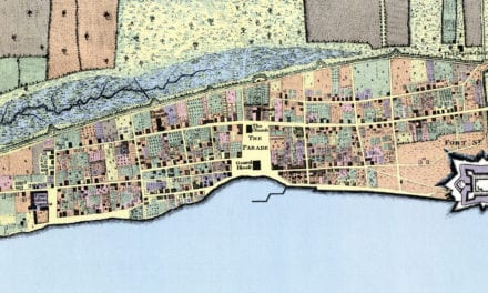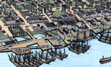
This vintage map of Tallahassee, Florida was created in 1885 by Norris, Wellge & Co., with lithography by Beck & Pauli of Milwaukee, Wisconsin. The map shows a bird’s-eye view of Tallahassee as it once was, including street names, old landmarks, churches, hotels, schools, residences, railroads, farms, orchards, and the rolling countryside surrounding Florida’s capital city. This is the only known colorized version of the map to exist. It was restored and colorized by KNOWOL. Archival prints of the map are available here.
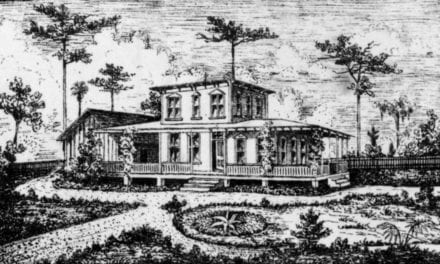
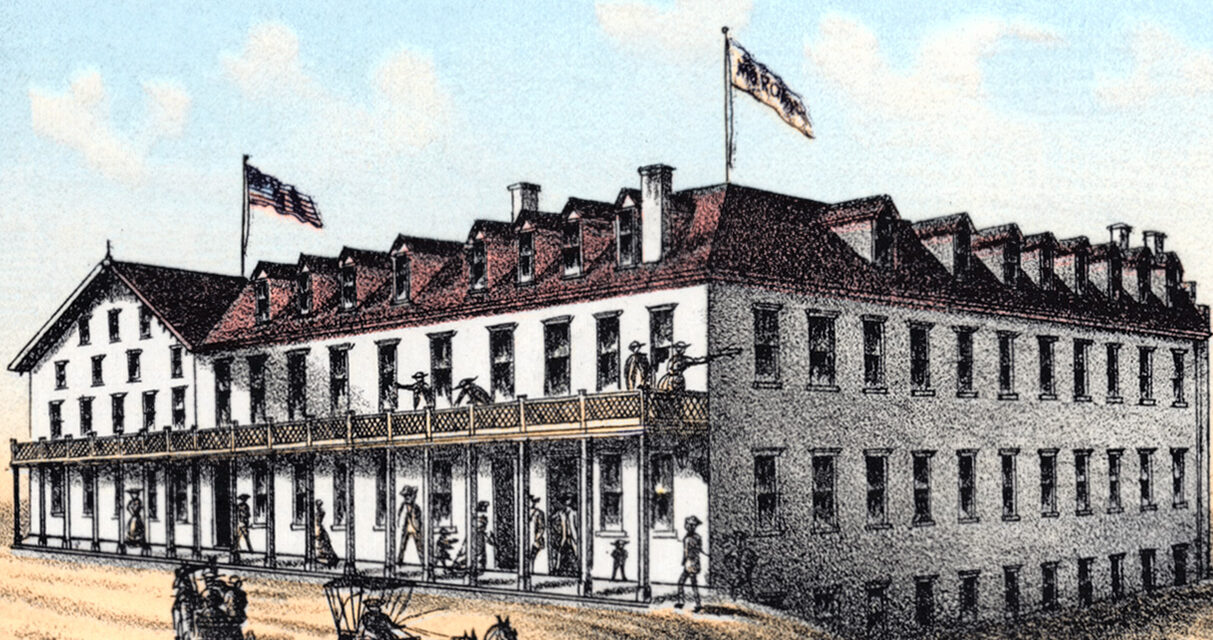
Historic Tallahassee landmarks on the map include the Capitol, County Court House, University of Florida, State Seminary, Lincoln Academy, University Library, Gallie’s Hall, Masonic and I.O.O.F. Hall, Leon Hotel, The Morgan Hotel, St. James Hotel, The Floridian Office, The Land of Flowers Office, The Tallahassee Real Estate Exchange, and “The Murat Place,” the residence of Prince Murat, son of the King of Naples. The map also marks the Graves of Prince and Princess Murat, the Site of Fort San Luis, railroad depots and shops, local businesses, prominent residences, and many of the civic, religious, educational, and commercial landmarks that shaped Tallahassee in the late 1800s.
This vintage map of Tallahassee has been lovingly restored and colorized by KNOWOL. Reproductions of the restored map are available here. You can click on the image below to view a large version.
Vintage Map of Tallahassee, Florida 1885
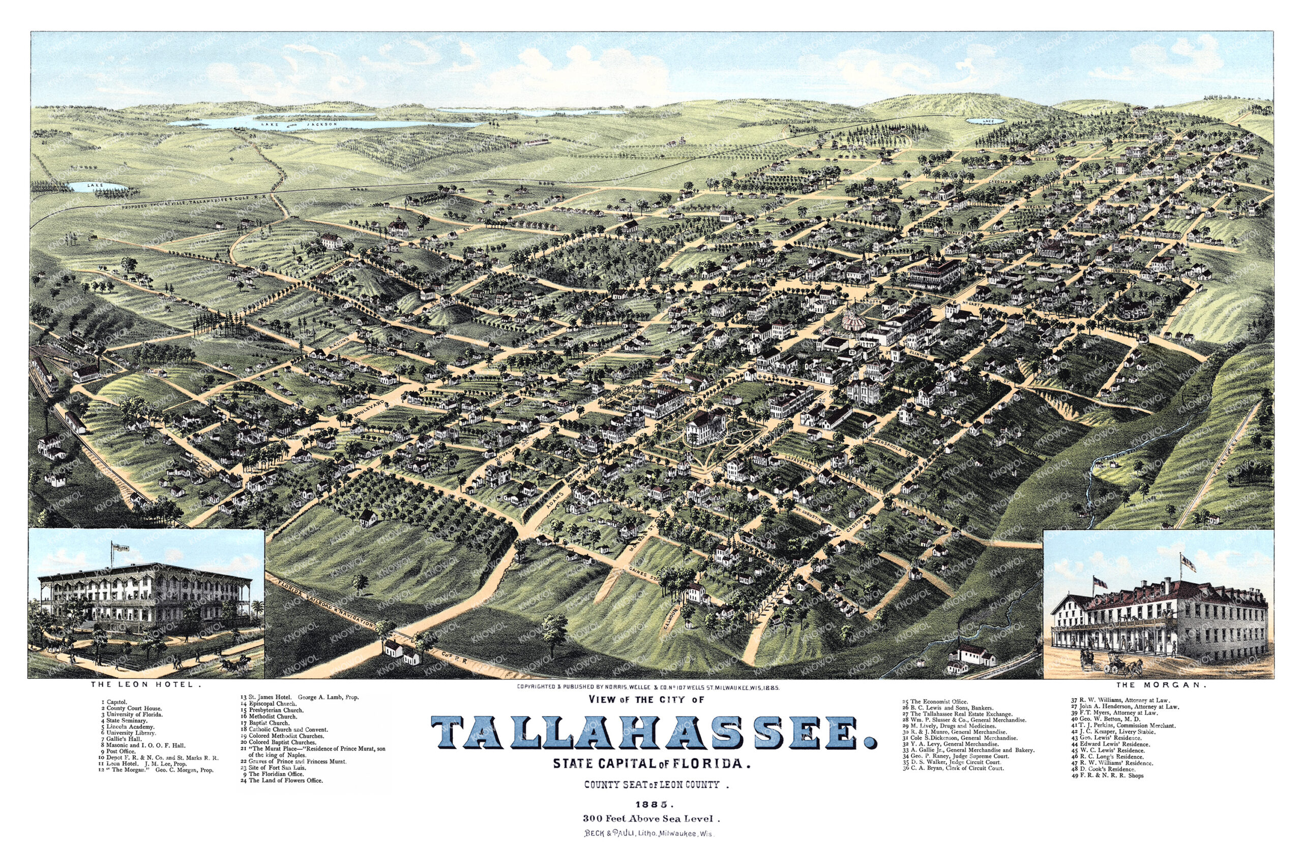
Restored and colorized 1885 bird’s-eye view map of Tallahassee, Florida, featuring the state capital, historic schools, hotels, churches, businesses, residences, railroads, and landmarks surrounded by the rolling countryside of Leon County.
At the time this map was drawn, Tallahassee was already one of the most important inland cities in Florida. As the state capital and county seat of Leon County, it was home to government offices, schools, churches, hotels, newspapers, attorneys, merchants, railroad connections, and prominent residences. The map captures the city during a period when Tallahassee was still surrounded by open fields, groves, lakes, rural roads, and large estates, giving modern viewers a rare look at the capital before the growth of the 20th century changed its appearance.
This beautiful old map of Tallahassee makes an attractive addition to your office, library, study, classroom, or den and can even be used to teach children the geography and history of Florida’s capital city. When you’re done exploring, click here to get your copy of the restored map.