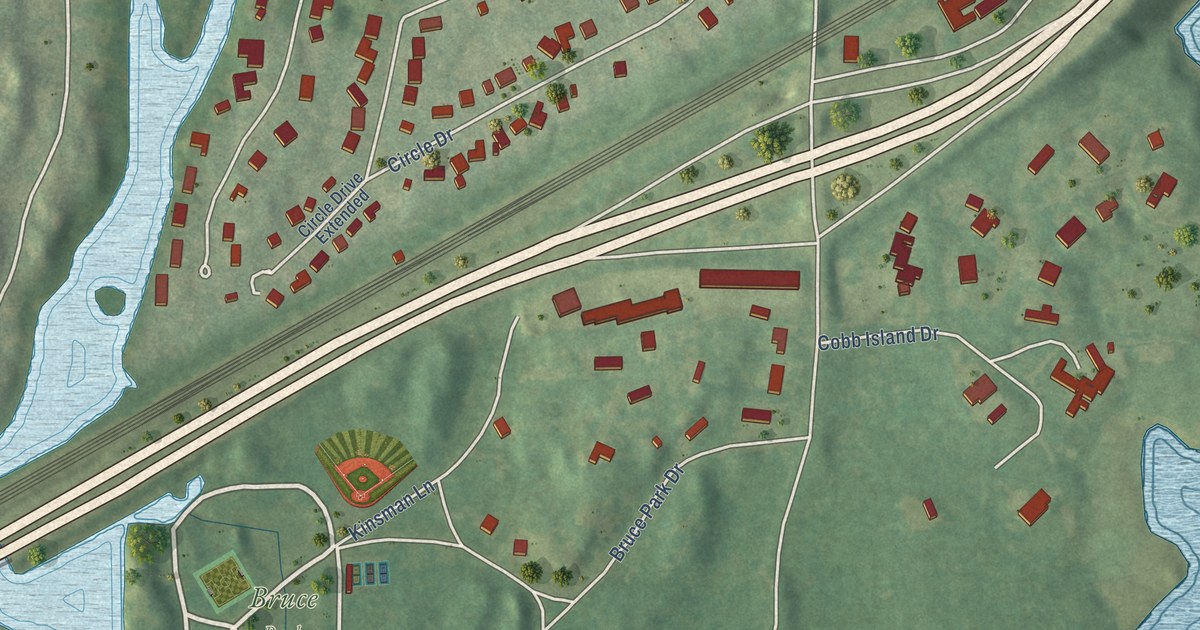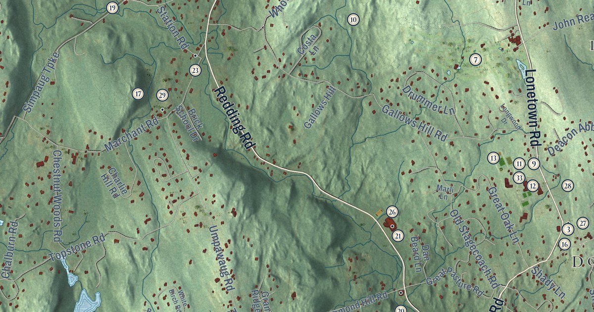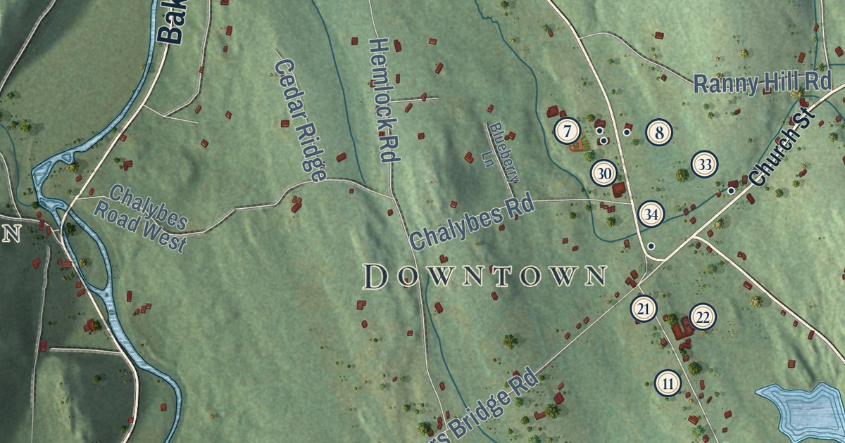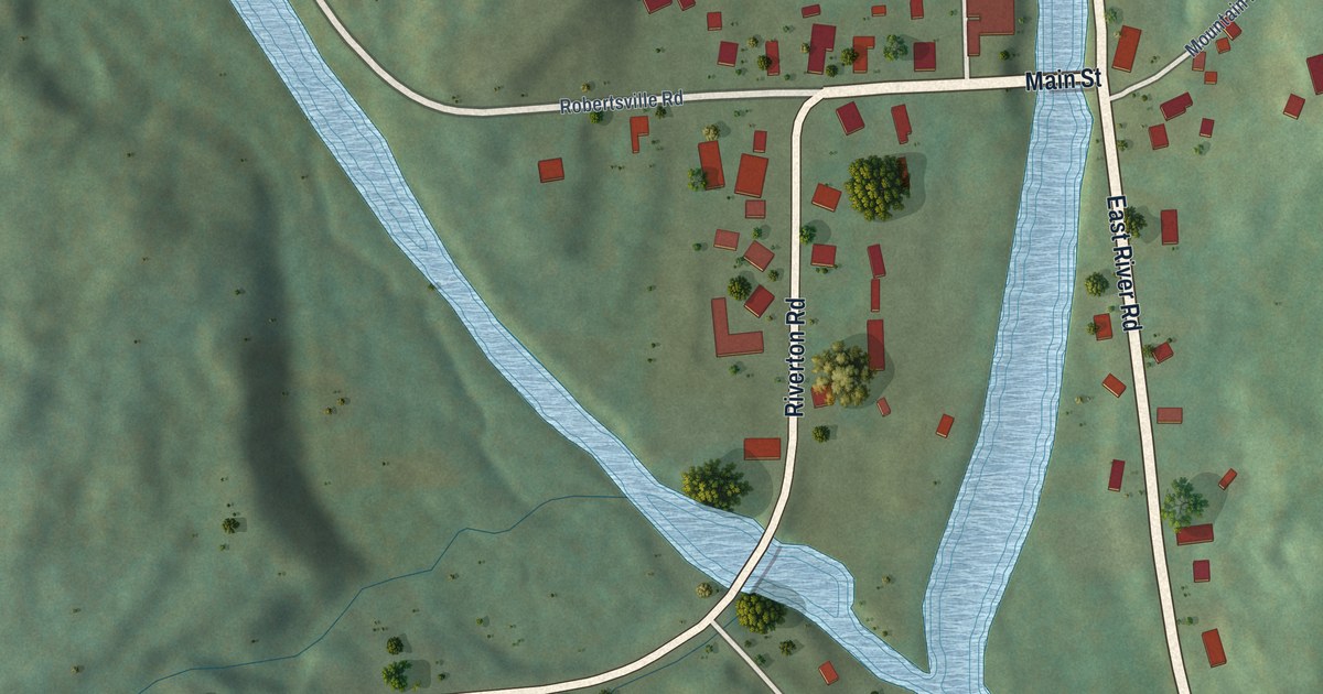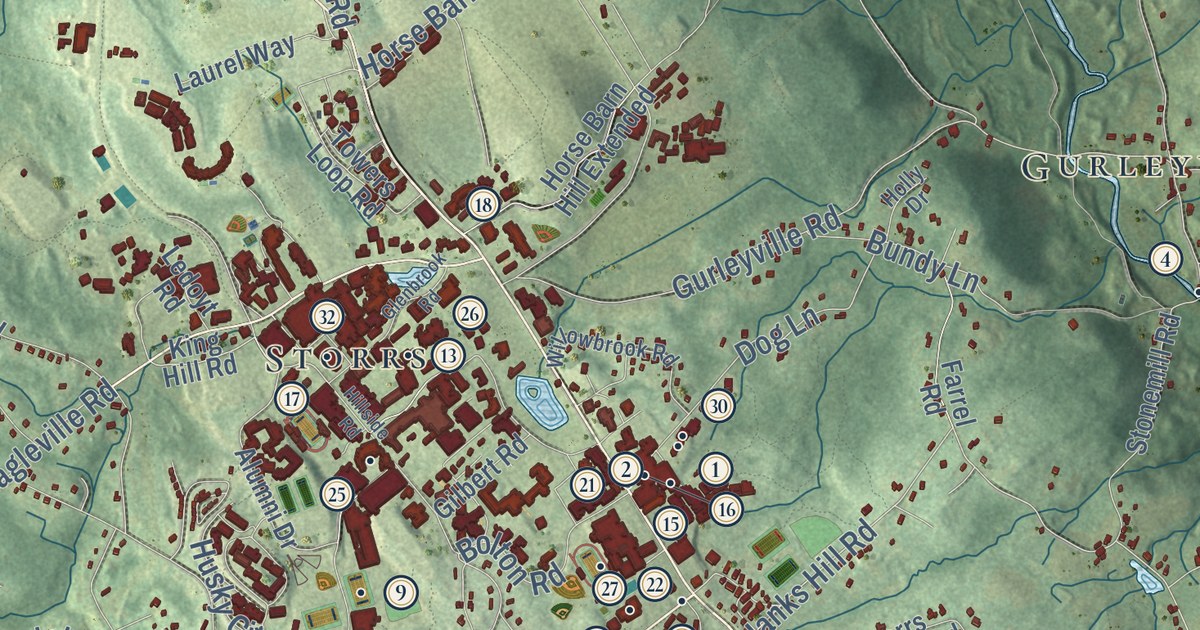
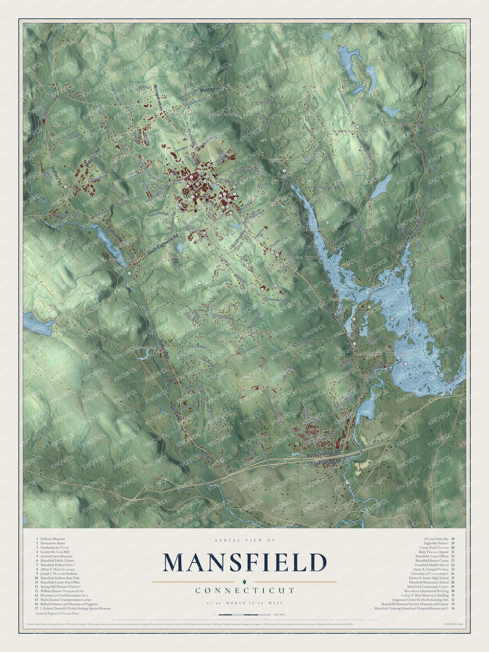
This beautifully detailed map of Mansfield, Connecticut was created in 2026 using aerial imagery combined with modern topographical, census, street and landmark data. It’s a one-of-a-kind view of Mansfield that combines accurate data with a vintage aesthetic. The map shows every building in its true location, many of the roads carry their names, and the shaded topographic relief shows the shape of the land.
See it on a wall
The Mansfield map as an 18 x 24 inch print in a black frame.

Explore an aerial view of Mansfield, Connecticut
On the map you’ll find Downtown, Merrow, Ball Hill, Chestnut Hill, Knowlton Hill, Chapins Pond, Decew Pond, Stearns Farm, Gurleyville, Atwoodville, Storrs, Perkins Corner, and more. If you look closely you can even find your house accurately drawn in its correct location. Zoom in on the preview to look for yours. Click here to learn more about the history of Mansfield.
Take a closer look at the Mansfield map
Click to explore a larger preview. The digital watermark does not appear on printed maps.
Names on this map
These names are printed on this map.
Places: Downtown, Merrow, Ball Hill, Chestnut Hill, Knowlton Hill, Chapins Pond, Decew Pond, Stearns Farm, Gurleyville, Atwoodville, Storrs, Perkins Corner, Chaffeeville, Mansfield Four Corners, Conantville, Mount Hope, Spring Hill, Mansfield Hollow, Wormwood Hill, Eagleville and Mansfield City.
Streets and roads: Stafford Road, Storrs Road, South Frontage Road, Warrenville Road, Middle Turnpike, South Eagleville Road, North Frontage Road, Higgins Highway, Hanks Hill Road, Ash Road, Mansfield City Road, Wormwood Hill Road.
More street names, A to Z
Agronomy Road, Alumni Drive, Anton Road, Atwoodville Road, Bassetts Bridge Road, Baxter Road, Beacon Hill Drive, Beech Mountain Road, Birch Road, Birchwood Heights, Bolton Road, Bonemill Road, Boulder Lane, Bradley Road, Brookside Lane, Browns Road, Bundy Lane, Candide Lane, Carriage House Drive, Cedar Swamp Road, Cemetery Road, Centre Street, Chaffeeville Road, Charles Lane, Chatham Drive, Cider Mill Road, Circle Drive, Clark Street, Clover Mill Road, Codfish Falls Road, Conantville Road, Coventry Road, Crane Hill Road, Crystal Lane, Daleville Road, Dartmouth Road, Davis Road, Depot Road, Dodd Road, Dog Lane, Dunham Pond Road, Dunhamtown Road, East Road, Echo Road, Elizabeth Road, Ellise Road, Farrel Road, Fellen Road, Fern Road, Flaherty Road, Forest Road, Foster Drive, Gilbert Road, Glenbrook Road, Grandview Circle, Gurleyville Road, Hickory Lane, Highland Road, Hillcrest Drive, Hillside Road, Hillyndale Road, Holly Drive, Horse Barn Hill Extended, Horse Barn Hill Road, Hunting Lodge Road, Husky Circle, Ice House Road, Jacobs Hill Road, Jonathan Lane, Jude Lane, Kaya Lane, King Hill Road, Knowlton Hill Road, Laurel Lane, Laurel Way, Ledoyt Road, Liberty Drive, Lodi Drive, Lorraine Drive, Lynwood Road, Mansfield Avenue, Mansfield Hollow Road, Maple Road, Mary Belle Drive, Max Felix Drive, Moulton Road, Mountain Road, Mount Hope Road, Mulberry Road, North Eagleville Road, North Windham Road, Northwood Road, Oak Drive, Old Route 89, Old Turnpike Road, Old Wood Road, Olsen Drive, Orchard Drive, Phillip Drive, Pine Woods Lane, Plains Road, Pleasant Valley Road, Puddin Lane, Quail Run, Ravine Road, Ridge Road, River Road, Riverview Road, Sawmill Brook Lane, Separatist Road, Shady Lane, Silo Road, Silver Falls Lane, South Bedlam Road, Spring Hill Road, Spring Manor Lane, Stearns Road, Stonemill Road, Storrs Heights Road, Summit Road, The Gardens Road, Thornbush Road, Timber Drive, Tolland Turnpike, Towers Loop Road, Warren Circle, Weaver Road, West Highland Road, Westwood Road, White Oak Road, Wildwood Road, Willington Hill Road, Willowbrook Road, Woodland Road, Woodmont Drive, Woods Road, Wyllys Farm Road.
This beautifully detailed map of Mansfield makes an attractive addition to your office, library, or den, and it can even be used to teach children the geography and history of the area. It also makes a great gift for anyone with Mansfield roots. When you’re done exploring, click here to get your copy of the Mansfield map.