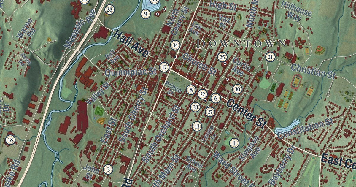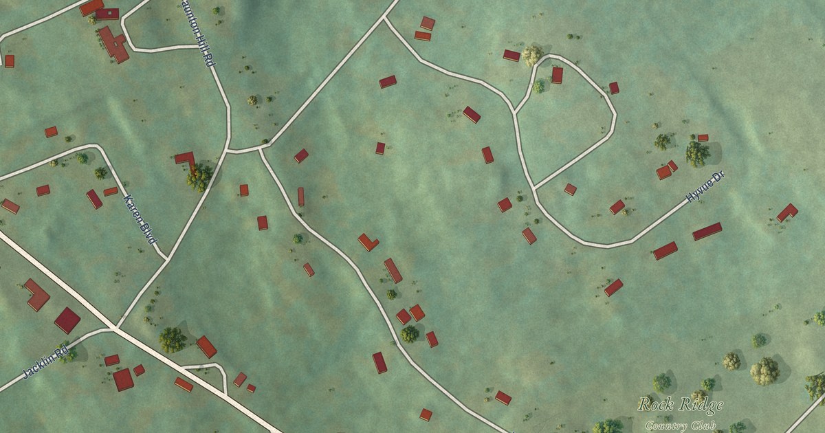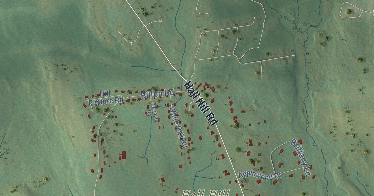
This beautifully detailed map of Somers, Connecticut was created in 2026 using aerial imagery combined with modern topographical, census, street and landmark data. It’s a one-of-a-kind view of Somers that combines accurate data with a vintage aesthetic. The map shows every building in its true location, many of the roads carry their names, and the shaded topographic relief shows the shape of the land.
See it on a wall
The Somers map as an 18 x 24 inch print in a black frame.

Explore an aerial view of Somers, Connecticut
On the map you’ll find Downtown, Somersville, North Somers, Bald Mountain, Hall Hill, Perkins Mountain, Rattlesnake Hill, Cooley Pond, Hurds Lake, Shenipsit State Forest, Camp Aya-Po, Whitaker Woods, and more. If you look closely you can even find your house accurately drawn in its correct location. Zoom in on the preview to look for yours. Click here to learn more about the history of Somers.
Take a closer look at the Somers map
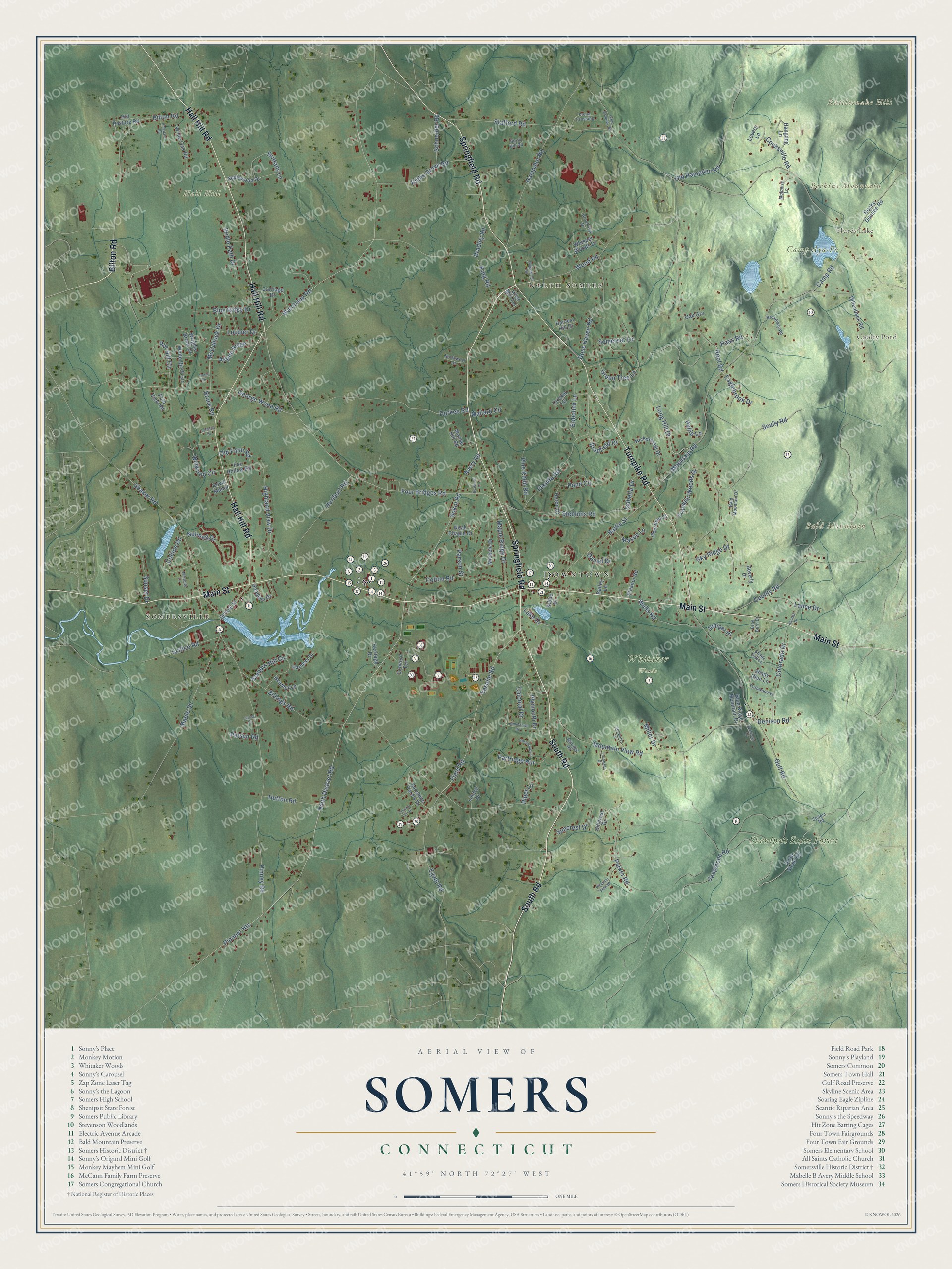
Click to explore a larger preview. The digital watermark does not appear on printed maps.
Names on this map
These names are printed on this map.
Places: Downtown, Somersville, North Somers, Bald Mountain, Hall Hill, Perkins Mountain, Rattlesnake Hill, Cooley Pond, Hurds Lake, Shenipsit State Forest, Camp Aya-Po and Whitaker Woods.
Streets and roads: Main Street, Bilton Road, Springfield Road, Hall Hill Road, Turnpike Road, South Road, Ninth District Road, Sokol Road, Pioneer Heights, Watchaug Road, Four Bridges Road, George Wood Road.
More street names, A to Z
Applewood Drive, Aspen Ridge, Avery Road, Bailey Lane, Bald Mountain Drive, Battle Street, Beverly Drive, Billings Road, Birch Hill Road, Blue Ridge Drive, Blue Ridge Mountain Drive, Bobolink Lane, Brace Road, Bradfield Drive, Bradford Lane, Bradley Road, Brae Burn Drive, Bridle Path Drive, Brittany Lane, Broadway Road, Brookford Drive, Camp Road, Carriage Drive, Collins Road, Colonial Drive, Colorado Drive, Colton Road, Concord Terrace, Cooksville Road, Country Fair Drive, County Road, Cricket Lane, Daniel Drive, Deerfield Street, Denison Road, Dillenback Road, Durkee Road, Eaglebrook Drive, Egypt Road, Eleanor Road, Fernwood Lane, Field Road, Florida Road, Fox Hollow Road, Franklin Woods Drive, Goodwin Drive, Grant Drive, Green Tree Lane, Grist Mill Terrace, Gulf Road, Haas Road, Hallie Lane, Hampden Road, Hangdog Lane, Harness Drive, Harvest Hill Drive, Heather Lane, Heritage Drive, Heron Drive, Hickory Hill Drive, Highland View Drive, Hillcrest Drive, Hill Pasture Road, Horseshoe Lane, Hurlburt Road, Hutton Road, Isaac Bradway Road, Isabella Drive, Jamestown Road, Juniper Hl, Kibbe Drive, Kibbe Grove Road, King Road, Lacabana Drive, Lafayette Lane, Lake Drive, Lamson Drive, Lance Drive, Lindell Drive, Long Hill Drive, Loubier Drive, Louise Street, Lovers Lane, Mallard Circle, Manse Hill Road, Maple Ridge Drive, Maple Street, Mason Lane, McCullock Drive, Michele Drive, Miller Drive, Milridge Road, Mountain Road, Mountain View Road, Mulberry Lane, Noah Chapin Drive, Northwest Drive, Nutmeg Drive, Oak Grv, Old Farm Road, Old Hampden Road, Parker Road, Parson Street, Partridge Run, Patsun Road, Pinedale Road, Pine Knob Road, Pinney Road, Piper Lane, Pleasant View Drive, Plymouth Drive, Polo View Road, Pomeroy Lane, Pond Circle, Randall Drive, Ridgewood Road, Rocky Dundee Road, Root Road, Rose Haven Road, Royal Manor, Rye Hill Circle, Schneider Road, School Street, Scitico Road, Scully Road, Shady Dell Lane, Shady Glen Lane, Shaker Road, Sky Ridge Drive, Soapstone Road, Soap Stone Road, Sodom Road, Somerset Lane, Somers Hill Circle, Stafford Road, Stebbins Road, Stillwater Lane, Stone Crossing, Suncrest Drive, Sunset Drive, Sunshine Farms Drive, Vasalie Road, Wells Road, Whisper Woods Drive, White Birch Circle, White Oak Road, Winwood Circle, Wood Road, Wrights Brook Drive.
This beautifully detailed map of Somers makes an attractive addition to your office, library, or den, and it can even be used to teach children the geography and history of the area. It also makes a great gift for anyone who grew up in Somers or moved away. When you’re done exploring, click here to get your copy of the Somers map.