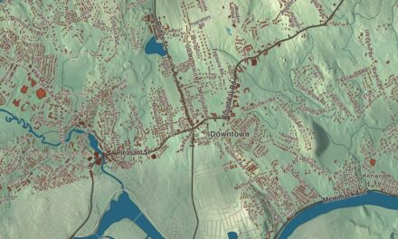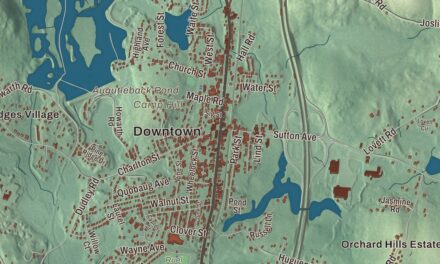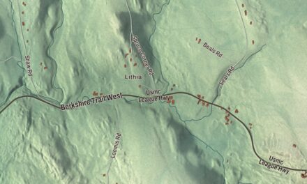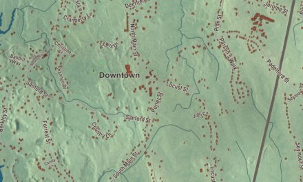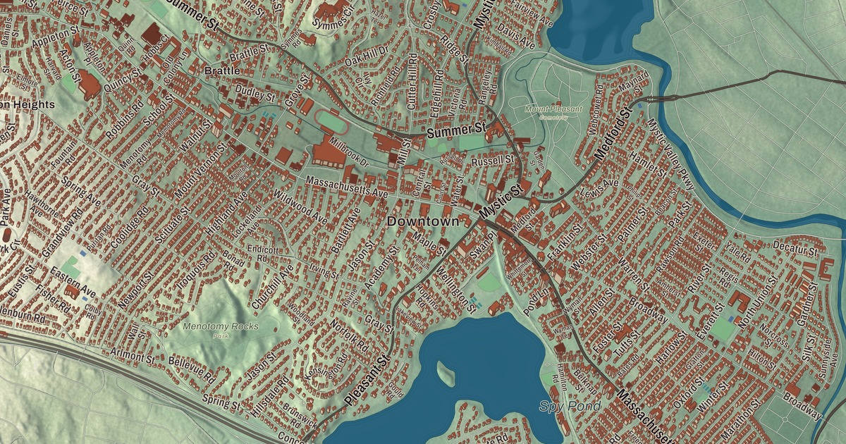
Massachusetts Avenue was once the Concord Road, and Pleasant Street was mostly the old Watertown Road; where the two met in Menotomy stood Jason Russell’s farm. This map prints both, along with Medford Street, Summer Street and Mystic Street, Spy Pond, Upper Mystic Lake, the Arlington Reservoir, Clarendon Hill and Flagstaff Hill. Click here to purchase a print of this map for your wall.
Arlington is in Middlesex County, six miles northwest of Boston.
KNOWOL made this map in 2026 from public survey data and gave it the look of an old atlas. The shaded terrain comes from United States Geological Survey elevation data, and the roads and the town line come from the Census Bureau. Spy Pond, near the middle of town, is a 103-acre kettle hole, a hollow the retreating glacier left behind. Arlington had 46,308 people at the 2020 census.
Menotomy
The Massachusett people lived around the Mystic Lakes, the Mystic River and Alewife Brook. After the sachem Nanepashemet died, about 1619, his widow led the tribe; she deeded the lands of Cambridge and Watertown to the colonists in 1639 and spent her last years on the west side of the Mystic Lakes. The town page says European colonists settled Arlington in 1635 as a village inside Cambridge called Menotomy, an Algonquian word some translate as “swift running water,” though linguists dispute it. The Town of Arlington’s recorded history in the state’s list dates European settlement to 1630. Arlington was incorporated as a town in 1807, on February 27, as West Cambridge, and renamed Arlington on April 30, 1867, in honor of those buried at Arlington National Cemetery. The town remains part of Middlesex County today.
Mill Brook runs through town and shaped its early economy. Captain George Cooke built the first mill in the area in 1637, and seven mills eventually stood on the stream. One survives: the Old Schwamb Mill at 17 Mill Lane, whose page says it claims the oldest continuously used mill site in the United States, with records going back to about 1684. Brothers Charles and Frederick Schwamb bought it in 1864 to make round and oval picture frames, and it’s now a living history museum where frames are still hand-turned much as they were then.
April 19, 1775
Paul Revere’s ride took him through Menotomy. Later that first day of the Revolution, minutemen from the surrounding towns gathered here to ambush the British on their retreat from Concord and Lexington, and the town page says more blood was shed in Menotomy than in the battles of Lexington and Concord combined. The Jason Russell House, on his farm at the corner of the Concord and Watertown roads, saw the largest clash of the day; the Arlington Historical Society bought it in 1923 and runs it as a museum. Not everyone fought with a musket. By Spy Pond, Mother Batherick, an elderly woman out gathering dandelions, managed to take six fleeing Redcoats prisoner.
Ice, lettuce and a spreadsheet
Arlington was a farming town known for its own lettuce, and from the middle of the 1800s Spy Pond fed a large ice industry, much of it shipped to the Caribbean and India by the “Ice King” Frederic Tudor, until the last ice house burned in 1930. Samuel Wilson, the meat packer whose name is said to be the source of “Uncle Sam,” was born in Menotomy in 1766, and a statue in town remembers him. The sculptor Cyrus Dallin moved to Arlington in 1900 and later made an iconic statue of Paul Revere on his midnight ride; a version stands at the Cyrus Dallin Art Museum in town. In 1979 Bob Frankston and Dan Bricklin developed VisiCalc, the first spreadsheet program, in the attic of Frankston’s Arlington apartment. On Medford Street, the Regent Theatre, built in 1916 for vaudeville, still puts on shows and films. The Robbins Library, in the Arlington Center Historic District with the Town Hall and the Old Burying Ground, has what the town page calls the oldest continuously operated free children’s library in the country. Click here to learn more about the history of Arlington.
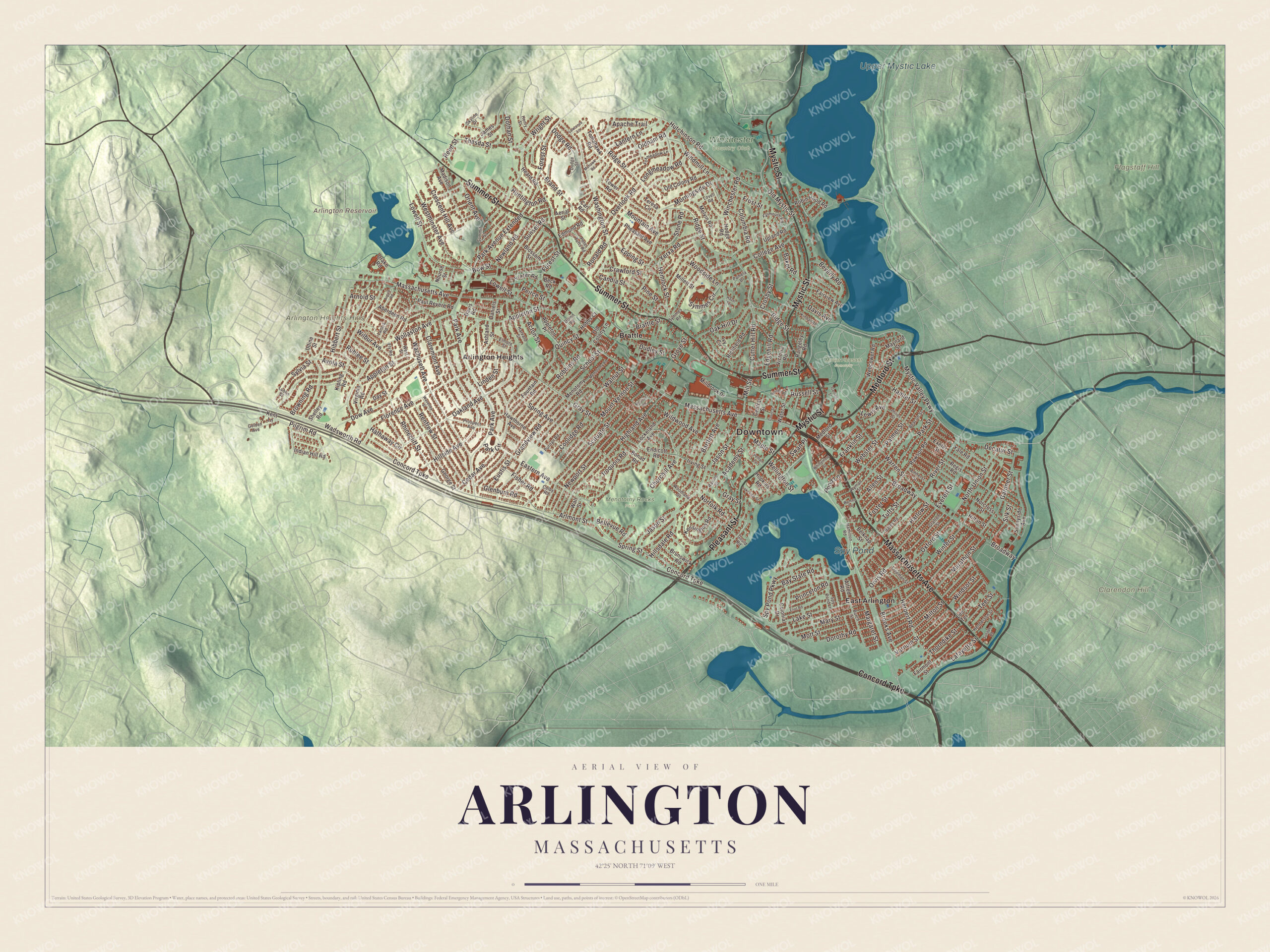
Click to explore a larger preview. The digital watermark does not appear on printed maps.
Names on this map
These names are printed on this map.
Places: Downtown, Arlington Heights Hills, Clarendon Hill, Flagstaff Hill, Arlington Reservoir, Upper Mystic Lake, Spy Pond, Menotomy Rocks Park, Mount Pleasant Cemetery, Winchester Country Club, Arlington Heights, Brattle and East Arlington.
Streets and roads: Massachusetts Avenue, Summer Street, Medford Street, Pleasant Street, Mystic Street, Concord Turnpike, Mystic Valley Parkway, Thorndike Street, Spring Street, Jason Street, Mill Street, Pond Lane.
More street names, A to Z
Aberdeen Road, Academy Street, Acton Street, Aerial Street, Alfred Road, Allen Street, Amherst Street, Apache Trail, Appleton Place, Appleton Street, Argyle Road, Arlmont Street, Arnold Street, Ashland Street, Avola Street, Baker Road, Bartlett Avenue, Bates Road, Bay State Road, Beacon Street, Beck Road, Belknap Street, Bellevue Road, Beverly Road, Blossom Street, Bonad Road, Bow Street, Brand Street, Brattle Street, Broadway, Brooks Avenue, Browning Road, Brunswick Road, Burch Street, Candia Street, Carl Road, Cedar Avenue, Central Street, Churchill Avenue, Claremont Avenue, Colby Road, College Avenue, Colonial Drive, Columbia Road, Coolidge Road, Court Street, Crawford Street, Crescent Hill Avenue, Crosby Street, Cutter Hill Road, Daniels Street, Davis Avenue, Davis Road, Day Street, Decatur Street, Dodge Road, Dodge Street, Dorothy Road, Dothan Street, Dow Avenue, Drake Road, Dudley Street, Eastern Avenue, Edgehill Road, Edmund Road, Eliot Road, Elmore Street, Ely Road, Endicott Road, Epping Street, Eustis Street, Everett Street, Exeter Street, Fairmont Street, Fairview Avenue, Falmouth Road, Fisher Road, Florence Avenue, Forest Street, Foster Street, Fountain Road, Foxmeadow Lane, Franklin Street, Frazer Road, Freeman Street, Frost Street, Garden Street, Gardner Street, George Street, Glenburn Road, Golden Avenue, Gould Road, Grafton Street, Grandview Road, Gray Street, Grove Street, Hamilton Road, Hamlet Street, Harlow Street, Harvard Street, Hathaway Circle, Hawthorne Avenue, Hazel Terrace, Heard Road, Hemlock Street, Henderson Street, Henry Street, Herbert Road, Hibbert Street, Highland Avenue, Hillsdale Road, Hillside Avenue, Hilton Street, Hobbs Court, Hodge Road, Hopkins Road, Huntington Road, Hutchinson Road, Indian Hill Road, Iroquois Road, Irving Street, Ivy Circle, James Street, Kensington Road, Kent Lane, Kimball Road, Kipling Road, Lafayette Street, Lake Street, Lakeview Street, Lanark Road, Lantern Lane, Lawrence Lane, Lee Terrace, Lewis Avenue, Linden Street, Lockeland Avenue, Longmeadow Road, Lovell Road, Lowell Street, Lublin Street, Madison Avenue, Maple Street, Marathon Street, Margaret Street, Mary Street, Maynard Street, Melvin Road, Memotomy Road, Menotomy Road, Millbrook Drive, Millett Street, Milton Street, Mohawk Road, Morningside Drive, Mott Street, Moulton Road, Mountain Avenue, Mount Vernon Street, Newland Road, Newport Street, Norcross Street, Norfolk Road, North Union Street, Nourse Street, Oak Hill Drive, Oakland Avenue, Old Colony Lane, Old Colony Road, Oldham Road, Old Mystic Street, Orient Avenue, Orvis Road, Overlook Road, Oxford Street, Palmer Street, Pamela Drive, Park Avenue, Park Avenue Extended, Park Circle, Park Street, Paul Revere Road, Peirce Street, Pelham Terrace, Peter Tufts Road, Pheasant Avenue, Philips Street, Pilgrim Road, Pine Street, Princeton Road, Prospect Avenue, Puritan Road, Quincy Street, Quinn Road, Rangeley Road, Ravine Street, Rawson Road, Reed Street, Regis Road, Renfrew Street, Rhinecliff Street, Richfield Road, Ridge Street, River Street, Robbins Road, Robin Hood Road, Ronald Road, Rublee Street, Russell Place, Russell Street, School Street, Scituate Street, Shelley Road, Silk Street, Skyline Drive, Spring Avenue, Spy Pond Lane, Spy Pond Parkway, Stone Road, Summit Street, Sunapee Road, Sunnyside Avenue, Sunset Road, Swan Place, Sylvia Street, Symmes Circle, Symmes Road, Teel Street, Teresa Circle, Thesda Street, Tomahawk Road, Tower Road, Tufts Street, Udine Street, Upland Road, Varnum Street, Victoria Road, Virginia Road, Wachusett Avenue, Wadsworth Road, Wall Street, Walnut Street, Warren Street, Washington Street, Water Street, Waverley Street, Webcowet Road, Webster Street, Wellington Street, Westminster Avenue, West Street, Whittemore Street, Wilbur Avenue, Wildwood Avenue, Winchester Road, Windmill Lane, Windsor Street, Winter Street, Wollaston Avenue, Woodland Street, Woodside Lane, Wright Street, Wyman Street, Wyman Terrace, Yale Road, Yerxa Road.
See it on a wall
The Arlington map as a framed print. Swipe for more.


Around the map
Start with Arlington Heights, which locals use for every neighborhood west of Arlington Center. Follow Massachusetts Avenue, Summer Street, Medford Street, Pleasant Street, Mystic Street or the Concord Turnpike across town, then look outward toward Brattle and East Arlington. Spy Pond sits beside the Minuteman Bikeway, and its two-acre Elizabeth Island was set aside for conservation in 2010. The Mystic Lakes, Upper Mystic Lake among them, lie in Arlington, Winchester and Medford. The Arlington Reservoir, Clarendon Hill and Flagstaff Hill are printed on the map too. Lexington is to the west, Winchester to the north, Medford to the northeast, Somerville to the east, Cambridge to the southeast and Belmont to the south.
Hang this Arlington map in an office, library or den, and use it to teach children the geography and history of old Menotomy and the first day of the Revolution. It’s made for people who call Arlington home, from the Heights to Spy Pond. KNOWOL created it in 2026, and it’s printed on museum quality archival paper. Zoom in on the preview above to explore the details, then click here to get your copy of the Arlington, Massachusetts map.

Sources
- Arlington, Massachusetts, Wikipedia
- Jason Russell House, Wikipedia
- Spy Pond, Wikipedia
- Old Schwamb Mill, Wikipedia
- Mystic Lakes, Wikipedia
- Samuel Wilson, Wikipedia
- Cyrus Dallin, Wikipedia
- City and Town Incorporation and Settlement Dates, Secretary of the Commonwealth of Massachusetts (archived copy)