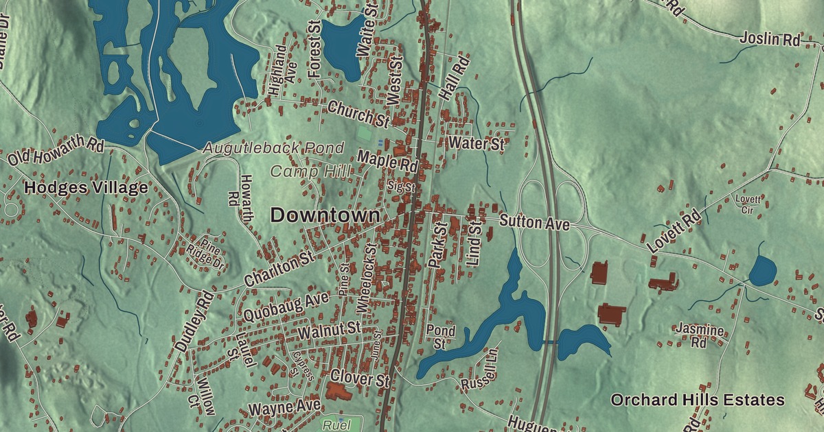
Clara Barton, who founded the American Red Cross, was born in Oxford, in a house her father built in the north part of town. This map shows the town she knew as it stands now, with Main Street, Southbridge Road, Leicester Street, Linwood Street, Joe Jenny Road and Douglas Road printed by name, and Buffumville Lake, Buffum Pond and Ramshorn Pond in the water. Click here to purchase a print of this map for your wall.
Oxford is in Worcester County.
KNOWOL made this map in 2026 from public survey data and gave it the look of an old atlas. The hills come from United States Geological Survey elevation data, and the streets and the town line come from the Census Bureau. Oxford sits in a valley, and much of it lies in the flood plain of the French River, which runs through town. It covers 27.5 square miles and had 13,347 people at the 2020 census.
The French settlers
People lived here for thousands of years before the English came; an arrowhead found at an Oxford site has been radiocarbon dated to 2990 years before the present, give or take 155. In the 1600s the land belonged to the Pegan band of the Nipmuc, and in the early 1670s it fell within Manchaug, one of the praying towns set up for Christian Nipmuc converts. In 1681 and 1682 Black James, constable of the neighboring praying town of Chaubunagungamaug, signed a deed selling large tracts, present Oxford among them, to investors that included Joseph Dudley and Robert Thompson.
Thompson brought over 52 French Huguenots, Protestant refugees he had met in London, and they began the settlement in 1687. The Town of Oxford’s recorded history dates European settlement to 1687. The French built a fort in 1694, and its remains still stand off Huguenot Road, commemorated by a nineteenth-century monument and listed on the National Register of Historic Places. The first settlement was abandoned after four of its residents were killed, and a second try from 1699 to 1704 ended during Queen Anne’s War. The French River is named for the French Protestant settlement in Oxford. English families came next, and by 1720 about 30 of them had founded a church with a minister. Oxford was incorporated as a town in 1713. The town remains part of Worcester County today. The Hudson House, part of it probably built around 1720 by William Hudson, one of the first English settlers, is believed to be Oxford’s oldest standing building.
Clara Barton and other Oxford names
Stephen Barton built his house in 1818, and his daughter Clarissa, known as Clara, was born there on Christmas Day, 1821. She taught for 11 years in schools in and around Oxford. In the Civil War she cared for wounded soldiers close to the fighting at Antietam, Fredericksburg and other battles and became known as the “Angel of the Battlefield.” In 1881 she became president of the American branch of the Red Cross, which held its first official meeting in her Washington apartment. Her birthplace, at 60 Clara Barton Road, has been a museum since 1921, restored to the years she lived there, and it stands on the grounds of the Barton Center for Diabetes Education, which runs a summer camp for children with diabetes.
Oxford also raised Elliott P. Joslin, born here in 1869 to a mill-owning family, who became the first medical doctor in the United States to specialize in diabetes and founded what’s now the Joslin Diabetes Center in Boston. Ebenezer Learned, born in Oxford in 1728, drilled a militia company here in the French and Indian War, served as a selectman in 25 of the years from 1758 to 1794, and rose to brigadier general in the Continental Army. Near the Barton home, Bartlett’s Bridge carries Clara Barton Road over the French River on a granite arch built in 1889, a rare late 19th-century stone bridge in the state, put up at the request of Edwin Bartlett, who owned textile mills in North Oxford.
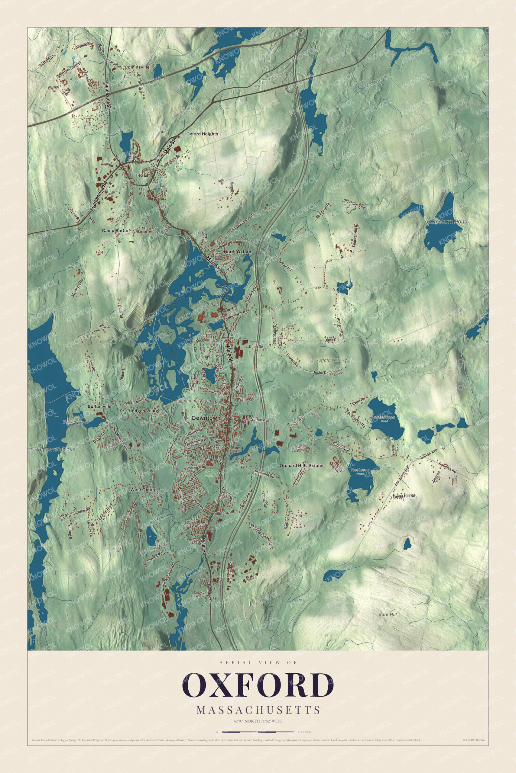
Click to explore a larger preview. The digital watermark does not appear on printed maps.
Names on this map
These names are printed on this map.
Places: Downtown, Cominsville, Bare Hill, Buffalo Hill, Camp Hill, Conlin Hill, Augutleback Pond, Buffum Pond, Ramshorn Pond, Buffumville Lake, Robinson Pond, Ruel Fields, Sacarrappa Pond, Buffumville, Camp Barton, Hodges Village, North Oxford, Orchard Hills Estates, Oxford Heights, Texas and West Oxford.
Streets and roads: Main Street, Southbridge Road, Leicester Street, Linwood Street, Joe Jenny Road, Douglas Road, Sutton Avenue, Church Street, Charlton Street, Old Webster Road, Federal Hill Road, Depot Road.
More street names, A to Z
Ashworth Drive, Bailey Road, Barrett Street, Brown Road, Cherry Street, Chris Road, Clara Barton Road, Clarence Drive, Clover Street, Cole Drive, Colony Avenue, Comins Road, Conlin Road, Coughlin Road, Country Lane, Cypress Street, Dana Drive, Dana Road, Diane Drive, Dolge Court, Douglas Drive, Dudley Road, Eddy Street, Ennis Road, Forest Street, Fort Hill Road, Foster Street, Garrison Heights, George Street, Hall Road, Harlan Drive, Harwood Street, Heritage Drive, Highland Avenue, Holbrook Road, Holley Street, Holly Street, Hope Avenue, Howarth Road, Hubbard Street, Hudson Road, Huguenot Road, Jasmine Road, Joslin Road, June Street, Kelly Street, Larned Road, Laurel Street, Lind Street, Locust Street, Lovett Circle, Lovett Road, Manor Lane, Maple Avenue, Maple Road, McIntyre Road, Merriam District, Millbury Boulevard, Millbury Road, Mill Street, Misty Meadow Lane, Mount Pleasant Street, Oak Drive, Oakwood Terrace, Old Charlton Road, Old Howarth Road, Old Millbury Road, Old Southbridge Road, Old Worcester Road, Orchard Hill Drive, Oxbow Road, Paige Lane, Park Street, Pine Ridge Drive, Pine Street, Pioneer Drive, Plantation Road, Pleasant Street, Polonia Drive, Pond Street, Pratt Avenue, Prince Street, Prospect Hill Road, Prospect Street, Quobaug Avenue, Rocky Hill Road, Russell Lane, Sacarrappa Road, Sig Street, Sneade Drive, Stafford Street, State Street, Stone Creek Circle, Sullivan Boulevard, Sunset Avenue, Suzanne Drive, Taft Hill Road, Thayer Pond Drive, Tower Hill Road, Town Forest Road, Turk Hollow Road, Turner Road, Waite Street, Walnut Street, Walters Drive, Warren Road, Water Street, Wayne Avenue, Wells Street, West Street, Westview Drive, Wheelock Street, Whiting Road, Willow Court.
Around the map
Start with Cominsville, then follow Main Street, Southbridge Road, Leicester Street, Linwood Street, Joe Jenny Road and Douglas Road across town. Then look outward toward Buffumville, Hodges Village, North Oxford, Oxford Heights and Texas. Buffum Pond, Ramshorn Pond, Buffumville Lake, Bare Hill, Buffalo Hill, Conlin Hill and Augutleback Pond are all printed on the map too. Main Street is the local name for Route 12, which runs north and south through town. At Hodges Village the Army Corps of Engineers built the Hodges Village Dam on the French River in 1959 for flood control, after the floods of 1936; the land around it has more than 18.2 miles of hiking trails, the Midstate Trail passes through, and it’s managed together with nearby Buffumville Lake. A good part of the land north and west of Oxford Center is held by the Corps for flood control and also serves as a nature preserve.
The Oxford map makes a fine addition to an office, library or den, and it can help teach children the geography and history of the Huguenot town on the French River. It’s made for people who call Oxford home, from North Oxford to the Douglas line, and it shows the town as it looks today. Zoom in on the preview above to explore the details, then click here to get your copy of the Oxford, Massachusetts map.

We made a map for every town and city in Massachusetts. Explore the complete Massachusetts map collection and find your town.
Sources
- Oxford, Massachusetts, Wikipedia
- Huguenot Fort, Wikipedia
- French River, Wikipedia
- Hudson House (Oxford, Massachusetts), Wikipedia
- Clara Barton, Wikipedia
- Clara Barton Homestead, Wikipedia
- Elliott P. Joslin, Wikipedia
- Ebenezer Learned, Wikipedia
- Bartlett’s Bridge, Wikipedia
- Hodges Village Dam, Wikipedia
- City and Town Incorporation and Settlement Dates, Secretary of the Commonwealth of Massachusetts (archived copy)