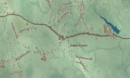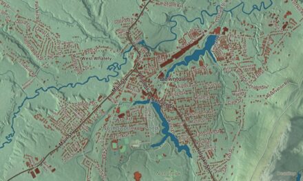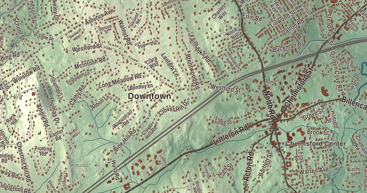
Chelmsford people know the town by its centers: Central Square with the common, North Chelmsford’s Vinal Square on the river side, and the roads that run between them. This map prints Boston Road, Billerica Road, Littleton Road, North Road, Princeton Street and Gorham Street, with Heart Pond, Newfield Pond, Baptist Pond, Fort Hill, Frances Hill and Chestnut Hill. Click here to purchase a print of this map for your wall.
Chelmsford is in Middlesex County, 25 miles northwest of Boston.
KNOWOL made this map in 2026 from public survey data and gave it the look of an old atlas. The relief comes from United States Geological Survey elevation data, and the streets and the town line come from the Census Bureau. Chelmsford covers 23.1 square miles in northern Middlesex County, with the city of Lowell to the northeast. Two sizable rivers bound it, the Merrimack River to the northeast and the Concord River at the town’s easternmost edge, and its neighborhoods include the center, South Chelmsford, West Chelmsford, East Chelmsford, North Chelmsford and the Westlands.
Pennacook land
The Pennacook lived here for thousands of years before the colonists came, and their leaders Passaconaway and Wonalancet worked to keep the peace with the settlers. The Town of Chelmsford’s recorded history, in the Secretary of the Commonwealth’s list, dates European settlement to 1633; the town page says settlers from Woburn and Concord founded Chelmsford in 1652. Chelmsford was incorporated as a town in 1655, by an act of the General Court in the last week of May, and it was named after Chelmsford in England. Groton and Billerica were incorporated at the same time. The town remains part of Middlesex County today.
The early town was much larger, taking in what is now Westford, parts of Carlisle and Tyngsborough, and much of Lowell. Lumber mills, limestone quarries and kilns drove its first economy. In the 1820s the farming community of East Chelmsford was incorporated as Lowell, which grew into one of the first large-scale factory towns in the United States.
Bunker Hill and after
Chelmsford’s militia fought at Lexington and Concord and at Bunker Hill. The town’s own Lieutenant Colonel Moses Parker fought on the hill, was wounded and captured, and died of his wounds on July 4, 1775; he appears in John Trumbull’s The Death of General Warren at the Battle of Bunker’s Hill, and the Parker Middle School carries his name. Captain Benjamin Walker of Chelmsford was killed in the same battle. Benjamin Pierce, born in Chelmsford in 1757, was at Bunker Hill too; he later moved to Hillsborough, New Hampshire, served twice as its governor, and was the father of President Franklin Pierce.
Other names belong here as well. Bridget Richardson Fletcher, born in Chelmsford in 1726, wrote hymns and religious poems that were among the first women’s poems in colonial America, and she’s buried at Fairview Cemetery. Ralph Waldo Emerson opened a school in town in 1825, running it for a few months. Chelmsford’s first school for the deaf opened in 1866, and in 1901 the Chelmsford Spring Company started here, later becoming the Chelmsford Ginger Ale Company; Canada Dry bought it in 1928, and the Chelmsford brand of golden ginger ale is still made today.
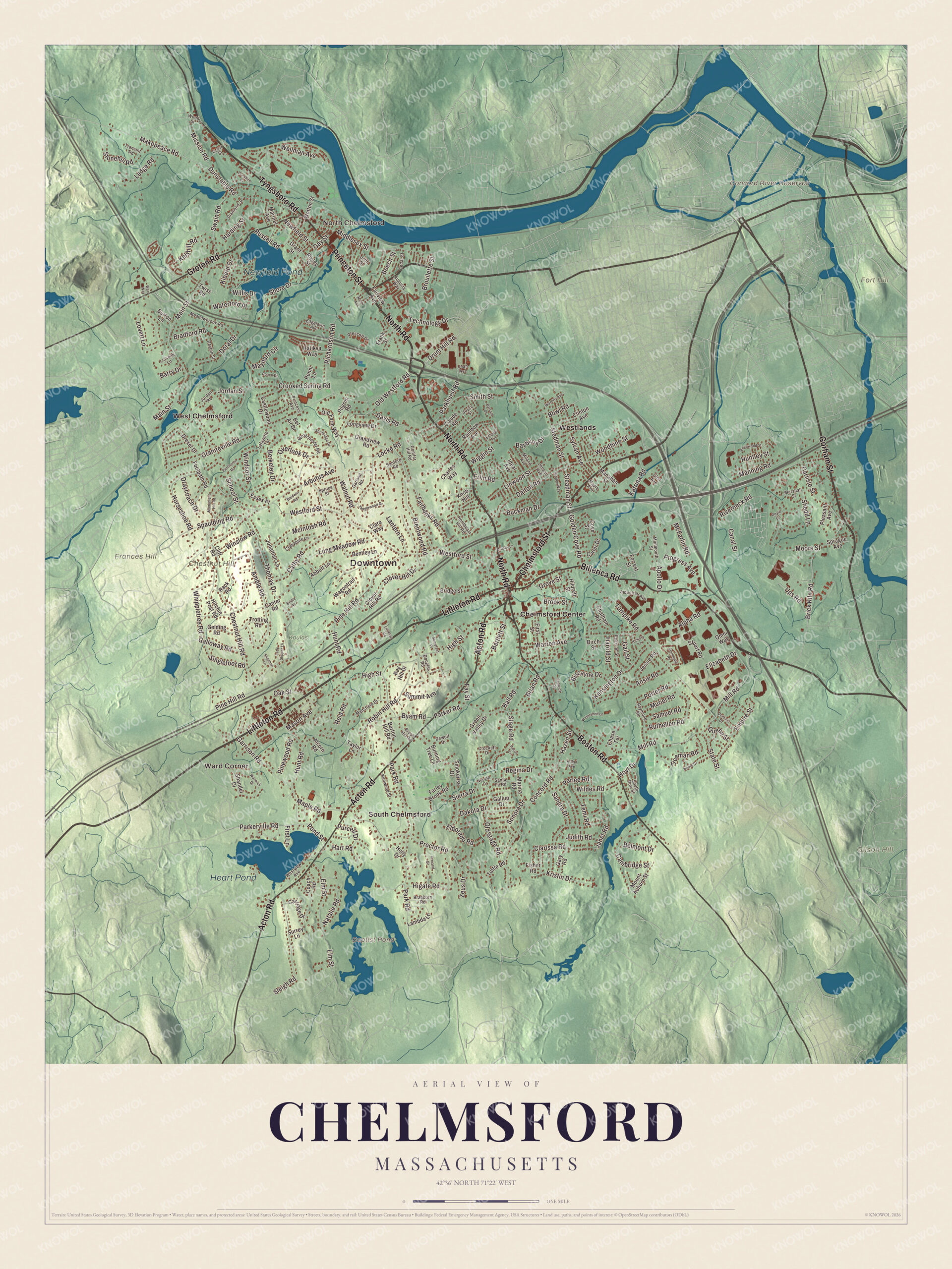
Click to explore a larger preview. The digital watermark does not appear on printed maps.
Names on this map
These names are printed on this map.
Places: Downtown, North Chelmsford, Ward Corner, Chestnut Hill, Fort Hill, Frances Hill, Gilson Hill, Baptist Pond, Concord River Reservoir, Heart Pond, Newfield Pond, Koulas Farm, Chelmsford Center, South Chelmsford, West Chelmsford and Westlands.
Streets and roads: North Road, Littleton Road, Princeton Street, Boston Road, Gorham Street, Billerica Road, Chelmsford Street, Tyngsboro Road, Acton Road, Groton Road, Middlesex Street, Shore Drive.
More street names, A to Z
Abbott Lane, Alcorn Road, Alpha Road, Amble Road, Ansie Road, Apollo Drive, Arbutus Avenue, Armand Drive, Arthur Avenue, Augusta Way, Baldwin Road, Balsam Drive, Barry Drive, Bartlett Street, Barton Hill Road, Bayberry Drive, Beech Street, Bel Air Drive, Belmont Drive, Bentley Lane, Berkeley Drive, Birch Street, Biscayne Drive, Bowl Road, Bradford Road, Braeburn Road, Brentwood Road, Brian Road, Brick Kiln Road, Bridge Street, Bridle Road, Brook Street, Brouilette Street, Brush Hill Road, Buckman Drive, Burning Tree Lane, Burton Lane, Byam Road, Cambridge Street, Canal Street, Canter Road, Carlisle Street, Carriage Drive, Carter Drive, Castlewood Drive, Cathy Road, Cedar Street, Charles Way, Chase Terrace, Chatham Road, Chestnut Hill Road, Clara Way, Clarissa Road, Claude Road, Cliff Road, Clinton Avenue, Clover Hill Drive, Clover Hill Road, Coach Road, Concord Road, Conifer Hill Road, Cove Street, Crabapple Lane, Crockett Drive, Crooked Spring Road, Crosby Lane, Cross Street, Dakota Drive, Dalton Road, Davis Road, Dayton Street, Dewolf Drive, Diamond Street, Dominic Drive, Doral Drive, Douglas Road, Doyle Circle, Draycoach Drive, Drexel Drive, Drum Hill Road, Dunshire Drive, Dunstable Road, Eclipse Avenue, Edgelawn Avenue, Edgewood Street, Eldorado Road, Elizabeth Drive, Elm Street, Empire Street, Erlin Road, Essex Place, Fairbanks Road, Fairview Avenue, Farley Brook Road, Fay Street, Fenwick Drive, First Lane, First Street, Fisher Road, Footpath Road, Forrest Street, Frank Street, Freeman Road, Gail Street, Galloway Road, Gallup Drive, Garland Road, Garrison Road, Gary Road, Gay Street, Gelding Road, Glen Avenue, Golden Cove Road, Grandview Road, Graniteville Road, Grant Street, Green Valley Drive, Grove Street, Hall Road, Harding Street, Harold Street, Hart Road, Hatikva Way, Hazen Street, Hickory Lane, Hidden Way, Higate Road, High Street, Hildreth Street, Hitchin Post Road, Holly Drive, Hornbeam Hill Road, Horseshoe Road, Hoyt Drive, Huntley Street, Hunt Road, Ideal Avenue, Industrial Avenue, Janet Road, Jean Avenue, Jensen Avenue, Jessie Road, John Street, Jonathan Lane, Jordan Road, Jordan Street, Joyce Street, Judith Road, Katrina Road, Kelshill Road, Kensington Drive, Kenwood Street, Kiberd Drive, Knob Hill, Kristin Drive, Lady Slipper Lane, Lafayette Terrace, Lambda Lane, Lantern Lane, Ledge Road, Linwood Street, Locke Road, Loiselle Lane, Long Meadow Road, Longview Drive, Lovett Lane, Main Street, Makepeace Road, Manahan Street, Manning Road, Mansfield Drive, Maple Avenue, Maple Road, Marina Road, Marinel Avenue, Marshall Street, Mason Avenue, Maynard Circle, McFarlin Road, McIntosh Road, Meadowbrook Road, Miland Avenue, Mill Road, Miner Avenue, Mission Road, Monmouth Street, Monument Hill Road, Moore Street, Mount Auburn Street, Muriel Road, Natalie Road, Nevada Drive, Newfield Street, Noble Drive, Oak Street, Old Farm Way, Old Stage Road, Old Westford Road, Omni Way, Overlook Drive, Parker Road, Parkerville Road, Parkhurst Road, Park Road, Parlee Road, Pearson Street, Pecos Circle, Penni Lane, Percheron Road, Pilgrim Road, Pine Hill Road, Pinewood Road, Pleasant Avenue, Pond Street, Porter Road, Prescott Drive, Princess Avenue, Proctor Road, Progress Avenue, Purcell Drive, Queen Street, Rack Road, Rainbow Avenue, Ray Hill Drive, Raymond Road, Regina Drive, Reid Road, Richardson Road, Ripley Street, Riverneck Road, Roaen Drive, Robin Hill Road, Russell Road, Ruthellen Road, Samuel Road, Sandra Drive, Sanford Road, Santa Fe Road, School Street, Shandel Drive, Shedd Lane, Sheehan Lane, Sierra Drive, Singlefoot Road, Sleigh Road, Smith Street, Smokerise Drive, Somerset Place, Sonora Drive, South Row Street, Spaulding Road, Sprague Avenue, Spruce Street, Stage Road, State Street, Steadman Street, Stedman Street, Stonegate Road, Stonehill Road, Stuart Road, Sturbridge Drive, Summit Avenue, Surrey Lane, Swain Road, Sylvan Avenue, Tanglewood Drive, Taylor Lane, Technology Drive, Temi Road, Thomas Drive, Tremont Road, Trotting Road, Turnpike Road, Tuttle Road, Twiss Road, Ups Road, Wagontrail Road, Walnut Road, Ward Way, Warren Avenue, Warwick Drive, Waterford Place, Watershed Lane, Waverly Avenue, Wellman Avenue, Westchester Road, Westford Street, Westview Avenue, Whippletree Road, Wiggin Street, Wildes Road, Willis Drive, Windsor Street, Winslow Road, Woodbine Street, Wood Street, Wotton Street, Zeus Drive.
See it on a wall
The Chelmsford map as a framed print. Swipe for more.


Canal, turnpike and old houses
Both the Middlesex Canal and the Middlesex Turnpike were built through Chelmsford early in the 19th century. The canal, 27 miles long and finished in 1803, linked the Merrimack River with Boston and was one of the first civil engineering projects of its kind in the country. The Chelmsford Center Historic District runs from Central Square, where Billerica Road meets Chelmsford Street, west past the junction of Littleton and North roads with Westford Street, taking in the 17th-century common and first burying ground. The Old Chelmsford Garrison House is the oldest house in town; its society says it stood before 1691, while a later deed and its style point to after 1700. The Barrett-Byam Homestead, established in 1663, is home to the Chelmsford Historical Society, and the 1853 North Town Hall on Princeton Street, where town meetings once alternated with the center, is a community center again.
Around the map
Start in North Chelmsford, centered on Vinal Square where Routes 3A and 40 meet, then follow North Road, Littleton Road, Princeton Street, Boston Road, Gorham Street and Billerica Road across town, and look outward toward Ward Corner, Chelmsford Center, South Chelmsford, West Chelmsford and the Westlands. North Chelmsford has its own library, post office, fire station and water district, and Chelmsford High School is there. Newfield Pond, beside Route 40, has been called Freeman Lake since 1986, after Bruce Freeman paid to rebuild its dam. Heart Pond, a 91-acre kettle pond in the southwestern corner on the Westford line, is also known as Baptist Pond, and ice was cut there into the early 1900s. The Bruce Freeman Rail Trail runs 6.8 miles through Lowell, Chelmsford and Westford, crossing Central Square. Heart Pond, Newfield Pond, Chestnut Hill, Fort Hill, Frances Hill, Baptist Pond and the Concord River Reservoir are all printed on the map.
Chelmsford’s map makes a fine addition to an office, library or den, and it can help teach children the geography and history of the town Lowell grew out of. It’s made for people who call Chelmsford home, from North Chelmsford to the Westlands, and it shows the town as it looks today. Zoom in on the preview above to explore the details, then click here to get your copy of the Chelmsford, Massachusetts map.

Sources
- Chelmsford, Massachusetts, Wikipedia
- Benjamin Pierce (politician), Wikipedia
- Bridget Richardson Fletcher, Wikipedia
- Middlesex Canal, Wikipedia
- Chelmsford Center Historic District, Wikipedia
- Old Chelmsford Garrison House, Wikipedia
- Barrett-Byam Homestead, Wikipedia
- North Town Hall, Wikipedia
- North Chelmsford, Massachusetts, Wikipedia
- Heart Pond (Massachusetts), Wikipedia
- Bruce Freeman Rail Trail, Wikipedia
- City and Town Incorporation and Settlement Dates, Secretary of the Commonwealth of Massachusetts (archived copy)