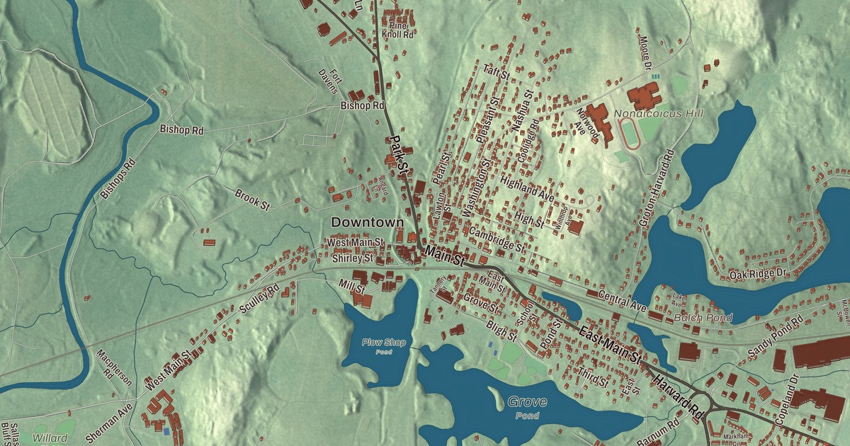
Ayer grew up where the railroads crossed, and anyone who has waited on the platform at Ayer station or walked Main Street past the old brick blocks has seen what the junction built. This map prints Main Street, East Main Street, Park Street, Harvard Road, Littleton Road and Fitchburg Road, with the Willows, Spectacle Pond, Balch Pond, Black Pond, Flannagan Pond, Brown Hill, Fletcher Hill and Longs Hill. Click here to purchase a print of this map for your wall.
Ayer is in Middlesex County, bordered by Shirley, Groton, Littleton and Harvard.
KNOWOL made this map in 2026 from public survey data and gave it an old atlas look. The terrain comes from United States Geological Survey elevation data; the roads and the town line come from the Census Bureau. The whole town covers only 9.6 square miles, and it had 8,479 people at the 2020 census; it takes in the census-designated places of Ayer and Devens.
Nonacoicus
Ayer was home to the Nashaway, a Nipmuc people who lived along the Nashua River and its streams, with a small settlement on Nonacoicus Brook in the western part of town. In 1698 Justice Samuel Sewall recorded that the name meant a small earthen pot, probably for a row of little mounds along the brook. Parts of Main Street and Sandy Pond Road are believed to follow trails that Native people used for trade and travel, and every year salmon, shad and herring once ran up the Nashua River from the sea. Groton, which then included Ayer, was settled by English colonists as early as 1655, and the town page dates the first settlement in today’s Ayer to 1667, when a mill went up on Nonacoicus Brook. The Town of Ayer’s recorded history, in the Secretary of the Commonwealth’s list, dates European settlement to 1668.
Groton Junction
The hamlet became South Groton, then Groton Junction once the trains came. The Fitchburg Railroad arrived in the mid-1840s, and in 1848 the Peterborough and Shirley, the Worcester and Nashua and the Stony Brook railroads all joined it, and the railroad access grew a tiny farm village into a major junction. A new station went up in 1896, and by 1900 five lines served the town. The junction split off from Groton and incorporated on February 14, 1871, as Ayer, named for Dr. James Cook Ayer of Lowell, the patent medicine maker, who paid for the Town Hall. The town remains part of Middlesex County today. A fire in 1872 cleared many older buildings, and the brick and stone blocks that replaced them, built mostly between 1872 and 1898 on the north side of Main Street facing the rail yards, now form the Ayer Main Street Historic District, listed on the National Register of Historic Places in 1989. The Town Hall, in high Victorian Gothic style, stands near its eastern end, and the Fitchburg Line still stops at Ayer station just south of Main Street.
The Pleasant Street School, a Colonial Revival building designed by Boston architect Charles E. Parks, opened in 1893, doubled in size in 1906, and taught children until 1984. Two Ayer High School students went far. Norbert Wiener graduated from Ayer High School in 1906 at the age of 11 and became a pioneering electronics engineer and theorist of computers and cybernetics. Rita Briggs, born in Ayer in 1929, was the full-time catcher on the Ayer High baseball team and went on to catch for seven teams of the All-American Girls Professional Baseball League from 1947 to 1954; in 1948 she caught 128 games, a record for a catcher in one season. Click here to learn more about the history of Ayer.
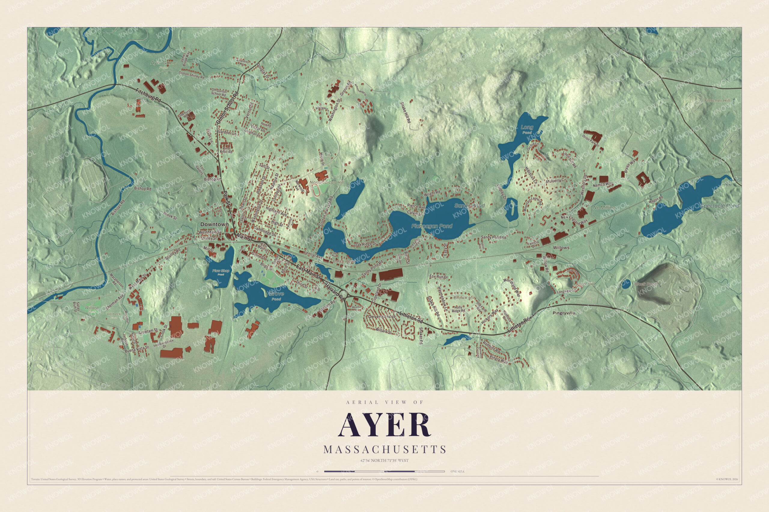
Click to explore a larger preview. The digital watermark does not appear on printed maps.
Names on this map
These names are printed on this map.
Places: Downtown, Willows, Devenscrest, Brown Hill, Fletcher Hill, Longs Hill, Nonaicoicus Hill, Balch Pond, Black Pond, Flannagan Pond, Spectacle Pond, Sandy Pond, Ayer Game Farm, Grove Pond, Long Pond, Ne Milling, Plow Shop Pond, Verbeck Field, Willard Field and Pingryville.
Streets and roads: Park Street, East Main Street, Main Street, Harvard Road, Littleton Road, Fitchburg Road, Groton School Road, West Main Street, Barnum Road, Buena Vista Street, Mill Street, Sandy Pond Road.
More street names, A to Z
Amandrey Way, Angard Lane, Antietam Street, Auman Street, Autumn Ridge Drive, Bennetts Crossing, Birch Street, Bishop Road, Bishops Road, Bligh Street, Brook Street, Bryan Way, Calvin Street, Cambridge Street, Central Avenue, Cook Street, Coolidge Road, Copeland Drive, Douglas Drive, Doug Road, East Street, Easy Street, Fort Davens, Fox Run Drive, Gardner Lane, Groton-Harvard Road, Groton-Shirley Road, Groton Road, Grove Street, Haymeadow Lane, Hemlock Drive, Hibiscus Lane, Hickory Way, Highland Avenue, High Street, Holly Ridge Road, Independence Drive, Isaac Lane, Jackson Road, James Brook Way, Jonathan Drive, Juniper Ridge, Lake Avenue, Lawton Street, Lindley Drive, Longview Circle, Loon Hill Road, Macarthur Avenue, Macpherson Road, Madigan Lane, Markham Circle, McDowell Street, Moore Drive, Mountain Laurel Road, Mulberry Circle, Nashua Street, Nemco Way, New England Way, Norwood Avenue, Oakhurst Road, Oak Ridge Drive, Off Gorton School Road, Old Farm Way, Old Sandy Pond Road, Orchid Lane, Orion Park Drive, Patricia Drive, Patriot Way, Pearl Street, Pierce Avenue, Pine Knoll Road, Pingry Way, Pleasant Street, Pond Street, Robbins Road, Sallas Bluff Street, School Street, Sculley Road, Shaker Road, Sherman Avenue, Shirley Street, Snake Hill Road, Taft Street, Tannery Street, Third Street, Vernon Street, Victor Drive, Wagon Road, Washington Street, Westford Road, Willard Street, Willow Road, Winthrop Avenue, Woodland Way, Wright Road.
See it on a wall
The Ayer map as a framed print. Swipe for more.


Camps, a ski jump and a rail trail
During the Civil War, Camp Stevens trained Massachusetts volunteers near the Nashua River. In 1917 the federal government set up Camp Devens, named for the jurist and Civil War general Charles Devens, on land bought in Ayer, Harvard, Lancaster and Shirley, and more than 100,000 soldiers trained or passed through it in the First World War. Fort Devens closed in 1996 and reopened the next day as a reserve training area, much smaller than before. In 1935 a wooden ski jump went up at Pingry Hill near the Willows, which the town page calls the largest Nordic ski jump in North America. It was used for a single winter, part of it blew down in the summer of 1936, and it was never rebuilt. Today the Nashua River Rail Trail starts in Ayer, close to the station, and runs 12.5 miles along the old Worcester and Nashua line to Nashua, New Hampshire; it opened in 2002.
Start in the Willows and Pingryville, then follow Main Street, East Main Street, Park Street, Harvard Road, Littleton Road and Fitchburg Road across town and out toward Devenscrest. Spectacle Pond, Balch Pond, Black Pond, Flannagan Pond, Brown Hill, Fletcher Hill and Longs Hill are all printed on the map.
This Ayer map belongs in an office, library or den, and it can help teach children the geography and history of the old Groton Junction. It’s made for people who call Ayer home, from the Willows to Devenscrest, and it shows the town as it looks today. Zoom in on the preview above to explore the details, then click here to get your copy of the Ayer, Massachusetts map.

Sources
- Ayer, Massachusetts, Wikipedia
- Ayer station, Wikipedia
- Ayer Main Street Historic District, Wikipedia
- James Cook Ayer, Wikipedia
- Pleasant Street School (Ayer, Massachusetts), Wikipedia
- Norbert Wiener, Wikipedia
- Rita Briggs, Wikipedia
- Fort Devens, Wikipedia
- Nashua River Rail Trail, Wikipedia
- City and Town Incorporation and Settlement Dates, Secretary of the Commonwealth of Massachusetts (archived copy)