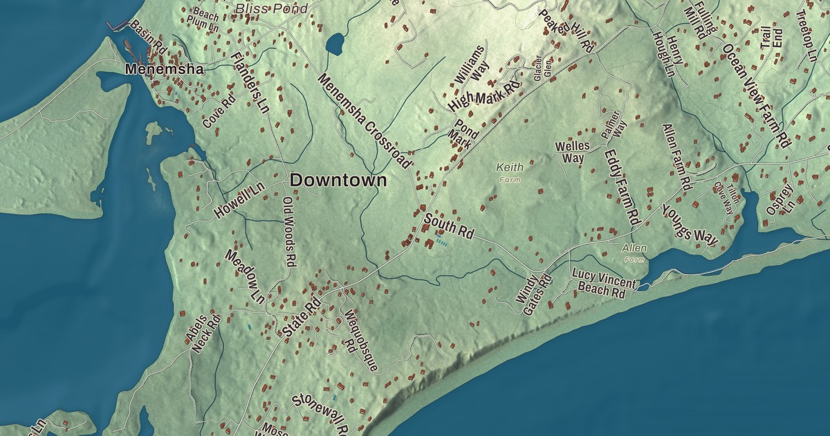
Chilmark runs from the fishing boats at Menemsha on Vineyard Sound to the Atlantic shore at Squibnocket, with a string of salt ponds along its south side. This map prints State Road, South Road, North Road, Quenames Road, Quansoo Road and High Mark Road, with Squibnocket Pond, Tisbury Great Pond, Bliss Pond and Abel Hill. Click here to purchase a print of this map for your wall.
Chilmark is a town on Martha’s Vineyard, in Dukes County.
KNOWOL made this map in 2026 from public survey data and gave it the look of an old atlas. The relief comes from United States Geological Survey elevation data, and the roads and the town line come from the Census Bureau. Chilmark has 19.0 square miles of land, with Vineyard Sound and Aquinnah to the west, West Tisbury to the east and the Atlantic Ocean to the south. The town also takes in Nomans Land, an uninhabited island about 3 miles off the Vineyard’s southwest corner, which makes Chilmark officially the second most southerly point in Massachusetts. It had 1,212 people at the 2020 census.
Named for a Wiltshire village
Governor Thomas Mayhew, the Elder, set up the first English settlement on Martha’s Vineyard, Nantucket and the nearby islands in 1642. The Town of Chilmark’s recorded history, in the Secretary of the Commonwealth’s list, dates European settlement here to 1671. The town’s own page says it was incorporated on September 14, 1694, the first town to break away from the island’s two original towns, Tisbury and Edgartown. It was named for Chilmark in the English county of Wiltshire, the Mayhew family’s ancestral home. In 1714 Chilmark was made a township that included Nomans Land, and the state list gives that year: Chilmark was incorporated as a town in 1714. The town remains part of Dukes County today.
A town that signed
For generations, deaf and hearing people in Chilmark talked with their hands. Hereditary deafness was on Martha’s Vineyard by 1714, and in 1854, when the national average was one deaf person in 5,728, one person in every 25 in Chilmark was. In Squibnocket, at one point, as many as 1 in 4 of its 60 people were deaf. By the 18th century there was a distinct Chilmark Sign Language, which grew into what’s now called Martha’s Vineyard Sign Language, and from the late 1700s to the early 1900s nearly everyone on the island could sign to some degree, hearing people as well as deaf. Deaf islanders worked, went to island events and took part in town life as everyone else did, an integration that set the Vineyard apart from deaf communities elsewhere. Many of the language’s users were influential in the development of American Sign Language. Katie West, the last deaf person born into the tradition, died in 1952.
Menemsha
Menemsha is Chilmark’s small fishing village, on the east shore of Menemsha Pond beside the opening to Vineyard Sound, and it was once known as Menemsha Creek. Fishermen leave from its historic harbor, some from families that have fished for generations, along with charter boats to the Elizabeth Islands, and a bicycle ferry crosses the pond to Aquinnah. It has a public beach, a boat launch and Coast Guard Station Menemsha, which burned in July 2010 and was rebuilt and recommissioned in April 2015. Steven Spielberg used Chilmark and Menemsha as the fictional Amity Island in his 1975 film Jaws. Just northeast of the village, the Menemsha Hills Reservation is the largest of the town’s sanctuaries and preserves.
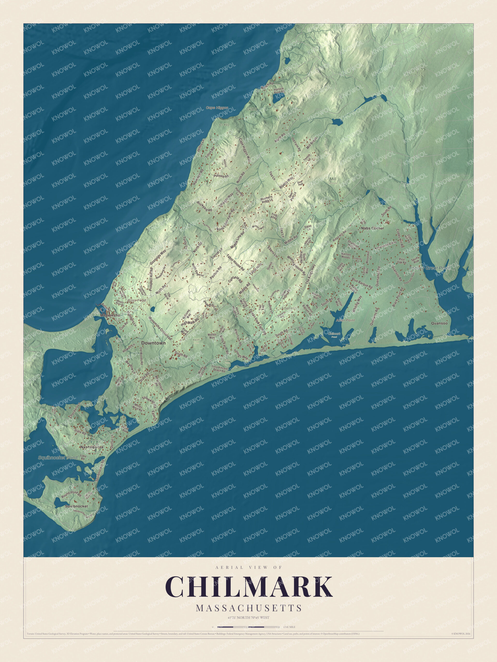
Click to explore a larger preview. The digital watermark does not appear on printed maps.
Names on this map
These names are printed on this map.
Places: Downtown, Abel Hill, Allen Point, Cape Higgon, Bliss Pond, Tisbury Great Pond, Squibnocket Pond, Allen Farm, Chilmark Pond, Cr #41, Ganz, Keith Farm, Mill Brook, Menemsha, Nabs Corner, Nashaquitsa, Quansoo and Squibnocket.
Streets and roads: State Road, South Road, Quenames Road, High Mark Road, Quansoo Road, Turtle Cv, North Road, Middle Road, Tea Lane, Gosnolds Way, Black Point Road, Meeting House Road.
More street names, A to Z
Abels Neck Road, Allen Farm Road, Arno Camp Road, Bartlett Woods, Barton Way, Basin Road, Beach Plum Lane, Beach Road, Beetlebung Road, Bijah's Way, Blue Barque Road, Blueberry Ridge Lane, Brickyard Road, Cape Higgon Way, Cencelle Road, Chappaquoit Road, Chockers Lane, Cobb Hill Road, Cobbs Hill Road, Cottle Cove Road, Cove Road, Cranberry Hill Road, Daisy Lane, Davids Way, Deer Path, Deer Path Lane, Doctors Creek Path, East Lane, Ebens Lane, Eddy Farm Road, Eliot Avenue, Fenner Way, Flanders Lane, Frog Alley, Fulling Mill Road, Glacier Glen, Greystone, Guerin Lane, Hammett Lane, Hammett Road, Harding Hill, Harlock Pond Road, Hawk Valley Road, Henry Hough Lane, Herring Run, Hewing Field, Howell Lane, Jethro Lane, Kenasaoome Way, Lake Road, Line Drive, Lobster Lane, Lookout Place, Lucy Vincent Beach Road, Marion's Way, Meadow Lane, Menemsha Crossroad, Menemsha Inn Road, Middle Line Road, Mollys Lane, Moses West Road, North Slope Lane, North Tabor Farm Road, Ocean View Farm Road, Old Farm Road, Old Fields Path, Old Woods Road, Osprey Lane, Palmer Way, Pasture Road, Peaked Hill Road, Pier Point Avenue, Pond Mark, Post Oak Road, Prospect Hill Road, Putnam Road, Quenams Road, Quitsa Lane, Rebecca Lane, Ridge Hill Road, Round Pond Road, Seaward Way, Shadbush Hollow, Sheep Hill Road, Snail Road, South Ridge Road, Spruce Gate Road, Spuds Row, Squibnocket Farm Road, Squibnocket Road, Stonewall Road, Straight Way, Tabor Hills, Tabor House Road, Tennis Lane, The Aerie, The Kings Highway, Tiercel Lane, Tilton Cove Way, Tilton Road, Trail End, Treetop Lane, Trustees Lane, Tysbury Manor Road, Wades Field Lane, Welles Way, Wequobsque Road, Whiting Way, Williams Way, Windy Gates Road, Wooton Bassett Road, Wososket Lane, Youngs Way.
Around the map
Start with Menemsha, then follow State Road, South Road, Quenames Road, High Mark Road, Quansoo Road and North Road across town, and look outward toward Nabs Corner, Nashaquitsa, Quansoo and Squibnocket. Chilmark shares Squibnocket Pond and Menemsha Pond with Aquinnah, and the only road to Aquinnah passes between those two ponds, just 1,100 feet apart at their closest. The barrier beach on the south side of Squibnocket Pond hasn’t been breached in a hundred years, and Herring Creek, owned and kept by the Wampanoag Tribe of Gay Head, still carries alewives and blueback herring from Menemsha Pond into Squibnocket to spawn each spring. Tisbury Great Pond, which its page places in West Tisbury, is the largest great pond on the Vineyard. Chilmark also has the highest point on Martha’s Vineyard, the 311-foot summit of Peaked Hill. Bliss Pond, Tisbury Great Pond, Squibnocket Pond and Abel Hill are all printed on the map.
The artist Thomas Hart Benton first came to Chilmark in the summer of 1919, and his 1920 People of Chilmark, the largest work he’d made to that point, hangs at the Hirshhorn Museum in Washington. A Chilmark map makes a fine addition to an office, library or den, and it can help teach children the geography and history of the island town their family loves. It’s made for people who call Chilmark home, from Menemsha to Squibnocket, and it shows the town as it looks today. Zoom in on the preview above to explore the details, then click here to get your copy of the Chilmark, Massachusetts map.

We made a map for every town and city in Massachusetts. Explore the complete Massachusetts map collection and find your town.
Sources
- Chilmark, Massachusetts, Wikipedia
- Martha’s Vineyard Sign Language, Wikipedia
- Menemsha, Massachusetts, Wikipedia
- Squibnocket Pond, Wikipedia
- Tisbury Great Pond, Wikipedia
- Nomans Land, Wikipedia
- City and Town Incorporation and Settlement Dates, Secretary of the Commonwealth of Massachusetts (archived copy)