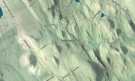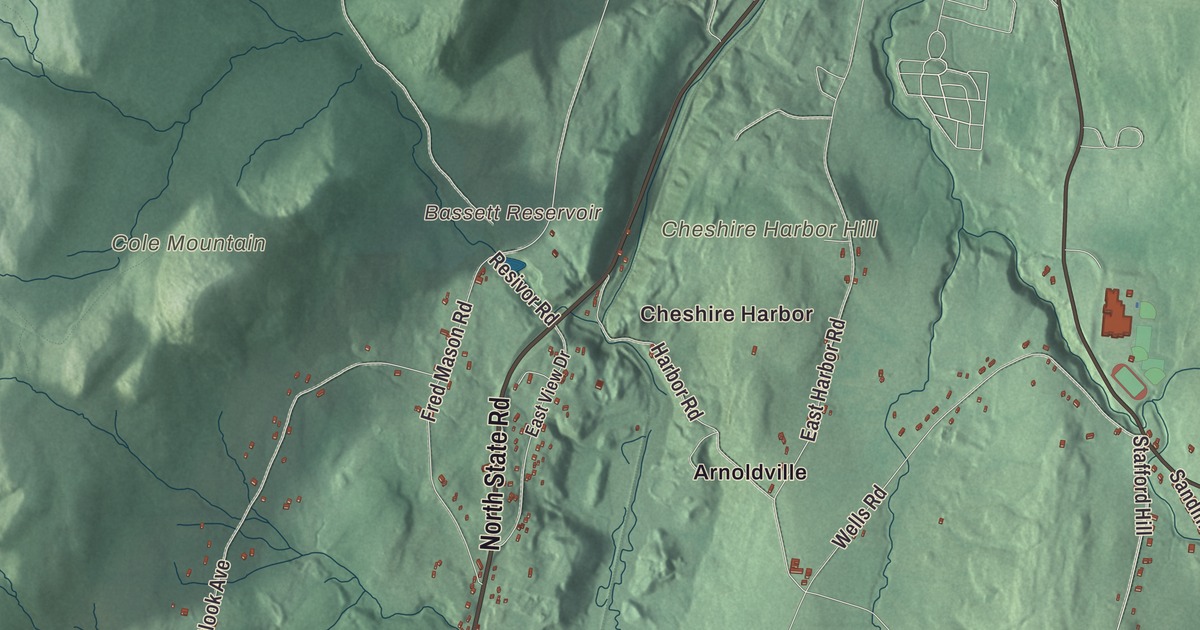
Cheshire is the Hoosic River valley between Mount Greylock and the Hoosac Range, the town where the Appalachian Trail crosses the center and the rail trail runs along the reservoir. This map prints North State Road, South State Road, North Street, Railroad Street, Savoy Road and Windsor Road, with the Cheshire Reservoir, Bassett Reservoir, Gore Pond, Cole Mountain, Hales Hill and Cheshire Harbor Hill. Click here to purchase a print of this map for your wall.
Cheshire is in Berkshire County, 10.5 miles northeast of Pittsfield.
KNOWOL made this map in 2026 from public survey data and gave it the look of an old atlas. The relief comes from United States Geological Survey elevation data, and the roads and the town line come from the Census Bureau. Cheshire covers 27.5 square miles in the valley of the Hoosic River, with parts of the Mount Greylock State Reservation on the west, the southern foothills of the Hoosac Range on the east, and North Mountain just past the line to the southeast. New Ashford, Adams, Savoy, Windsor, Dalton and Lanesborough surround it, and it had 3,258 people at the 2020 census.
Baptists from Rhode Island
Cheshire was founded by Baptists from Rhode Island, mostly descendants of those who had followed Roger Williams there to worship freely, and they were the first settlers in the region who didn’t belong to the established Puritan church. They called their settlement New Providence and built on Providence Hill, later renamed Stafford Hill for Colonel Joab Stafford, who had surveyed the land and led the men of Cheshire into the Revolution. The Town of Cheshire’s recorded history, in the Secretary of the Commonwealth’s list, dates European settlement to 1766. Cheshire was incorporated as a town in 1793, made from parts of Adams, New Ashford, Lanesborough and Windsor and named for Cheshire in England, and it remains part of Berkshire County today. On Stafford Hill, the Pioneer Monument, a fieldstone copy of the old stone mill in Newport, Rhode Island, remembers the founders.
The Mammoth Cheese
Cheshire people took their politics seriously. In the hard-fought election of 1800 it was the only Berkshire town that favored Thomas Jefferson, and its Baptist pastor, Elder John Leland, a friend of Jefferson’s and a champion of religious freedom, campaigned for him. When Jefferson won, Leland urged everyone in his congregation who owned a cow to bring a day’s milk, or its curds, to a great cider mill, and he insisted that “no Federal cow” be allowed to contribute. Pressed in a cider press fitted with a giant hoop, the cheese came out 4 feet across, 18 inches thick and 1,235 pounds, and it carried Jefferson’s motto, “Rebellion to tyrants is obedience to God.”
It went to Washington on a sled drawn by six horses and by water, and Leland presented it to the President on January 1, 1802, preaching all the way there and back. Jefferson sent a personal letter of thanks, and Leland was invited to preach to Congress. A monument in town commemorates the cheese, and the town page says Cheshire, like its English namesake, specialized in dairying and cheesemaking.
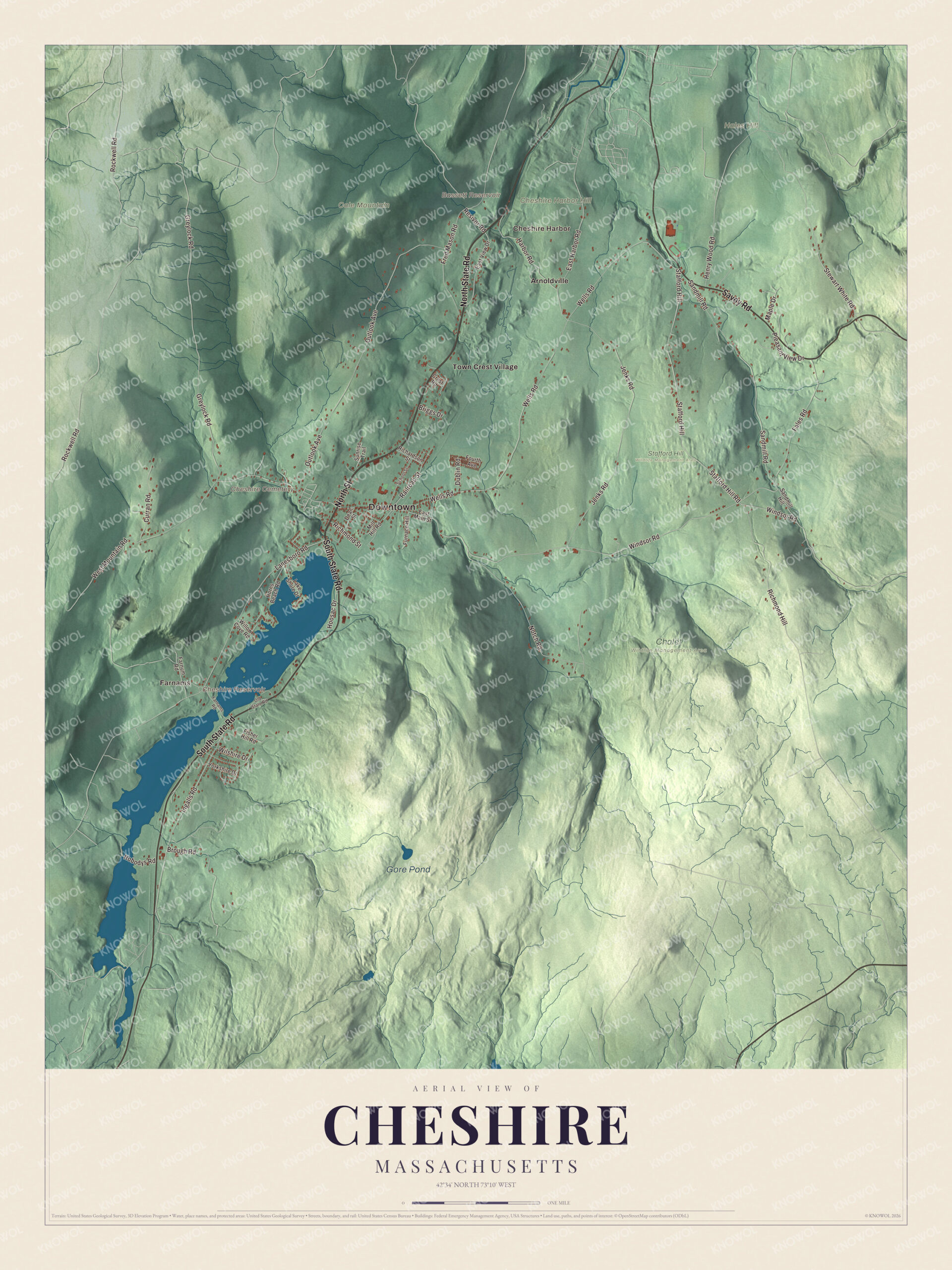
Click to explore a larger preview. The digital watermark does not appear on printed maps.
Names on this map
These names are printed on this map.
Places: Downtown, Cheshire Harbor, Farnams, Cheshire Cemetery, Cheshire Harbor Hill, Cole Mountain, Hales Hill, Bassett Reservoir, Cheshire Reservoir, Gore Pond, Chalet Wildlife Management Area, Stafford Hill Wildlife Management Area, Arnoldville and Town Crest Village.
Streets and roads: North Street, North State Road, Savoy Road, South State Road, Railroad Street, Windsor Road, Lanesboro Road, Stewart White Road, Nobodys Road, East Harbor Road, Wells Road, West Mountain Road.
More street names, A to Z
Briggs Drive, Brough Road, Crest Road, Curran Road, Dean Street, Dublin Road, East Main Street, East View Drive, Fales Road, Farnams Road, Farnum Road, Fisher Hill Road, Fourth Avenue, Fred Mason Road, Furnace Hill, Greylock Road, Harbor Road, Henry Wood Road, Hoosac Drive, Horns Beach Road, Ingalls Road, Jenks Road, Lake Shore Drive, Maple Drive, Mill Hill Road, Notch Road, Old State Road, Outlook Avenue, Pleasant View Drive, Resivor Road, Richardson Street, Richmond Hill, Richmond Street, Rockwell Road, Sandmill Hill, Sandmill Road, School Street, Stafford Hill, Stafford Hill Road, Sunrise Trail, Willow Cove Road, Wilshire Drive, Yorkshire Drive.
See it on a wall
The Cheshire map as a framed print. Swipe for more.


Glass, lime and a famous gunsmith
The town had early forges, sawmills, gristmills and tanneries, and in 1812 the Cheshire Crown Glass Company opened. In the south of town, Farnams Village grew up around limestone quarries. Brothers Alfred and Albert Farnam opened a lime works there in 1874 and made a high quality white plaster lime, and the quarries ran until 1969; the village and its old quarry works are now a historic district. Horace Smith, born in Cheshire in 1808, became a gunsmith and with Daniel B. Wesson founded the company that became Smith & Wesson. The town kept its reputation for religious variety, with four churches for only 1,537 people in 1885.
Around the map
Start at Cheshire Harbor, then follow North Street, North State Road, Savoy Road, South State Road, Railroad Street and Windsor Road across town, and look outward toward Farnams, Arnoldville and Town Crest Village. Route 8 is the main road through town, and stretches of Route 116 give wide views of Mount Greylock. The Cheshire Reservoir, also called Hoosac Lake, is a dammed reservoir on the South Branch of the Hoosic River, which begins on the west slope of North Mountain and fills the reservoir almost at once. The Ashuwillticook Rail Trail, built on the old Pittsfield and North Adams Railroad, runs past it from Pittsfield and Lanesborough through Cheshire to Adams; its name means the pleasant river in between the hills. The Appalachian Trail crosses the center of town on its way from North Mountain to Mount Greylock. Bassett Reservoir, the Cheshire Reservoir, Gore Pond, Cheshire Harbor Hill, Cole Mountain, Hales Hill and the Cheshire Cemetery are all printed on the map.
Cheshire’s map makes a fine addition to an office, library or den, and it can help teach children the geography and history of the town that sent a President its cheese. It’s made for people who call Cheshire home, from Cheshire Harbor to Farnams, and it shows the town as it looks today. Zoom in on the preview above to explore the details, then click here to get your copy of the Cheshire, Massachusetts map.

Sources
- Cheshire, Massachusetts, Wikipedia
- Cheshire Mammoth Cheese, Wikipedia
- John Leland (Baptist), Wikipedia
- Farnams Village Historic District, Wikipedia
- Horace Smith (inventor), Wikipedia
- Hoosic River, Wikipedia
- Ashuwillticook Rail Trail, Wikipedia
- City and Town Incorporation and Settlement Dates, Secretary of the Commonwealth of Massachusetts (archived copy)