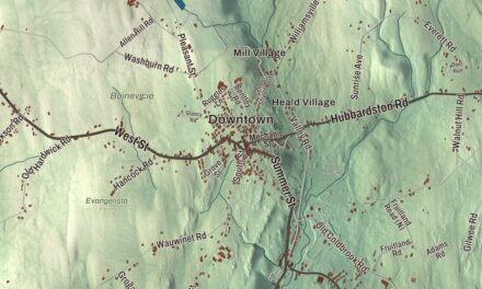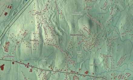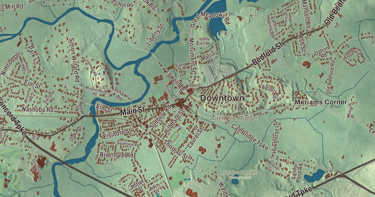
Concord is where the Sudbury and Assabet rivers meet to make the Concord River, where the first day of the Revolution came to the North Bridge, and where Emerson, Thoreau, Hawthorne and the Alcotts wrote. This map prints Main Street, Bedford Street and Elm Street, with Authors Ridge, Annursnac Hill, Balls Hill, Flints Pond, Farrar Pond, Angiers Pond and the Assabet River Reservoir. Click here to purchase a print of this map for your wall.
Concord is in Middlesex County, 19 miles west of Boston.
KNOWOL made this map in 2026 from public survey data and gave it the look of an old atlas. The relief comes from United States Geological Survey elevation data, and the streets and the town line come from the Census Bureau. Concord covers 25.9 square miles, about a square mile of it water, and the town center sits near the meeting of the rivers. Concord had 18,491 people at the 2020 census, and it contains the census-designated place of West Concord.
Musketaquid
The land was first known as Musketaquid, an Algonquian word for “grassy plain,” fitting for its low marshes where Native people had grown corn and fished the rivers. The Town of Concord’s recorded history, in the Secretary of the Commonwealth’s list, dates European settlement to 1635. Concord was incorporated as a town that same year. The settlers, led by Rev. Peter Bulkeley and Major Simon Willard, a trader who spoke the Algonquian language, bought a six-square-mile tract from the woman sachem of Mistick with wampum, hatchets, knives and cloth, and called the town Concord in appreciation of the peaceful purchase. It was the first inland colonial settlement in New England, and the town remains part of Middlesex County today.
The North Bridge
On April 19, 1775, about 700 British troops under Lieutenant Colonel Francis Smith marched out from Boston to seize militia arms stored in Concord, not knowing that Patriot leaders had already moved most of them. After the fight at dawn in Lexington, the regulars spread through Concord to search, and at the North Bridge over the Concord River some 400 minutemen and militia faced them. It was the first time American forces advanced in formation on British regulars, inflicted casualties and drove them back, and the march back to Boston became a running fight. Emerson later called that moment “the shot heard round the world” in his 1837 “Concord Hymn.” Today’s wooden footbridge is a 1956 replica, part of Minute Man National Historical Park, with Daniel Chester French’s Minute Man statue of 1874 beside it. The Old Manse, built for the Emerson family in 1770, stands next door, and the Rev. William Emerson watched the fight from his fields while his family looked on from the upstairs windows.
The biggest little place in America
Ralph Waldo Emerson moved to Concord in 1835 and soon became its most prominent citizen, at the center of a circle that included Nathaniel Hawthorne, Amos Bronson Alcott and his daughter Louisa May Alcott, and Henry David Thoreau, who was born here. Henry James called the town “the biggest little place in America.” Emerson’s Self-Reliance, Hawthorne’s Mosses from an Old Manse and Louisa May Alcott’s Little Women, written and set at Orchard House, all came out of Concord. Thoreau spent two years from 1845 in a cabin on the north shore of Walden Pond, on land his friend Emerson owned, and wrote Walden; he was inspired by Zilpah White, a formerly enslaved woman who lived on her own in a one-room house by Walden Road and made her living spinning flax. After he was jailed in Concord for refusing to pay taxes in protest of slavery and the Mexican-American War, he wrote what became known as Civil Disobedience, and he and many of his neighbors were station masters and agents on the Underground Railroad.
In 1849 Ephraim Wales Bull developed the Concord grape at his home on Lexington Road, where the original vine still grows. He planted some 22,000 seedlings before he got the hardy, early-ripening grape he wanted, and he won a prize with it in Boston in 1853. His tombstone says that he sowed and others reaped.
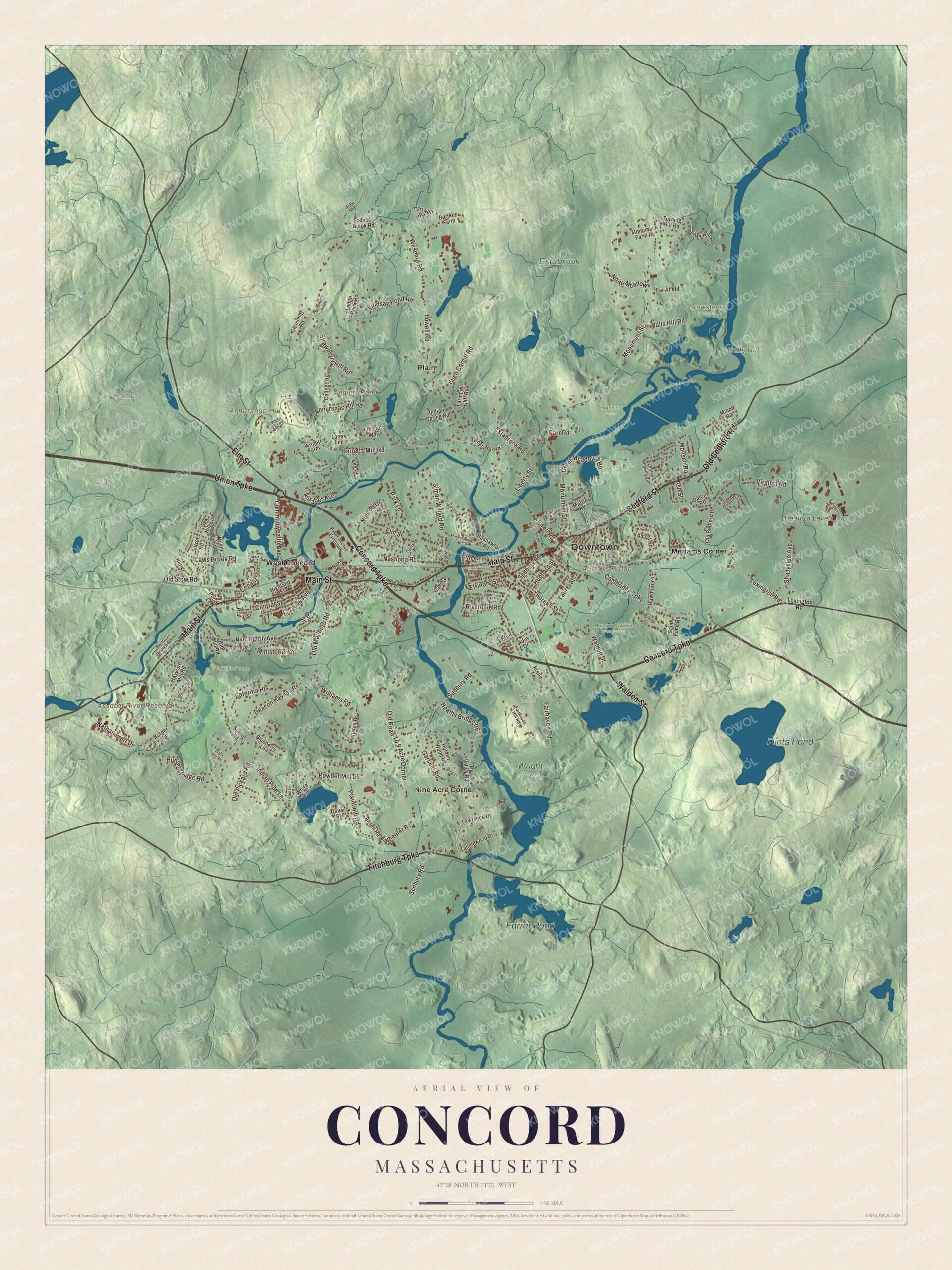
Click to explore a larger preview. The digital watermark does not appear on printed maps.
Names on this map
These names are printed on this map.
Places: Downtown, Annursnac Hill, Authors Ridge, Balls Hill, Bedford Levels, Angiers Pond, Assabet River Reservoir, Flints Pond, Farrar Pond, Brewster's Woods, Estabrook Woods, Hapgood Wright Town Forest, Hutchins Farm, Miller Farm, Old Rifle Range, Seton Woods, Wright Woods, Meriams Corner, Nine Acre Corner, Plain and West Concord.
Streets and roads: Union Turnpike, Concord Turnpike, Fitchburg Turnpike, Main Street, Bedford Street, Elm Street, Old Bedford Road, Walden Street, Lexington Road, Commonwealth Avenue, Powder Mill Road, Barretts Mill Road.
More street names, A to Z
Adams Road, Adin Drive, Alcott Road, Annursnac Hill Road, Anson Road, Arena Terrace, Ash Street, Assabet Avenue, Autumn Lane, Baker Avenue, Baker Avenue Extended, Balls Hill Road, Barnes Hill Road, Bartkus Farm, Bateman's Ridge, Blueberry Lane, Border Road, Bradford Street, Cambridge Turnpike, Carr Road, Caterina Heights, Central Street, Channing Road, College Road, Conant Street, Cottage Street, Court Lane, Dalton Road, Deaconess Road, Deacon Haynes Road, Dee Road, Dover Street, Drum Hill Road, Elsinore Street, Estabrook Road, Fairhaven Hill Road, Fairhaven Road, Far Afield, Farmers Cliff Road, Finigan Way, Fuller Lane, Garfield Road, Garland Road, Great Meadows Road, Harrington Avenue, Hartwell Road, Hawthorne Lane, Hayward Mill Road, Heaths Bridge Road, Highland Street, Hillcrest Road, Hill Street, Holden Wood Road, Hubbard Street, Hugh Cargill Road, Hunters Ridge Road, Indian Pipe Lane, Indian Spring Road, Kenney Lane, Keyes Road, King Lane, Lanes End, Lang Street, Laurel Street, Lawrence Drive, Laws Brook Road, Ledge Rock Road, Lee Drive, Liberty Street, Lindsay Pond Road, Lowell Road, Macarthur Road, Manuel Drive, Martin Road, Mattison Drive, Mildred Circle, Ministerial Drive, Minot Road, Monsen Road, Monument Farm Road, Monument Street, Musketaquid Road, Musterfield Road, Nashawtuc Road, Nashoba Road, Nathan Pratt Drive, Nimrod Drive, North Branch Road, North Meadows, Oak Hill Circle, Oak Road, Old Marlboro Road, Old Mill Road, Old Pickard Road, Old Road To 9 Acre Corner, Old Stow Road, Park Lane, Paul Revere Road, Peter Spring Road, Pine Street, Plainfield Road, Pond Lane, Pond Street, Pope Road, Potter Street, Prairie Street, Prescott Road, Range Road, Ripley Hill Road, Riverdale Road, Riverside Avenue, Sandy Pond Road, Shadyside Avenue, Silver Hill Road, Simon Willard Road, Sorrel Road, Southfield Road, Spencer Brook Road, Spring Road, Stone Root Lane, Strawberry Hill Road, Sudbury Road, Tanglewood Drive, The Valley Road, Thoreau Street, Turning Mill Road, Virginia Road, Westford Road, Wheeler Road, White Avenue, Whits End Road, Williams Road, Wilson Road, Wood Street, Wright Farm, Wright Road.
See it on a wall
The Concord map as a framed print. Swipe for more.


Authors Ridge
Sleepy Hollow Cemetery, on Bedford Street near the center of town, was laid out in 1855 by the landscape architects Cleveland and Copeland as a natural garden, fitted into the hollow’s amphitheater and left with its own wild plants, and Emerson gave the address at its dedication that September. Emerson, Thoreau, Hawthorne and the Alcotts are all buried on Authors Ridge there, and Daniel Chester French’s Mourning Victory marks the grave of three brothers lost in the Civil War. A path from the back of the cemetery leads into the Great Meadows National Wildlife Refuge, whose Concord unit began with 250 acres of river meadow that D. Samuel Hoar gave the government in 1944.
Around the map
Start with Meriams Corner, then follow Union Turnpike, Concord Turnpike, Fitchburg Turnpike, Main Street, Bedford Street and Elm Street across town, and look outward toward Nine Acre Corner, Plain and West Concord. In West Concord, Main Street is Route 62, running 2 miles east to the town center, and the Assabet River flows just south of the village center on its way to Egg Rock, where it joins the Sudbury. Annursnac Hill, at 361 feet, is the highest point in Concord, and the town bought 118 acres there in 1970, most of it now conservation land. Flints Pond is in neighboring Lincoln; Thoreau’s classmate Charles Stearns Wheeler kept a hut there, with Thoreau as a guest. Angiers Pond, Flints Pond, Farrar Pond, Annursnac Hill, Authors Ridge, Balls Hill and the Assabet River Reservoir are all printed on the map.
Concord’s map makes a fine addition to an office, library or den, and it can help teach children the geography and history of the town where Thoreau and Alcott wrote. It’s made for people who call Concord home, from Nine Acre Corner to West Concord, and it shows the town as it looks today. Zoom in on the preview above to explore the details, then click here to get your copy of the Concord, Massachusetts map.

Sources
- Concord, Massachusetts, Wikipedia
- Old North Bridge, Wikipedia
- Minute Man National Historical Park, Wikipedia
- The Old Manse, Wikipedia
- Orchard House, Wikipedia
- Walden Pond, Wikipedia
- Sleepy Hollow Cemetery (Concord, Massachusetts), Wikipedia
- Great Meadows National Wildlife Refuge, Wikipedia
- West Concord, Massachusetts, Wikipedia
- Assabet River, Wikipedia
- Annursnac Hill, Wikipedia
- Flints Pond, Wikipedia
- City and Town Incorporation and Settlement Dates, Secretary of the Commonwealth of Massachusetts (archived copy)