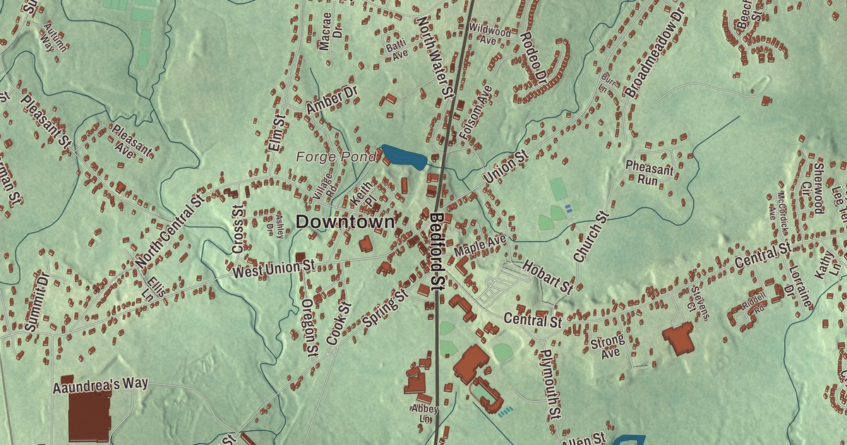
East Bridgewater is the old East Parish of Bridgewater, a town of ponds, woods and rivers where the Matfield River runs south through the village of Elmwood. This map prints Plymouth Street, Bedford Street, North Bedford Street, Oak Street, West Street and Whitman Street, with Forge Pond, Jones Pond, Robbins Reservoir, Osceola Island and Spragues Hill. Click here to purchase a print of this map for your wall.
East Bridgewater is in Plymouth County, twenty-seven miles southeast of Boston.
KNOWOL made this map in 2026 from public survey data and gave it the look of an old atlas. The relief comes from United States Geological Survey elevation data, and the roads and the town line come from the Census Bureau. East Bridgewater covers 17.5 square miles, with Whitman to the north, Hanson to the east, Halifax to the southeast, Bridgewater to the south, West Bridgewater to the west and Brockton to the northwest. The town had 14,440 people at the 2020 census.
The East Parish
The town’s page says Europeans first settled this land in 1630, as an offshoot of the Plymouth and Duxbury plantations, and the Town of East Bridgewater’s recorded history, in the Secretary of the Commonwealth’s list, dates European settlement to 1649. It was part of Old Bridgewater, and in 1723 it became Bridgewater’s “East Parish.” East Bridgewater was incorporated as a town in 1823, separating from Bridgewater on June 14 of that year, and the town remains part of Plymouth County today.
The town sits on the northern reaches of the Taunton River and lived mostly by farming, though industry followed. Its iron works made muskets and cannon for the colonial armies in the American Revolution. In the late 19th and early 20th centuries, houses went up along the rail and trolley lines, and today East Bridgewater is mostly a residential town. Ezekiel Whitman, born here in 1776, went on to represent Maine in Congress both before and after it became a state, helped write Maine’s first constitution and served as chief justice of its Supreme Judicial Court, and he came home to East Bridgewater in retirement. The actor Tom Everett Scott and the Red Sox pitcher Manny Delcarmen are among the town’s notable people. Click here to learn more about the history of East Bridgewater.
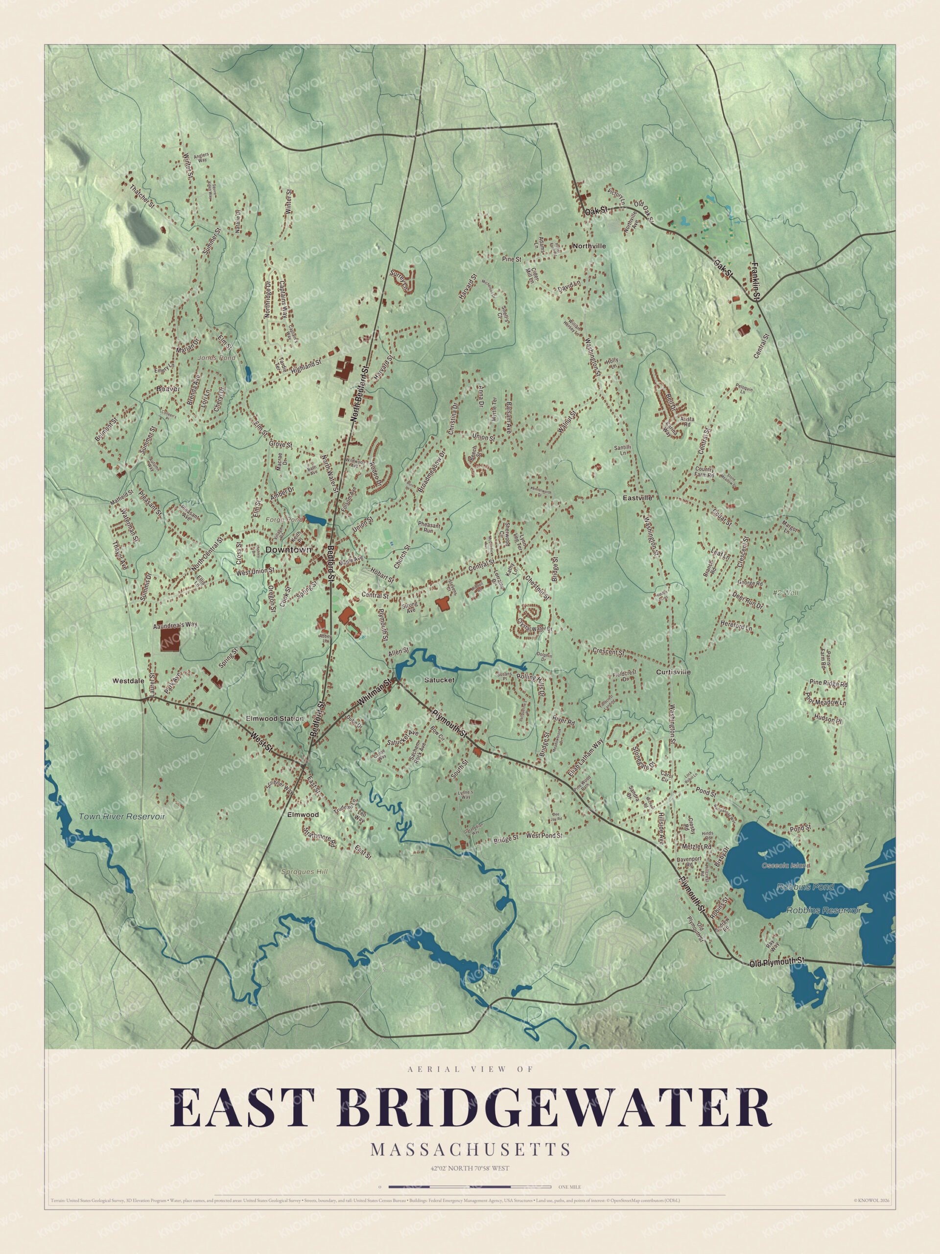
Click to explore a larger preview. The digital watermark does not appear on printed maps.
Names on this map
These names are printed on this map.
Places: Downtown, Osceola Island, Spragues Hill, Forge Pond, Jones Pond, Robbins Reservoir, Robbins Pond, Town River Reservoir, #2 Well, Beaver, Curtisville, Eastville, Elmwood, Elmwood Station, Northville, Satucket and Westdale.
Streets and roads: Plymouth Street, Oak Street, West Street, Whitman Street, Bedford Street, North Bedford Street, Old Plymouth Street, Franklin Street, Washington Street, East Street, Winter Street, West Union Street.
More street names, A to Z
Aaundrea's Way, Abbey Lane, Adams Lane, Allen Street, Amber Drive, Andrew Road, Anglers Way, Anna Drive, Arista Road, Ashley Drive, Autumn Way, Balsam Avenue, Batti Avenue, Beech Street, Bell Drive, Belmont Street, Bixby Drive, Bow Circle, Branch Road, Brenda Avenue, Bridge Street, Broadmeadow Drive, Burr Lane, Canoe Way, Captain's Way, Captains Way, Carina Way, Carol Circle, Cedar Street, Central Street, Cheryl Drive, Chestnut Street, Christina Drive, Church Street, Cider Mill Lane, Colleen's Place, Cook Street, Country Farm Road, Crescent Street, Crosby Road, Cross Street, Crystal Water Drive, Davenport Road, David Lane, Dee Jay Road, Deer Run Drive, Dolphin Drive, Dube Drive, Eliab Latham Way, Ellis Lane, Elm Street, Emery Lane, Fieldcrest Drive, Fieldcrest Landing, Folsom Avenue, Garabedian Way, George Road, Grove Street, Harvard Street, Hereford Lane, Hidden Acres, Highland Street, Hillcrest Road, Hillside Avenue, Hinds Road, Hobart Street, Holly Lane, Hudson Place, Jacqueline's Place, Kathy Lane, Keith Place, Kennelworth Drive, Laurel Street, Leaf Lane, Leo Way, Lock Robin Lane, Lori Lane, Lorraine Drive, Lynne's Way, Lynn Lee Terrace, Macrae Drive, Maple Avenue, Margot Lane, Marjan Drive, Matfield Street, McCordick Avenue, Meadowbrook Drive, Metzler Road, Michael Road, Michelson Drive, Myrtle Terrace, Natalie Drive, North Central Street, Northridge Drive, Northville Avenue, North Water Street, Old Oak Street, Oregon Street, Park Avenue, Parris Farm Road, Peloquin Lane, Pheasant Run, Pine Ridge Road, Pine Street, Pine Wood Path, Pleasant Avenue, Pleasant Street, Pond Street, Poor Meadow Lane, Porter Farm Road, Ray Way, Riddell Road, River Road, Robins Street, Rodeo Drive, Rolling Hills Drive, Sachem Rock Avenue, Sandra Drive, Santilli Lane, Satucket Avenue, Scribner Way, Sherwood Circle, Snell's Court, South Street, Spring Street, Squire Alden Way, Stevens Court, Stonegate Drive, Stone Meadow Drive, Strathmore Road, Strong Avenue, Summer Street, Summit Drive, Surrey Lane, Susans Place, Tardie Terrace, Thatcher Street, Thayer Avenue, Trudeau Lane, Union Street, Victory Lane, Village Road, Walnut Street, Wampanoag Way, Waterman Street, West Pond Street, Wildwood Avenue, William Hersey Lane.
See it on a wall
The East Bridgewater map as a framed print. Swipe for more.


Rivers and ponds
The Matfield River flows 6.3 miles south through the town to meet the Town River, and together they form the Taunton River. Where it passes the historic village of Elmwood and runs under Route 18, people call it the Elmwood River. The Satucket River flows west for 5.5 miles from Robbins Pond, a 124-acre natural pond in the southeast corner and the largest body of water in town, to join the Matfield. It’s slow and shallow, rich in iron and tinted the color of tea, and Poor Meadow Brook joins it just below the pond. In the northwest corner, the Beaver Brook Beagle Club holds a large stretch of woods.
Around the map
Start with Beaver, then follow Plymouth Street, Oak Street, West Street, Whitman Street, Bedford Street and North Bedford Street across town, and look outward toward Curtisville, Eastville, Elmwood, Elmwood Station and Northville. The Catholic Church of Saint John the Evangelist stands on Central Street. Osceola Island, Forge Pond, Jones Pond, Robbins Reservoir and Spragues Hill are all printed on the map.
The East Bridgewater map makes a fine addition to an office, library or den, and it can help teach children the geography and history of the town that grew from Bridgewater’s East Parish. It’s made for people who call East Bridgewater home, from Elmwood to Northville, and it shows the town as it looks today. Zoom in on the preview above to explore the details, then click here to get your copy of the East Bridgewater, Massachusetts map.

Sources