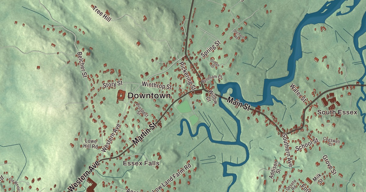
Essex grew up building schooners on the Essex River, and locals still call one stretch of Main Street the causeway. This map prints Main Street, John Wise Avenue, Martin Street, Western Avenue, Eastern Avenue and Southern Avenue, with Chebacco Lake, Round Pond, Haskell Pond, Gravelly Pond, the Essex-Manchester Woods, Choate Island and Bull Island. Click here to purchase a print of this map for your wall.
Essex is in Essex County, about 26 miles north of Boston.
KNOWOL made this map in 2026 from public survey data and gave it the look of an old atlas. The relief comes from United States Geological Survey elevation data, and the roads and the town line come from the Census Bureau. Essex covers 15.9 square miles, and 2 of them are water. The center of town lies on marshland around the Essex River, part of the Great Marsh, and the land sits close to sea level with a few low hills. Hamilton lies to the west, Manchester-by-the-Sea to the south, Gloucester to the east and Ipswich to the north. The town had 3,675 people at the 2020 census.
Chebacco Parish
The Agawam people lived here when the English came. The Town of Essex’s recorded history, in the Secretary of the Commonwealth’s list, dates European settlement to 1634, and until the 1800s the place was Chebacco Parish, part of the town of Ipswich. Chebacco is an Agawam name for the big lake whose waters reach into Hamilton, and Conomo Point, at the eastern end of town, is named for Masconomo, the Agawam sachem. Essex was incorporated as a town in 1819, and it remains part of Essex County today.
The parish wanted to be its own town, and in colonial days a meeting house meant near independence, so permission to build one was refused. The popular story is that the order said “no man shall raise a meeting house,” so a local woman, Madam Varney, gathered the women of the parish and they built it themselves while the men looked on. John Wise was Chebacco’s pastor from the 1680s until his death in 1725. In 1687 he rallied his parishioners against a tax laid on them by the royal governor, Edmund Andros, and he was arrested, convicted and fined for it. Calvin Coolidge called him one of the inspirations for the Declaration of Independence, and John Wise Avenue, part of Route 133, carries his name.
Schooners, clams and a library
Shipbuilding paid most of the town’s bills from the parish days into the early 1900s, and Essex was a leading supplier of schooners for Gloucester and other fishing ports. The Essex Shipbuilding Museum says the town built more wooden fishing schooners between 1668 and the twentieth century than any other place in America. Essex didn’t make the switch from wooden sailing ships to engine-powered metal ones, and the trade disappeared around World War II. The museum keeps its tools, models and half hulls, along with the Evelina M. Goulart, a schooner built in Essex in 1927. Next door, the Story family’s boat yard still builds and launches wooden boats in the Essex tradition.
In 1914 Lawrence “Chubby” Woodman and his wife, Bessie, opened a clam shack on the causeway, selling steamers, ice cream and homemade potato chips. According to legend, Chubby invented the fried clam on July 3, 1916, after a fisherman friend from Gloucester suggested dropping some clams into the potato chip oil. Woodman’s of Essex is still a family business. On Martin Street, the Essex Town Hall and TOHP Burnham Library, a Shingle Style building with a fieldstone ground floor and a wooden tower, was built in 1893 and 1894 with money left by T. O. H. P. Burnham, an Essex native. The First Congregational Church on Main Street, built in 1792, has a bell cast by Paul Revere in 1797 hanging in its belfry.
The islands and the lake
Out in the Essex River estuary, Choate Island, also called Hog Island, is part of the Crane Wildlife Refuge, kept by The Trustees of Reservations. The Choate House there, built around 1730, is the birthplace of Rufus Choate, the lawyer, orator and United States senator, and it has changed very little since. Its spruce forest, planted in the 1930s, makes the island easy to spot, and Miné and Cornelius Crane are buried at its summit. Much of the 1996 film The Crucible was shot on the island. Nearby, Cogswell’s Grant, the 18th-century farm where the collectors Bertram and Nina Fletcher Little spent their summers, looks out on the Essex River and is open for tours.
Chebacco Lake, which Essex shares with Hamilton, covers about 209 acres, and every spring alewife herring swim up the Essex River and Alewife Brook to spawn there. A stream passing under Chebacco Road links Round Pond to the lake. Centennial Grove, on the Essex side, has long been the town’s beach on the lake. Annie Gosbee, who grew up playing sandlot ball in a field near the Essex River, joined the Grand Rapids Chicks of the All-American Girls Professional Baseball League in 1953 and was a member of that year’s championship team.
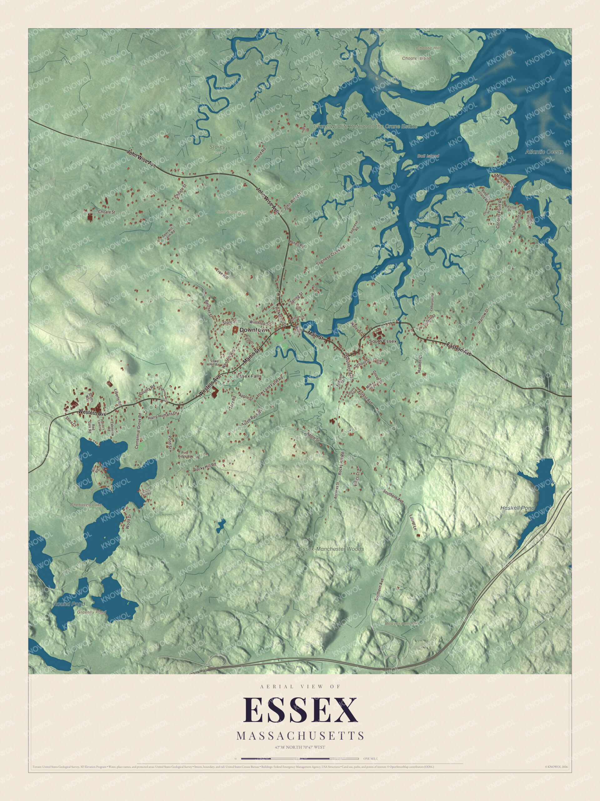
Click to explore a larger preview. The digital watermark does not appear on printed maps.
Names on this map
These names are printed on this map.
Places: Downtown, Essex Falls, South Essex, Beaverdam Hill, Bull Island, Choate Hill, Choate Island, Chebacco Lake, Gravelly Pond, Haskell Pond, Round Pond, Crane Wildlife Refuge on the Crane Estate, Essex-Manchester Woods, Atlantic Ocean, John Wise Avenue and Storey Farm.
Streets and roads: Western Avenue, Main Street, Eastern Avenue, Martin Street, Southern Avenue, Harlow Street, Pond Street, Rocky Hill Road, Conomo Point Road, Apple Street, Belcher Street, Choate Street.
More street names, A to Z
Addison Street, Andrews Street, Burnham Court, Centennial Grove Road, Cogswell Court, Cogswell Road, Coral Hill Road, County Road, Deer Hill Farm Road, Desoto Road, Dodge Street, Forest Avenue, Grove Street, Hardy Lane, Harry Homans Drive, Haskell Court, Hill Road, Island Road, John Wise Lane, Kings Court, Lakeview Road, Lanes Road, Laurel Lane, Lebaron Road, Liberty Road, Lowe Hill Road, Low Land Farm Road, Lufkin Point Lane, Lufkin Point Road, Lufkin Street, Middle Road, Milk Street, Old Western Avenue, Orchard Road, Patriot's Landing, Pickering Street, Pine Ridge Road, Prospect Street, Ralston Drive, Red Gate Road, Robbins Island Road, School Street, Scotts Way, Shea Court, Soginese Creek Road, Soginese Road, Spring Street, Story Street, Tara Road, Tree Hill, Turtle Back Road, Water Street, Willow Court, Winthrop Street, Wood Drive.
See it on a wall
The Essex map as a framed print. Swipe for more.


Around the map
Start with Essex Falls, then follow Western Avenue, Main Street, Eastern Avenue, John Wise Avenue, Martin Street and Southern Avenue across town. Look outward toward South Essex, then down the river to the islands. Chebacco Lake, Gravelly Pond, Haskell Pond, Round Pond, the Essex-Manchester Woods, Beaverdam Hill, Choate Hill, Bull Island and Choate Island are all printed on the map.
The Essex map makes a fine addition to an office, library or den, and it can help teach children the geography and history of a shipbuilding town on the Great Marsh. It’s made for people who call Essex home, from Essex Falls to South Essex, and it shows the town as it looks today. Zoom in on the preview above to explore the details, then click here to get your copy of the Essex, Massachusetts map.

Sources
- Essex, Massachusetts, Wikipedia
- John Wise (clergyman), Wikipedia
- Essex Shipbuilding Museum, Wikipedia
- Woodman’s of Essex, Wikipedia
- Essex Town Hall and TOHP Burnham Library, Wikipedia
- Choate Island, Wikipedia
- Rufus Choate, Wikipedia
- Cogswell’s Grant, Wikipedia
- Chebacco Lake, Wikipedia
- Annie Gosbee, Wikipedia
- City and Town Incorporation and Settlement Dates, Secretary of the Commonwealth of Massachusetts (archived copy)