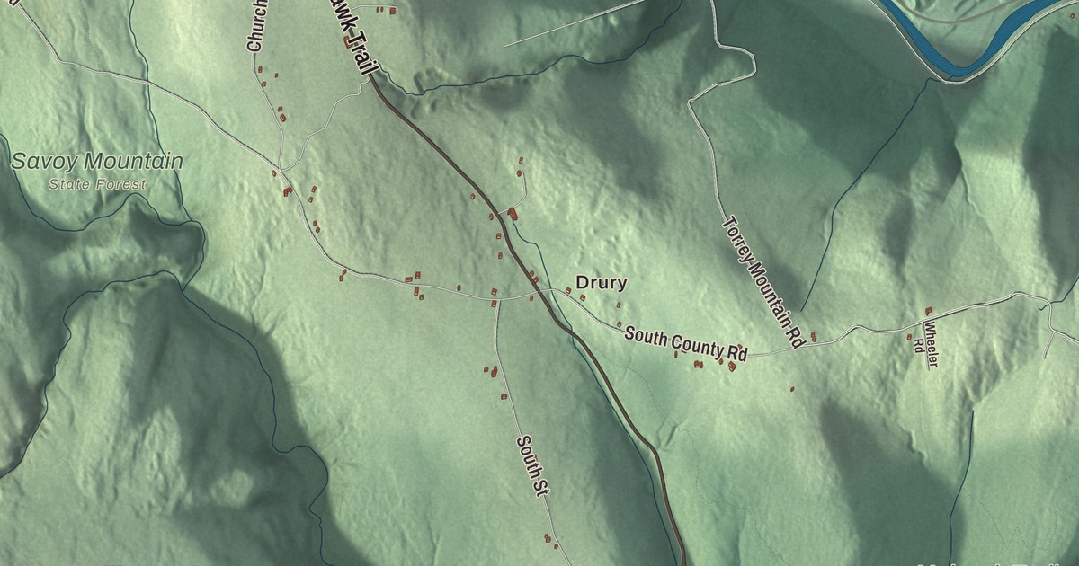
Florida sits high on the Hoosac Range, and anyone who’s driven the Mohawk Trail over Whitcomb Summit knows how high. This map prints the Mohawk Trail, River Road, Tilda Hill Road, Central Shaft Road, Monroe Road and Tower Road, with Bakke Mountain, Clark Mountain, Blackpoll Mountain, Bog Pond, Browns Pond, Beaver Island, Upper Reservoir Bear Swamp and Lower Reservoir Bear Swamp. Click here to purchase a print of this map for your wall.
Florida is in Berkshire County, on the Vermont line.
KNOWOL made this map in 2026 from public survey data and gave it the look of an old atlas. The relief comes from United States Geological Survey elevation data, and the roads and the town line come from the Census Bureau. Florida covers 24.6 square miles. Stamford, Vermont, lies to the north, Monroe to the northeast, Rowe to the east, Charlemont to the southeast, Savoy to the south, Adams to the southwest, and North Adams and Clarksburg to the west. The Deerfield River forms much of the eastern border. The town had 694 people at the 2020 census, and despite its name, its page calls it statistically the coldest and snowiest town in Massachusetts.
A warm name for a cold town
The land was first settled by Europeans as part of the Equivalent Lands, and most of it was granted to the town of Bernardston sometime before 1771. The Town of Florida’s recorded history, in the Secretary of the Commonwealth’s list, dates European settlement to 1783, and the town’s page says the first settler, Dr. Daniel Nelson, arrived around then. Florida was incorporated as a town in 1805, and it was named Florida perhaps because Spanish Florida was a topic of conversation at the time. The town remains part of Berkshire County today. In his American Notebooks, Nathaniel Hawthorne wrote the town’s name as Lebrida and called the Hoosac Range “the Green Mountain,” which reflects the local usage of 1838. For many years the town lived on maple syrup, wool and potatoes.
The Hoosac Tunnel
In the middle of the 1800s Florida became a boom town for the men building the Hoosac Tunnel. The tunnel runs in a straight line for 4.75 miles under the Hoosac Range, from its east portal on the Deerfield River in Florida to its west portal in North Adams. Work began in 1851, and the first train went through on February 9, 1875. Crews also sank a Central Shaft 1,028 feet deep, which let them dig outward from the middle to meet the tunnels coming in from each end, and when the east and central tunnels met in 1872 they lined up within 9/16 of an inch. The job was the first large-scale commercial use of nitroglycerin and electric blasting, and it came at a hard cost, with 195 workers killed or badly hurt. When it was finished, the tunnel was the second-longest in the world, and it’s still the longest active transportation tunnel east of the Rocky Mountains. Hoosac is an Algonquian word meaning “place of stones.”
Water and wind on the mountain
The Mohawk Trail began as a Native trade route over the Hoosac Range, and today it’s part of Route 2, running northwest across the middle of town. At 2,172 feet, Whitcomb Summit is the highest point on the trail, known for its views, and a monument there honors the Elks, whose members helped modernize the road and worked on the tunnel. Down on the Deerfield River, the Bear Swamp station, built between 1968 and 1974, straddles the river in Rowe and Florida. It’s a pumped-storage plant that sends water uphill to its upper reservoir when power is cheap and lets it fall back through its turbines when power is needed.
Bakke Mountain is named for Master Sergeant Roald Bakke, and the Bakke family bought the land in the 1960s. On a hike there in 1980 they noticed how breezy it was, with the sparse trees misshapen by the wind, and Hans Bakke began to think about wind power. The Hoosac Wind Power Project went into full operation in 2012 with 19 turbines on Bakke Mountain and Crum Hill in Monroe, and its page calls it the largest wind farm in Massachusetts. Florida also holds parts of three state forests: Monroe State Forest to the northeast, Savoy Mountain State Forest to the south, where Bog Pond is one of four ponds, and Mohawk Trail State Forest to the southeast.
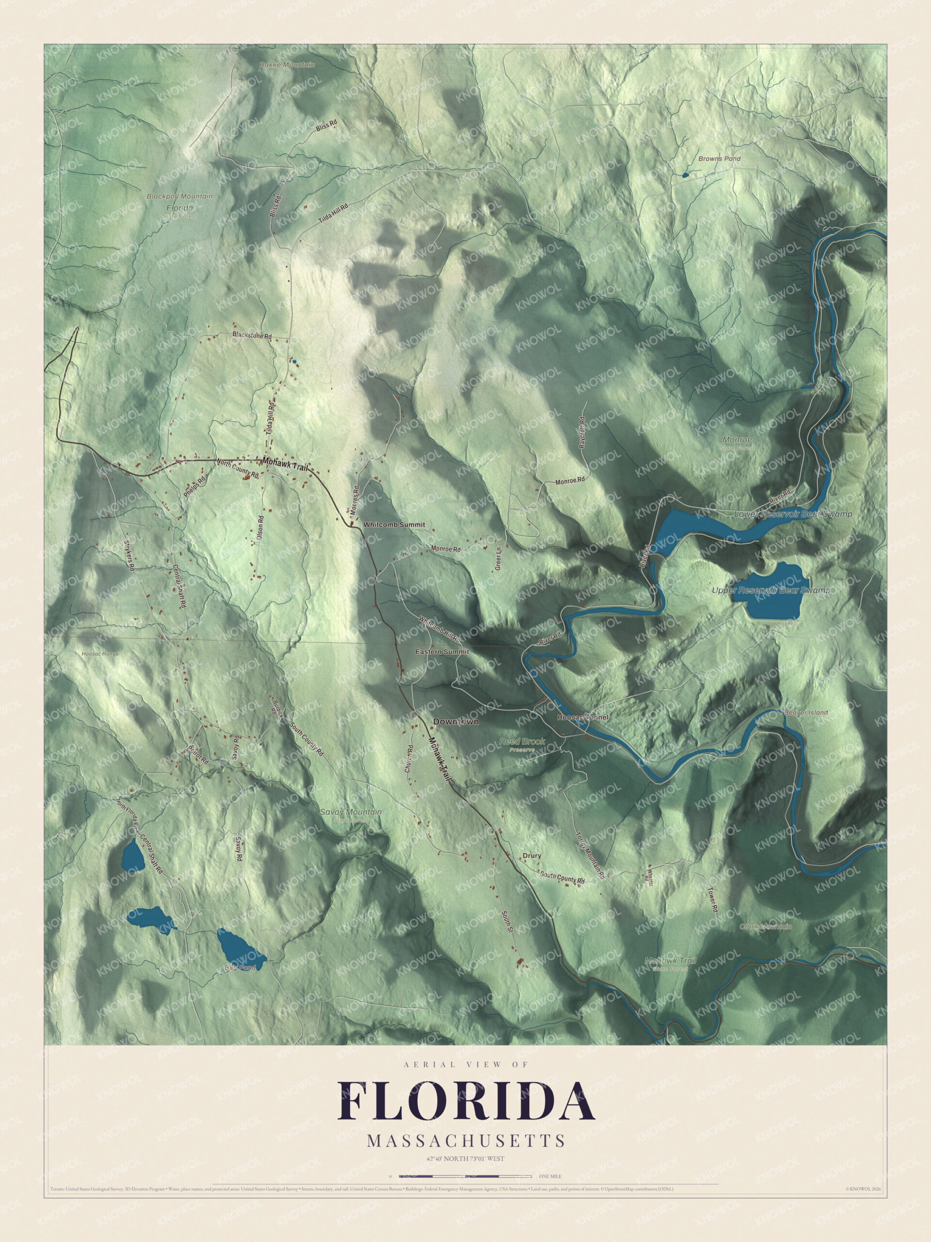
Click to explore a larger preview. The digital watermark does not appear on printed maps.
Names on this map
These names are printed on this map.
Places: Downtown, Drury, Hoosac Tunnel, Eastern Summit, Bakke Mountain, Beaver Island, Blackpoll Mountain, Clark Mountain, Bog Pond, Browns Pond, Upper Reservoir Bear Swamp, Lower Reservoir Bear Swamp, Florida State Forest, Hoosac Range, Mohawk Trail State Forest, Monroe State Forest, Reed Brook Preserve, Savoy Mountain State Forest and Whitcomb Summit.
Streets and roads: Mohawk Trail, River Road, Tilda Hill Road, Central Shaft Road, Monroe Road, Tower Road, South County Road, Whitcomb Hill Road, Raycroft Road, Strykers Road, Blackstone Road, Church Road.
More street names, A to Z
Bliss Road, Burdick Road, Greer Lane, Moores Road, North County Road, North Florida Road, Olson Road, Phelps Road, Poirot Road, Savoy Road, South Street, Torrey Mountain Road, Wheeler Road.
See it on a wall
The Florida map as a framed print. Swipe for more.


Around the map
Start with Drury, then follow the Mohawk Trail, River Road, Tilda Hill Road, Central Shaft Road, Monroe Road and Tower Road across town. Look outward toward Hoosac Tunnel, Eastern Summit and Whitcomb Summit. Bog Pond, Browns Pond, Upper Reservoir Bear Swamp, Lower Reservoir Bear Swamp, Bakke Mountain, Blackpoll Mountain, Clark Mountain and Beaver Island are all printed on the map.
The Florida map makes a fine addition to an office, library or den, and it can help teach children the geography and history of a mountain town above the Deerfield River. It’s made for people who call Florida home, from Drury to Whitcomb Summit, and it shows the town as it looks today. Zoom in on the preview above to explore the details, then click here to get your copy of the Florida, Massachusetts map.

Sources
- Florida, Massachusetts, Wikipedia
- Hoosac Tunnel, Wikipedia
- Mohawk Trail, Wikipedia
- Bear Swamp Generating Station, Wikipedia
- Bakke Mountain, Wikipedia
- Hoosac Wind Power Project, Wikipedia
- Savoy Mountain State Forest, Wikipedia
- Monroe State Forest, Wikipedia
- City and Town Incorporation and Settlement Dates, Secretary of the Commonwealth of Massachusetts (archived copy)