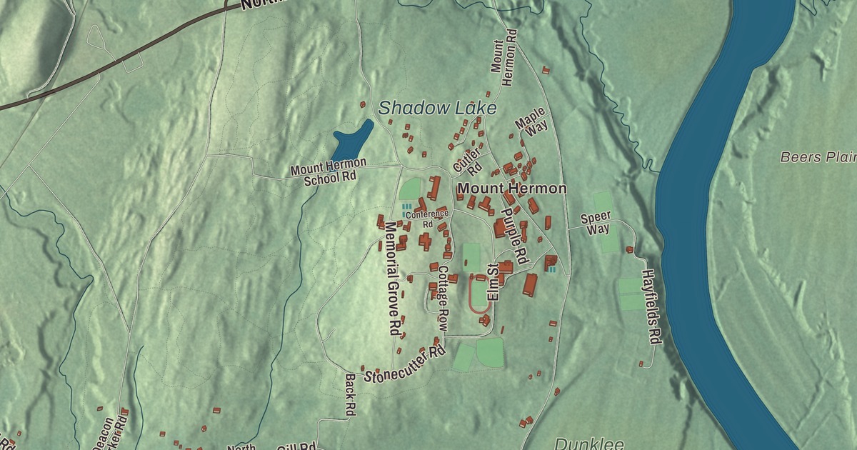
If you grew up in Gill, the Connecticut River was never far away: it runs along the east and south sides of town, past Barton Island and down to the falls. This map prints French King Highway, Northfield Road, Stonecutter Road, West Gill Road, River Road and Elm Street, with Barton Island, the Connecticut River Reservoir, Bennett Meadow, Deane Pond, Otter Pond and Barnard Hill. Click here to purchase a print of this map for your wall.
Gill is in Franklin County.
KNOWOL made this map in 2026 from public survey data and gave it the look of an old atlas. The relief comes from United States Geological Survey elevation data, and the roads and the town line come from the Census Bureau. Gill covers 14.8 square miles on the west bank of the Connecticut River. The river forms most of its line with Northfield and separates it from Erving and Montague, and the little Fall River marks its border with Greenfield. Gill had 1,551 people at the 2020 census.
A town named for a governor
The Town of Gill’s recorded history, in the Secretary of the Commonwealth’s list, dates European settlement to 1776, and Gill was incorporated as a town in 1793. The town page gives the same two years. Gill took its name from Moses Gill, a member of the state’s Executive Council who became lieutenant governor in 1794 and acting governor in 1799, after Governor Increase Sumner died. The first town meeting came on December 18, 1793, with Moses Bascom as moderator. The town remains part of Franklin County today.
People lived along this stretch of river long before that. Before English colonists arrived, the Nipmuc held this part of the Connecticut River valley, and a site on the river near the great falls shows signs of people living there 10,000 years ago or more. In the 1670s the Nipmuc had a village there called Peskeompscut. The Riverside Archeological District, on the river north of the falls in Gill and Greenfield, was added to the National Register of Historic Places in 1975. Its page dates the area’s archaeological record to the late Pleistocene and notes it was the site of a 1676 battle in King Philip’s War. The district reaches from Adams Road in Greenfield east to the Lily’s Pond area of Barton Cove, and north to just past Riverside Cemetery.
Mount Hermon
In 1879 Dwight Lyman Moody, a preacher born in Northfield, opened a school for young women in his hometown. Two years later he started a brother school, the Mount Hermon School for Boys, across the river in Gill. Moody wanted to give a Christian education to students “of high purpose and limited means,” and tuition was $100 a year in 1881. Every student, boy or girl, worked to help run the schools, and the campus kept a farm. The two schools joined as one corporation in 1912 but ran separately until 1971. By 1930 their combined enrollment made them the largest private secondary school in the United States, according to the school’s page. Today Northfield Mount Hermon School is a coeducational college-preparatory school in Gill, and every student still holds a campus job for three hours a week.
Bridges and an island
Two bridges carry Gill across the river. The French King Bridge, part of Route 2 on the line between Erving and Gill, opened on September 10, 1932, and the American Institute of Steel Construction named it the “Most Beautiful Steel Bridge” of that year. It takes its name from French King Rock, which you can see in the middle of the river. Downstream, the Turners Falls-Gill Bridge links Gill with the village of Turners Falls in Montague. Before it, a ferry crossed near the site, and then a red suspension bridge from 1878 until the flood of 1936 wrecked it. The current steel truss bridge was dedicated on September 10, 1938. The falls themselves are named for Captain William Turner, and they gave their name to the village of Turners Falls across the river.
Barton Island sits in the Connecticut near Barton Cove, southeast of the Riverside neighborhood. It’s heavily wooded in three separate sections, it’s an important bird area, and bald eagles have nested there since 1989. Barton Cove has a paved boat ramp off Route 2, east of Turners Falls.
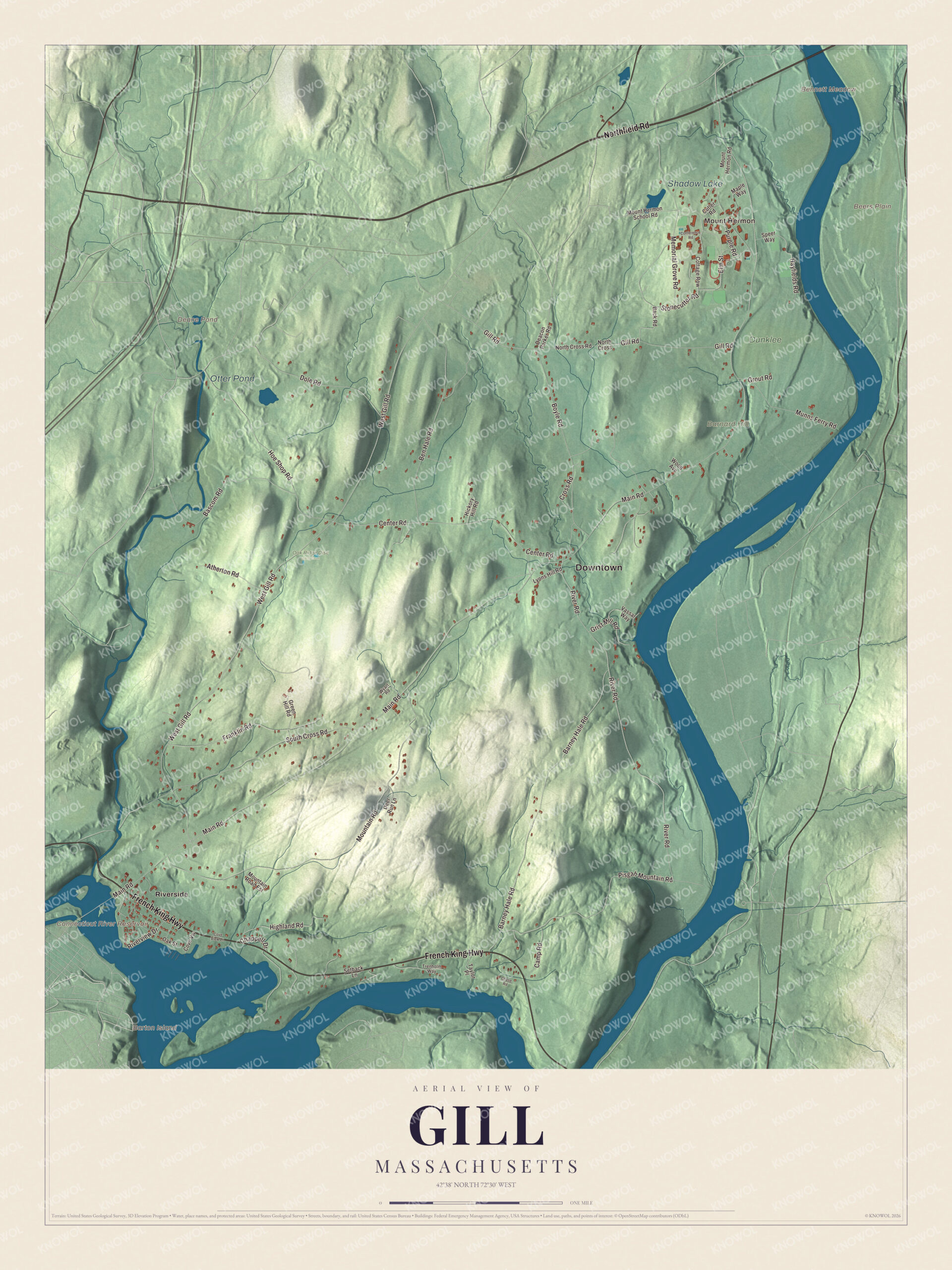
Click to explore a larger preview. The digital watermark does not appear on printed maps.
Names on this map
These names are printed on this map.
Places: Downtown, Mount Hermon, Barnard Hill, Barton Island, Beers Plain, Bennett Meadow, Connecticut River Reservoir, Deane Pond, Otter Pond, Shadow Lake, Dunklee, Oak Ridge Disc Golf Club and Riverside.
Streets and roads: Northfield Road, French King Highway, Stonecutter Road, Elm Street, West Gill Road, River Road, Main Road, Mountain Road, Barney Hale Road, Center Road, Gill Road, Boyle Road.
More street names, A to Z
Atherton Road, Back Road, Bascom Road, Ben Hale Road, Camp Road, Chappell Drive, Chase Road, Conference Road, Cottage Row, Cove View Lane, Cove Vw, Cross Road, Cutler Road, Deacon Parker Road, Deer Run Lane, Dole Road, Franklin Road, Green Hill Road, Grist Mill Road, Grout Road, Hayfields Road, Hickory Hill Road, Highland Road, Hoe Shop Road, Lyons Hill Road, Maple Way, Memorial Grove Road, Mountain Road Est, Mount Hermon Road, Mount Hermon School Road, Munns Ferry Road, North Cross, North Cross Road, Oak Street, Pisgah Mountain Road, Purple Road, Riverview Drive, Setback Lane, South Cross Road, Speer Way, Taylor Place, Trenholm Way, Vassar Way, Wood Avenue, Wyart Road.
Around the map
Start with Mount Hermon, then follow Northfield Road, French King Highway, Stonecutter Road, Elm Street, West Gill Road and River Road across town. Look outward toward Riverside, along the river by the cove. Barton Island, the Connecticut River Reservoir, Deane Pond, Otter Pond, Barnard Hill and Bennett Meadow are all printed on the map. Every one of those names is right there on the artwork, and there’s plenty to find.
The Gill map makes a fine addition to an office, library or den, and it can help teach children the geography and history of a river town with eagles on its island. It’s made for people who call Gill home, from Mount Hermon to Riverside, and it shows the town as it looks today. Zoom in on the preview above to explore the details, then click here to get your copy of the Gill, Massachusetts map.

We made a map for every town and city in Massachusetts. Explore the complete Massachusetts map collection and find your town.
Sources
- Gill, Massachusetts, Wikipedia
- Moses Gill, Wikipedia
- Riverside Archeological District, Wikipedia
- Northfield Mount Hermon School, Wikipedia
- French King Bridge, Wikipedia
- Turners Falls-Gill Bridge, Wikipedia
- Turners Falls, Massachusetts, Wikipedia
- Barton Island, Wikipedia
- Connecticut River Greenway State Park, Wikipedia
- City and Town Incorporation and Settlement Dates, Secretary of the Commonwealth of Massachusetts (archived copy)