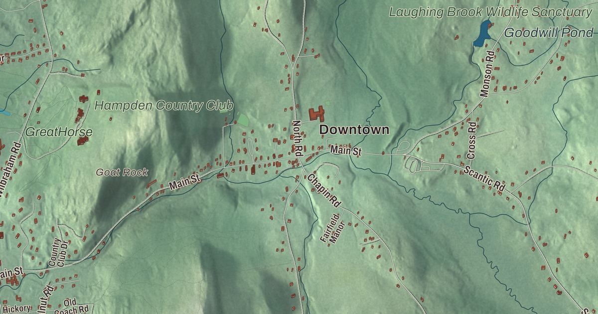
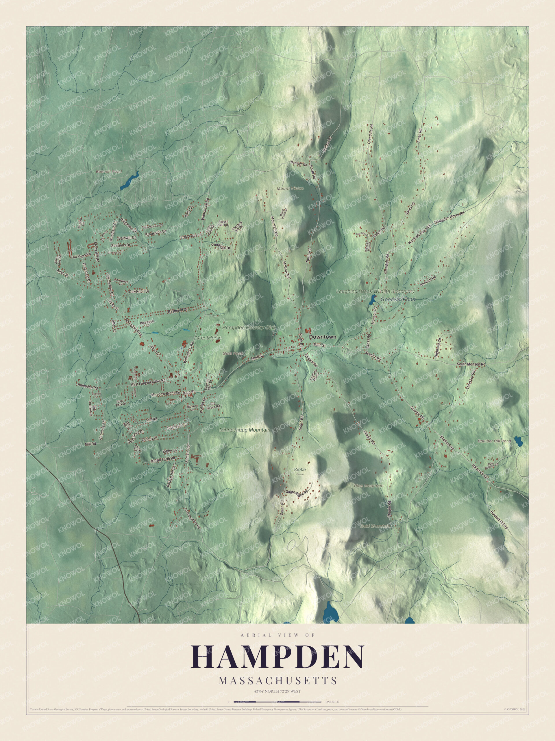
Hampden is a hill town on the Connecticut line with no stoplights and no numbered highways, and the children’s author Thornton W. Burgess made his home here. This map prints Scantic Road, Chapin Road, Glendale Road, North Road, South Road and Somers Road, with Pine Mountain, Bald Mountain, Goat Rock, the Laughing Brook Wildlife Sanctuary, Bennett Pond, Boulder Hill Pond and Goodwill Pond. Click here to purchase a print of this map for your wall.
Hampden is in Hampden County.
KNOWOL made this map in 2026 from public survey data and gave it the look of an old atlas. The relief comes from United States Geological Survey elevation data, and the streets and the town line come from the Census Bureau. Hampden covers 19.6 square miles at the eastern edge of the Connecticut River Valley, where hills rise to more than 1,000 feet. Its highest peaks, Pine Mountain and Rattlesnake Peak, both reach 1,070 feet. The town has no large bodies of water, only brooks that drain toward the Connecticut. Hampden is one of sixteen towns in Massachusetts with no numbered highways or state routes, and leaving out the island towns and Nahant, the town page says Hampden is the easternmost of them. It had 4,966 people at the 2020 census.
Minnechaug
The Nipmuc called the Hampden and Wilbraham country Minnechaug, “berry land” or “berry hill,” and they sold it to William Pynchon of Springfield in 1674. It then became known as Springfield Mountain. The Town of Hampden’s recorded history, in the Secretary of the Commonwealth’s list, dates European settlement to 1741, and the town page agrees it wasn’t settled, as South Wilbraham, until about then. The Stebbins and Hitchcock families came first. Their first grist and saw mills ran on the Scantic River, so the earliest homes were built along the river and its brooks, and the first sawmill stood near today’s V.F.W. building. The Scantic rises in Hampden and the towns around it and flows 40.6 miles southwest through Connecticut to the Connecticut River.
For its first hundred years Hampden was the farming south end of Wilbraham. It became its own town in 1878, named for the English patriot John Hampden, and Hampden was incorporated as a town that year. The town remains part of Hampden County today. Mills were busy then, though fires leveled the Lacowsic mill in 1892 and the Ravine mill in 1904, and the town went back to orchards, dairy herds and crops. Summer homes went up for Springfield families, and many became year-round homes. One of the earliest American ballads, “On Springfield Mountain,” tells of a young man’s fatal snakebite while mowing in 1761, and the town page says the field is thought to lie in what is now Hampden.
Thornton W. Burgess and Laughing Brook
Thornton W. Burgess, the children’s author who wrote the Bedtime Stories newspaper column without a break from 1912 to 1960 and filled his books with Peter Rabbit, Jimmy Skunk and Grandfather Frog, bought a home in Hampden in 1925. It became his permanent home in 1957. The Thornton W. Burgess House, at 789 Main Street just west of Glendale Road, was built between 1780 and 1784 by one of the area’s early settlers and was listed on the National Register in 1983. The Massachusetts Audubon Society owns it, next to its Laughing Brook Wildlife Sanctuary. A fire in 2004 destroyed the sanctuary’s headquarters building, which had been dedicated to Burgess, but his house was untouched and still stands.
Monument, mountain and a story
Hampden put up one of the first World War I monuments, in January 1920, only months after the war, and it still stands on the village green. Since 2000 residents have protected more than 100 acres of open space, including the top of Minnechaug Mountain, with a trailhead and parking lot on South Road. The old Algonquin Trail, also called the Boy Scout Trail or Ridge Trail, crosses the town from north to south, in pieces. H. P. Lovecraft traveled through Hampden, and the town page says the trip inspired his 1928 story “The Dunwich Horror.”
Click to explore a larger preview. The digital watermark does not appear on printed maps.
Names on this map
These names are printed on this map.
Places: Downtown, Bald Mountain, Goat Rock, Mount Vision, Pine Mountain, Bennett Pond, Boulder Hill Pond, Goodwill Pond, Laughing Brook Wildlife Sanctuary, Hampden Country Club, Minnechaug Mountain, Kibbe Farm and GreatHorse.
Streets and roads: Scantic Road, Chapin Road, Glendale Road, South Road, North Road, Somers Road, Wilbraham Road, North Monson Road, Hampden Upper Road, Main Street, Allen Street, Springfield Road.
More street names, A to Z
Allen Court, Allen Crest Street, Ames Road, Andrew Circle, Baldwin Drive, Bayberry Road, Bennett Road, Brookside Drive, Burleigh Road, Carmody Road, Charles Street, Chestnut Hill Road, Circleview Drive, Colony Drive, Commercial Drive, Country Club Drive, Crestwood Lane, Cross Road, Deerfield Circle, East Brook Drive, East Longmeadow Road, Echo Valley Road, Erica Circle, Fairfield Manor, Fernwood Drive, Forest Hill Road, Fox Run Lane, Genevieve Drive, Glendale View Drive, Greenleaf Drive, Grist Mill Lane, Hampden Road, Hancock Road, Hickory Lane, Highland Circle, Hollow Road, Howlett Hill Road, Issac Bradway Road, Kelly Lane, Kibbe Lane, Martin Farm Road, McCray Road, Meadow Brook Lane, Mill Road, Mohawk Drive, Monson Road, Mountain Road, Mountainview Drive, Mount Vision Road, Oak Knoll Drive, Old Coach Road, Old Orchard Road, Pinewood Road, Pondview Drive, Potash Hill Lane, Raymond Drive, Ridge Road, Ridgeway Drive, River Park Drive, Saint Germain Road, Sessions Drive, South Monson Road, South Ridge Road, Stafford Road, Stony Hill Road, Tall Pines Road, Thresher Road, Valley View Road, Walnut Road, Woodland Drive.
See it on a wall
The Hampden map as a framed print. Swipe for more.


Around the map
Start at the village green, then follow Scantic Road, Chapin Road, Glendale Road, South Road, North Road and Somers Road across town. Bennett Pond, Boulder Hill Pond, Goodwill Pond, the Laughing Brook Wildlife Sanctuary, Bald Mountain, Pine Mountain and Goat Rock are all printed on the map. One part of southeast Hampden, near the corner of Scantic Road and Rock-A-Dundee Road, carries the river’s name.
The Hampden map makes a fine addition to an office, library or den, and it can help teach children the geography and history of the town where Thornton W. Burgess wrote. It’s made for people who call Hampden home, from the village green to Pine Mountain, and it shows the town as it looks today. Zoom in on the preview above to explore the details, then click here to get your copy of the Hampden, Massachusetts map.

Sources
- Hampden, Massachusetts, Wikipedia
- Scantic River, Wikipedia
- On Springfield Mountain, Wikipedia
- Thornton W. Burgess, Wikipedia
- Thornton W. Burgess House, Wikipedia
- The Dunwich Horror, Wikipedia
- City and Town Incorporation and Settlement Dates, Secretary of the Commonwealth of Massachusetts (archived copy)