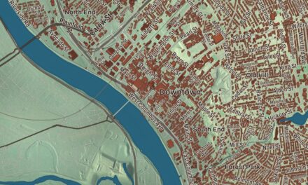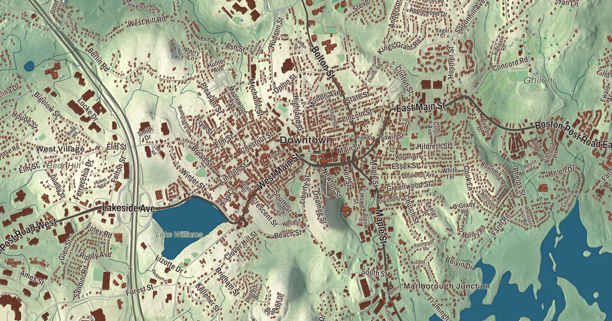
If you grew up in Marlborough, you know East Main Street and West Main Street, Lakeside Avenue, Maple Street, Bolton Street and Williams Street. This map prints all six, with Fort Meadow Reservoir, Sudbury Reservoir, Gates Pond, Bartlett Pond and the hills around the city. Click here to purchase a print of this map for your wall.
Marlborough is in Middlesex County.
KNOWOL made this map in 2026 from public survey data and gave it the look of an old atlas. The relief comes from United States Geological Survey elevation data, and the streets and the city line come from the Census Bureau. Marlborough covers 22.2 square miles, bordered by Berlin, Hudson, Sudbury, Framingham, Southborough and Northborough. The Assabet River cuts across its northwest corner, and Lake Williams, Millham Reservoir and Fort Meadow Reservoir are the three large lakes inside the city. Interstate 495, U.S. Route 20 and Route 85 cross it, and Interstate 290 ends here. The city had 41,793 people at the 2020 census.
Where two trails met
In 1656 several families from Sudbury, led by Edmund Rice, John Howe, John Ruddock and John Bent, asked the General Court for a new town southwest of Sudbury, where two Native trails crossed, the Nashua Trail and the Connecticut path. They named it for the market town of Marlborough in Wiltshire, England. Howe, a fur trader who spoke the Algonquian language of the Pennacook people living here, was the first settler to move in. The City of Marlborough’s recorded history, in the Secretary of the Commonwealth’s list, dates European settlement to 1657, and Marlborough was incorporated as a town in 1660. The Reverend William Brimstead was the first minister of the First Church. Later Marlborough became a favorite rest stop on the Boston Post Road, and George Washington stopped at the Williams Tavern soon after his inauguration in 1789.
The shoe city
In 1836 Samuel Boyd, remembered as the “father of the city,” opened Marlborough’s first shoe manufacturing business with his brother, Joseph. By 1890 the town had 14,000 people and was a major shoe center, making boots for Union soldiers and shoes for everyone else. Marlborough was incorporated as a city in 1890, and its new seal carried a factory, a shoe box and a pair of boots. Shoemaking lasted here long after it left many other New England towns: Frye boots were made in the city through the 1970s, and The Rockport Company was founded here in 1971. When Marlborough celebrated its centennial as a city in 1990, it built a park honoring the shoe industry, with statues by David Kapenteopolous. Workers came from Quebec, Ireland, Italy and Greece, and the town page says Marlborough is believed to have been the first community in the country to get a charter for a streetcar system, a few months ahead of Baltimore.
The city also keeps one of the region’s most unusual monuments. In 1861 soldiers of Company I of the 13th Massachusetts, many of them Marlborough firemen, took the bell from the fire engine house at Harpers Ferry where John Brown’s raid had ended. They left it with Elizabeth Ensminger, who had supplied them with bread in Williamsport, Maryland, and about 30 years later, in 1892, some of the old soldiers went back and brought it home. The John Brown Bell, which its page says has been called the “second-most important bell in American history,” hangs in a tower at the corner of Route 85 and Main Street. The author Horatio Alger graduated from Marlborough’s high school in 1847.
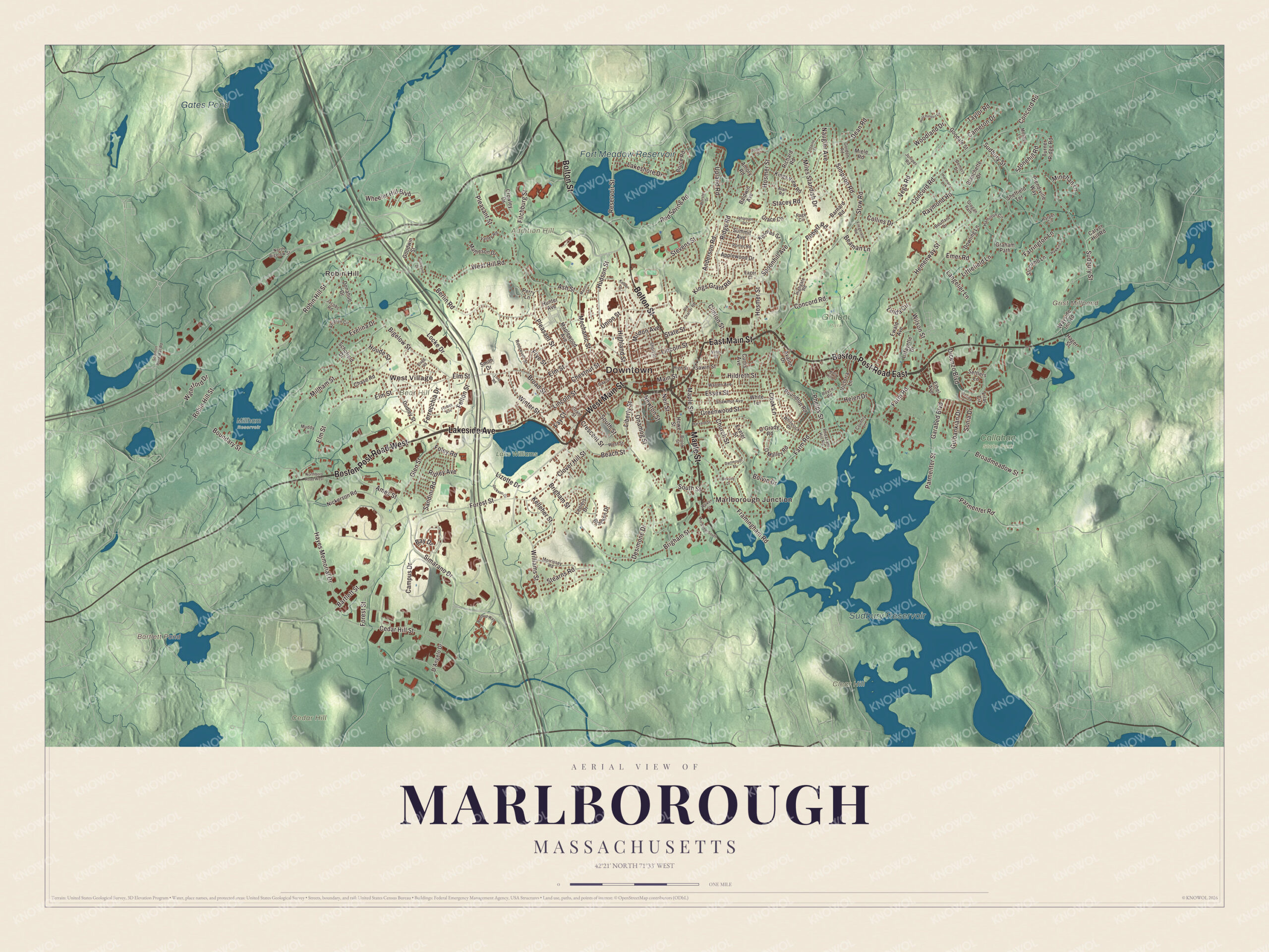
Click to explore a larger preview. The digital watermark does not appear on printed maps.
Names on this map
These names are printed on this map.
Places: Downtown, Robin Hill, West Village, Marlborough Junction, Addition Hill, Bear Hill, Cedar Hill, Clear Hill, Bartlett Pond, Grist Millpond, Sudbury Reservoir, Fort Meadow Reservoir, Gates Pond, Callahan State Park, Ghiloni Park, Lake Williams and Millham Reservoir.
Streets and roads: Lakeside Avenue, West Main Street, Boston Post Road East, Maple Street, Boston Post Road West, Bolton Street, East Main Street, Williams Street, Main Street, Elm Street, Hudson Street, Simarano Drive.
More street names, A to Z
Ahlgren Circle, Alan Road, Ames Street, Amory Road, Anderson Road, Applewood Drive, Ash Street, Avalon Drive, Azalea Lane, Baldwin Avenue, Barnard Road, Bartlett Street, Bay Drive, Beach Street, Beaman Lane, Berlin Road, Beverly Drive, Bigelow Street, Blanchette Drive, Boivin Drive, Bouffard Drive, Boundary Street, Bracken Drive, Brigham Street, Broadmeadow Street, Broad Street, Brook Street, Bruce Road, Cameron Drive, Campus Drive, Carver Hill Road, Cedar Hill Street, Chase Road, Chestnut Street, Church Street, Clinton Street, Clover Hill Street, Collins Drive, Concord Road, Cook Lane, Country Lane, Crescent Street, Crowley Drive, Curtis Avenue, D'Angelo Drive, Dartmouth Street, Dean Road, Demers Drive, Desimone Drive, Dicenzo Boulevard, Donahue Drive, Dowling Lane, Dudley Street, Dufresne Drive, Eager Court, Emer Road, Essex Street, Ethel Avenue, Evelina Drive, Ewald Avenue, Exeter Street, Farm Road, Farrington Lane, Fay Court, Felton Street, Ferrecchia Drive, Fitchburg Street, Fitzgerald Road, Flagg Road, Foley Road, Fontaine Street, Forbes Avenue, Forest Street, Framingham Road, Frye Street, Garabed Boulevard, Gay Street, Glen Street, Goodale Street, Goodwin Street, Gordon Road, Grace Circle, Graham Path, Grant Street, Greenwood Street, Grogan Path, Gulbankian Drive, Hager Street, Hamilton Circle, Harmony Lane, Harper Circle, Harvard Street, Hawkins Lane, Hayes Memorial Drive, Helen Drive, Hemenway Street, Highgate Road, Highland Street, High Street, Hildreth Street, Holly Hill Lane, Hosmer Street, Houde Street, Howe Street, Hunter Avenue, Hutchinson Drive, Jackson Drive, Jacobs Road, Johansen Drive, Juniper Road, Kelber Drive, Kelleher Street, Kings Grant Road, Kings View Road, Kosmas Street, Lafayette Drive, Lakeshore Drive, Langelier Lane, Leoleis Drive, Liberty Street, Lilac Circle, Lincoln Street, Linda Circle, Littlefield Lane, Lizotte Drive, Locke Drive, Lord Road, Maplewood Avenue, Marien Lane, Matheson Drive, Mechanic Street, Miele Road, Mildon Avenue, Miles Standish Drive, Millham Street, Mill Street South, Minehan Lane, Morrissey Road, Mosher Lane, Muddy Lane, Naugler Avenue, Neil Street, Newton Street, Nickerson Road, North Bigelow Street, Northboro Road West, O'Grady Road, O'Malley Road, Old Charter Road, Onamog Street, Page Circle, Paquin Drive, Parmenter Road, Parmenter Street, Perry Lane, Pheasant Hill Road, Phelps Street, Pleasant Street, Porter Road, Prendiville Way, Raymond Road, Redbud Way, Red Spring Road, Reservoir Street, Richard Road, Ridge Road, Ripley Avenue, Robert Road, Robin Hill Street, Roosevelt Street, Roundtop Road, Royce Road, Sandini Road, Sawin Street, Schofield Drive, Settlers Lane, Shawmut Avenue, Sheffield Terrace, Short Street, Simpson Road, Slocumb Lane, Smith Drive, Solomon Pond Mall Road, Sonia Drive, South Street, Spoonhill Avenue, Stacey Road, State Street, Stearns Road, Stevens Street, Stonehill Road, Stow Road, Sudbury Street, Summit Avenue, Taylor Road, Turner Ridge Road, Union Street, Upland Road, Varley Road, Vega Road, Victoria Lane, Vine Street, Walker Street, Warren Avenue, Waterford Drive, Wayside Inn Road, West Hill Road, West Street, Wheeler Hill Boulevard, Whitelock Drive, White Terrace, Wilson Street, Winter Street, Woodland Drive, Worster Drive.
See it on a wall
The Marlborough map as a framed print. Swipe for more.


Around the map
Start with Robin Hill, then follow Lakeside Avenue, West Main Street, Maple Street, Bolton Street, East Main Street and Williams Street across the city. The Marlborough Center Historic District runs along Main Street from Mechanic Street east to Bolton Street, which carries Route 85, and keeps City Hall, built in 1905. Then look outward toward West Village and Marlborough Junction. Bartlett Pond, Sudbury Reservoir, Fort Meadow Reservoir, Gates Pond, Addition Hill, Bear Hill and Cedar Hill are all printed on the map, and every one of those names is right there on the artwork. Fort Meadow Reservoir is a 260-acre lake on the Hudson line, with Memorial Beach on the Marlborough side. The Sudbury Reservoir, dug out from 1894 to 1898 for Boston’s water, lies mostly in Southborough and Marlborough, and no part of it lies in Sudbury; it’s an emergency backup reservoir today.
The Marlborough map makes a fine addition to an office, library or den, and it can help teach children the geography and history of a Middlesex County shoe city. It’s made for people who call Marlborough home, from West Village to Marlborough Junction, and it shows the city as it looks today. Zoom in on the preview above to explore the details, then click here to get your copy of the Marlborough, Massachusetts map.

Sources
- Marlborough, Massachusetts, Wikipedia
- Edmund Rice (colonist), Wikipedia
- John Brown Bell, Wikipedia
- Marlborough Center Historic District, Wikipedia
- Fort Meadow Reservoir, Wikipedia
- Sudbury Reservoir, Wikipedia
- City and Town Incorporation and Settlement Dates, Secretary of the Commonwealth of Massachusetts (archived copy)