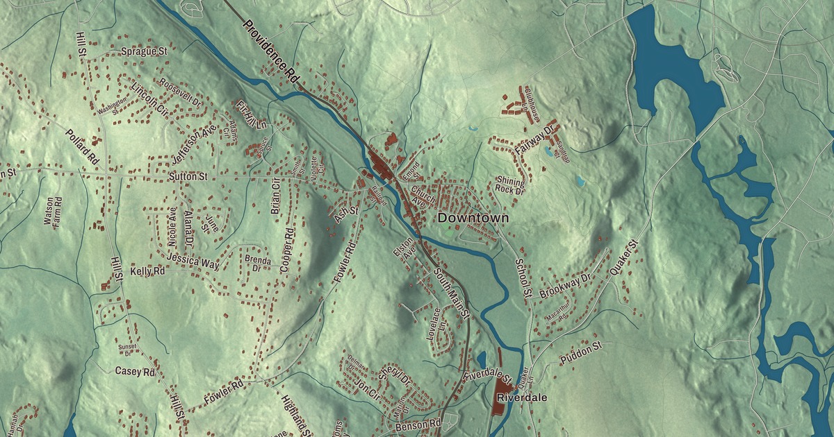
Northbridge grew as a town of mill villages along two rivers. This map prints the roads that join them, Providence Road, Quaker Street, Hill Street, Carpenter Road, Moon Hill Road and Prospect Street, with Whitins Pond, Arcade Pond and Plummers Hill along the way. Click here to purchase a print of this map for your wall.
Northbridge is in Worcester County.
KNOWOL made this map in 2026 from public survey data and gave it the look of an old atlas. United States Geological Survey elevation data shapes the valley, and the Census Bureau supplied the streets and the town line. Northbridge covers 18.1 square miles and had 16,335 people at the 2020 census. The Blackstone and Mumford rivers run through it, and the town is part of the Blackstone River Valley National Heritage Corridor, where the National Park Service has designated a number of sites. Its town hall is at 7 Main Street in Whitinsville.
From Mendon and Uxbridge
This was Nipmuc land. The Town of Northbridge’s recorded history, in the Secretary of the Commonwealth’s list, dates European settlement to 1704. The land was part of Mendon from 1667 to 1726 and part of Uxbridge from 1727 to 1772. The town page dates the new town’s incorporation to July 14, 1772, and the state’s list says Northbridge was incorporated as a town in 1775. Colonel John Spring, who had pushed for the new town and later changed his mind, led a company of men in the Massachusetts militia in the Revolution, and dozens of local men fought at the Lexington Alarm and at Bunker Hill. His son Samuel Spring served as a chaplain at the Siege of Boston and on the invasion of Canada under Benedict Arnold, and the town page says he carried Arnold and Aaron Burr, his Princeton classmate, off separate battlefields. Colonel Seth Read and his brother, Colonel Joseph Read, owned more than half the town’s land at the time of the Revolution, and Phoebe Millard, the mother of President Millard Fillmore, was born in Northbridge.
The Shop
In 1809 Paul Whitin, his father-in-law James Fletcher and others started the Northbridge Cotton Manufacturing Company. Whitin and his sons founded the Whitin Machine Works beside the river in 1831, the year his son John Crane Whitin patented a new cotton picker, the first of the inventions that made the company a major maker of textile machinery. In 1847 the family built “The Shop,” and at its peak the company was the largest manufacturer of textile machines in the world, with more than 5,600 people on the payroll by 1948. The village that grew around it, Whitinsville, is named for the family, and it’s one of four villages the Blackstone River Valley corridor commission has designated a mill village of national historic significance. The Whitin Community Center, which four Whitin daughters paid for in 1922 in memory of their father, sent swimmers to the 1932 and 1936 Olympics. Workers came from Canada, the Netherlands and Armenia, and in Linwood, settled mostly by French Canadians, the Linwood Mill went up in 1866, the crowning glory, its village page says, of James Fletcher Whitin and Charles Pinckney Whitin. Since 2011 it has held apartments for older adults, with a restaurant and offices on the ground floor. The town remains part of Worcester County today.
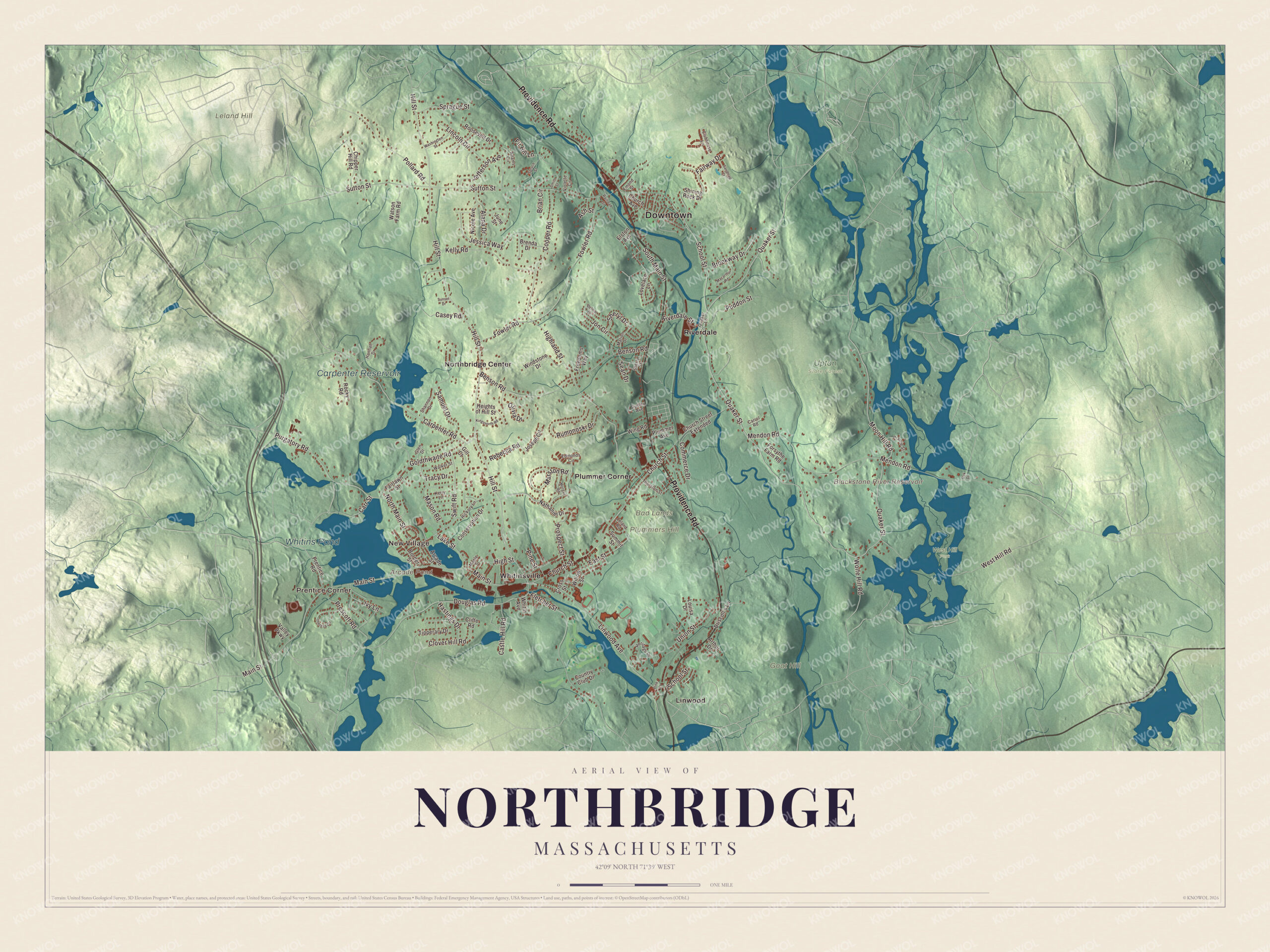
Click to explore a larger preview. The digital watermark does not appear on printed maps.
Names on this map
These names are printed on this map.
Places: Downtown, Prentice Corner, New Village, Bad Lands, Goat Hill, Leland Hill, Plummers Hill, Arcade Pond, Blackstone River Reservoir, Whitins Pond, Carpenter Reservoir, Upton State Forest, West Hill Park, Linwood, Northbridge Center, Plummer Corner, Riverdale and Whitinsville.
Streets and roads: Providence Road, Quaker Street, Hill Street, Carpenter Road, Moon Hill Road, Prospect Street, Highland Street, Linwood Avenue, Douglas Road, Main Street, Mendon Road, Sutton Street.
More street names, A to Z
Adams Circle, Alana Drive, Arcade Street, Arthur Drive, Ash Street, Benson Road, Border Street, Brenda Drive, Brian Circle, Brookway Drive, Carrol Road, Carr Street, Casey Road, Castle Hill Road, Chipper Hill Road, Church Avenue, Church Street, Church Street Extended, Cliffe Road, Clover Hill Road, Clubhouse Lane, Commerce Drive, Conservation Drive, Cooper Road, Country Club Drive, Cross Street, Delmar Drive, Driscoll's Lane, Dudley Avenue, East Street, Edmonds Circle, Elston Avenue, Emond Street, Fairlawn Street, Fairway Drive, Fir Hill Lane, Fletcher Street, Forsythe Farm Road, Fowler Road, Freedoms Way, Gill Court, Glen Drive, Goldthwaite Road, Hannah Drive, Hastings Drive, Heights of Hill Street, Heritage Drive, Hickory Lane, High Street, Ivy Lane, Jefferson Avenue, Jessica Way, Jon Circle, Joseph Circle, June Street, Kelly Road, Kerry Lane, Kingsnorth Road, Lake Street, Leland Road, Lincoln Circle, Louisa Drive, Lovelace Lane, Macarthur Road, Maple Street, Marion Drive, Marston Road, Mason Road, Morgan Road, Nathaniel Drive, Nicole Avenue, North Main Street, Oak Drive, Olivia Drive, Pine Court, Pine Street, Plummer Avenue, Pollard Road, Prairie Street, Prentice Road, Prescott Road, Puddon Street, Purgatory Road, Quaker Lane, Railroad Street, Rebecca Road, Riverdale Street, Rocky Road, Roosevelt Drive, Rumonoski Drive, Samuel Drive, Sandtrap Court, School Street, Sean Drive, Shannon Drive, Sherry Street, Sheryl Drive, Shining Rock Drive, Smith Street, South Main Street, Sprague Street, Spruce Street, Summit Street, Sunset Drive, Swift Road, Theresa Circle, Thurston Street, Tipperary Drive, Tracy Drive, Union Street, Valley Parkway, Violette Circle, Walker Street, Washington Street, Watson Farm Road, West Hill Road, Whitin Avenue, Willow Street, Windstone Drive, Wing Road, Wolfe Hill Road.
See it on a wall
The Northbridge map as a framed print. Swipe for more.


Around the map
Start with Prentice Corner. Follow Providence Road, Quaker Street, Hill Street, Carpenter Road, Moon Hill Road and Prospect Street across town. Then look outward toward New Village, Linwood, Northbridge Center, Plummer Corner and Riverdale. Arcade Pond, Whitins Pond, Carpenter Reservoir, Goat Hill, Leland Hill, Plummers Hill, Moon Hill and Blackstone River Reservoir are all printed on the map. The Whitin Community Center runs the Rockdale Youth Center at 2219 Providence Road, and the St. Camillus Health Center stands at 447 Hill Street on the old E. Kent Swift Estate. Linwood lies in both Northbridge and Uxbridge, and the reservoir of the West Hill Dam flood control project lies within the town limits of Northbridge.
The Northbridge map makes a strong addition to an office, library or den, and it can help teach children the geography and history of a Blackstone Valley mill town. It’s made for anyone who calls Northbridge home, from Prentice Corner to Riverdale, and it shows the town as it looks today. Zoom in on the preview above to explore the details, then click here to get your copy of the Northbridge, Massachusetts map.

Sources