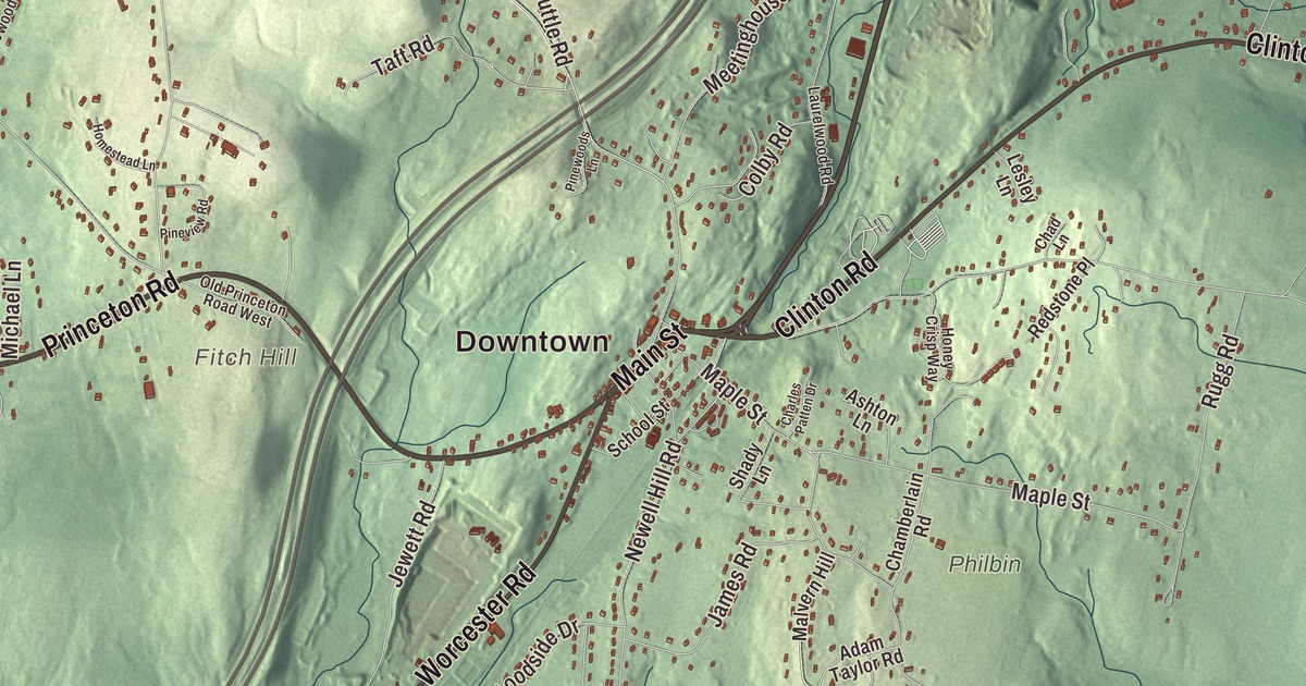
From West Sterling to Sterling Junction, this map gathers the whole town: Main Street and the common, Redemption Rock Trail and Leominster Road, the two Waushacum ponds, Fitch Hill and the edge of the Wachusett Reservoir. Click here to purchase a print of this map for your wall.
Sterling is in Worcester County.
KNOWOL made this map in 2026 from public survey data and lettered it in the fashion of an old atlas. The hills are built from United States Geological Survey elevation data, and the roads and the town line come from the Census Bureau. Sterling covers 31.7 square miles between Leominster on the north, West Boylston on the south, Princeton and Holden on the west, Lancaster on the northeast and Clinton and Boylston on the southeast, and it meets Boylston on the waters of the Wachusett Reservoir. Interstate 190 cuts the town in half. Sterling had 7,985 people at the 2020 census.
Chocksett
The old name of this country was Woonsechocksett, and people long called it Chocksett for short. There was a Native fort and burying ground between East Waushacum Pond and West Waushacum Pond, and the Nipmuc minister Peter Jethro worked in the area in the 1670s. In 1713 Tahanto, the nephew of the sachem Sholan, sold the Chocksett land to the people of Lancaster. The Town of Sterling’s recorded history, in the Secretary of the Commonwealth’s list, dates European settlement to 1720, when the first families came out from Lancaster. Among them were the Bemans, Sawyers, Houghtons and Osgoods, whose names still mark Sterling’s oldest roads. The town common was laid out in 1724, while the area was still part of Lancaster.
In 1733 the Second Parish asked to become its own town, because of the “great inconvenience” of the long trip to church in Lancaster’s center, and it was turned down. By 1780 Chocksett’s people made up a majority of Lancaster, and they voted out the town officers and began holding town meetings in Chocksett. Lancaster gave way, and Sterling was incorporated as a town in 1781. It was named for General William Alexander, called Lord Stirling, who served under George Washington; his portrait hangs in the town hall.
Mary and her lamb
Mary Sawyer was born on a Sterling farm in 1806. At 70 she said she was the girl in “Mary Had a Little Lamb,” the girl who took her pet lamb to school one day at her brother’s suggestion. She remembered that a young visitor named John Roulstone was so taken with the scene that he brought her three stanzas the next day. The poem was first published by Sarah Josepha Hale in 1830, and Mary’s story rests on her own memory, but Sterling keeps the story alive: a small statue of the lamb and a historical marker stand in the town center. The Redstone School of 1798, where she went to school, was bought by Henry Ford in 1926 and moved to the grounds of Longfellow’s Wayside Inn in Sudbury. Sterling was also the birthplace of Ebenezer Butterick, who with his wife, Ellen, began selling tissue paper dress patterns in graded sizes in 1863, which revolutionized home sewing.
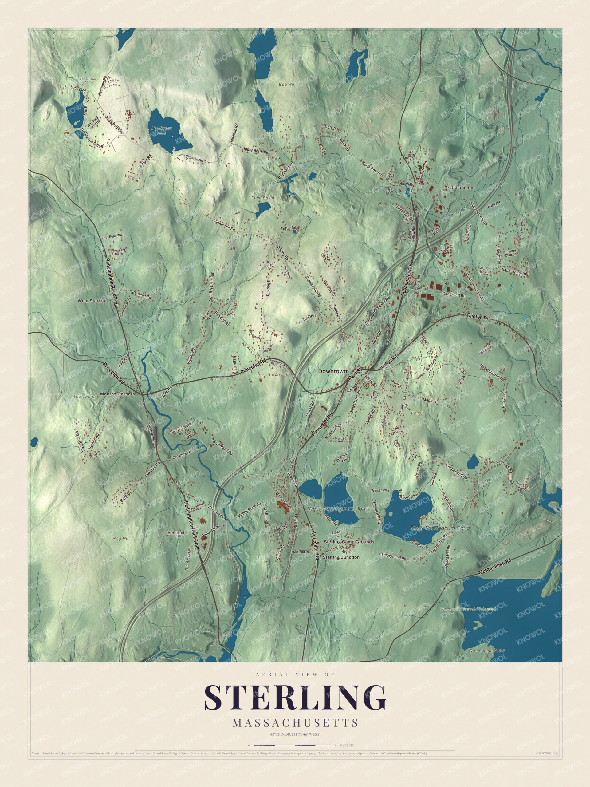
Click to explore a larger preview. The digital watermark does not appear on printed maps.
Names on this map
These names are printed on this map.
Places: Downtown, West Sterling, Pratt Junction, Sterling Junction, Sterling Camp Grounds, Bee Hill, Fitch Hill, Greenhalge Point, Hog Hill, Fitch Basin, Fitch Pond, East Waushacum Pond, West Waushacum Pond, Hy-Crest Pond, Leominster State Forest, Philbin, Town Forest, Wachusett Reservoir Watershed and Moores Corners.
Streets and roads: Leominster Road, Princeton Road, Main Street, Clinton Road, Worcester Road, Redemption Rock Trail, Metropolitan Road, Justice Hill Road, Beaman Road, Greenland Road, Chace Hill Road, Newell Hill Road.
More street names, A to Z
Adam Taylor Road, Albright Road, Ashton Lane, Avery Lane, Beach Road, Bean Road, Beverly Drive, Birch Drive, Blueberry Lane, Boutelle Road, Broadway Avenue, Burpee Road, Calvin's Lane, Campground Road, Carriage Way, Chad Lane, Chamberlain Road, Charles Patten Drive, Chestnut Avenue, Chocksett Road, Clemence Avenue, Colby Road, Cole Road, Connelly Road, Country Club Lane, Country Club Road, Crowley Road, Cynthia Lane, Dana Hill Road, Deborah Lane, East Park Road, Elliott Road, Evergreen Circle, Farm Road, Fitch Farm Road, Flanagan Hill Road, Ford Road, Four Sons Way, Fox Run Road, Gates Road, Gibbons Drive, Glendale Avenue, Griffin Road, Hall Avenue, Hapgood Road, Hastings Road, Hawkins Lane, Heywood Road, Hilltop Drive, Holden Road, Homestead Lane, Honey Crisp Way, Industrial Drive, James Road, Jewett Road, Jill Lane, John Dee Road, Johnson Road, Justice Hill Cutoff, Karen Drive, Kathleen Lane, Kendall Hill Road, Kilbourne Road, Lake Shore Drive, Laurelwood Road, Legate Hill Road, Lesley Lane, Lucas Road, Malvern Hill, Maple Street, Meetinghouse Hill Road, Mellon Hollow Road, Merrill Road, Michael Lane, Mortimer Road, Muddy Pond Road, Noahs Way, North Cove Road, North East Boulevard, North Road, North Row Road, Old Princeton Road West, Osgood Road, Pamela Lane, Pheasant Hill Lane, Pikes Hill Road, Pineview Road, Pinewoods Lane, Pratts Junction Road, Redstone Hill Road, Redstone Place, Reed Road, Riverview Road, Roper Road, Rowley Hill Road, Rowley Road, Rugg Road, Runaway Brook, Ryan Way, Sandy Ridge Road, School Street, Shady Lane, Sherwood Drive, Sky Farm Lane, Smith Avenue, South Nelson Road, Squareshire Road, State Access Road, Still River Road, Sunset Drive, Swett Hill Road, Taft Road, Tanglewood Road, Tara Lane, Trinity Avenue, Tuttle Road, Twine Road, Upper North Road, Upper North Row, Village Lane, Westland Farm Road, Wilder Lane, Wilder Road, Wiles Road, Woodside Drive, Wyman Way.
Around the map
Start with West Sterling. Follow Leominster Road, Princeton Road, Main Street, Clinton Road, Worcester Road and Redemption Rock Trail across town. Then look outward toward Pratt Junction, Sterling Junction and Moores Corners. Fitch Pond, East Waushacum Pond, West Waushacum Pond, Wachusett Reservoir Watershed, Town Forest, Bee Hill, Fitch Hill and Hog Hill are all printed on the map. The Sterling Center Historic District, between Main, Maple, Worcester and Princeton streets, keeps the common, houses of the 1700s and 1800s, several churches and the town hall of 1835. The Conant Public Library building, paid for by Edwin Conant in memory of his daughter, was dedicated in 1886. Sterling’s town water comes from wells on Redemption Rock Trail and Worcester Road, and in 2016 its municipal light department began building what it calls the first utility-scale energy storage facility in Massachusetts. When the Wachusett Dam held back the Nashua River, 4,380 acres were flooded in Boylston, West Boylston, Clinton and Sterling, and on completion it was the largest public water supply reservoir in the world. Each September the Sterling Fair, still free to enter, brings livestock, oxen pulls and fireworks, and Sholan Park on the Waushacum shore has a swimming beach.
The Sterling map makes a cheerful addition to an office, library or den, and it can help teach children the geography and history of the town where Mary kept her lamb. It’s made for people who call Sterling home, from West Sterling to Moores Corners, and it shows the town as it looks today. Zoom in on the preview above to explore the details, then click here to get your copy of the Sterling, Massachusetts map.

We made a map for every town and city in Massachusetts. Explore the complete Massachusetts map collection and find your town.
Sources
- Sterling, Massachusetts, Wikipedia
- Sterling Center Historic District, Wikipedia
- Mary Tyler, Wikipedia
- Mary Had a Little Lamb, Wikipedia
- Redstone School, Wikipedia
- Ebenezer Butterick, Wikipedia
- Wachusett Reservoir, Wikipedia
- City and Town Incorporation and Settlement Dates, Secretary of the Commonwealth of Massachusetts (archived copy)