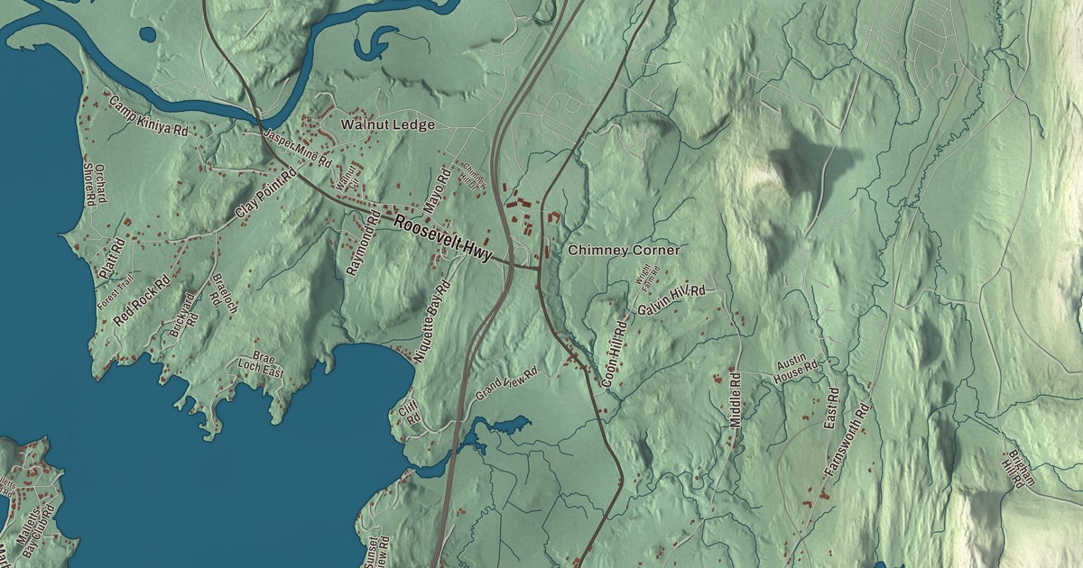
In Colchester, summer means Malletts Bay, when the lakeshore fills with visitors and the Father’s Day fishing derby comes around again. This map prints Malletts Bay and Lake Champlain, the Winooski River and Colchester Pond, the corners and beaches of Chimney Corner, Nourses Corner, Thayer Beach, Walnut Ledge and Shipman Hill, and Roosevelt Highway, College Parkway, Blakely Road, Prim Road, Heineberg Drive and West Lakeshore Drive.
Colchester is a town in Chittenden County, Vermont.
KNOWOL made this map in 2026 from public survey data and gave it the look of an old county atlas. The land is shaded from United States Geological Survey elevation data, and the roads and the town line come from the Census Bureau. Of Colchester’s 58.6 square miles, 22.2 are water: the town runs west into the lake as far as the New York line. With 17,524 people at the 2020 census, it’s the most populous town in Vermont and the third most populous municipality of any kind. Click here to purchase a print of this map for your wall.
Chartered in 1763
Colchester dates to 1763. New Hampshire chartered it on June 7 of that year and named it for the Earl of Colchester, and the town organized in 1791. That same year Roger Enos, the general who had commanded the Vermont militia late in the Revolution, moved to Colchester, and he lived here in retirement until his death in 1808.
Until 1922, Winooski Falls was part of Colchester. Ira Allen dammed the river there after the Revolution and put a sawmill at each end, and later the falls powered woolen mills. In 1922 Winooski Falls broke away as the city of Winooski, and Colchester lost a large share of its people.
Fort Ethan Allen and the Buffalo Soldiers
Fort Ethan Allen opened in 1894 as a cavalry post, and its grounds still straddle the line between southeastern Colchester and Essex. Its barracks, stables and parade ground are now a national historic district, and its oldest structure is an 80-foot water tower from 1893. From 1909 to 1913 the fort was home to the 10th Cavalry, one of the original Buffalo Soldier regiments of Black troopers. The regiment’s coat of arms was first confirmed at Fort Ethan Allen in 1911. When the 10th Cavalry left Vermont in 1913, many of its men retired and stayed, and many of their descendants still live in Colchester, Winooski and Burlington.
The Vermont Army National Guard has its headquarters at Camp Johnson in Colchester, named in 1945 for General Herbert T. Johnson, who led Vermont’s military during and between the world wars. The Vermont National Guard Museum and Library is there as well. Saint Michael’s College has been in Colchester since 1904, when priests of the Society of Saint Edmund, who had left France in 1889, opened it as Saint Michael’s Institute. After World War II it took over barracks from Fort Ethan Allen to house students on the GI Bill.
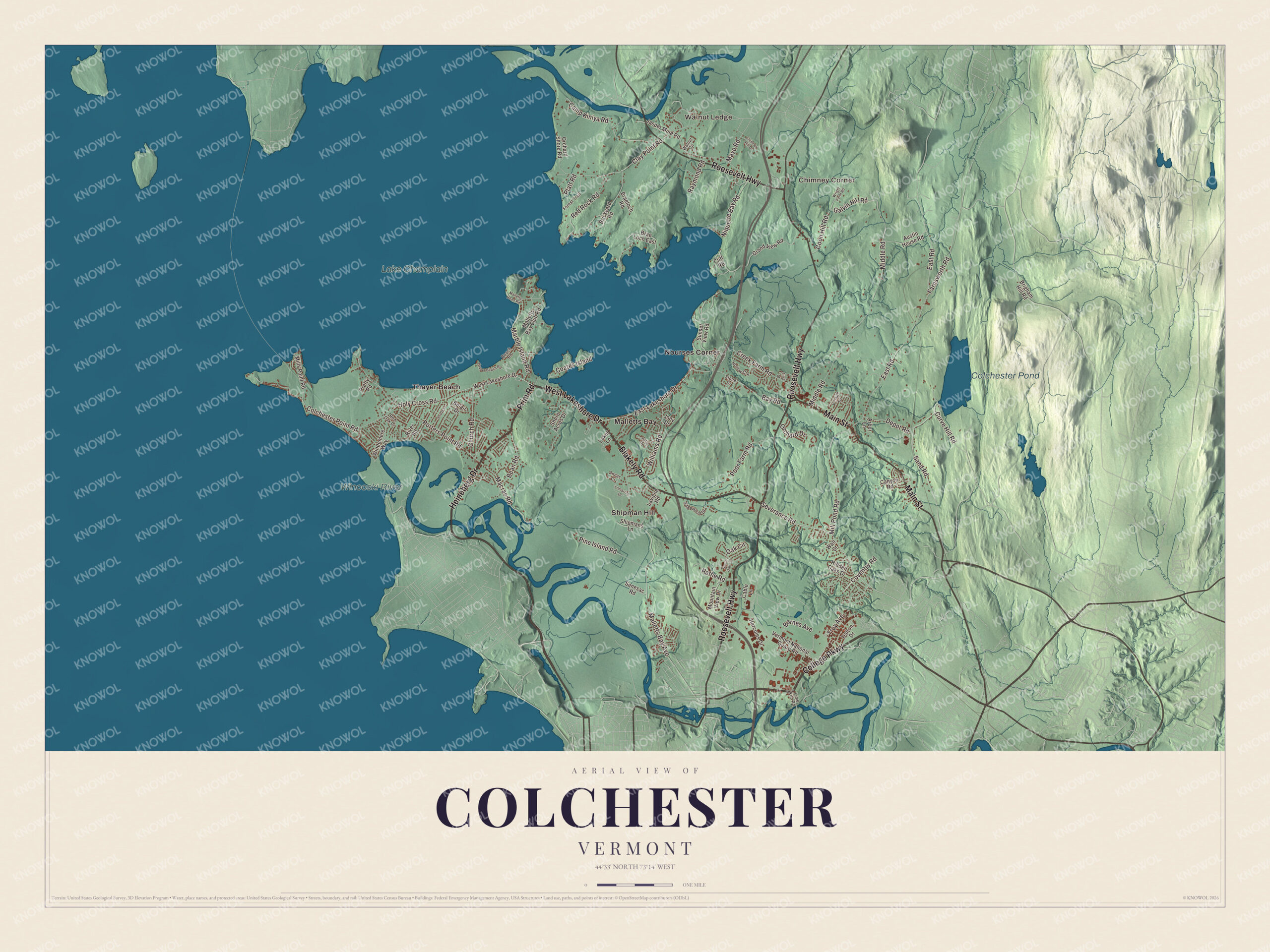
Click to explore a larger preview. The digital watermark does not appear on printed maps.
Names on this map
These names are printed on this map.
Places: Chimney Corner, Walnut Ledge, Colchester Pond, Winooski River, Lake Champlain, Malletts Bay, Nourses Corner, Shipman Hill and Thayer Beach.
Streets and roads: Blakely Road, College Parkway, Prim Road, West Lakeshore Drive, Heineberg Drive, Roosevelt Highway, Main Street, Severance Road, Holy Cross Road, East Lakeshore Drive, Macrae Road, Middle Road.
More street names, A to Z
Annas Court, Arbor Lane, Austin House Road, Barnes Avenue, Bay Road, Beach Road, Bean Road, Belair Drive, Brae Loch East, Braeloch Road, Brickyard Road, Brigham Hill Road, Cable Lane, Camp Kiniya Road, Canyon Road, Chimney Hill Drive, Church Road, Clay Point Road, Cliff Road, Coates Island, Colchester Point Road, Coon Hill Road, Coventry Road, Creek Farm Road, Curve Hill Road, Dalton Drive, Depot Road, East Road, Edgewood Drive, Farnsworth Road, First Street, Forest Trail, Galvin Hill Road, Grand View Road, Hercules Drive, Hidden Oaks Drive, Hollow Crk, Jasper Mine Road, Joey Drive, Julie Drive, Laker Lane, Lavigne Road, Lime Kiln Road, Lomartire Drive, Malletts Bay Avenue, Malletts Bay Club Road, Malletts Head Road, Marble Island Road, Mayo Road, Mill Pond Road, Mills Point Road, Mountain View Drive, Niquette Bay Road, Oak Circle, Orchard Drive, Orchard Shore Road, Pine Island Road, Platt Road, Poor Farm Road, Porters Point Road, Pretty Road, Rathe Road, Raymond Road, Red Oak Drive, Red Rock Road, River Road, Sand Road, Senesac Road, Shady Lane, Shipmans Lane, Shore Acres Drive, South Oak Circle, Stone Drive, Sunset View Road, Thayer Beach Road, Troy Avenue, Vermont National Guard Road, Village Drive, Wall Street, Walnut Circle, Williams Road, Windemere Way, Wright Farm Road.
See it on a wall
The Colchester map as a framed print. Swipe for more.


On the lake
Colchester sits on Malletts Bay, a part of Lake Champlain, and in summer the lakeshore fills with vacationers from southern New England and New York City. The Lake Champlain International Father’s Day Fishing Derby has run every year since 1981; in 2009, 6,000 people entered. Niquette Bay State Park covers 584 acres on the lake, with a swimming beach and trails through the woods down to it. Out on the water, the Colchester Reef Light warned ships off the reefs northwest of Colchester Point from 1871 until it was retired in 1933. The lighthouse no longer stands on the reef: it was moved to the Shelburne Museum in 1956.
Ray Collins, a native of Colchester, pitched for the Boston Red Sox from 1909 to 1915. He came home to coach baseball at the University of Vermont, ran his family’s dairy farm in Colchester until 1960, and helped found the Burlington Milk Cooperative Creamery.
Roosevelt Highway is the stretch where U.S. Routes 2 and 7 run together just north of Winooski. From there, the map lets you follow College Parkway, Prim Road, Blakely Road, Heineberg Drive and West Lakeshore Drive, and find Thayer Beach, Walnut Ledge, Shipman Hill, Chimney Corner, Nourses Corner and Colchester Pond.
Hang this map of Colchester in an office, library or den, or use it to teach children the geography and history of a lake town. It’s made for everyone who calls Colchester home and shows the town as it looks today, from Malletts Bay to the Winooski River. KNOWOL created it in 2026, and it’s printed on museum quality archival paper. Zoom in on the preview above to explore the details, then click here to get your copy of the Colchester, Vermont map.

Sources
- Colchester, Vermont, Wikipedia
- Town histories and representatives, C towns, Vermont Legislature
- Roger Enos, Wikipedia
- Winooski, Vermont, Wikipedia
- Winooski River, Wikipedia
- Fort Ethan Allen, Wikipedia
- 10th Cavalry Regiment (United States), Wikipedia
- Camp Johnson (Vermont), Wikipedia
- Saint Michael’s College, Wikipedia
- Niquette Bay State Park, Wikipedia
- Colchester Reef Light, Wikipedia
- Ray Collins (baseball), Wikipedia