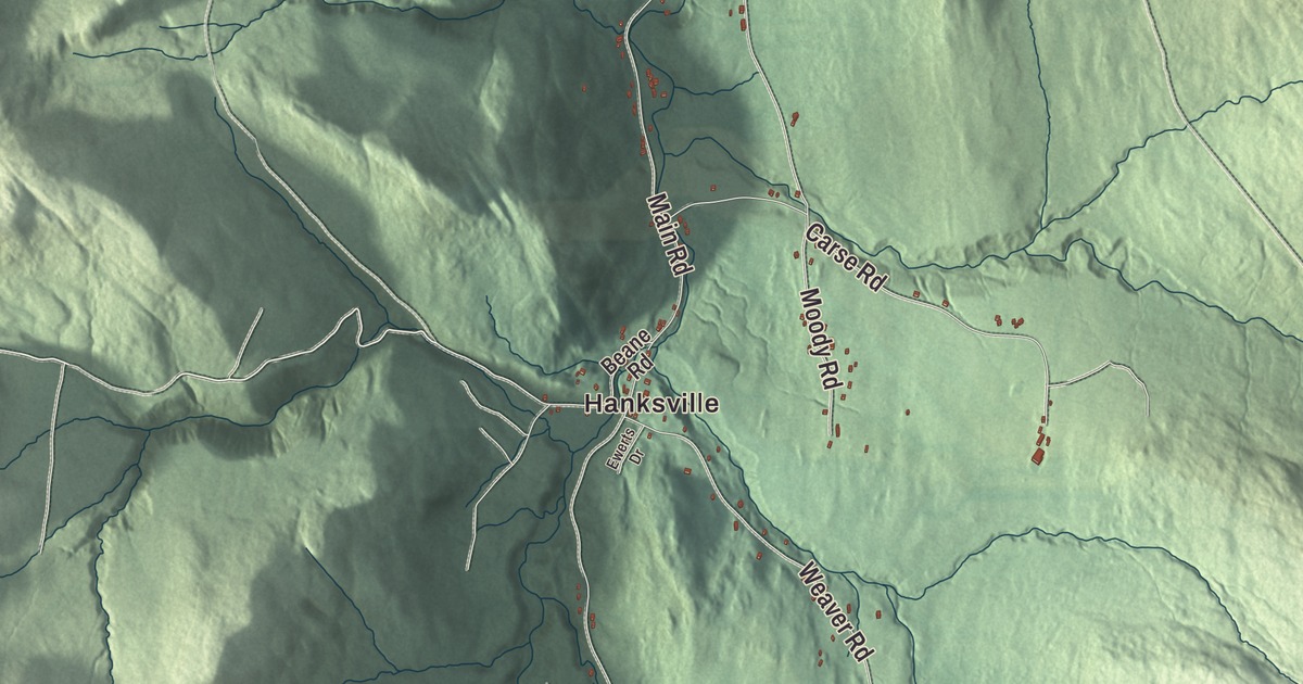
All three of Huntington’s villages sit along the Huntington River, and Camel’s Hump rises on the town line in the northeast corner. This map prints Main Road, Camels Hump Road, Mayo Road, Pond Road, Bert White Road and Trapp Road, with Hanksville, Huntington Center and the Huntington River.
Huntington is a town in Chittenden County, Vermont.
KNOWOL made this map in 2026 from public survey data and gave it the look of an old county atlas, shading the mountains from United States Geological Survey elevation data and drawing the roads and town line from the Census Bureau. Huntington lies on the west side of the Green Mountains, the Huntington River flows north through it to the Winooski, and 1,938 people lived here at the 2020 census. Click here to purchase a print of this map for your wall.
New Huntington
New Hampshire granted the town on June 7, 1763, as New Huntington, naming it for the landholders Josiah, Charles and Marmaduke Hunt. It organized on March 29, 1790, sent Jehiel Johns to the legislature in 1791, and dropped the “New” on October 27, 1795. The villages are Huntington village in the northwest, Huntington Center in the middle and Hanksville in the south.
Charles Bowles founded Huntington’s first church. Born in Boston in 1761, he ran away as a teenager to join the Continental Army and served through the Revolution, then became a Free Will Baptist preacher. Bowles, who was African American, was ordained in 1816 and preached across northern Vermont. In Huntington he gathered a congregation of ninety, and the families he brought into the faith built the town’s first church building, which later served as the first town hall and then the first volunteer fire station. He spoke out openly against slavery, and his biographer credited him with helping turn public feeling in Vermont against it. In 1870 the Huntington Lower Village Church was built at 2156 Main Road, on the site where the older church had stood, and it now holds the town library and serves as a community center.
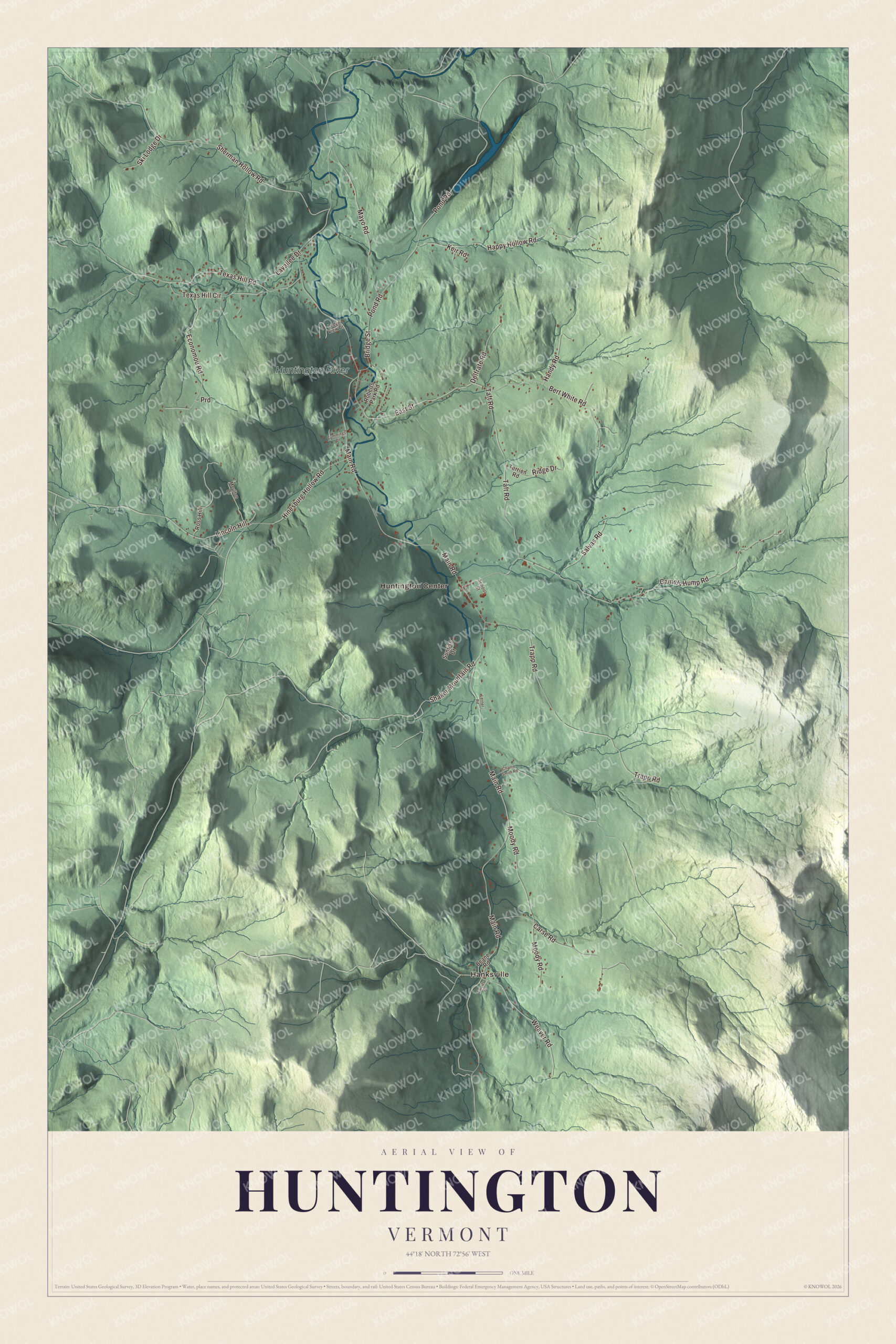
Click to explore a larger preview. The digital watermark does not appear on printed maps.
Names on this map
These names are printed on this map.
Places: Hanksville, Huntington Center and Huntington River.
Streets and roads: Mayo Road, Pond Road, Bert White Road, Trapp Road, Main Road, Camels Hump Road, Sherman Hollow Road, Happy Hollow Road, East Street, Texas Hill Road, Taft Road, Moody Road.
More street names, A to Z
Beane Road, Bridge Street, Carse Road, Charlie Smith Road, Cummings Drive, Delfrate Road, Economou Road, Ewerts Drive, Handy Road, Hinesburg Hollow Road, Keir Road, Lavallee Drive, Ledge View Drive, Lerner Road, Lincoln Hill, Moulton Drive, Prd, Ridge Drive, Roberts Park Road, Ross Hill, Salvas Road, School Street, Shaker Mountain Road, Ski Lodge Drive, Sunrise Drive, Terrien Road, Texas Hill Circle, Weaver Road.
See it on a wall
The Huntington map as a framed print. Swipe for more.


Up the valley
About half a mile north of the village center, the Remington and Williamson Farm at 4582 Main Road keeps the brick farmhouse Jeremiah Remington took over in 1830 and a bank barn of 1895; his descendants held it into the 1980s. At the south end of town, Main Road runs through Hanksville beside the river, about 3.5 miles from Huntington Center, below the main ridge of the Green Mountains, which runs from Burnt Rock Mountain to Molly Stark Mountain. The naturalist and woodcarver Bob Spear helped start the Green Mountain Audubon Center in Huntington and was its first director, and in 1987 the Birds of Vermont Museum opened here with his work. Its galleries hold hundreds of his lifelike bird carvings, and a 100-acre bird sanctuary surrounds it. The actor and writer Damon Wayans Jr. was born in Huntington in 1982.
Camel’s Hump, at 4,083 feet, stands on the town line with Duxbury and ties Mount Ellen as the third highest mountain in Vermont. The Abenaki called it Moziozagan, the moose’s shoulder. Camels Hump Road ends at the Burrows Trailhead east of Huntington, and the Burrows Trail, the oldest trail on the mountain, climbs the west face through old spruce and fir forest.
On the map, follow Main Road from Huntington Center south to Hanksville, then take Camels Hump Road toward the mountain. Mayo Road, Pond Road, Bert White Road and Trapp Road are printed too, and so is the Huntington River. Huntington dates to 1763.
This map of Huntington is made for everyone who calls Huntington home, and it shows the town as it looks today, from Huntington Center to Hanksville. Hang it in an office, library or den, or use it to teach children the geography and history of their town. It’s printed on museum quality archival paper. Zoom in on the preview above to explore the details, then click here to get your copy of the Huntington, Vermont map.

Sources
- Huntington, Vermont, Wikipedia
- Town histories and representatives, H towns, Vermont Legislature
- Charles Bowles (minister), Wikipedia
- Huntington Lower Village Church, Wikipedia
- Remington-Williamson Farm, Wikipedia
- Hanksville, Vermont, Wikipedia
- Bob Spear (naturalist), Wikipedia
- Birds of Vermont Museum, Wikipedia
- Damon Wayans Jr., Wikipedia
- Camel’s Hump, Wikipedia