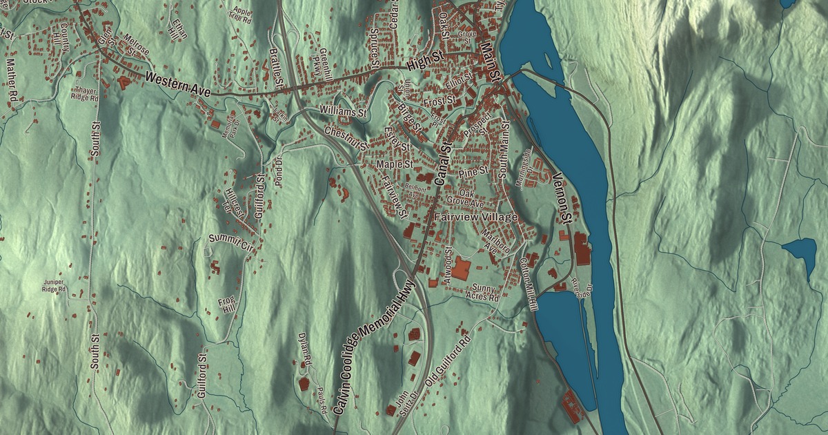
Coming north on Interstate 91 from Massachusetts, Brattleboro is the first major town you reach, and its downtown runs along Main Street. This map prints Main Street, Canal Street, Linden Street, Putney Road, Western Avenue and the Calvin Coolidge Memorial Highway, along with West Brattleboro, Fairview Village and Pleasant Valley Reservoir.
Brattleboro is in Windham County, at the meeting of the West River and the Connecticut, about 10 miles north of the Massachusetts line.
KNOWOL made this map in 2026 from public survey data and gave it the look of an old atlas. The shaded terrain comes from United States Geological Survey elevation data: the town sits in the Connecticut River valley, drained by the West River, Ames Hill Brook and Whetstone Brook, with hills and mountains all around. The streets and the town line come from the Census Bureau. Brattleboro covers 32.5 square miles, and the Census counted 12,106 people in 2022, which makes it the most populous municipality on Vermont’s border with New Hampshire. Click here to purchase a print of this map for your wall.
From Fort Dummer to Brattleborough
The Sokoki band of the Abenaki called this place Wantastegok. In 1724, during Dummer’s War, Massachusetts built a blockhouse and stockade on the Connecticut here, Fort Dummer, which its page calls the first permanent European settlement in Vermont; in peaceful years it became a trading post between colonists and Native people. Governor Benning Wentworth chartered the township on December 26, 1753, and named it Brattleborough after William Brattle Jr. of Boston, a principal proprietor; there’s no record that he ever visited. The spelling was shortened to Brattleboro in 1888.
Once the wars ended, the town grew quickly. Stephen Greenleaf opened Vermont’s first store in the east village in 1771, a post office came in 1784, and a bridge reached Hinsdale, New Hampshire, in 1804. The Whetstone Brook drove mills, and in 1811 the first paper mill was built on it. In 1834 a bequest from Anna Marsh of Hinsdale founded the Brattleboro Retreat, and in 1844 Robert Wesselhoeft opened a water cure that made the town known as a health resort until 1871. The Estey Organ Company, founded by Jacob Estey in 1852, grew into one of the world’s largest organ makers, and one building of its old factory complex near Birge Street now houses the Estey Organ Museum.
Firsts and famous neighbors
Rudyard Kipling married Carrie Balestier of Brattleboro in 1892, and the couple built their home, Naulakha, just over the line in Dummerston, where he wrote The Jungle Book. Ida May Fuller of Brattleboro received the first recurring monthly Social Security check, issued on January 31, 1940. On May 12, 1950, Emma Bailey held her first auction in town, selling a rocking chair for $2.50; she’s credited as the first American woman auctioneer. Fred Harris, a Brattleboro native who founded the Dartmouth Outing Club, started the Brattleboro Outing Club in 1922 and built the Harris Hill ski jump, which still holds international competitions every February.
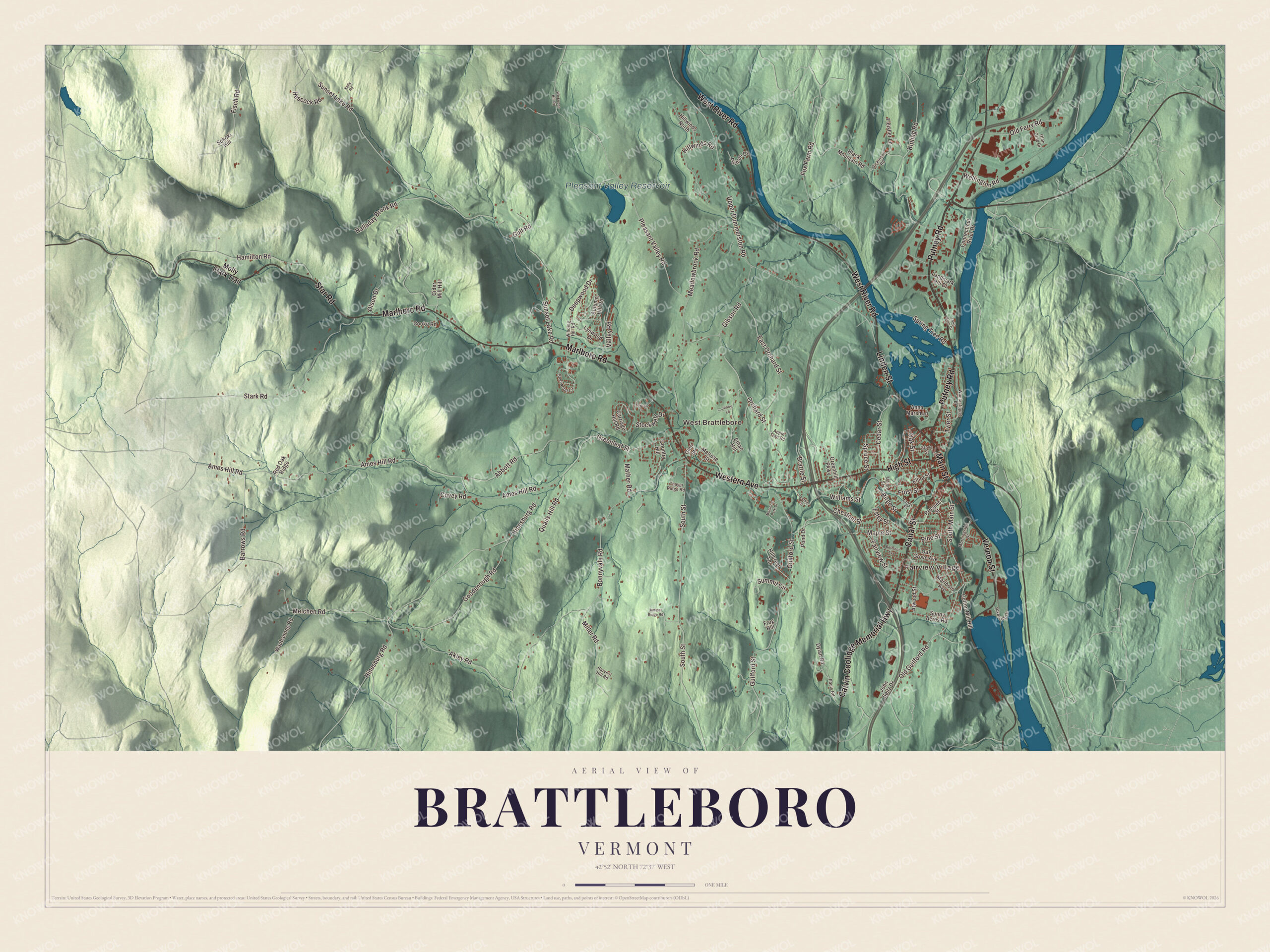
Click to explore a larger preview. The digital watermark does not appear on printed maps.
Names on this map
These names are printed on this map.
Places: Fairview Village, West Brattleboro and Pleasant Valley Reservoir.
Streets and roads: Calvin Coolidge Memorial Highway, Putney Road, Main Street, Canal Street, Linden Street, Western Avenue, West River Road, Vernon Street, Marlboro Road, Star Road, High Street, South Main Street.
More street names, A to Z
Abbott Road, Akley Road, Ames Hill Road, Anna Marsh Lane, Apple Tree Road, Atwood Street, Autumn Hill Road, Barrows Road, Belmont Avenue, Birge Street, Black Mountain Road, Bonnyvale Road, Brattle Street, Carriage Hill Road, Cedar Street, Chestnut Street, Cider Mill Hill, Connecticut River Drive, Cooke Road, Cotton Mill Hill, Country Hill, Covey Road, Deepwood Drive, Dickinson Road, Dylan Road, East Orchard Street, Elliot Street, Estey Street, Ethan Hill, Fairview Street, Fisch Road, Fleisher Lane, Fox Farm Road, Frog Hill, Frost Place, Frost Street, Gibson Road, Glen Orne Drive, Glen Street, Goodenough Road, Greenhill Parkway, Greenleaf Street, Grove Street, Guilford Street, Gulf Road, Halladay Brook Road, Hamilton Road, Harvest Hill Road, Hescock Road, Hillcrest Terrace, Hillwinds North, Hillwinds Road, Hinesburg Road, Jenny Lane, John Seitz Drive, Juniper Ridge Road, Kelly Road, Kipling Road, Landmark Hill Drive, Larkin Street, Lawton Drive, Lynwood Drive, Maple Street, Marlboro Avenue, Mather Road, Meadowbrook Road, Melchen Road, Melrose Street, Memorial Park Drive, Miller Road, Molly Stark Trail, Morningside Drive, Oak Grove Avenue, Oak Street, Old Ferry Road, Old Guilford Road, Olson Drive, Orchard Street, Pauls Road, Pine Street, Pleasant Valley Road, Pond Drive, Prospect Street, Putnam Drive, Quails Hill Road, Red Oak Ridge, Riverside Drive, Sherwood Circle, Sokoki Hill, South Street, Spring Tree Road, Spruce Street, Stark Road, Stockwell Drive, Summit Circle, Sunny Acres Road, Sunset Lake Road, Thayer Ridge Road, Town Crier Drive, Tyler Street, Union Street, Upper Dummerston Road, Valley Road, Wantastiquet Drive, Waubanong Road, Wellington Road, Wickopee Hill Road, Williams Street, Winding Hill Road.
See it on a wall
The Brattleboro map as a framed print. Swipe for more.


Main Street, Putney Road and Western Avenue
The Brattleboro Downtown Historic District runs along Main Street from the fountain where Main meets Linden Street, Walnut Street and Putney Road, south to Whetstone Brook and Plaza Park, with its casting of Daniel Chester French’s Spirit of Life. Along the way are the Brooks House, the Art Deco Latchis Hotel and Theatre of 1938, built by his sons as a memorial to the Greek immigrant Demetrius P. Latchis, and, across the brook, the old railroad station, now the Brattleboro Museum and Art Center. Canal Street, which carries U.S. Route 5, is the town’s main commercial and industrial artery, and Linden Street carries Route 30 up the West River. North of the West River, Putney Road holds most of the larger stores and hotels.
Route 9 runs west from downtown as Western Avenue. The western part of town built up around it became a designated village in 2005, and the West Brattleboro census area had 2,803 people in 2020. Just south of Route 9 in West Brattleboro, the Creamery Covered Bridge of 1879 crosses Whetstone Brook. It’s Brattleboro’s last 19th century covered bridge, and it has been closed to traffic since 2010. Fairview Village, Pleasant Valley Reservoir and the Calvin Coolidge Memorial Highway are printed on the map too.
This map of Brattleboro has a place in an office, library or den, and it can even help teach children the geography and history of Vermont’s southern gateway on the Connecticut. It’s made for everyone who calls Brattleboro home and shows the town as it looks today, from Putney Road to West Brattleboro. KNOWOL created it in 2026, and it’s printed on museum quality archival paper. Zoom in on the preview above to explore the details, then click here to get your copy of the Brattleboro, Vermont map.

Sources