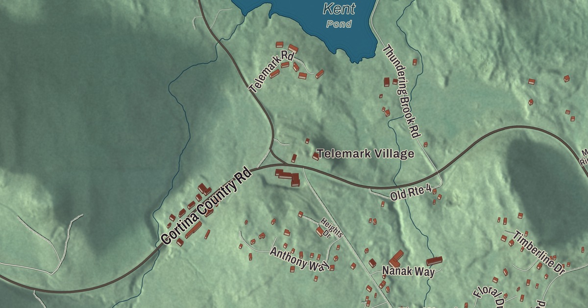
Killington Village is the community that grew up around the ski resort, along both sides of Killington Road, which runs 4 miles south from Route 4 to the ski area. This map prints Killington Road with East Mountain Road, River Road, Old Mill Road, Woods Lane and Cortina Country Road, and places such as Telemark Village, The Woods, Sherburne Center and Killington.
Killington Village is a community in Rutland County, Vermont.
KNOWOL made this map in 2026 from public survey data and gave it the look of an old county atlas, shading the hills from United States Geological Survey elevation data and drawing the roads and boundary line from the Census Bureau. Killington Village is a census-designated place within Killington, made up of the homes and other development tied to Killington Ski Resort, and the community has its own statistical boundary. In 2020, Killington Village had 861 residents, out of 1,407 in the whole town. Click here to purchase a print of this map for your wall.
The ski area
In 1954 Perry H. Merrill, who looked after Vermont’s state land leases and is remembered as the father of its state parks and ski areas, wanted a ski resort built on Killington Peak. Preston Leete Smith agreed to take it on, and Killington opened on December 13, 1958. It grew quickly through the 1960s, putting in snowmaking when many still thought of it as a luxury and adding beginner trails reachable from every lift. In 1963 the resort introduced the ticket wicket, a way to keep skiers from sharing lift tickets without damaging their clothes. Killington Peak, at 4,229 feet, has the second highest summit in Vermont, and the resort’s page calls it the largest ski area in the eastern U.S., with the largest vertical drop in New England, 3,050 feet. It’s nicknamed the “Beast of the East.”
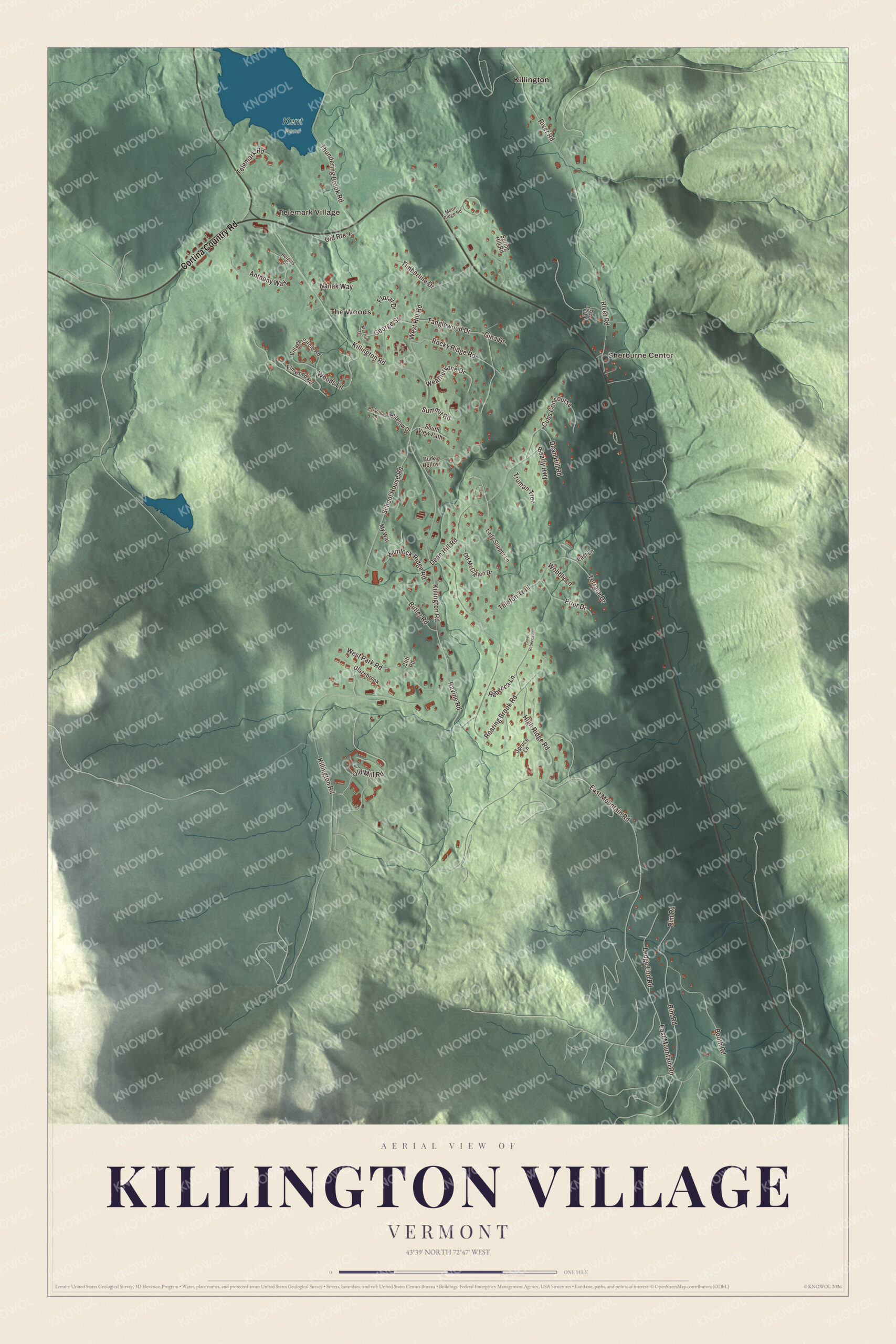
Click to explore a larger preview. The digital watermark does not appear on printed maps.
Names on this map
These names are printed on this map.
Places: Telemark Village, The Woods, Sherburne Center, Kent Pond, Killington and Valley Park.
Streets and roads: Cortina Country Road, Woods Lane, Old Mill Road, Killington Road, East Mountain Road, River Road, Roaring Brook Road, Dean Hill Road, Thundering Brook Road, Rim Road, West Hill Road, Tanglewood Drive.
More street names, A to Z
Anthony Way, Bearly Highway, Bigelow Drive, Booth Road, Burke Hollow, Butler Road, Cliff Road, Cubs Concourse, East Lane, Elmwood Road, Floral Drive, George Street, Gina Drive, Glazebrook, Heights Drive, Hemlock Ridge Road, High Ridge Road, Lady Slipper Lane, Ledge End Road, Lower Rebecca Lane, Merrill Drive, Moon Ridge Road, My Way, Nanak Way, Off McClallen Drive, Old Route 4, Prior Drive, Priscilla Lane, Ravine Road, Rebecca Lane, Rocky Ridge Road, School House Road, South View Path, Spring Hill Road, Spruce Lane, Summit Road, Telefon Trail, Telemark Road, Terrace Drive, Timberline Drive, Truman Trec, Village Circle Road, Weathervane Drive, West Park Road, Wobbly Lane.
See it on a wall
The Killington Village map as a framed print. Swipe for more.


Two of the resort’s base areas are Snowshed, set aside for beginners, and Ramshead, home of the youth ski school, and the Killington Grand Hotel stands near the bottom of Snowshed across a pond. The resort’s page says the eastern ski season traditionally begins on the North Ridge of Killington Peak, on the trail called Rime and Reason.
Around the community
Route 4 crosses the northern part of Killington Village, from Sherburne Pass in the west down into the Ottauquechee valley in the east. At Sherburne Center it turns south and forms the community’s eastern edge. North of Route 4 the boundary reaches Kent Pond and takes in part of Gifford Woods State Park, and the Appalachian Trail crosses that northern end.
On the map, follow Killington Road up toward the mountain, then take East Mountain Road, River Road, Old Mill Road, Woods Lane and Cortina Country Road. Telemark Village and The Woods are printed, and so are Sherburne Center and Killington.
This map of Killington Village is made for everyone who calls Killington Village home, and it shows the community as it looks today, from Sherburne Center to the ski area. Hang it in an office, library or den, or use it to teach children the geography and history of their community. It’s printed on museum quality archival paper. Zoom in on the preview above to explore the details, then click here to get your copy of the Killington Village, Vermont map.

Sources