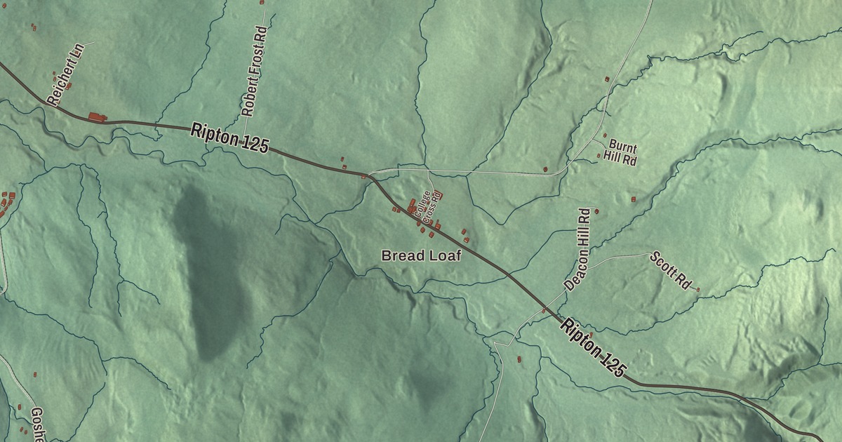
Ripton is a mountain town of northern hardwood forest east of Middlebury, where Route 125 climbs toward Middlebury Gap past the hamlet of Bread Loaf. This map prints Bread Loaf, Lincoln Road, Steam Mill Road, Chandler Hill Road and North Branch Road, with Abbey Pond and Skylight Pond up in the hills.
Ripton is a town in Addison County, Vermont.
KNOWOL made this map in 2026 from public survey data and gave it the look of an old county atlas, shading the hills from United States Geological Survey elevation data and drawing the roads and town line from the Census Bureau. The town covers 49.8 square miles, and 739 people lived here at the 2020 census. Click here to purchase a print of this map for your wall.
Bread Loaf
The Vermont legislature granted Ripton on April 13, 1781, though the town didn’t organize until March 3, 1828. The highest point in town is the 3,835-foot summit of Bread Loaf Mountain, which gave its name to the hamlet of Bread Loaf. Ill health ended Joseph Battell’s studies at Middlebury College in the early 1860s, and on his doctor’s advice he spent a weekend at a Ripton farmhouse, where the mountain air was meant to help his lungs. He loved the hills so much that he bought the farmhouse, which became known as the Bread Loaf Inn after the mountain. Battell owned and edited the Middlebury Register newspaper, and over the years he bought more than 30,000 acres of forest around it. At his death in 1915 he was the state’s largest individual landowner, and he left more than 25,000 acres around the inn, the inn included, to Middlebury College.
Middlebury College opened the Bread Loaf School of English at its mountain campus in 1920, and every summer since, it has offered intensive courses in literature, creative writing, the teaching of writing and theater. The Bread Loaf Writers’ Conference followed in 1926. It meets each summer at the Bread Loaf Inn, and The New Yorker has called it “the oldest and most prestigious writers’ conference in the country.” Richard Wright, Carson McCullers, Eudora Welty, Shirley Jackson, Toni Morrison, John Irving and George R. R. Martin are among the writers who have been part of it.
Robert Frost in Ripton
From 1921 to 1962, Robert Frost spent almost every summer and fall teaching at the Bread Loaf School of English, and he attended 29 sessions of the writers’ conference. He bought the Homer Noble Farm, about 3 miles east of Ripton’s center off Route 125, in 1940, and he lived and wrote there each summer and fall until his death in 1963. The 150-acre farm, ringed on three sides by the Green Mountain National Forest, has a 19th-century farmhouse and a log writing cabin where Frost did most of his work; between them is a small apple orchard he planted and tended. Five of his books were written here, among them A Witness Tree, which won the Pulitzer Prize in 1943. Middlebury College bought the farm in 1966, it’s a National Historic Landmark, and the grounds are open to the public during daylight hours.
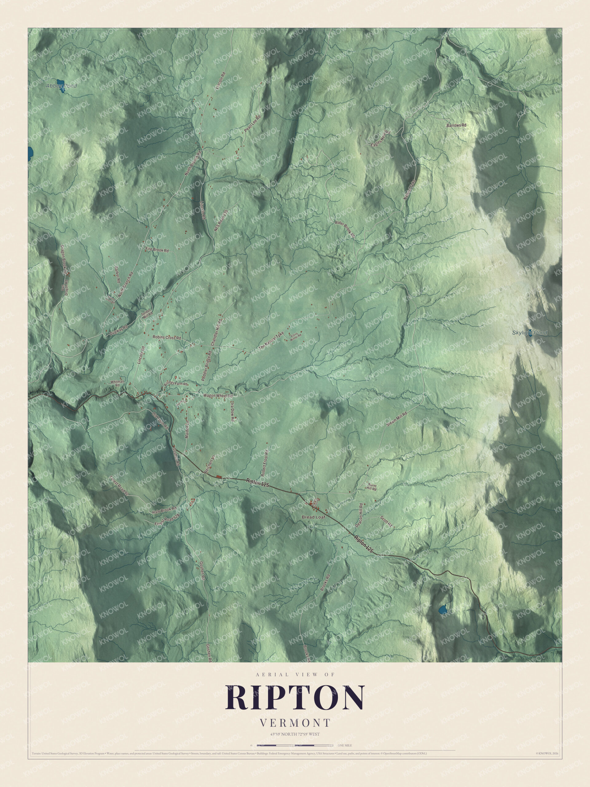
Click to explore a larger preview. The digital watermark does not appear on printed maps.
Names on this map
These names are printed on this map.
Places: Bread Loaf, Abbey Pond and Skylight Pond.
Streets and roads: Ripton 125, Natural Turnpike, Chandler Hill Road, Lincoln Road, Steam Mill Road, The Natural Turnpike, North Branch Road, Goshen Road, Brooks Road, Alder Brook Road, Wagon Wheel Road, Pearl Lee Road.
More street names, A to Z
Barker Road, Barrows Road, Billings Farm Road, Burnt Hill Road, College Cross Road, County Cross Road, Dan Dragon Road, Deacon Hill Road, Dragon Brook Road, Dugway Road, Eagles Nest Road, Elzira Winter Road, Fire Brook Road, Forest Road 92, Hale Brook Road, Ira Dow Road, Maiden Lane, NFS Road 235, Old Town Road, Peddler Bridge Road, Reichert Lane, Robert Frost Road, Robins Cross Road, Scott Road, Selden Mill Road, Whitman Road, Wimett Lane.
See it on a wall
The Ripton map as a framed print. Swipe for more.


The village and the mountains
Coming up from Middlebury, Route 125 passes Lincoln Road and then a small cluster of homes and businesses in Ripton village, crossing the Middle Branch of the Middlebury River. The Ripton Community House stands on the north side of the road among the village’s civic buildings. It was built in 1864 as the Congregational church on land given by Silvester Fisher, sold to a Methodist group in 1920, and deeded in 1928 to the Ripton Community Club, which made it a hall for dances and social events; when the club folded in 1968 the town took it over, and town meetings are held there too. Farther east the highway reaches Bread Loaf and crosses Steam Mill Road, one of the ways hikers reach the Long Trail on the flank of Bread Loaf Mountain.
Bread Loaf Mountain is the highest of at least ten peaks above 3,000 feet along the 17.3 miles of the Long Trail in the Breadloaf Wilderness, which runs from Middlebury Gap north to Lincoln Gap. At 24,986 acres, it’s the largest wilderness area in Vermont, and roughly half of it was land Battell left to Middlebury College. The Skylight Pond Trail is one of the side trails into it. The climb toward Middlebury Gap begins in Ripton, though the height of land is in Hancock.
The environmental writer Bill McKibben lives in Ripton with his wife, the writer Sue Halpern. A CNN writer once described Ripton as “the kind of place where cell service fails more often than it works and the country store is really just that.”
On the map, start with Bread Loaf, then follow the Natural Turnpike, Chandler Hill Road, Lincoln Road, Steam Mill Road and North Branch Road across town. Abbey Pond and Skylight Pond are printed too. Ripton dates to 1781.
This map of Ripton is made for everyone who calls Ripton home, and it shows the town as it looks today, from Bread Loaf and Steam Mill Road to Lincoln Road and Abbey Pond. Hang it in an office, library or den, or use it to teach children the geography and history of their town. It’s printed on museum quality archival paper. Zoom in on the preview above to explore the details, then click here to get your copy of the Ripton, Vermont map.

Sources
- Ripton, Vermont, Wikipedia
- Town histories and representatives, R towns, Vermont Legislature
- Bread Loaf Mountain, Wikipedia
- Joseph Battell, Wikipedia
- Middlebury College (Bread Loaf School of English), Wikipedia
- Bread Loaf Writers’ Conference, Wikipedia
- Robert Frost, Wikipedia
- Robert Frost Farm (Ripton, Vermont), Wikipedia
- Vermont Route 125, Wikipedia
- Ripton Community House, Wikipedia
- Breadloaf Wilderness, Wikipedia
- Bill McKibben, Wikipedia