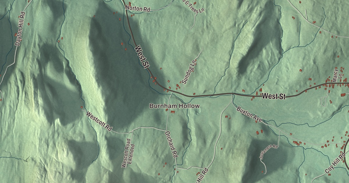
Middletown Springs grew up where four streets meet at a village common, and this map prints all four of them, North Street, South Street, East Street and West Street, along with Coy Hill Road, Mountain Road and Burnham Hollow. The village sits at the center of the town, in a valley ringed by mountains.
Middletown Springs is a town in Rutland County, Vermont.
KNOWOL made this map in 2026 from public survey data and gave it the look of an old county atlas, shading the hills from United States Geological Survey elevation data and drawing the roads and town line from the Census Bureau. The town covers 22.9 square miles, and 794 people lived here at the 2020 census. Click here to purchase a print of this map for your wall.
A town made from four
Settlers came into this valley shortly before the Revolutionary War. It was fertile ground, ringed by mountains, where the corners of four towns, Ira, Poultney, Wells and Tinmouth, came together. The people living here had a hard time getting over the mountains to church and to town business in their own towns, and in 1784 they resolved to ask the legislature for a new town. Vermont incorporated Middletown on October 28, 1784, out of parts of those four towns, and it organized on November 17. The settler Joseph Spaulding was given the honor of naming it for his work surveying its borders. He chose Middletown for its place in the middle of the four towns and for his hometown of Middletown, Connecticut, and he became its first representative in the legislature, in 1785.
By 1810 the population had reached 1,207, the most the town has ever counted. Middletown had become “a central place” in Rutland County, and people from nearby towns came to do business at its grist and saw mills, forges, distilleries, tanneries and clothiers’ works, its mechanics’ shops, taverns and general stores. A severe flood in the summer of 1811 damaged or swept away nearly all of those mills and shops, and the town never truly recovered from it.
Horse engines and mineral springs
The village center stands at the supposed site of the first house, a log building put up by Luther Fillmore, and the roads were laid out along the points of the compass not long after the town organized. Mills on the Poultney River came first. In the 1850s a local millwright, A. W. Gray, developed a new type of horse engine, and his factory in an old mill did well enough to set off a building boom that ran from the 1850s into the 1870s. Gray also developed the mineral springs as a resort, and they drew large numbers of visitors in the late 1800s. The town took the name Middletown Springs in the 1880s, a nod to those springs.
The Middletown Springs Historic District, listed on the National Register of Historic Places in 1985, takes in 91 buildings around the junction of North, East, South and West Streets, with the village common at the northeast corner and the cemetery at the southwest. Look for the Greek Revival community church at the north end of the common, a number of high-style Italianate houses from the boom years, and the Colonial Revival schoolhouse southwest of the cemetery, the largest building in the district. The springs themselves belong to the Middletown Springs Historical Society, which keeps them as Mineral Springs Park. Visitors can see the original marble enclosures around the springs and a re-creation of the Victorian spring house, and walk along the Poultney River, which rises in Tinmouth and flows through Middletown Springs and Poultney before it forms the line with New York.
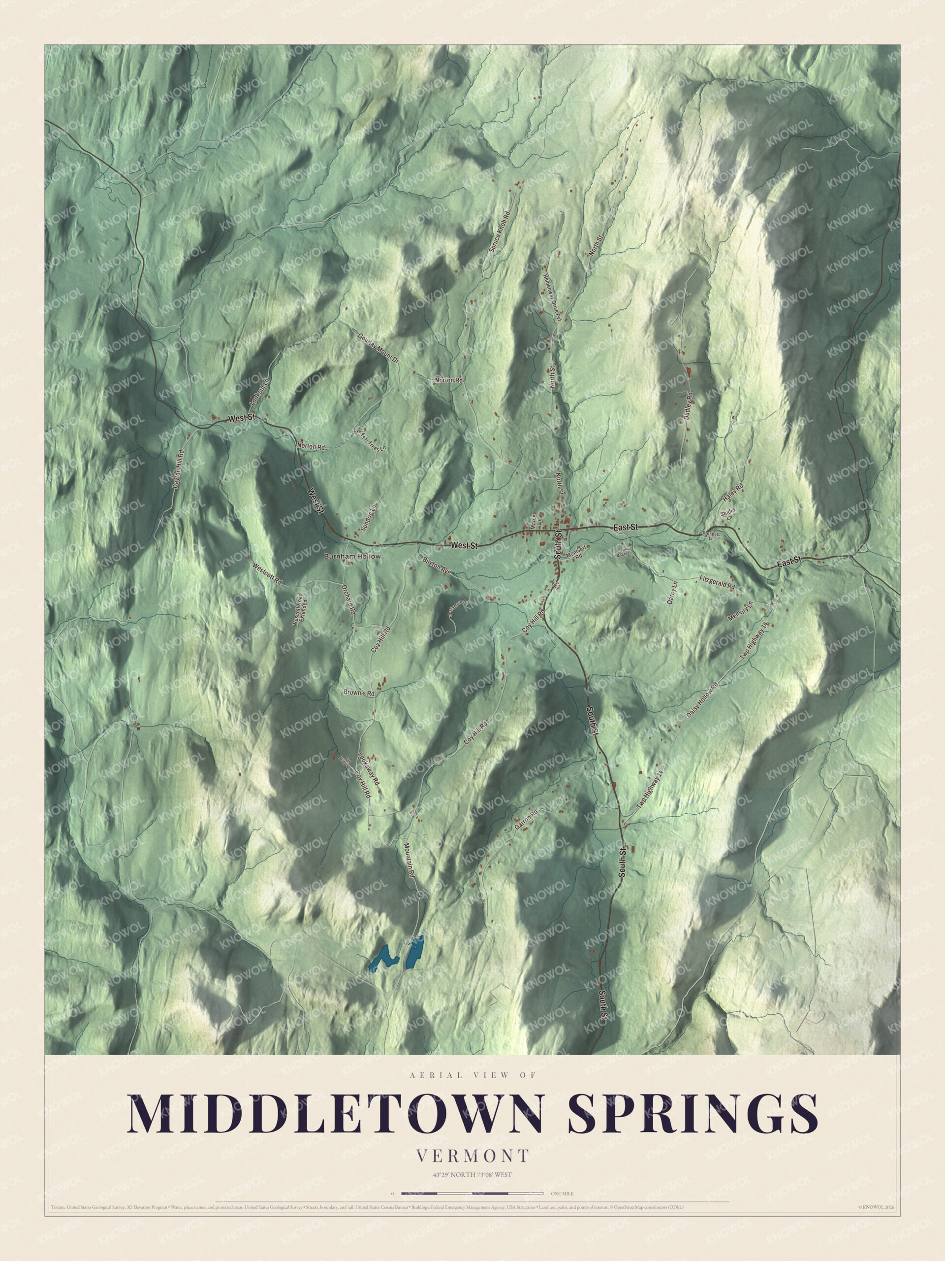
Click to explore a larger preview. The digital watermark does not appear on printed maps.
Names on this map
These names are printed on this map.
Places: Burnham Hollow.
Streets and roads: South Street, East Street, West Street, Coy Hill Road, Mountain Road, North Street, Haley Road, Spruce Knob Road, Daisy Hollow Road, Twp Highway 14, Dudley Road, Garron Road.
More street names, A to Z
Apple Mount Lane, Brown's Road, Buxton Avenue, Darcy Lane, Dayton Hill Road, Fitzgerald Road, Fox Bridge Lane, Gourlay Mount Drive, Hemenway Drive Pvt, Justamere Road, Lookaway Road, Lookout Lane, Marcy Lane, Memory Lane, Montvert Road, Norton Road, Orchard Road, Otis Drive, Prospect Lane, Rocks & Trees Lane, Studio Lane, Sundog Lane, Wescott Road Extended, Westcott Road.
See it on a wall
The Middletown Springs map as a framed print. Swipe for more.


Middletown Springs people
Walter W. Granger was born here in 1872. At 17 he went to New York to work as a taxidermist at the American Museum of Natural History, and he stayed on to become one of the foremost paleontologists of his time. He found Bone Cabin Quarry in Wyoming in 1897, helped open the site in China that yielded Peking Man, and on the museum’s Gobi Desert expeditions of the 1920s took part in finds that included Velociraptor, Oviraptor and Protoceratops. He served as president of the Explorers Club, and his ashes were scattered on his mother’s grave in Pleasant View Cemetery in his hometown. The children’s author Frank Asch, who wrote more than 60 books, among them the Moonbear picture books, also lived in Middletown Springs.
On the map, start at Burnham Hollow, then follow South Street, East Street, West Street, Coy Hill Road, Mountain Road and North Street. West Street brings Route 140 in from Poultney, South Street carries Route 133 into the village center, and the two highways share East Street as they leave for Tinmouth. Middletown Springs dates to 1784.
This map of Middletown Springs is made for everyone who calls Middletown Springs home, and it shows the town as it looks today, from the village crossroads out to Burnham Hollow. Hang it in an office, library or den, or use it to teach children the geography and history of their town. It’s printed on museum quality archival paper. Zoom in on the preview above to explore the details, then click here to get your copy of the Middletown Springs, Vermont map.

Sources