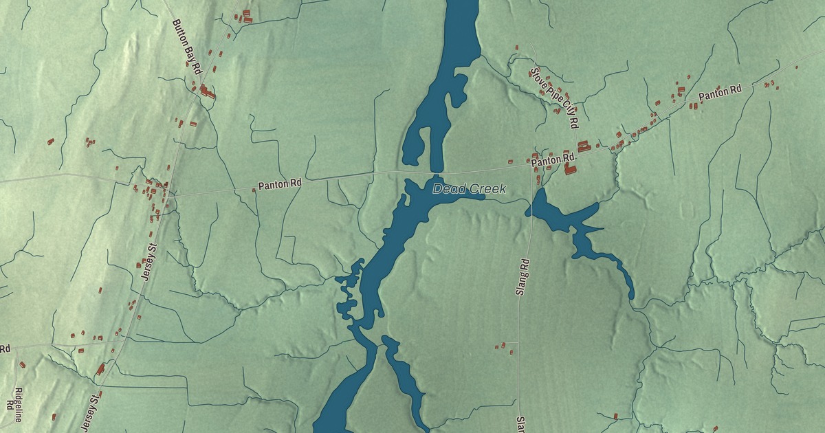
Panton lies on the New York line in northwestern Addison County, where the town runs out into Lake Champlain, Otter Creek forms much of its eastern border, and Dead Creek crosses the whole town from south to north near its center. This map prints Allen Road, Jackson Road, Arnold Bay Road, Lake Road, Panton Road and Jersey Street.
Panton is a town in Addison County, Vermont.
KNOWOL made this map in 2026 from public survey data and gave it the look of an old county atlas, shading the hills from United States Geological Survey elevation data and drawing the roads and town line from the Census Bureau. The town covers 22.0 square miles, 6.6 of them water, and 646 people lived here at the 2020 census. Click here to purchase a print of this map for your wall.
Arnold’s Bay
New Hampshire granted Panton on November 3, 1761, and the town organized on March 30, 1784; Zadock Everest first represented it in the legislature in 1785, and Peter Ferris held the seat several times after him. In October 1776, retreating from the Battle of Valcour Island, one of the first naval battles of the Revolutionary War, General Benedict Arnold ran his five vessels aground in Ferris Bay in Panton, where the water was too shallow for the larger British ships to follow. His men stripped the boats and set them on fire with their flags still flying, and Arnold, the last to come ashore, set fire to his flagship, the row galley Congress, himself. Ferris Bay is now called Arnold’s Bay.
Panton Stone
Ferrisburgh lies to the north, the city of Vergennes to the northeast, Waltham to the east and Addison to the south, and across Lake Champlain, about 2 miles wide here, is Westport, New York. As is common in the Champlain Valley, much of Panton’s land is flat and good for farming. For centuries people here have quarried a native stone known as Panton Stone for foundations and walls. It comes from the Ordovician Crown Point Formation, so objects made of it often carry fossils of invertebrates, and quarries in Panton are among the formation’s noted fossil sites. The District School No. 1 on Lake Road, at Spaulding Road, was built about 1818, the year the town divided itself into four school districts, of limestone quarried from outcrops on the west side of Dead Creek, with white marble sills and lintels against its rough gray walls. Its page counts it among Vermont’s oldest district schoolhouses. It was used as a school into the first quarter of the 1900s, was sold to a farmer in 1932 who used it as a chicken coop, and was listed on the National Register of Historic Places in 1980.
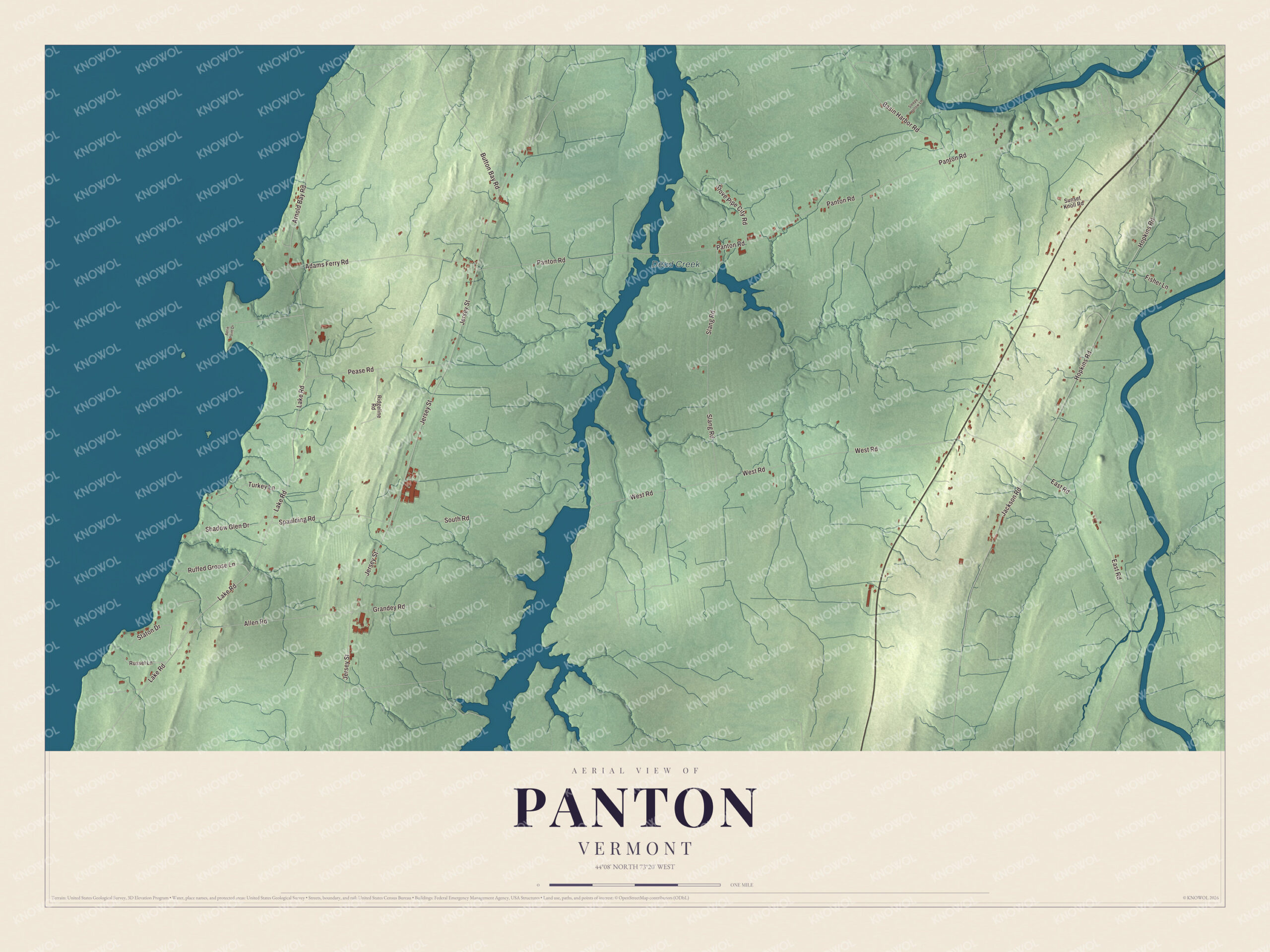
Click to explore a larger preview. The digital watermark does not appear on printed maps.
Names on this map
These names are printed on this map.
Places: Dead Creek.
Streets and roads: Allen Road, Jackson Road, Arnold Bay Road, Lake Road, Panton Road, Jersey Street, West Road, Hopkins Road, Slang Road, Adams Ferry Road, East Road, Pease Road.
More street names, A to Z
Aerie Point Drive, Basin Harbor Road, Button Bay Road, Fisher Lane, Grandey Road, Ridgeline Road, Ruffed Grouse Lane, Russel Lane, Shadow Glen Drive, Sleepy Hollow Lane, South Road, Spaulding Road, Staton Drive, Stove Pipe City Road, Sunset Knoll Road, Turkey Lane.
See it on a wall
The Panton map as a framed print. Swipe for more.


Panton people
Harriet Bishop, born in Panton in 1817, moved to Saint Paul in 1847 and started the first public school and the first Sunday school in Minnesota Territory, opening the school in an old blacksmith shop. She helped found the Minnesota Woman Suffrage Association and was the first organizer of the Minnesota Women’s Christian Temperance Union, and Harriet Island on the Mississippi at Saint Paul is named for her. George W. Grandey, born in Panton in 1813, practiced law in Vergennes, served as its mayor, and was twice Speaker of the Vermont House. The videomaker Peter Santenello was raised in Panton.
On the map, start on Allen Road, then follow Jackson Road, Arnold Bay Road, Lake Road, Panton Road and Jersey Street across town. Dead Creek is printed. Panton dates to 1761.
This map of Panton is made for everyone who calls Panton home, and it shows the town as it looks today, from Arnold Bay Road to Dead Creek. Hang it in an office, library or den, or use it to teach children the geography and history of their town. It’s printed on museum quality archival paper. Zoom in on the preview above to explore the details, then click here to get your copy of the Panton, Vermont map.

Sources