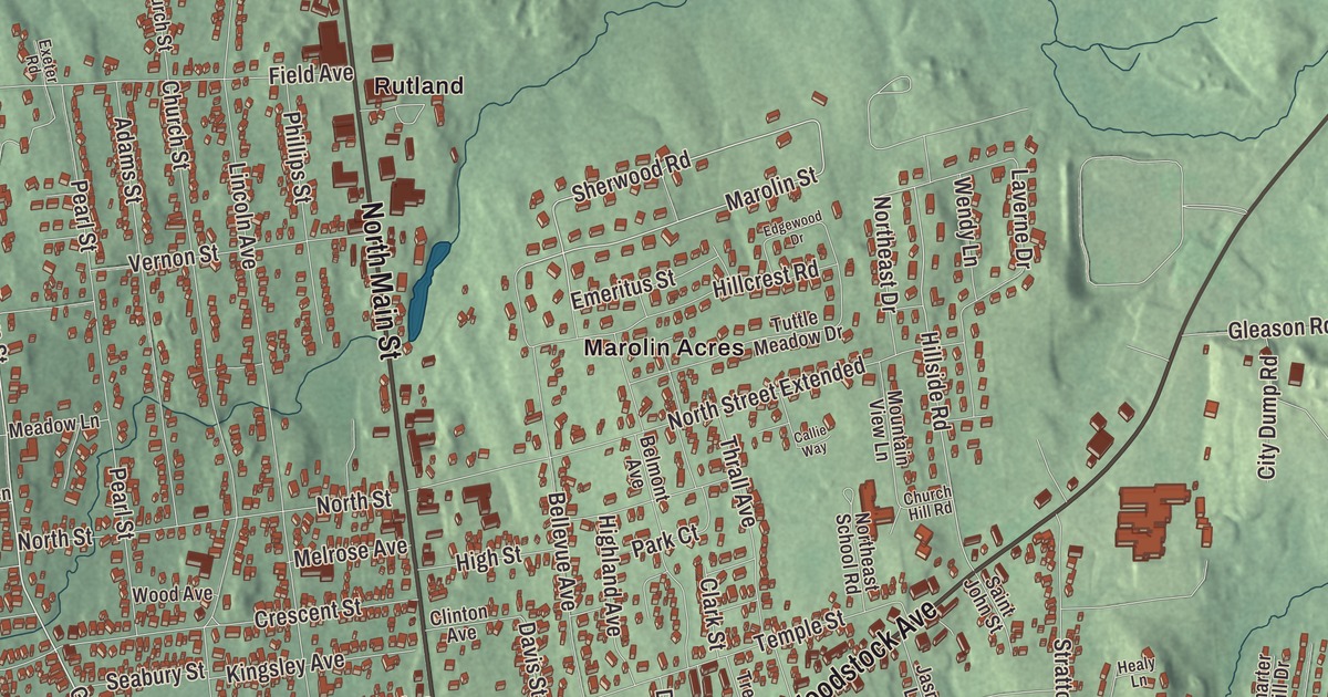
Rutland City is the seat of Rutland County and the only city in it, where Routes 4 and 7 meet and run together along Main Street. This map prints North Main Street, South Main Street, West Street, Woodstock Avenue, Grove Street and Dorr Drive, with Marolin Acres, Rocky Pond and Combination Pond.
Rutland City is a city in Rutland County, Vermont.
KNOWOL made this map in 2026 from public survey data and gave it the look of an old county atlas, shading the hills from United States Geological Survey elevation data and drawing the streets and city line from the Census Bureau. The city covers 7.67 square miles and is completely surrounded by Rutland Town, a separate municipality, and 15,807 people lived here at the 2020 census. Click here to purchase a print of this map for your wall.
Vermont’s third city
Rutland’s downtown grew fastest after 1850, once the marble business took off; the city’s population tripled between 1850 and 1880, and many of the buildings from those years were built of marble or trimmed with it. Italians with experience in the stone trade came with their families, and from 1869 to 1873 Italian American stoneworkers did much of the work on St. Peter’s Church, using stone quarried on the site. In 1886 the center of the old town incorporated as the village of Rutland, and on November 18, 1892, it became Vermont’s third city. Thomas W. Moloney, an Irish American lawyer, played a major role in winning its charter. The first mayor was John A. Mead, a Civil War veteran and doctor who practiced in Rutland, held the office from 1893 to 1894, and later served as governor of Vermont from 1910 to 1912. Today Rutland is the third largest city in the state, after Burlington and South Burlington.
Downtown
The Rutland Downtown Historic District, with 90 contributing buildings, is the city’s center of government and business, and 108 buildings downtown are on the National Register. The arts flourished here in the 1890s, with the writer Julia Caroline Dorr spurring much of it; her father had built the first Rutland Opera House, and in 1884 she led the group of women who founded the Rutland Free Library. In 1913 George Chaffee built the Playhouse, classical outside and lavish inside. It was renamed the Paramount in 1931 and turned to movies, closed in 1975, and reopened in March 2000 after a local group restored it. The Rutland Free Library itself is in the old federal building and post office, begun in 1856, credited to the architect Ammi B. Young, across Court Street from the Rutland County Courthouse of 1869. They anchor the Rutland Courthouse Historic District, bounded by South Main Street, West Street, Court Street and Washington Street, where Italianate houses went up between 1850 and 1875.
The Rutland Herald began as a weekly on December 8, 1794, and in 2001 it won a Pulitzer Prize for David Moats’s editorials, the first Pulitzer for journalism given in Vermont. Since 1960 the city has held a Halloween parade with a strong superhero theme. Tom Fagan, a local writer and comic book fan, helped shape it and brought comic book writers and artists to march in costume, and the parade became the setting for stories in Batman, Justice League of America, The Avengers and The Mighty Thor.
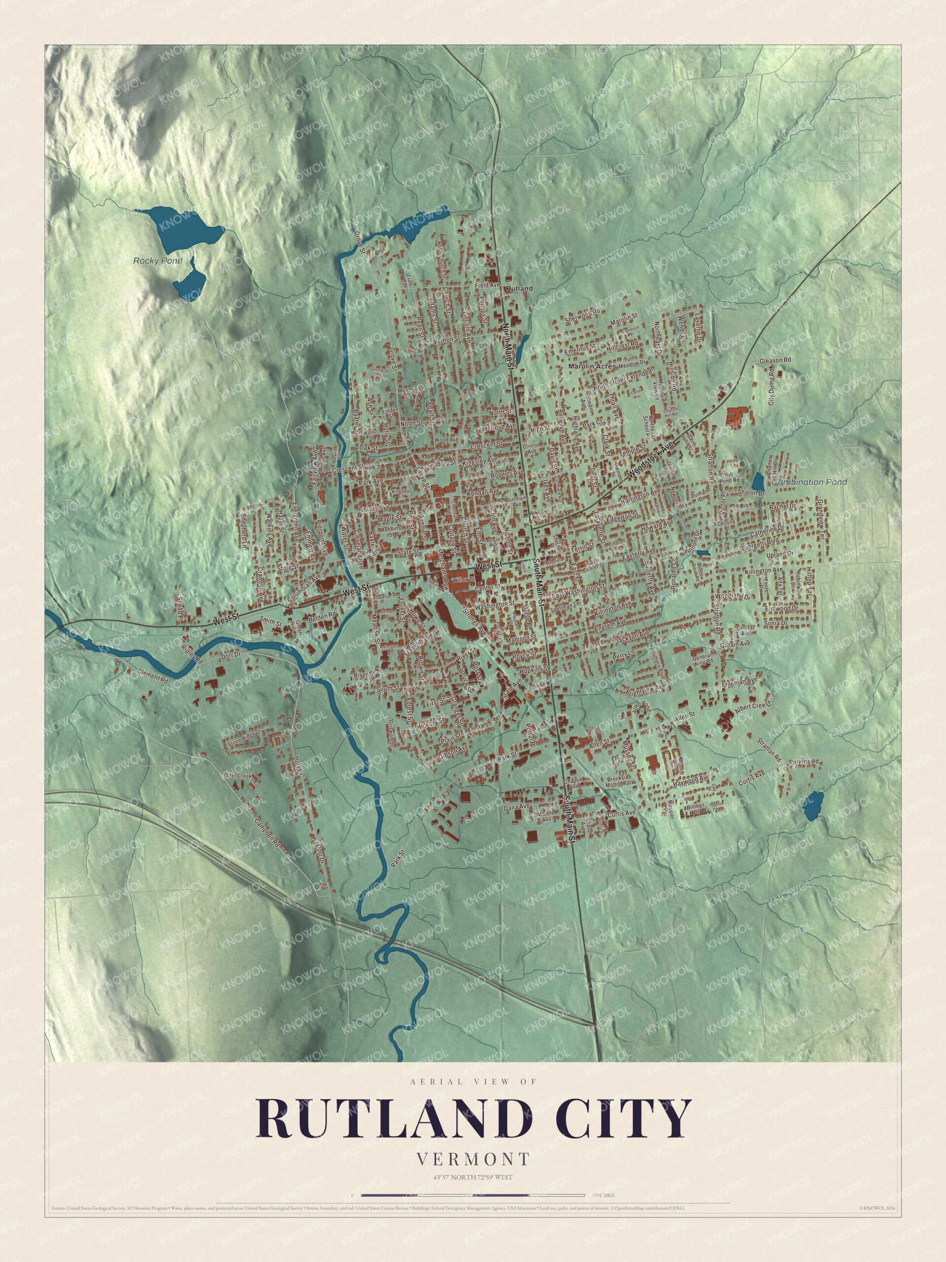
Click to explore a larger preview. The digital watermark does not appear on printed maps.
Names on this map
These names are printed on this map.
Places: Rocky Pond, Combination Pond, Marolin Acres, Rutland, Brookside Mobile Park and Preston Park.
Streets and roads: West Street, South Main Street, North Main Street, Woodstock Avenue, Dorr Drive, Grove Street, Washington Street, Merchants Row, Sherwood Road, Marolin Street, Sonia Drive, Campbell Road.
More street names, A to Z
Adams Street, Aiken Place, Albert Cree Drive, Allen Pond, Allen Street, Alta Terrace, Ash Street, Baxter Street, Belden Road, Bellevue Avenue, Belmont Avenue, Billings Drive, Brightview Avenue, Brown Street, Burnham Avenue, Butterfly Avenue, Callie Way, Catherine Drive, Center Street, Central Avenue, Cessna Place, Chaplin Avenue, Charles Street, Charter Hill Drive, Chase Avenue, Chestnut Avenue, Church Hill Road, Church Street, City Dump Road, Clark Street, Clement Road, Cleveland Avenue, Clinton Avenue, Clover Street, Columbian Avenue, Convent Avenue, Cottage Street, Court Square, Cramton Avenue, Crescent Street, Curtis Avenue, Dana Avenue, Davis Street, Deer Street, Durham Drive, East Center Street, Easterly Avenue, East Street, East Washington Street, Edgerton Street, Edgewood Drive, Elm Street, Elmwood Drive, Emeritus Street, Emmett Avenue, Engrem Avenue, Evelyn Street, Evergreen Avenue, Exeter Road, Fairview Avenue, Field Avenue, First Street, Forest Street, Foster Place, Franklin Street, Freeman Avenue, Gay Street, General Wing Road, Geno Avenue, Gibson Avenue, Gilrain Avenue, Giorgetti Boulevard, Gleason Road, Grandview Terrace, Granger Street, Grant Avenue, Green Hill Lane, Griswold Drive, Harrington Avenue, Harvard Street, Haywood Avenue, Hazel Street, Healy Lane, Hickory Street, Highland Avenue, High Street, Hillcrest Road, Hill Pond Road, Hillside Road, Hilltop Terrace, Holly Street, Hopkins Street, Horton Street, Howard Avenue, Howe Street, Ives Avenue, Jackson Avenue, Jasmin Lane, Kendall Avenue, Killington Avenue, Kingsley Avenue, Kingsley Court, Lafayette Street, Laverne Drive, Library Avenue, Lincoln Avenue, Linden Street, Litchfield Avenue, Madison Street, Mahoney Avenue, Mansfield Place, Maple Street, Marble Avenue, Meadow Brook Road, Meadow Lane, Meadow Street, Melrose Avenue, Messier Place, Morse Place, Mountain View Lane, Mussey Street, Newport Drive, Nichols Street, Nicole Place, North Church Street, Northeast Drive, Northeast School Road, North Street, North Street Extended, Norton Place, Oak Street, Orchard Drive, Otter Creek, Park Avenue, Park Court, Park Street, Pearl Street, Perkins Road, Perry Lane, Phillips Street, Piedmont Drive, Pierpoint Avenue, Pine Street, Plain Street, Pleasant Street, Porter Place, Post Street, Preville Avenue, Prospect Street, Rachel Drive, Regency Manor, Ripley Road, River Street, Robbins Street, Roberts Avenue, Robinwood Lane, Ronaldo Court, Royce Street, Saint John Street, Scale Avenue, School Street, Seabury Street, Sharon Drive, Shedd Place, Sheldon Place, Shepherd Lane, Smith Street, Southern Boulevard, South Street, Spellman Terrace, Spruce Street, State Street, Stone Ridge Drive, Stratton Road, Strongs Avenue, Summer Street, Taft Avenue, Temple Street, Terrill Street, Thrall Avenue, Traverse Place, Tremont Street, Tuttle Meadow Drive, Upland Drive, Vernon Street, Victor Place, Walnut Street, Water Street, Watkins Avenue, Wendy Lane, Willow Street, Wood Avenue, Woodland Drive.
See it on a wall
The Rutland City map as a framed print. Swipe for more.


Along the streets on the map
At 96 Grove Street stands the gray marble library that Mary E. Roberts Baxter built beginning in 1889 in memory of her husband, Horace Henry Baxter, part owner of the Rutland Marble Company; it opened in 1895, and since 1927 it has been the home of Congregation Adath Israel, now the Rutland Jewish Center. Near the northern city line, at Grove Street and Field Avenue, Redfield Proctor built an Italianate house in 1867 at the corner of Field Avenue, before he moved to Sutherland Falls and the marble business there, and Linden Terrace at 191 Grove Street was built in 1912 as a summer estate. Near the city’s southern line, the brick Arthur Perkins House at 242 South Main Street was built in 1915 and 1916 with concrete porches; Perkins, owner of the Rutland Fire Clay Company, had lost two plants to fire and turned to fire-resistant building, and he served as mayor from 1927 to 1935. The Vermont State Fair, first held in 1846 and one of the oldest state fairs in the country, meets at the Vermont State Fairgrounds in Rutland. West Street is the main road west out of downtown, and the Longfellow School of 1890, near Church and West Streets, was the city’s first school built for graded classes.
Martin Henry Freeman, born in Rutland in 1826, became the first Black president of an American college when Avery College in Pennsylvania named him president in 1856, and he later led Liberia College; a sculpture honoring him was installed downtown in 2020. Amtrak’s Ethan Allen Express stops at the brick station on the western edge of downtown, named for Rutland native Jim Jeffords.
On the map, start with Marolin Acres and Rutland, then follow West Street, South Main Street, North Main Street, Woodstock Avenue, Dorr Drive and Grove Street across the city. Rocky Pond and Combination Pond are printed too. Rutland City dates to 1892.
This map of Rutland City is made for everyone who calls Rutland City home, and it shows the city as it looks today, from Grove Street and West Street to South Main Street and Woodstock Avenue. Hang it in an office, library or den, or use it to teach children the geography and history of their city. It’s printed on museum quality archival paper. Zoom in on the preview above to explore the details, then click here to get your copy of the Rutland City, Vermont map.

Sources
- Rutland (city), Vermont, Wikipedia
- St. Peter’s Church and Mount St. Joseph Convent Complex, Wikipedia
- Chaffee-Moloney Houses, Wikipedia
- John A. Mead, Wikipedia
- Rutland Downtown Historic District, Wikipedia
- Julia C. R. Dorr, Wikipedia
- Rutland Courthouse Historic District, Wikipedia
- Rutland Herald, Wikipedia
- Rutland Halloween Parade, Wikipedia
- Rutland Jewish Center (H. H. Baxter Memorial Library), Wikipedia
- Proctor-Clement House, Wikipedia
- Linden Terrace, Wikipedia
- Arthur Perkins House, Wikipedia
- Vermont State Fair, Wikipedia
- Longfellow School (Rutland, Vermont), Wikipedia
- Martin Henry Freeman, Wikipedia
- Rutland station, Wikipedia