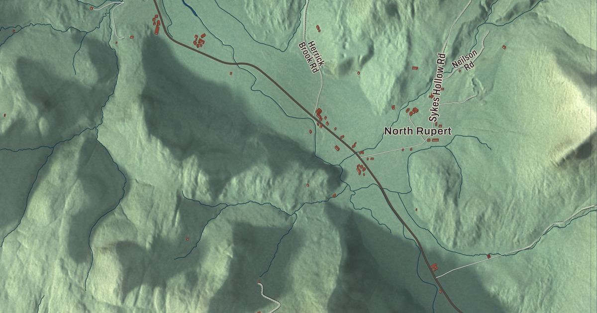
Rupert lies in the Taconic Mountains in the northwest corner of Bennington County, with New York State along its western line and settlements at Rupert village, East Rupert, West Rupert and North Rupert. This map prints North Rupert, East Rupert and West Rupert, with Rupert Mountain Road, West Pawlet Road, Youlin Road and Kent Hollow Road.
Rupert is a town in Bennington County, Vermont.
KNOWOL made this map in 2026 from public survey data and gave it the look of an old county atlas, shading the hills from United States Geological Survey elevation data and drawing the roads and town line from the Census Bureau. The town covers 44.6 square miles, and 698 people lived here at the 2020 census. Click here to purchase a print of this map for your wall.
Prince Rupert’s town
New Hampshire’s governor, Benning Wentworth, granted Rupert on August 20, 1761, and many historians agree that he named it for Prince Rupert of the Rhine, a leading figure in the English Civil War. Settlers came in the 1770s, the town organized about 1778, and farming has shaped it ever since. It grew fast after independence, peaking at 1,600 people in 1820. The village grew up in the southwest part of town, where the Indian River meets Mill Brook. The village’s oldest surviving building, the Congregational church of 1786, was for many years the center of town affairs, and the railroad arrived in 1852. The Rupert Village Historic District runs about half a mile along Route 153, north from the railroad to Youlin Road and Rupert Mountain Road, with 74 historic buildings and the open land around them. Its most elaborate building is the Gothic Methodist church of 1884, paid for by J. H. Guild, the village’s wealthiest resident, who owned a small patent medicine factory.
Vermont’s own coins
Reuben Harmon, a metalsmith among Rupert’s early settlers, asked the Vermont Republic for the right to mint copper coins. On June 15, 1785, a committee of the House recommended that he get the exclusive right to coin copper in the state for two years, and two days later he posted his bond and began setting up a mint beside Hagar’s Brook in East Rupert; it later moved to Southwind Farm in North Rupert. The first Vermont coppers showed the sun rising over the Green Mountains with a plow in front, ringed by the Latin for “the republic of Vermont,” and on the back a star surrounded by thirteen smaller stars with the motto STELLA QUARTA DECIMA, “the 14th star.” Vermont coppers were struck until the state joined the Union in 1791.
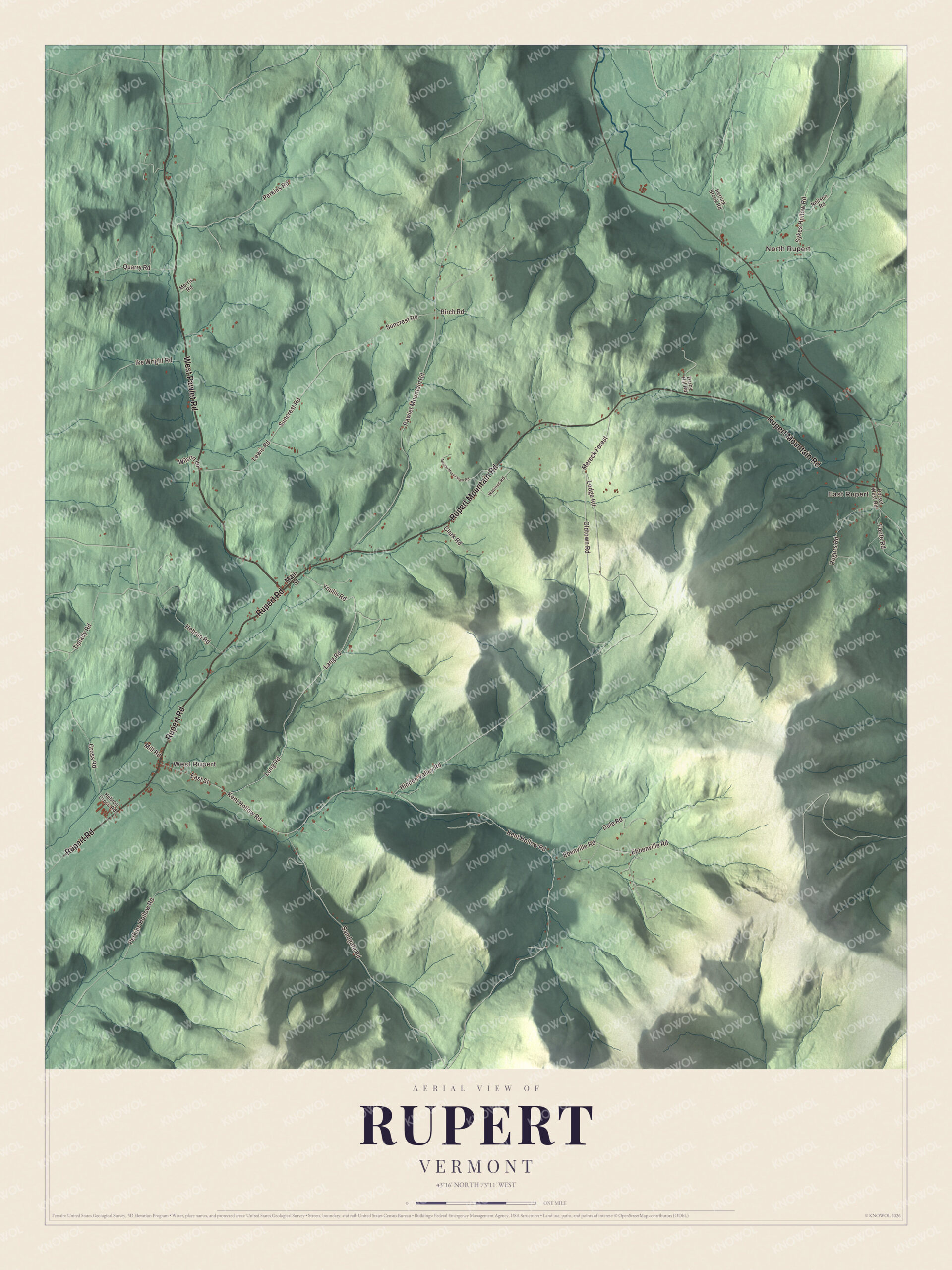
Click to explore a larger preview. The digital watermark does not appear on printed maps.
Names on this map
These names are printed on this map.
Places: North Rupert, East Rupert and West Rupert.
Streets and roads: West Pawlet Road, Rupert Mountain Road, Rupert Road, Lang Road, Youlin Road, Kent Hollow Road, Lodge Road, Pawlet Mountain Road, Suncrest Road, Hebron Road, Sandgate Road, Perkins Road.
More street names, A to Z
Antone Mount View Road, Birch Road, Clark Road, Cross Road, Derby Hill Road, Dole Road, Dorset West Road, East Street, Ebbenville Road, Ebenville Road, Foote Road, Hebron Cross Road, Herrick Brook Road, Hidden Valley Road, Ike Wright Road, Lewis Road, Main Street, Mereck Forest, Mill Road, Morris Road, Neilson Road, Oldtown Road, Perkins Hollow Road, Quarry Road, Rogers Road, Sykes Hollow Road, Tiplady Road, Watrous Road, Wilson Lane.
See it on a wall
The Rupert map as a framed print. Swipe for more.


East Rupert and the turnpike
Rupert Mountain Road, which carries Route 315, crosses the middle of town from Route 153 in the village to Route 30 in East Rupert; it follows roughly the line of the old Rupert Turnpike between Pawlet and Salem, New York. When the turnpike was finished, James Moore Jr. built a tavern about 1807 in East Rupert, overlooking the Mettawee River where Route 30 now meets Route 315. Known later as the East Rupert Hotel and the Hotel G. Jenks, the Jenks Tavern was widely known in the region for the sprung dance floor of its attic ballroom, and it’s one of the few little-altered taverns of its kind left in southwestern Vermont. It has been a private home or empty since the 1930s.
Rupert people
Israel Smith, later governor of Vermont and a United States senator, began his law practice in Rupert. Samuel Gookins, a judge of the Indiana Supreme Court, was born here in 1809, and Moses Sherman, who built streetcar systems in Phoenix and Los Angeles, was born in West Rupert in 1853. The writer and theologian Frederick Buechner had a farm on the eastern slope of Rupert Mountain, where he spent a sabbatical school year starting in 1963 and went back to writing; he died at his home in Rupert in 2022. The public television cooking show Cook’s Country taped its first nine seasons at a farmhouse in Rupert with Christopher Kimball as host, and the town is home to The Maple News, a trade paper for the maple syrup business.
On the map, start with North Rupert, then follow West Pawlet Road, Rupert Mountain Road, Rupert Road, Lang Road, Youlin Road and Kent Hollow Road across town. Then look outward toward East Rupert and West Rupert. All six of those roads are printed on the map. Rupert dates to 1761.
This map of Rupert is made for everyone who calls Rupert home, and it shows the town as it looks today, from Rupert Mountain Road and Youlin Road to East Rupert and West Rupert. Hang it in an office, library or den, or use it to teach children the geography and history of their town. It’s printed on museum quality archival paper. Zoom in on the preview above to explore the details, then click here to get your copy of the Rupert, Vermont map.

Sources
- Rupert, Vermont, Wikipedia
- Town histories and representatives, R towns, Vermont Legislature
- Rupert Village Historic District, Wikipedia
- Vermont copper, Wikipedia
- Vermont Route 315, Wikipedia
- Jenks Tavern, Wikipedia
- Israel Smith, Wikipedia
- Samuel Gookins, Wikipedia
- Moses Sherman, Wikipedia
- Frederick Buechner, Wikipedia
- Cook’s Country, Wikipedia