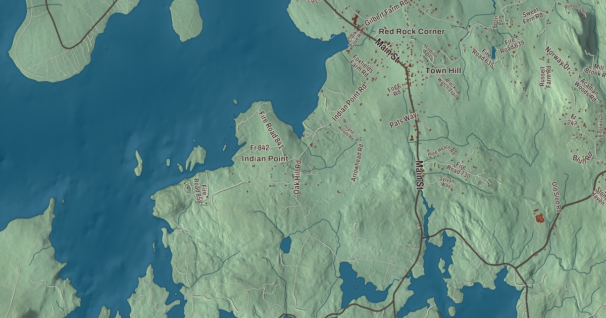
Bar Harbor takes up the northeast shore of Mount Desert Island, and the largest parts of Acadia National Park are within it. This map prints Main Street, Eden Street, Bar Harbor Road, Eagle Lake Road, Otter Creek Road and the Park Loop Road, with Eagle Lake and the Atlantic Ocean, and the villages of Hulls Cove, Salsbury Cove, Town Hill, Red Rock Corner, Indian Point and Eden. Click here to purchase a print of this map for your wall.
Bar Harbor is in Hancock County, and its town page counts 5,089 people at the 2020 census.
KNOWOL made this map in 2026 from public survey data and gave it the look of an old atlas. The shaded terrain comes from United States Geological Survey elevation data, and the roads and the town line come from the Census Bureau, which counts 63.11 square miles here, 42.24 of them land and 20.87 water. The town sits on Frenchman Bay, with small islands just offshore, and State Route 3 brings visitors in from the mainland.
Pemetic, Eden and Bar Harbor
The Wabanaki knew the island as Pemetic, “range of mountains,” and they called this shore by names that mean “clam-gathering place” and “clambake place,” leaving great heaps of shells behind. In September 1604 Samuel de Champlain ran aground on a ledge believed to be Egg Rock, off Otter Cliffs, and while he repaired his boat he met the people living here. He named the island Isles des Monts Deserts, the island of barren mountains. It’s the largest island in Maine.
The town was incorporated as Eden on February 23, 1796. Eden is still printed on the map. Its early people fished, cut timber, built ships and kept dairy farms on the best soil on the island. In the 1840s painters of the Hudson River School, among them Thomas Cole and Frederic Edwin Church, came for the rugged coast, and the “rusticators” followed their paintings here. Tobias Roberts opened the Agamont House, Eden’s first hotel, in 1855, and the first summer estate went up in 1868. By 1880 there were 30 hotels, and the Gilded Age resort would come to rival Newport, Rhode Island. On March 3, 1918, Eden became Bar Harbor, named for the sand bar that comes out of the water at low tide and leads across to Bar Island. Nelson Rockefeller, later vice president, was born here.
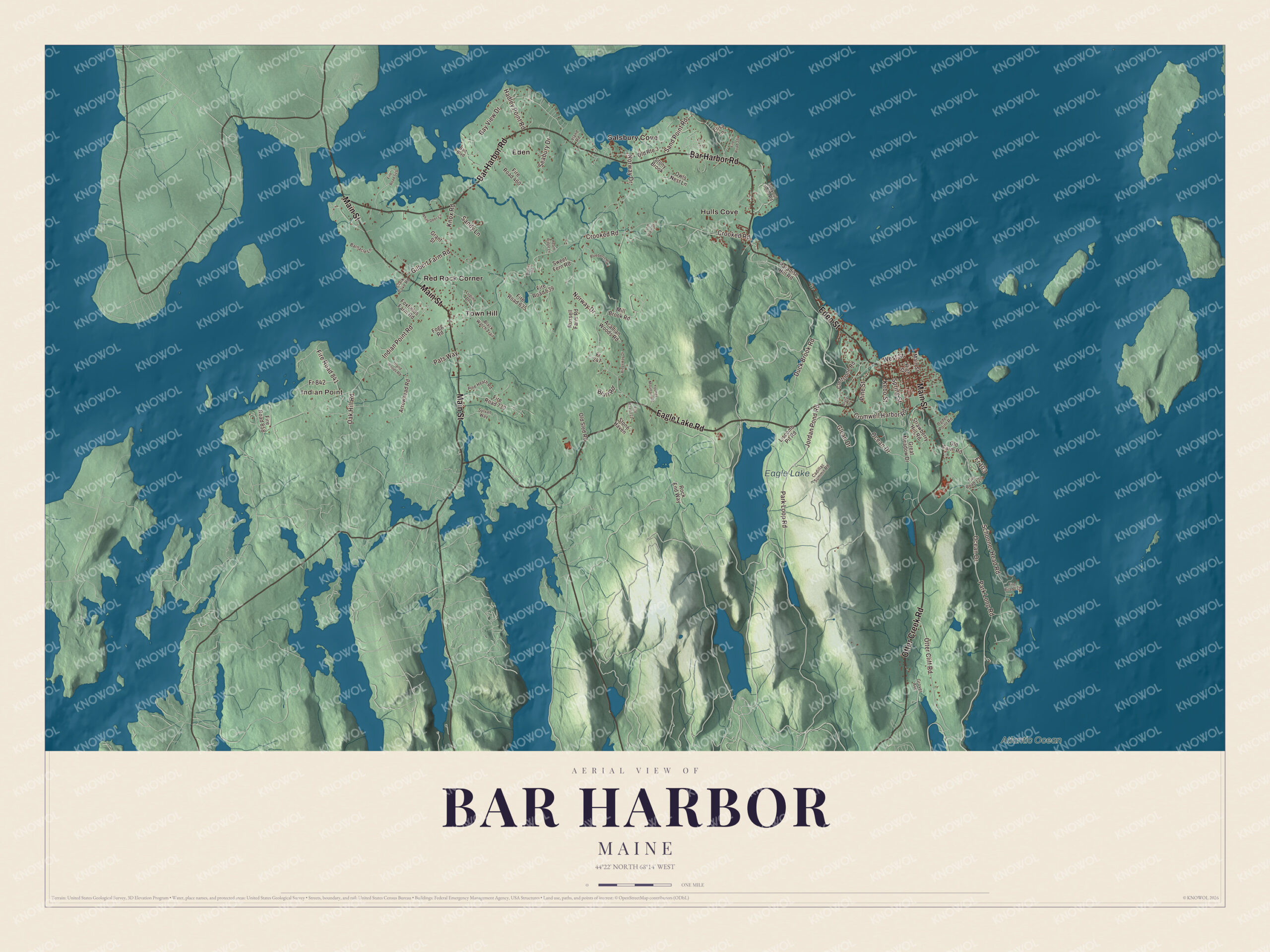
Click to explore a larger preview. The digital watermark does not appear on printed maps.
Names on this map
These names are printed on this map.
Places: Indian Point, Eagle Lake, Atlantic Ocean, Eden, Hulls Cove, Red Rock Corner, Salsbury Cove and Town Hill.
Streets and roads: Main Street, Otter Creek Road, Eden Street, Bar Harbor Road, Eagle Lake Road, Park Loop Road, Schooner Head Road, Ocean Drive, Kebo Street, West Street, Fr 103, Jordan Pond Road.
More street names, A to Z
Acadian Woods Road, Arata Drive, Arrowhead Road, Bait Boulevard, Barnacle Lane, Bay View Drive, Betsys Road, Black Watch Trail, Blueberry Hl, Bluff Road, Cadillac Summit Road, Clark Cove Road, Cleftstone Road, Cromwell Harbor Road, Crooked Road, Duck Brook Road, Elisa Lane, Farm View Drive, Fire Road 120, Fire Road 132, Fire Road 221, Fire Road 314, Fire Road 460, Fire Road 515, Fire Road 635, Fire Road 639, Fire Road 730, Fire Road 841, Fire Road 858, Fogg Road, Foxfields Farm Road, Fr 247, Fr 842, Gilbert Farm Road, Glean Drive, Grant Street, Great Meadow Drive, Grover Avenue, Hadley Point Road, Heath Ridge Lane, High Street, Indian Point Road, Island Woods Road, Knox Road, Leland Road, Liscomb Pit Road, Lookout Point Road, Lupine Drive, Mill Brook Road, Norway Drive, Oak Hill Road, Ogden Point Road, Old Farm Road, Old Route 3, Old Sled Road, Otter Cliff Road, Owls Nest Lane, Paradise Hill Road, Pats Way, Pine Heath Road, Pine Street, Ridgeway Drive, Rock End Way, Russell Farm Road, Sand Point Road, Sandy Lane, Seabury Drive, Spring Street, Stone Haven, Stony Brook, Strawberry Hill Road, Sweet Fern Road, Sylvan Way, White Deer Circle, Youngs Mountain Road.
See it on a wall
The Bar Harbor map as a framed print. Swipe for more.


Into the park
The Park Loop Road is printed on the map. It runs 27 miles around the eastern side of the island, mostly one way and clockwise, from Bar Harbor to Seal Harbor, past Sand Beach, Thunder Hole, Otter Cliff, Jordan Pond and Eagle Lake, with the side road up Cadillac Mountain. It was finished in 1958 under the guidance of John D. Rockefeller Jr., after 37 years of work. Rockefeller also gave about a third of the park’s land and built the carriage roads people still walk and bike. Eagle Lake Road is printed too, leading west from Eden Street into the park, and so is Eagle Lake. Cadillac Mountain, the town page says, is the highest point within 25 miles of the coast anywhere on the East Coast of the United States.
Conservation-minded citizens worked to create the park. The landscape architect Charles Eliot is credited with the idea, and George B. Dorr, called the Father of Acadia National Park, and Eliot’s father, Charles W. Eliot, backed it with gifts of land and with advocacy. In 1916 President Woodrow Wilson made it Sieur de Monts National Monument. In 1919 it became Lafayette National Park, the first national park east of the Mississippi, and in 1929 it took the name Acadia. Hulls Cove is printed on the map, and the park’s main visitor center is there. So are Salsbury Cove, Town Hill, Red Rock Corner and Indian Point, the villages the town page lists along with Bar Harbor itself.
Eden Street and Main Street are printed on the map. Route 3 comes in from the Trenton Bridge as Eden Street along the shore, turns onto Mount Desert Street and then south onto Main Street at the Village Green, which the American Planning Association named one of the ten Great Places in America for public spaces in 2012. The College of the Atlantic is on Route 3, and the Jackson Laboratory, founded by Clarence Cook Little in 1929, does its work on mammalian genetics here.
This Bar Harbor map makes a handsome addition to an office, library or den, and it can teach children the geography and history of the town at the doorstep of Acadia. It’s made for anyone who calls Bar Harbor home, from Hulls Cove to Otter Creek Road, as it looks today. Zoom in on the preview above to explore the details, then click here to get your copy of the Bar Harbor, Maine map.

Sources