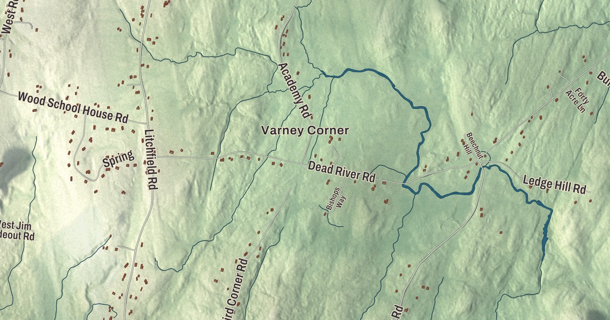
Bowdoin Center, West Bowdoin, Varney Corner and Starbird Corner each have their names on this map of Bowdoin. So do Main Street, Post Road, Augusta Road, Richmond Road, Litchfield Road and John Tarr Road, and two ponds, Caesar Pond and Stoddard Pond. Click here to purchase a print of this map for your wall.
Bowdoin is a town in Sagadahoc County, with 3,136 people at the 2020 census.
KNOWOL made this map in 2026 from public survey data and gave it the look of an old atlas. Its shaded hills come from United States Geological Survey elevation data, and its roads and town line from the Census Bureau, which counts 43.58 square miles in Bowdoin, almost all of it land. The town is 36 miles north-northeast of Portland and 28 miles south-southwest of Augusta, and it’s drained by the Little River, the Dead River and the east and west streams of the Cathance River.
West Bowdoinham Plantation
Bowdoin was part of a tract running from Merrymeeting Bay to the Androscoggin River that the Kennebec Company conveyed in 1752 to William Bowdoin of Boston. People called it West Bowdoinham Plantation, and it was settled some years before the Revolution. William died in 1773, and by 1779 his younger brother James Bowdoin had the legal claim and was granting deeds. About 121 families lived here when the Massachusetts General Court incorporated the town on March 21, 1788, and it was named for the Bowdoin family. James Bowdoin was governor of Massachusetts from 1785 to 1787, worked with Benjamin Franklin on his research into electricity and was the first president of the American Academy of Arts and Sciences, and Bowdoin College was named for him.
The town gave up land twice to its western neighbor: in 1799 to form Thompsonborough, which became Lisbon in 1802, and again to Lisbon in 1834. Bowdoin grew as a farming town, raising sheep and growing apples, wheat, hay and potatoes, with an ice company, a sawmill, a gristmill, a carding mill and a brickyard besides. Since 1993, alpacas have been raised here too. Royce Purinton, born in West Bowdoin in 1877, captained the Bates College football team in 1899 and came back to coach it, leading Bates football and baseball for most of the years from 1902 to 1917.
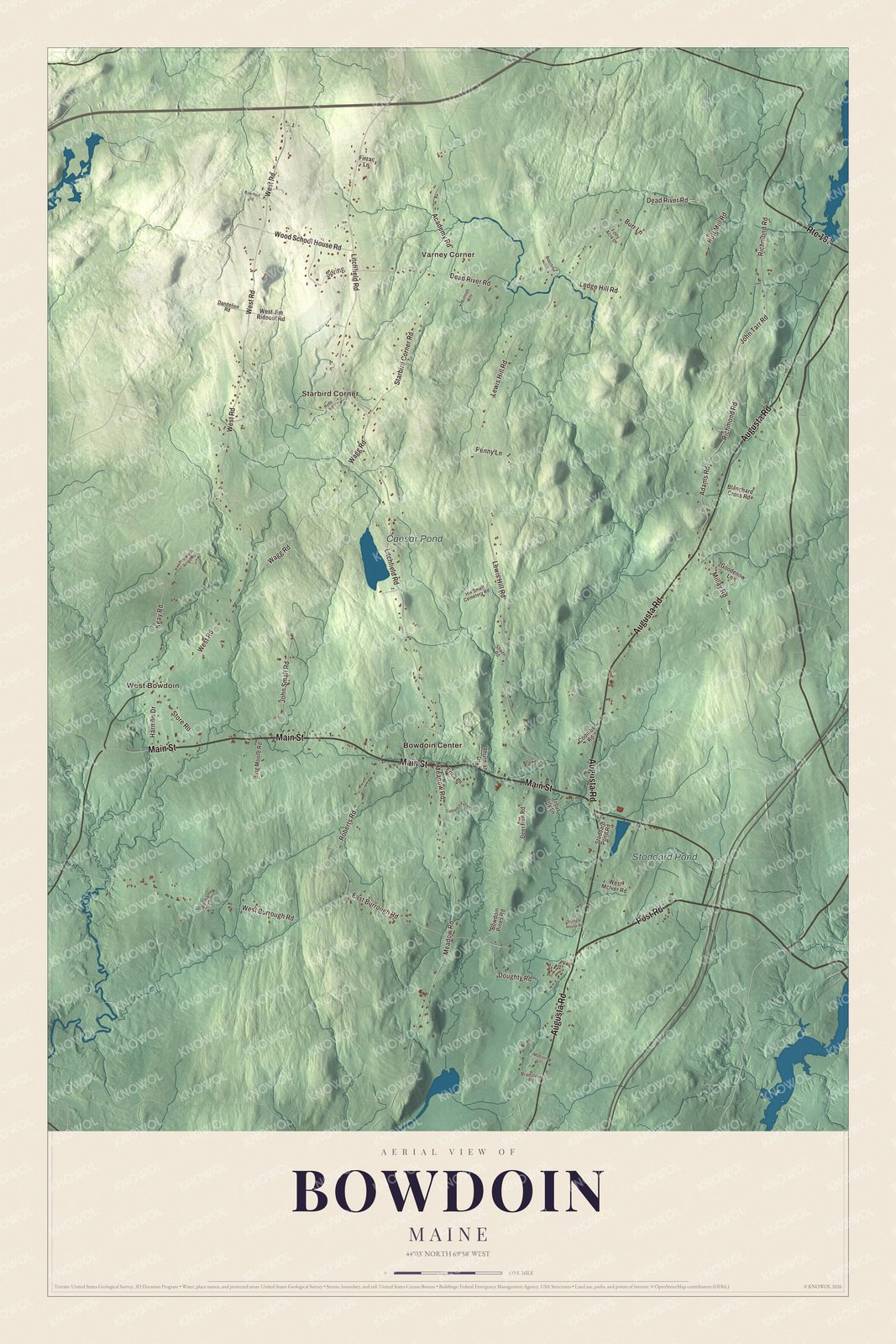
Click to explore a larger preview. The digital watermark does not appear on printed maps.
See it on a wall
The Bowdoin map as a framed print. Swipe for more.


Bowdoin Center and the Cathance
Bowdoin Center is printed on the map. The county’s National Register list places the First Baptist Church of Bowdoin and the Coombs Cemetery there, just off the west side of U.S. Route 201. The congregation was organized in 1788, the year the town was incorporated, and its first church went up in 1799. When that building burned in 1834, the present one was built soon after and finished in 1839, a modest wood-frame church that mixes Federal and Greek Revival styles. The congregation stayed small, and the property went back to the Coombs family, on whose land it stood. In 1900 John and Viola Coombs restored the church and their family cemetery, adding the low stone wall around it, and Viola Coombs gave Bowdoin College an endowment for its care. The college later passed that care to the local historical society. Its page says it was the first property in town to be actively preserved, and it was listed on the National Register of Historic Places in 1997.
West Bowdoin, Varney Corner and Starbird Corner are printed on the map, along with Caesar Pond and Stoddard Pond. Main Street, Post Road and John Tarr Road are printed too. Augusta Road, Richmond Road and Litchfield Road are printed as well. Richmond and Litchfield are two of the towns on Bowdoin’s borders, with Lisbon, Sabattus, Bowdoinham and Topsham. The Cathance River begins in Bowdoin, where its east and west streams meet, and runs 16.4 miles through Topsham and Bowdoinham to Merrymeeting Bay.
This Bowdoin map makes a handsome addition to an office, library or den, and it can teach children the geography and history of a Sagadahoc County farm town. It’s made for anyone who calls Bowdoin home, from West Bowdoin to Bowdoin Center, as it looks today. Zoom in on the preview above to explore the details, then click here to get your copy of the Bowdoin, Maine map.

Sources