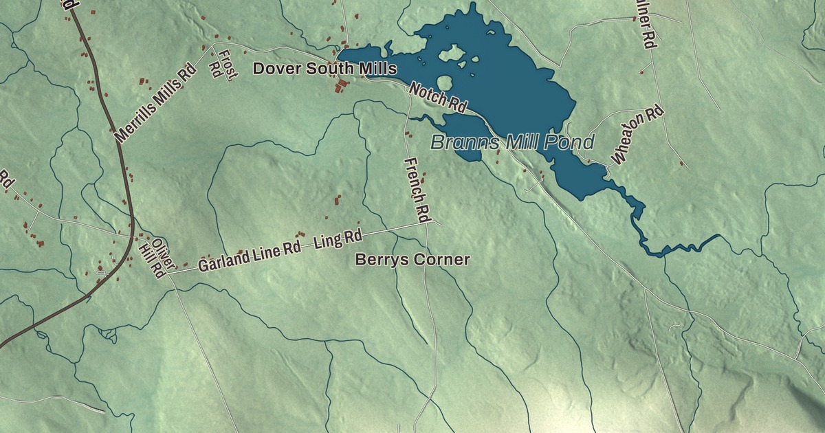
If you’re from Dover-Foxcroft, Maine, look first for West Main Street, Summer Street and North Street. Dover South Mills and Berrys Corner are close by. Milo Road, Dexter Road and Greelys Landing Road head out toward East Dover, South Dover, Goffs Corner, Hurd Corner and Parson Landing. Click here to purchase a print of this map for your wall.
Dover-Foxcroft is a town in Piscataquis County, with 4,422 people at the 2020 census.
KNOWOL made this map in 2026 from public survey data and gave it the look of an old atlas. The Census Bureau measures the town at 71.18 square miles, 3.37 of them water, and its files give the streets and the town line. United States Geological Survey elevation data shades the hills, and Dover-Foxcroft has a listed elevation of 371 feet.
Two towns on one river
Dover-Foxcroft is the largest town in Piscataquis County and its county seat, close to the geographic center of Maine. It began as two towns separated by the Piscataquis River, Dover on the south bank and Foxcroft on the north. Boston merchants Charles Vaughan and John Merrick, both of whom had come from England, bought Dover from Massachusetts, and Eli Towne of Temple, New Hampshire, settled it for good in 1803. Dover was incorporated on January 19, 1822, and its first farmers grew potatoes, corn and grain.
Foxcroft started out as a numbered township, T5 R7 NWP, one of five that Massachusetts gave to Bowdoin College in 1796. Joseph E. Foxcroft of New Gloucester bought it from the college in 1800, and John, Eleazer and Seth Spaulding settled it in 1806 and built the first mill. It went by Spauldingtown until February 29, 1812, when it was incorporated as Foxcroft, after its owner. The river gave both towns water power. By 1859 Dover had about 2,500 people, with sawmills, tanneries, carriage makers and a woolen factory, and Foxcroft had 1,045, with mills, a chair maker, a fork maker, pail makers and a sash, door and blind factory. A piano company, Hughes and Son, ran here from 1866 until 1921. The next year, in 1922, the two towns merged into one.
Mills, a newspaper and a theater
The American Woolen Company Foxcroft Mill on East Main Street, on the west side of the river, stands on a site used for industry since 1822. James Mayo and his partners built a mill there in 1844, and for about a century it was one of the region’s major employers, making woolen cloth. Its 1908 concrete building is one of the earliest known uses of concrete as a structural material in Maine. Textile work ended in 1953, a furniture maker used the buildings until 2007, and in 2014 the complex was renovated as The Mill at Dover-Foxcroft. It joined the National Register of Historic Places in 2012.
The Observer Building, a triangular “flatiron” building of 1854 where Pleasant Street leaves East Main Street, was home for most of the 20th century to The Piscataquis Observer, a weekly whose history goes back to 1838 and which its page calls one of Maine’s oldest. The building is now a historical society museum, and so is the Chandler-Parsons Blacksmith Shop on Dawes Road, a smithy probably built in the early 1860s that still holds its 19th-century tools. The Center Theatre on East Main Street opened in 1940, closed in 1971, and reopened in 2006 after local people formed a group to save it. It runs the Maine Whoopie Pie Festival, a one-day event in late June that began in 2009 and draws thousands of visitors downtown.
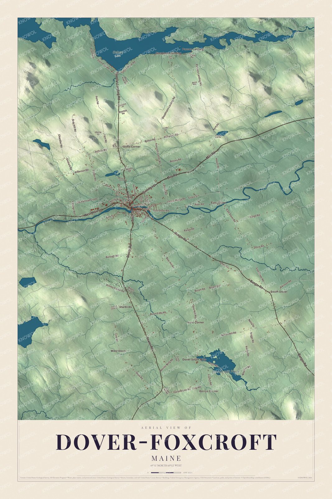
Click to explore a larger preview. The digital watermark does not appear on printed maps.
See it on a wall
The Dover-Foxcroft map as a framed print. Swipe for more.


Born in Dover
Mary Mitchell Birchall, born in Dover in 1840, graduated from Bates College in 1869 while working in a textile mill to support herself, and her page calls her the first woman in New England to earn a bachelor’s degree. She later taught at Vassar College. Lillian M. N. Stevens, born in Dover in 1843, helped start the Maine chapter of the Woman’s Christian Temperance Union and became president of the national organization. James Sullivan Wiley, who came from Mercer to be principal of Foxcroft Academy and later served a term in Congress, built the temple-fronted house at 148 East Main Street in 1849. Foxcroft Academy, a private school, still takes all of the district’s high school students.
Around town
West Main Street, Summer Street and North Street are printed on the map, along with Milo Road, Dexter Road and Greelys Landing Road. Berrys Corner, Dover South Mills, East Dover, South Dover, Goffs Corner, Hurd Corner and Parson Landing are printed too, and Branns Mill Pond is labeled on the map. The side streets around them are drawn in as well.
This Dover-Foxcroft map makes a fine addition to an office, library or den, and it can help teach children the geography and history of the area. It’s made for everyone who calls Dover-Foxcroft home, from West Main Street to Parson Landing, as it looks today. Zoom in on the preview above to explore the details, then click here to get your copy of the Dover-Foxcroft, Maine map.

Sources
- Dover-Foxcroft, Maine, Wikipedia
- American Woolen Company Foxcroft Mill, Wikipedia
- Observer Building, Wikipedia
- Chandler-Parsons Blacksmith Shop, Wikipedia
- Center Theatre (Dover-Foxcroft), Wikipedia
- Mary Mitchell Birchall, Wikipedia
- Lillian M. N. Stevens, Wikipedia
- James Sullivan Wiley House, Wikipedia
- Foxcroft Academy, Wikipedia