Map of Historic Michigan, a one page history dedicated to the Old Timers, 1935
Dive into the historic grandeur of the Great Lake State with this Pictorial Map of Michigan from...

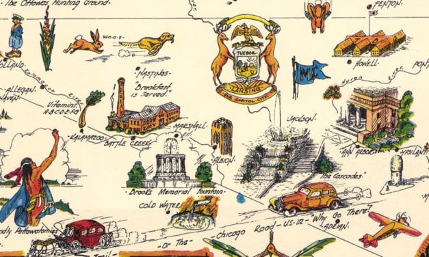
Dive into the historic grandeur of the Great Lake State with this Pictorial Map of Michigan from...
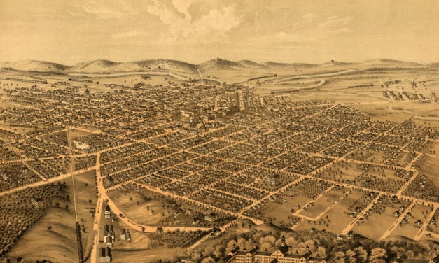
Historic bird’s eye view of Ann Arbor, Michigan from 1880
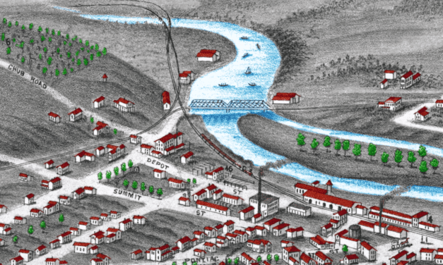
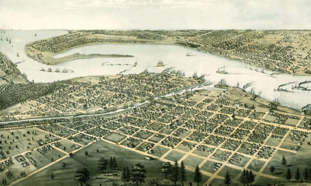
Historic bird’s eye view of Muskegon, Michigan from 1874
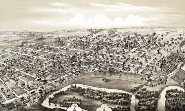
Historic old map shows a bird’s eye view of Midland City, Michigan in 1884
This old map shows Ironwood, Michigan in the late 19th century.
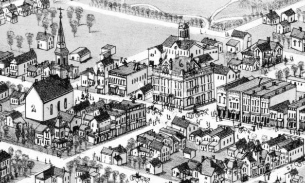
Historic bird’s eye view of Alma, Michigan in 1885
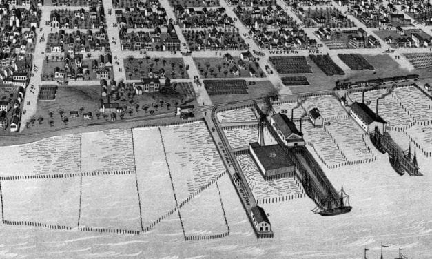
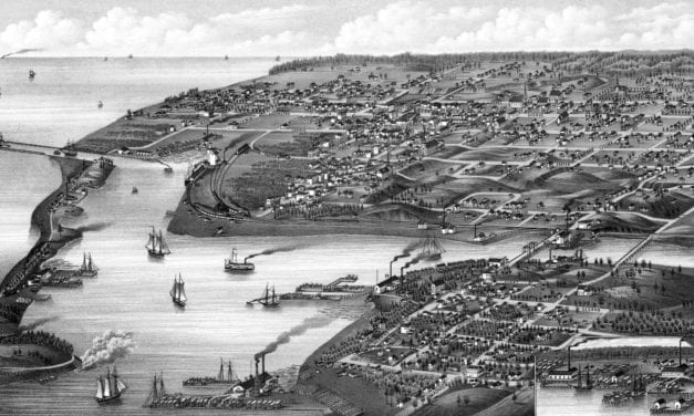
Detailed bird’s eye view of Port Huron, Michigan from 1867
This historic old map of Mount Pleasant, Michigan was created in 1884 by O.H. Bailey, a prominent...
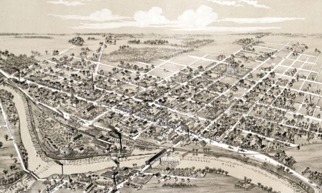
Detailed bird’s eye view of Kalamazoo, Michigan as it used to be.
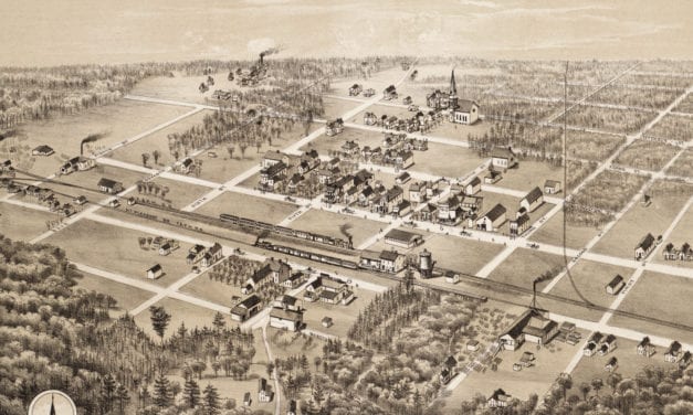
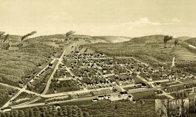
Detailed bird’s eye view of Coleman, Michigan in the late 19th century
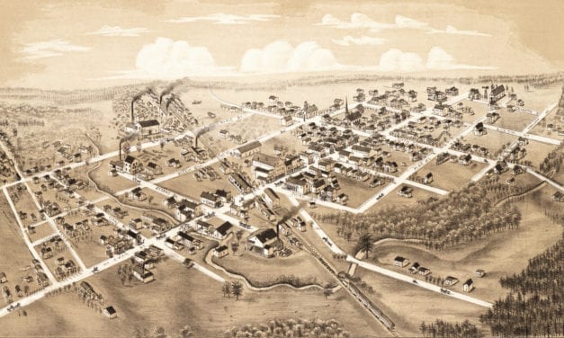
Detailed bird’s eye view of Clare, Michigan in 1884
Detailed bird’s eye view of Ludington, Michigan in 1880