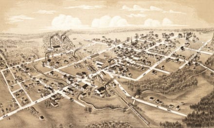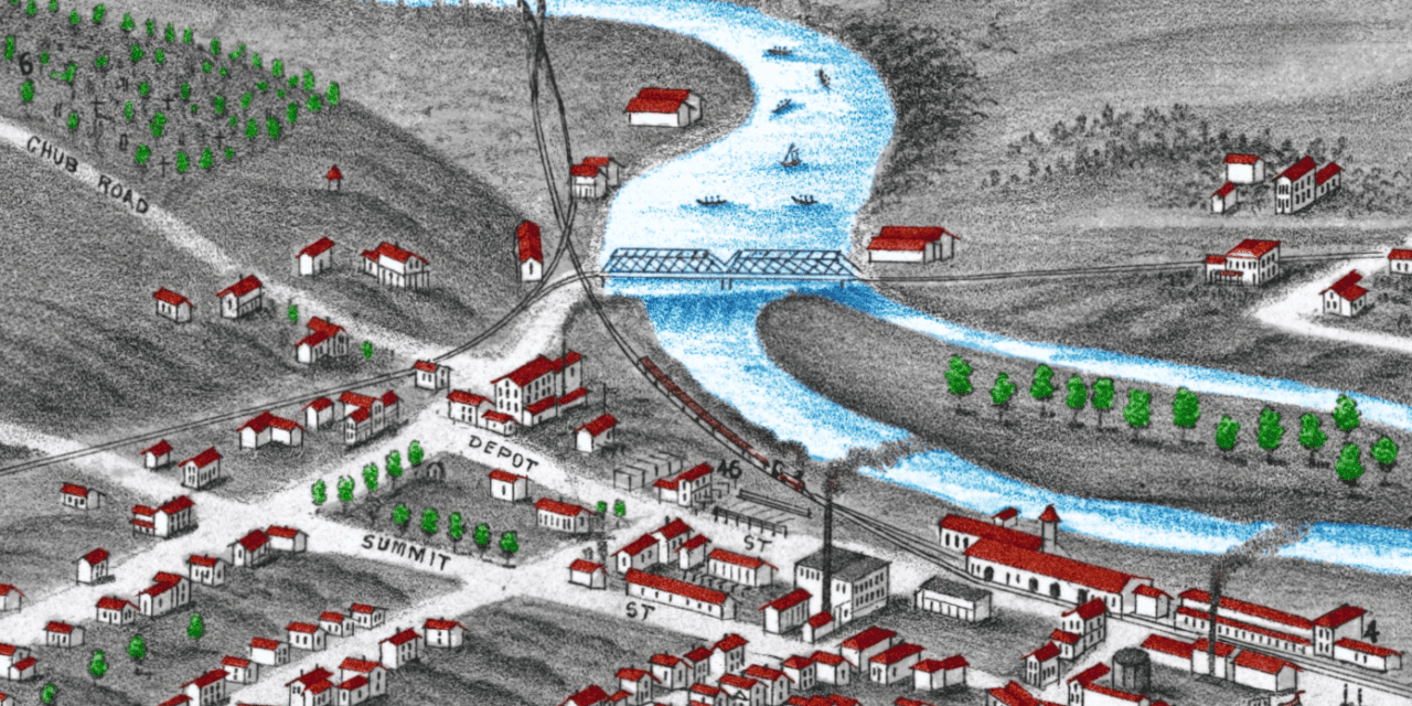
This historic map of Ann Arbor, Michigan was created in 1880 by J.J. Stoner, a prominent 19th century map maker. The map shows a bird’s eye view of the area as it once was, including street names and old landmarks.
The original map was printed in a sepia tone as you can see by viewing the copy held by the Library of Congress. The colorized map seen on this page has been restored and hand-colored by KNOWOL’s team of graphic designers. Reproductions of the restored map are available here.
Historic Old Map of Ann Arbor, Michigan from 1880
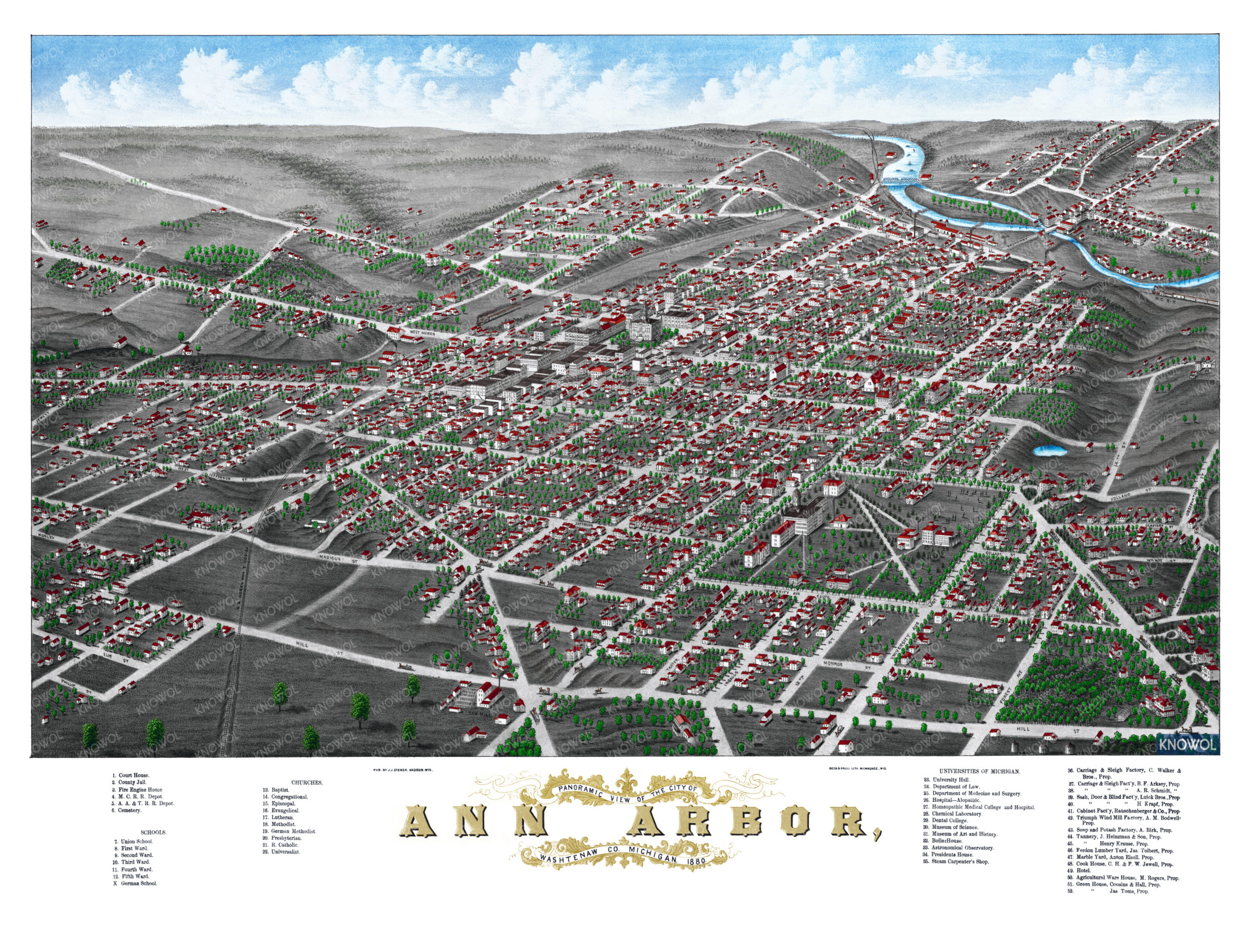
Landmarks on the map include The University of Michigan, Agricultural Ware House, Cabinet Factory, Museum of Science, Museum of Art and History, Michigan University Hospital, Department of Law, Dental College, Soap & Potash Factory, Carriage & Sleigh Factory, Court House, County Jail, Fire Engine House, Railroads, Churches, and more. If you zoom in closely you can even see a group of people playing football on the lawn.
This old map of Ann Arbor will make an attractive addition to your office, library, or den and can even be used to teach children the geography and history of the area. When you’re done exploring, click here to get your copy of the restored map.