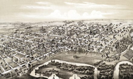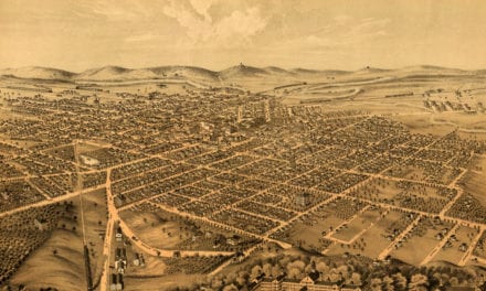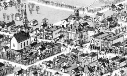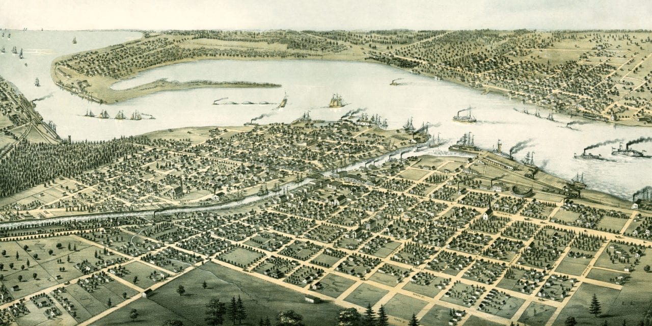
This historic old map of Port Huron, Michigan was created in 1867 by Albert Ruger, a prominent 19th century map maker. The map shows a bird’s eye view of Port Huron and Sarnia, Canada including street names and old landmarks.
Landmarks on the map include the Port Huron & Lake Michigan Railroad Depot Building, Grand Trunk Railroad, Fort Gratiot, Union School, Court House, and Presbyterian, Episcopal, Methodist, Catholic and Baptist Churches.
This historic map of Port Huron, MI has been restored by KNOWOL. Reproductions of the map are available here.
Bird’s Eye View of Port Huron, Michigan in 1867
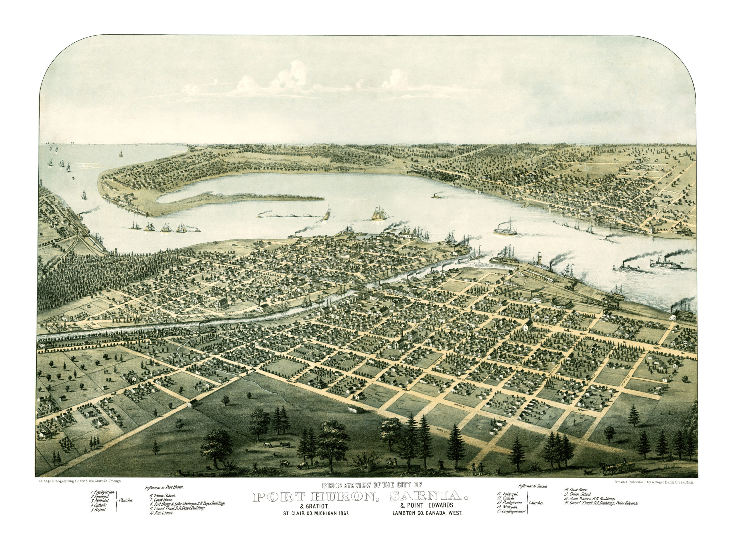
This historic map of Port Huron will make an attractive addition to your office, library, or den and can even be used to teach children the geography and history of the area. When you’re done exploring, click here to get your copy.