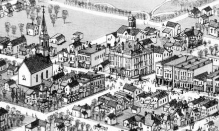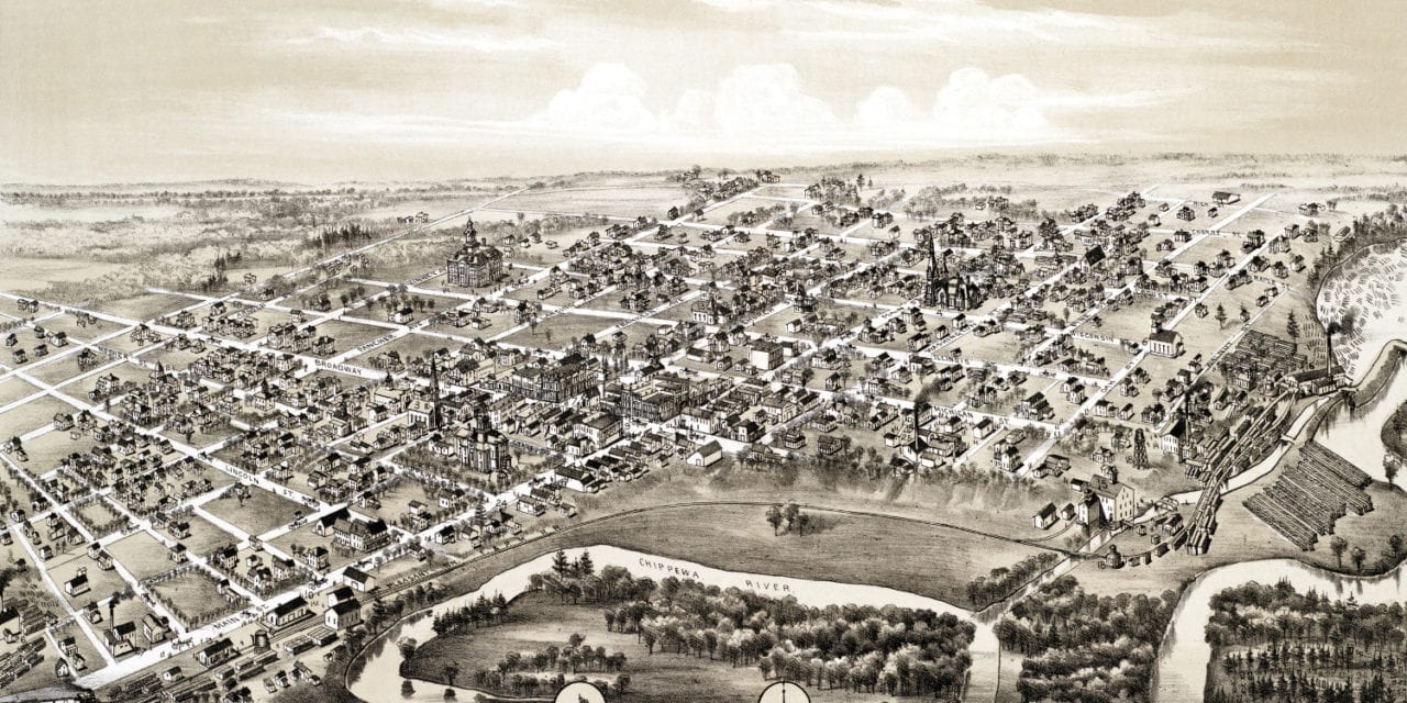
This historic old map of Mount Pleasant, Michigan was created in 1884 by O.H. Bailey, a prominent 19th century map maker. The map shows a bird’s eye view of the city as it used to be, including street names and old landmarks.
Landmarks on the map include the Chippewa River, Flint and Pere Marquette Railroad, Mount Pleasant Opera House, Angell’s One Price Store, Maxwell’s Store, Waterworks, Harris Brothers Roller Process Mills, McDonald’s Livery & Sale Stable, Sweeney Groceries, Chatterton Mills, and more.
This historic map of Mt. Pleasant was restored by KNOWOL. Reproductions of the restored map are available here.
Bird’s Eye View of Mt Pleasant, Michigan in 1884
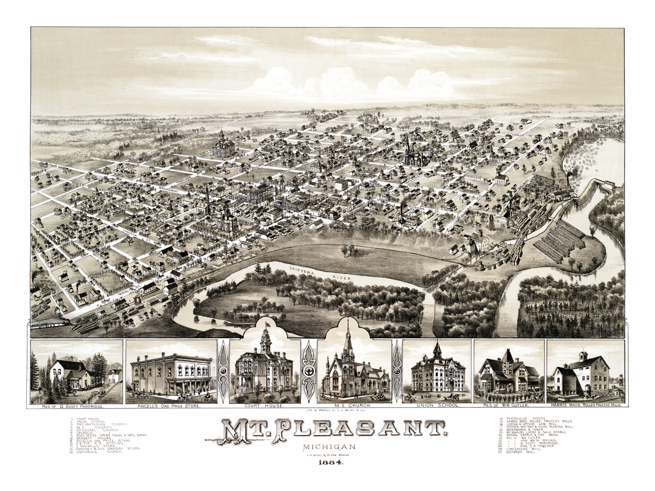
This old map of Mt. Pleasant makes an attractive addition to your office, library, or den and can even be used to teach children the geography and history of the area. When you’re done exploring, click here to get your copy.