
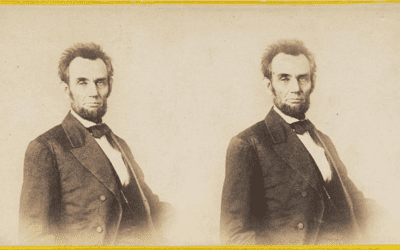
Abraham Lincoln’s travels through Massachusetts, map from 1848
Historic map showing Abraham Lincoln’s route through Massachusetts in 1848
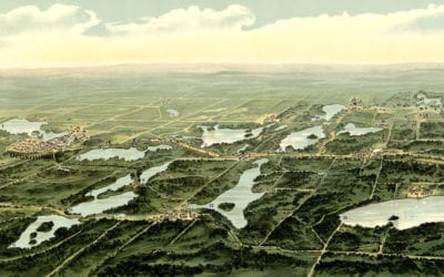
Beautiful old map of Waukesha County Wisconsin in 1890
This map from 1890 shows Oconomowoc, Waukesha and Waukesha County, Wisconsin.
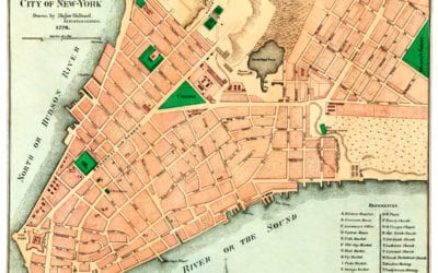
Amazing old map reveals original layout of NYC in 1776
This old map shows New York City in the late 18th century.
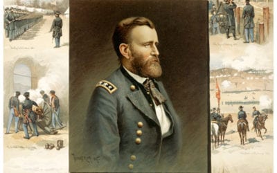
Ulysses S. Grant, from West Point to Appomattox
This engraving was created to honor Ulysses S. Grants achievements after his death.

10 historic images of Houston, TX as it looked in the 1940’s
Houston is the largest city in Texas and the fourth largest in the United States. It is named after Sam Houston, a General who led troops to victory in the Texas Revolution, and the first president of the Republic of Texas. Houston was first colonized in August 1836...
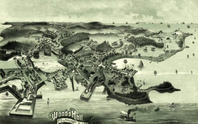
Bird’s eye view of Woods Hole, Massachusetts from 1887
This old map shows Woods Hole, Massachusetts in the late 19th century.
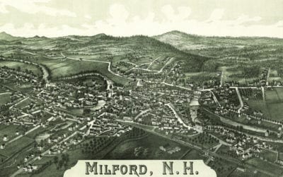
Stunning historical map of Milford, NH from 1886
This map shows Milford, New Hampshire as it looked in 1886.
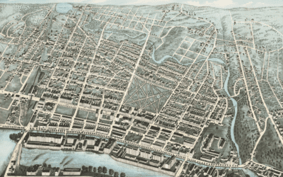
Beautifully detailed map of Lawrence, MA from 1876
Detailed bird’s eye view of Lawrence, Massachusetts from 1876
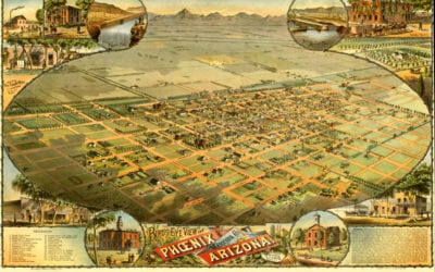
Amazing bird’s eye view of Phoenix, Arizona in 1885
This vintage map shows Phoenix, Arizona as it looked in 1885.

Scientists prove psychedelics lead to higher levels of consciousness
For the first time, neuroscientists have proven that psychedelic substances…


