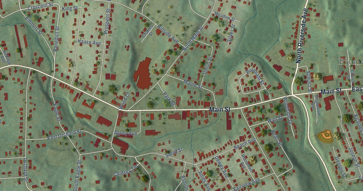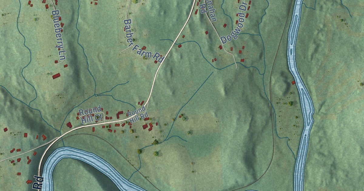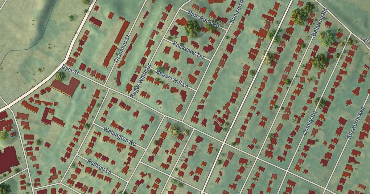
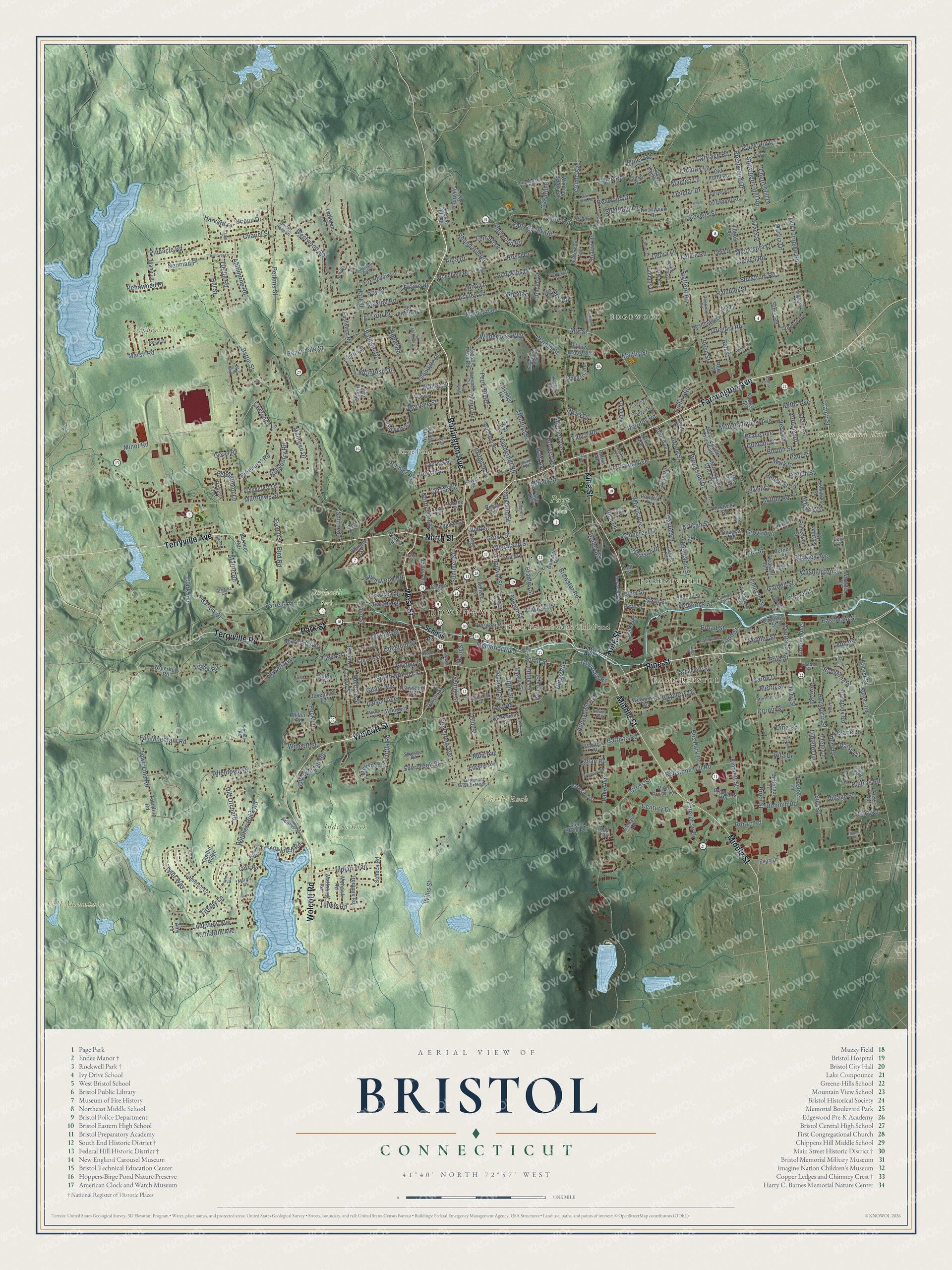
This beautifully detailed map of Bristol, Connecticut was created in 2026 using aerial imagery combined with modern topographical, census, street and landmark data. It’s a one-of-a-kind view of Bristol that combines accurate data with a vintage aesthetic. The map shows every building in its true location, many of the roads carry their names, and the shaded topographic relief shows the shape of the land.
See it on a wall
The Bristol map as an 18 x 24 inch print in a black frame.

Explore an aerial view of Bristol, Connecticut
On the map you’ll find Downtown, East Bristol, Edgewood, Campground Hill, Castle Rock, Chippen Hill, Fall Mountain, Birge Pond, Bristol Fish and Game Club Pond, Indian Rock Nature Preserve, Page Park, Rockwell Park, and more. If you look closely you can even find your house accurately drawn in its correct location. Zoom in on the preview to look for yours. Click here to learn more about the history of Bristol.
Take a closer look at the Bristol map
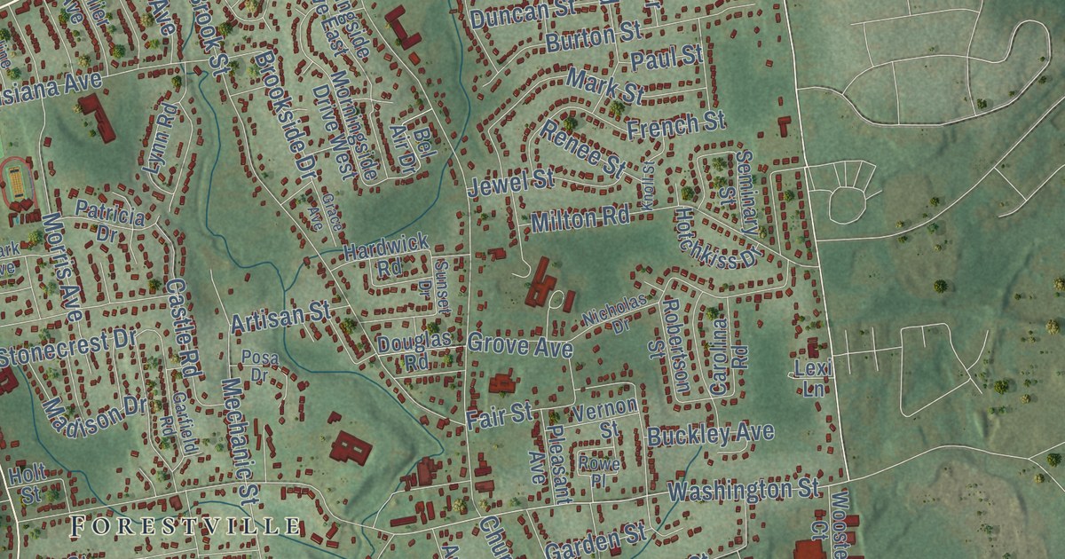
Click to explore a larger preview. The digital watermark does not appear on printed maps.
Names on this map
These names are printed on this map.
Places: Downtown, East Bristol, Edgewood, Campground Hill, Castle Rock, Chippen Hill, Fall Mountain, Birge Pond, Bristol Fish and Game Club Pond, Indian Rock Nature Preserve, Page Park, Rockwell Park and Forestville.
Streets and roads: Farmington Avenue, Burlington Avenue, Wolcott Street, West Street, Pine Street, North Street, Terryville Avenue, Park Street, Terryville Road, Middle Street, King Street, Wolcott Road.
More street names, A to Z
Academy Street, Acorn Lane, Adams Street, Adeline Avenue, Alba Drive, Aldbourne Road, Allentown Road, Ambler Road, Amy Lane, Anderson Avenue, Anthony Drive, Apple Road, Arcadia Road, Arlington Street, Artisan Street, Ashley Road, Ashover Lane, Baldwin Drive, Barber Street, Barlow Street, Barnum Road, Battisto Road, Battle Street, Bayberry Drive, Beacon Street, Beech Street, Bel Air Drive, Belgian Circle, Bellevue Avenue, Belridge Road, Ben Street, Bernside Drive, Beths Avenue, Bingham Street, Birch Street, Bird Road, Birge Road, Blakeslee Street, Blue Trail, Boy Street, Brace Avenue, Bradley Street, Braeburn Road, Brentwood Drive, Brewster Road, Brightwood Road, Broad Street, Broderick Road, Brookside Drive, Brook Street, Buckboard Lane, Buckley Avenue, Burton Street, Bus Park Drive, Butternut Lane, Caeser Drive, Cameron Drive, Camp Street, Candy Lane, Carol Drive, Carolina Road, Carriage Road, Castle Road, Cawley Street, Center Street, Central Street, Century Drive, Chapel Street, Cherry Hill Drive, Chestnut Street, Church Avenue, Church Street, Circle Street, Claire Street, Claremont Street, Clark Avenue, Clin Alley, Cloos Road, Clover Road, Collier Avenue, Collins Road, Corbin Ridge, Country Lane, Couture Drive, Coventry Road, Cove Road, Cricket Hill Road, Cronin Street, Cross Street, Crown Street, Curtiss Avenue, Curtiss Street, Cypress Street, Daisy Circle, Daley Street, Dallas Avenue, Danbury Lane, Davis Drive, Debra Lane, Deerfield Road, Delmar Drive, Del Prado Drive, Dewey Avenue, Diane Lane, Dino Road, Dipietro Lane, Divinity Street, Dogwood Lane, Dolphin Road, Dorothy Road, Dorset Horn Lane, Douglas Road, Driftwood Road, Duncan Street, East Main Street, East Road, East Street, Eastwood Road, Eaton Road, Elaine Drive, Elberta Street, El Toro Drive, Emily Lane, Emmett Street, Empire Way, Enterprise Drive, Espn Drive, Eugene Avenue, Evelyn Road, Everett Street, Fair Street, Fall Mountain Road, Falls Brook Road, Farrell Avenue, Felice Road, Fern Hill Road, Ferraro Drive, Field Street, Fifth Street, Forest Street, Fox Den Road, Fox Hollow Lane, Francine Lane, Frederick Street, French Street, Garden Street, Garfield Road, Geary Avenue, George Street, Glendale Drive, Glen Eagle Drive, Glenn Street Circle, Goodwin Street, Goshen Court, Grace Avenue, Greene Street, Gregory Road, Greystone Avenue, Gridley Street, Grove Avenue, Grove Street, Hadden Street, Haig Avenue, Halcyon Drive, Hardwick Road, Harmony Road, Hart Street, Harvard Place, Harvest Lane, Haviland Street, Hepworth Street, Hill Street, Holley Road, Hollyberry Road, Holt Street, Hoover Avenue, Hotchkiss Drive, Hull Street, Illinois Avenue, Indiana Street, Indian Trail, Intervale Road, Ipswitch Road, Iroquois Road, Irving Street, Ivy Drive, Jacobs Street, Jan Road, Jeannette Street, Jefferson Avenue, Jerome Avenue, Jewel Street, John Avenue, Josephine Terrace, Judd Street, Judson Avenue, Julia Road, Juniper Road, Kathern Street, Kelley Street, Kenney Street, Kilmartin Avenue, Kimberly Lane, Knob Hill Lane, Knoll Street, Knollwood Drive, Kozani Street, Lacava Road, Lake Avenue, Lakeside Drive, Lakewood Circle, Larkspur Lane, Lawndale Avenue, Lawrence Lane, Leominster Road, Leon Road, Lewis Road, Lewis Street, Lexi Lane, Lexington Street, Lillian Road, Lincoln Avenue, Lincoln Street, Lochaven Road, Locust Street, Long Lane, Longview Avenue, Louisiana Avenue, Lufkin Lane, Lynn Road, Madison Drive, Maheu Street, Maiden Lane, Main Street, Maltby Street, Mano Lane, Maple Avenue, Maple Street, Marcia Drive, Marconi Avenue, Marion Street, Mark Street, Marlene Street, Marsh Road, Martin Road, Mattatuck Road, Matthews Street, Maureen Drive, Maurice Street, Maxine Road, McIntosh Drive, Mechanic Street, Medford Street, Melinda Lane, Melrose Street, Memorial Boulevard, Mercier Avenue, Merrill Court, Metro Street, Miller Road, Milton Road, Mine Road, Mines Road, Minnesota Lane, Minor Road, Mix Street, Mohawk Road, Moody Street, Morningside Drive East, Morningside Drive West, Morris Avenue, Mossa Drive, Mountain Road, Mountain View Avenue, Muir Avenue, Natalie Court, Nelson Farm Road, Neuman Place, Newell Avenue, New Street, Nicholas Drive, North Main Street, Northmont Road Extended, North Pond Street, Norton Street, Oak Hill Drive, Oakland Street, Oakridge Road, Oakwood Circle, Ohio Drive, Old Farm Road, Old Orchard, Old Turnpike Road, Old Wolcott Road, Orleans Drive, Page Avenue, Pardee Street, Partridge Run, Patricia Drive, Patton Drive, Paul Street, Payton Terrace, Peacedale Street, Peck Lane, Pennwood Place, Peppermint Lane, Perkins Street, Perry Road, Phelps Road, Pierce Street, Pilgrim Road, Pine Brook Terrace, Pinehurst Road, Pine Meadow Drive, Pinnacle Road, Plank Hill Road, Pleasant Avenue, Poitras Road, Pondview Lane, Posa Drive, Pound Street, Prestige Lane, Primrose Lane, Prince Street, Prospect Street, Puritan Road, Putnam Street, Queen Street, Race Street, Rambler Street, Redstone Hill Road, Redstone Street, Redwood Drive, Renee Street, Rhoda Lane, Richard Court, Rich Lane, Ridgecrest Lane, Ridge Road, Rita Drive, Riverside Avenue, Robertson Street, Roberts Trce, Rogers Road, Rollinson Road, Ronzo Road, Rosemary Lane, Rose Street, Rossi Drive, Round Hill Road, Rowe Place, Royal Drive, Rustic Terrace, Ruth Street, Saw Mill Road, School Street, Seminary Street, Seneca Road, Seymour Street, Shawn Drive, Sheffield Lane, Sheila Court, Sherbrook Street, Sherwood Road, Shrub Road, Sigourney Street, Silo Road, Simpkins Drive, Sims Road, Sixth Street, Skyridge Road, Smith Street, Sonstrom Road, South Street, South Street Extension, Spark Avenue, Stafford Avenue, Stearns Street, Sterling Way, Stevens Street, Stonecrest Drive, Strawberry Hill Road, Sturbridge Court, Summer Street, Sunnydale Avenue, Sunset Drive, Sycamore Street, Thistle Lane, Tiffany Lane, Timber Lane, Todd Street, Tolland Road, Tower Road, Town Line Road, Townline Road, Treble Road, Trelli Lane, Tufts Street, Tulip Street, Tunxis Road, Tuttle Road, Tuttle Street, Tyler Way, Uconn Drive, Union Street, Upson Street, Valley Street, Valmore Road, Vance Drive, Vance Road, Vanderbilt Road, Vera Road, Vernon Street, View Street, Villa Court, Village Street, Violet Drive, Warner Street, Washington Street, Waterbury Road, Westwood Road, Wilcox Street, Wilderness Way, Wildewood Run, Willis Street, Willow Brook Road, Windham Road, Winding Brook Road, Witches Rock Road, Woodard Drive, Woodfield Road, Woodland Street, Woodmere Road, Wooster Court, Yale Drive, Yarde Drive, Zack Lane.
This beautifully detailed map of Bristol makes an attractive addition to your office, library, or den, and it can even be used to teach children the geography and history of the area. It also makes a great gift for someone who left Bristol and still calls it home. When you’re done exploring, click here to get your copy of the Bristol map.