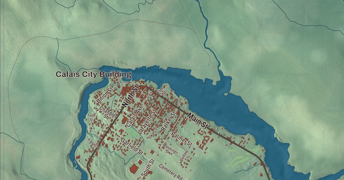
Main Street, North Street, Union Street and River Road are printed on this map of Calais, with Calais City Building and Milltown, Whitlocks Mill, Red Beach and Saint Croix Junction. Baring Street and Mount Holly Road carry their names too, and so do Nashs Lake, Howard Lake, Keene Lake, Beaver Lake and the Moosehorn National Wildlife Refuge: Bering Unit. Click here to purchase a print of this map for your wall.
Calais is a city in Washington County, with 3,079 people at the 2020 census.
KNOWOL made this map in 2026 from public survey data and gave it the look of an old atlas. The relief is shaded from United States Geological Survey elevation data, and the streets and city line come from the Census Bureau. The bureau counts 40.10 square miles in Calais, 5.78 of them water. The city sits at the head of tide on the St. Croix River, across from St. Stephen, New Brunswick, with three border crossings between them.
A mill town on the border
The Passamaquoddy lived here when Europeans arrived. Samuel de Champlain explored the St. Croix and spent the winter of 1604 on St. Croix Island with his men. The first permanent settler was Daniel Hill of Jonesboro, who came in 1779, while Maine was still part of Massachusetts, and with other settlers he built the first sawmill in 1782. Calais dates to 1809, when Plantation Number 5 was incorporated on June 16 and named for Calais, France, to honor French help in the American Revolution. It became a city in 1850. The river ran its sawmills, shingle and clapboard mills, planing mills, a saw factory, two axe factories and four grain mills, and Calais also had foundries, machine shops, granite works, shoe factories and a tannery.
Calais and St. Stephen have long been unusually close. During the War of 1812 the two sides agreed to a ceasefire along this stretch of the border. A story the city’s page calls likely apocryphal says the British gave St. Stephen a supply of gunpowder to defend itself against Calais, and the town elders sent it over the river for Calais’s Fourth of July. Calais also built the first railroad in Maine. The Calais Railroad was incorporated in 1832 to haul lumber from a mill on the river, opposite Milltown, New Brunswick, 2 miles down to tidewater, and it was running by 1835. In 1849 it was renamed the Calais and Baring Railroad and pushed 4 miles farther to Baring.
Harriet Prescott Spofford was born in Calais in 1835, the daughter of a local lumber merchant. Her family moved to Newburyport, Massachusetts, when she was young, and she became one of the most widely published writers in the United States, with novels, poems, stories and criticism over more than sixty years.
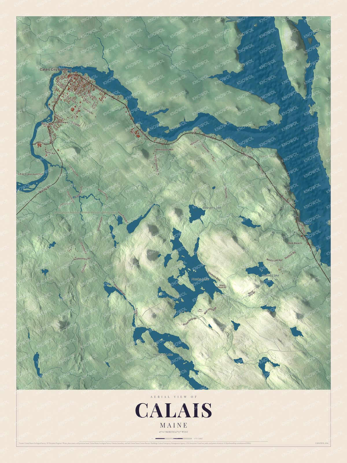
Click to explore a larger preview. The digital watermark does not appear on printed maps.
See it on a wall
The Calais map as a framed print. Swipe for more.


Main Street, North Street and Union Street
Main Street is printed on the map. In August 1870 a fire swept the business district, and within a year much of it had been rebuilt in brick. The Calais Historic District, on the south side of Main Street between North and Church streets, keeps that block of Italianate buildings, along with the 1847 Hill Building and, on Church Street, the 1901 City Hall and an 1874 fire station. Farther east, at 521 Main Street, stands the Holmes Cottage, from the early 1800s and the oldest surviving building in town, once the home of Dr. Job Holmes and now a museum of the St. Croix Historical Society. Next door is the Dr. Job Holmes House, one of the city’s finest Italianate houses. Nearby on Church Street, St. Anne’s Episcopal Church of 1853 is the only known Maine work of James Renwick Jr., the architect of St. Patrick’s Cathedral in New York.
North Street is printed too. At its corner with Lincoln Street, in Meridian Park on the grounds of the old Calais Academy, two granite stones survive from the Calais Observatory. Survey crews worked from them in 1857 and 1866, timing stars by telegraph to fix the city’s longitude against Cambridge, Massachusetts, and then against Greenwich, England, over the new Atlantic cable. Its page says that for a time Calais was arguably one of the most precisely located places in the United States. Union Street is printed as well. At its east end, between the street and the river, the Calais Free Library opened in 1893 in a Romanesque building of brick and brownstone by the Boston architect Arthur H. Vinal. James Shepherd Pike, one of the city’s leading citizens, started it by leaving his house to the city for a library.
River Road and Whitlocks Mill
River Road, printed on the map, carries Main Street east out of the center. On Hinckley Hill it passes three Gothic Revival houses from the early 1850s, built when Calais still felt like a frontier town. The finest, the Gilmore House at 764 River Road, was designed by the New Brunswick architect Matthew Stead, and George Washburn built another of the three. About 2 miles east of the center, down a lane off River Road, the Theodore Jellison House of 1825 is built of granite blocks with walls 26 inches thick. Jellison owned granite quarries and apparently built it to show off what he sold.
Whitlocks Mill is printed farther down the river. The Whitlocks Mill Light, on the south bank, is the northernmost lighthouse in Maine and the last one built in the state. It began as a lantern the local miller hung in a tree at a bend in the river, became a light station in 1892, and got its present brick tower in 1910.
Milltown is printed on the map. The Milltown International Bridge, the smallest and least busy of the three crossings to St. Stephen, shares the name. Bridges have stood at that spot since 1825. Calais City Building, Red Beach and Saint Croix Junction are printed too, along with Baring Street, Mount Holly Road, Nashs Lake, Howard Lake, Keene Lake and Beaver Lake. The Moosehorn National Wildlife Refuge: Bering Unit carries its name southwest of the city, where the refuge’s Baring Division gives birds of the Atlantic Flyway places to feed and nest.
This Calais map makes a handsome addition to an office, library or den, and it can teach children the geography and history of a border city on the St. Croix. It’s made for anyone who calls Calais home, from Milltown to Red Beach, as it looks today. Zoom in on the preview above to explore the details, then click here to get your copy of the Calais, Maine map.

Sources
- Calais, Maine, Wikipedia
- Harriet Prescott Spofford, Wikipedia
- Calais Historic District, Wikipedia
- Holmes Cottage, Wikipedia
- Calais Residential Historic District, Wikipedia
- St. Anne’s Episcopal Church (Calais, Maine), Wikipedia
- Calais Observatory, Wikipedia
- Calais Free Library, Wikipedia
- Hinckley Hill Historic District, Wikipedia
- Gilmore House (Calais, Maine), Wikipedia
- George Washburn House, Wikipedia
- Theodore Jellison House, Wikipedia
- Whitlocks Mill Light, Wikipedia
- Milltown International Bridge, Wikipedia
- Moosehorn National Wildlife Refuge, Wikipedia