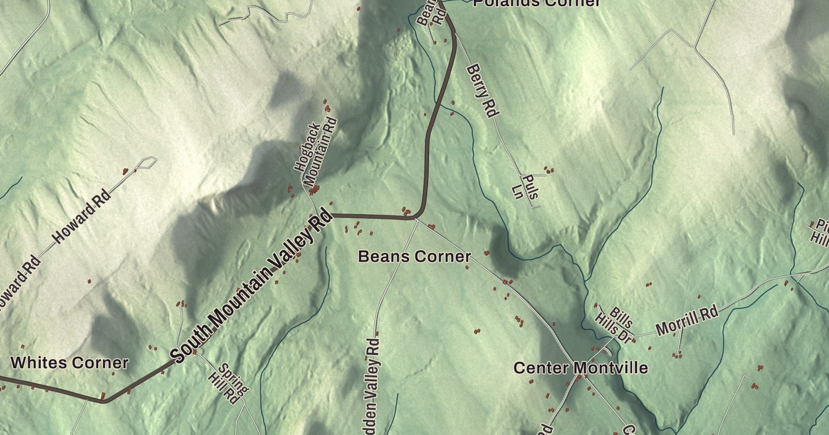
Montville’s name is French for “mountain town,” and this map follows North Mountain Valley Road, South Mountain Valley Road and Halldale Road across it, with Trues Pond in view. Click here to purchase a print of this map for your wall.
Montville is a town in Waldo County.
KNOWOL made this map in 2026 from public survey records, United States Geological Survey elevation data and Census Bureau files. Its atlas layout brings together Montville’s roads, buildings, ponds and waterways, and terrain, the town boundary and the pattern of buildings.
Davistown becomes the mountain town
The Wawenoec people lived here first. Around 1720 timber was cut in the area, including white pines that became masts for the British Royal Navy. In 1780 James Davis came from Massachusetts and started Davistown Plantation, which grew to take in today’s Montville and Liberty. Six families lived there by 1790, and 50 by 1800. Davistown was incorporated on February 18, 1807, as Montville, the French word for “mountain town,” and twenty years later the southern part split off as the town of Liberty.
Settlers here argued for years with the proprietors of the old Waldo Patent, which later belonged to Henry Knox. The settlers held that clearing and farming land made it theirs, while the proprietors went by government deeds. Calling themselves Liberty Men, the homesteaders banded together to stop surveying in their settlements.
Mills, barrels and forest
Montville’s population grew fast in the first four decades of the 1800s. Sawmills in Montville and Liberty sent wood to the coast for shipbuilding, and the two towns became a center of barrel making, with barrels going to fishermen for their catch and to brick masons in Portland and Boston as lime casks. The town peaked at 2,153 people in 1840, fell to 366 by 1960, and counted 1,020 in 2020. As the population dropped, old farmland went back to the wild, and most of Montville is forest today.
Ebenezer Knowlton grew up in South Montville after his family settled there in the 1820s. He became a Free Will Baptist minister, served as speaker of the Maine House in 1846 and in Congress from 1855 to 1857, and was a trustee of Bates College and Colby College. A lifelong supporter of abolition, he worked for the Freedmen’s Bureau in Beaufort, South Carolina, after the Civil War. His childhood home on Choate Road, built around 1827 with two period barns, is on the National Register of Historic Places.

Click to explore a larger preview. The digital watermark does not appear on printed maps.
See it on a wall
The Montville map as a framed print. Swipe for more.


Explore the Montville map
Start with Beans Corner, then follow North Mountain Valley Road, South Mountain Valley Road, Acadia Highway, Halldale Road, Burnham Hill Road and Hidden Valley Road across town. Those are printed names, and Center Montville, Connors Corner, Gregorys Corner and Halldale are farther out.
Trues Pond is labeled on the map, and at 173 acres it’s the town’s principal pond. Part of the Frye Mountain Wildlife Management Area lies in Montville too. Compare the scattered buildings with the woods that now cover most of the town.
For people who call Montville home, this map shows the town as it looks today. Put it in your office, library, or den, or use it to teach children the geography and history of the area. Zoom in on the preview above to explore the details, then click here to get your copy of the Montville, Maine map.

Sources