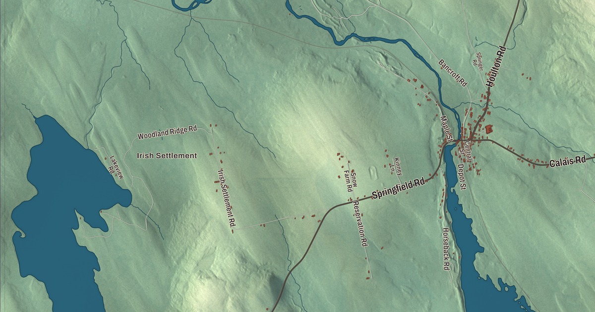
Depot Street, in the village center, is the first name to find on this map of Danforth, Maine. Houlton Road, Calais Road, Springfield Road, Chadwick Point Road and Bancroft Road fill in the town, Irish Settlement and Eaton are on the sheet too, and Crooked Brook Flowage and Sucker Lake hold the water. Click here to purchase a print of this map for your wall.
Danforth is a town in Washington County, with 587 people at the 2020 census.
KNOWOL made this map in 2026 from public survey data and gave it the look of an old atlas. The Census Bureau measures Danforth at 60.46 square miles, 6.46 of them water, and its files give the roads and the town line. United States Geological Survey elevation data shades the land; the town’s listed elevation is 452 feet.
Thomas Danforth’s town
Danforth dates to 1860, and it’s named for the proprietor Thomas Danforth. He was a leader of the Massachusetts Bay Colony, treasurer of Harvard College and later the colony’s deputy governor, and in 1680 the Massachusetts assembly chose him president of the District of Maine. In that role he made land grants and helped reestablish towns such as Falmouth and North Yarmouth after King Philip’s War. Danforth Street in Portland is named for him as well.
The town has two villages, Danforth and Eaton. Danforth village, a census-designated place since just before the 2020 census, lies in the northern part of town on Baskahegan Stream, where the stream starts at the outlet of Crooked Brook Flowage. The Baskahegan flows northwest to the Mattawamkeag River and on into the Penobscot watershed. U.S. Route 1 passes along the east side of the village, leading north 34 miles to Houlton and southeast 56 miles to Calais, and State Route 169 runs 24 miles southwest from Danforth to Springfield.
Union Hall and East Grand School
Union Hall stands near the corner of Depot and Central Streets, one block south of where Route 1 and Route 169 meet. It was built in 1890 to designs by Edwin E. Lewis of Gardiner, a busy architect in central and eastern Maine, for the Union Hall Corporation, which ran it for the public good. Town meetings, plays and social evenings filled the auditorium on the first floor, and in 1906 the upper floor was sold to the local Odd Fellows and Masons. Its three-story front tower holds a clock and an open belfry, and its page calls the hall a prominent landmark in the village center. It was listed on the National Register of Historic Places in 1987.
East Grand School, in Danforth, teaches every grade from pre-kindergarten through high school for Danforth and Weston, and it takes some students from Vanceboro and Bancroft as well. Its building opened in 1960. In 2000 the school began offering live lessons from a teacher in Houlton, and in 2023 it had 135 students, 46 of them in high school.
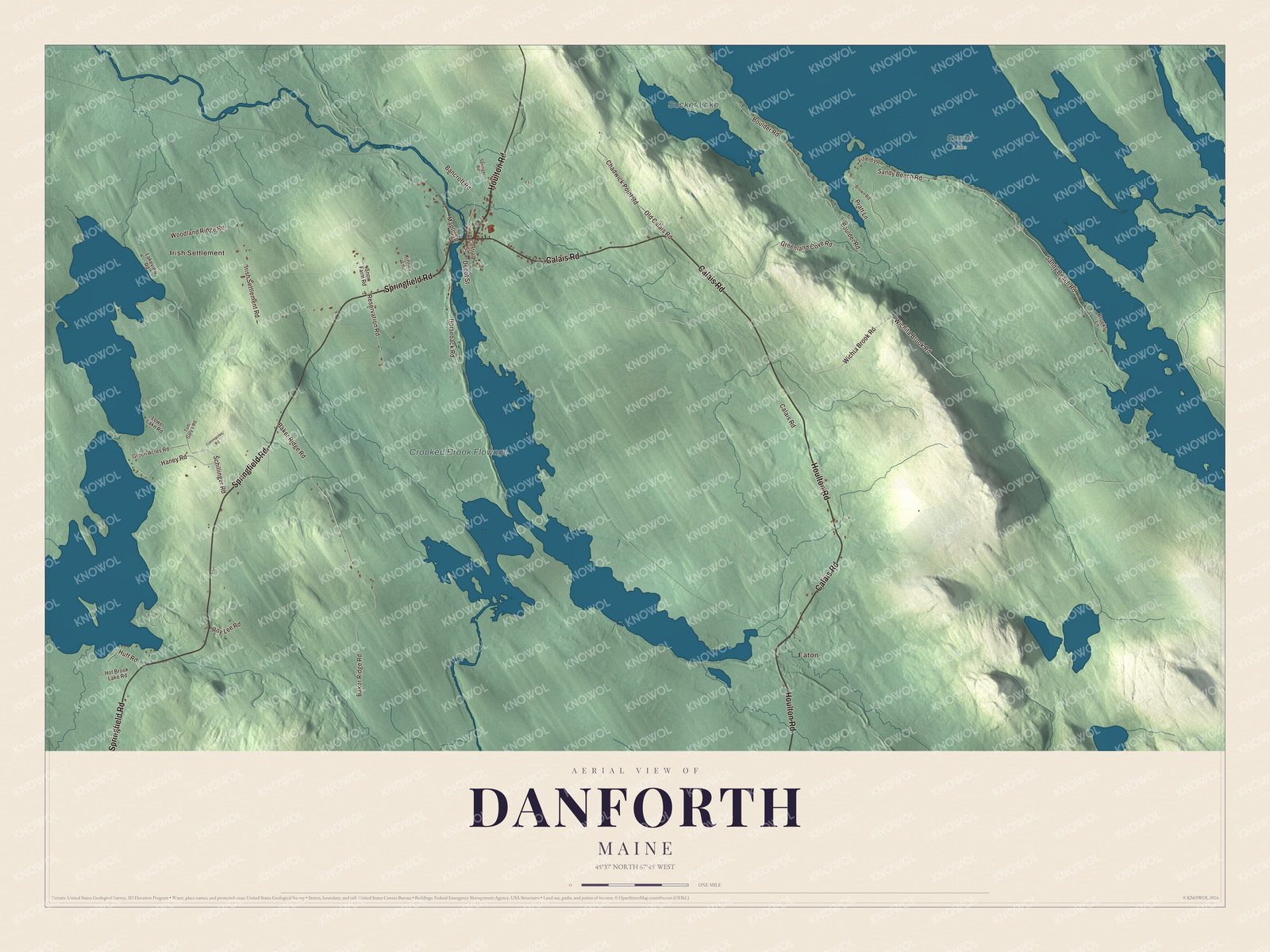
Click to explore a larger preview. The digital watermark does not appear on printed maps.
Names on this map
These names are printed on this map.
Places: Irish Settlement, Eaton, Crooked Brook Flowage, Sucker Lake and Grand Lake.
Streets and roads: Houlton Road, Calais Road, Springfield Road, Depot Street, Chadwick Point Road, Bancroft Road, Wichita Brook Road, Baker Ridge Road, Sandy Beach Road, Greenland Cove Road, Wichta Brook Road, Woodland Ridge Road.
More street names, A to Z
Boulder Road, Brooks Lane, Brown Road, Central Street, Fifield Lane, Green Acres Road, Greenacres Road, Haney Road, Horseback Road, Hot Brook Lake Road, Huff Road, Irish Settlement Road, Kinney Lane, Lakeview Road, Lower Lake Road, Maple Street, Old Calais Road, Pratt Lane, Reservation Road, Roy Lee Road, Schillinger Road, Snow Farm Road, Springer Road, Tom Gary's Road.
See it on a wall
The Danforth map as a framed print. Swipe for more.


Around Danforth
Depot Street is printed on the map, and so are Houlton Road, Calais Road and Springfield Road. Chadwick Point Road and Bancroft Road are printed too, and so are Irish Settlement and Eaton. Crooked Brook Flowage and Sucker Lake are labeled on the map.
This Danforth map makes a fine addition to an office, library or den, and it can help teach children the geography and history of the area. It’s made for everyone who calls Danforth home, from Depot Street to Eaton, as it looks today. Zoom in on the preview above to explore the details, then click here to get your copy of the Danforth, Maine map.

Sources