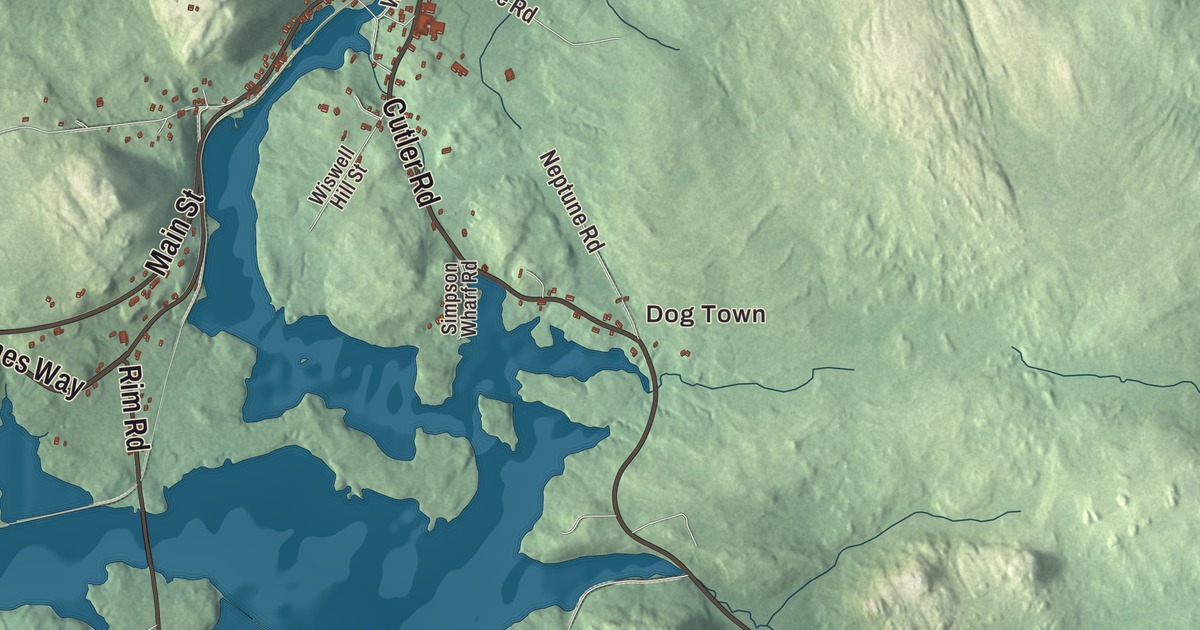
Main Street, Cutler Road and Rim Road are the first names to find on this map of East Machias, Maine. Holmes Way, Jacksonville Road and Hadley Lake Road fill in the rest, with Dog Town, Jacksonville and Hadley Lake. Click here to purchase a print of this map for your wall.
East Machias is a town in Washington County, with 1,326 people at the 2020 census.
KNOWOL made this map in 2026 from public survey data and gave it the look of an old atlas. The Census Bureau measures the town at 40.02 square miles, 5.21 of them water, and its files give the roads and the town line. United States Geological Survey elevation data shades the ground, and East Machias has a listed elevation of 46 feet.
Mills at the falls
East Machias was first settled in the 1760s and belonged to neighboring Machias until it became its own town in 1826. Its main village grew up beside a falls on the East Machias River, where several mills were built, and in the 19th century it was a center of lumbering and shipbuilding. The river runs 35.8 miles from Crawford Lake to the head of Machias Bay, and its mouth is on the line between East Machias and Machiasport.
The houses, churches and school of those years now make up the East Machias Historic District, 63 acres along the east bank of the river between the Route 1 bridge and the Willow Street bridge, reaching inland to Water Street and Cutler Road. Its houses date from about 1760 to 1880. The district takes in the original Washington Academy building of 1823, the First Congregational Church of 1836, the former Church of the Disciples of Christ of 1880, now an academy building, and the remains of four mills. On Main Street, the James R. Talbot House was built in 1874 for one of the area’s leading lumber manufacturers and shipbuilders. Portland architect James A. Tenney designed it in the Second Empire style, with a mansard roof, and its page calls it one of the finest examples of that style in eastern Washington County.
Washington Academy
Washington Academy was founded in 1792. Its first classes met in Machias, at the Burnham Tavern and the Masonic Hall, and after the nearby towns talked it over, its first building opened in East Machias on September 8, 1823. Today it’s a private high school of 438 day and boarding students, with students from more than 20 nearby communities and, in 2017, 96 from 24 countries. Its students have included Samuel Harris, born in East Machias in 1814, who became president of Bowdoin College and later taught at Yale, and Austin Cary, born here in 1865, who became known as the “father of southern forestry.” Martha Seavey Hoyt, born in East Machias in 1844, went on to work as a biographer, newspaper correspondent and businesswoman, and Anna L. Alline, also born here, became a nurse and a teacher of nurses.
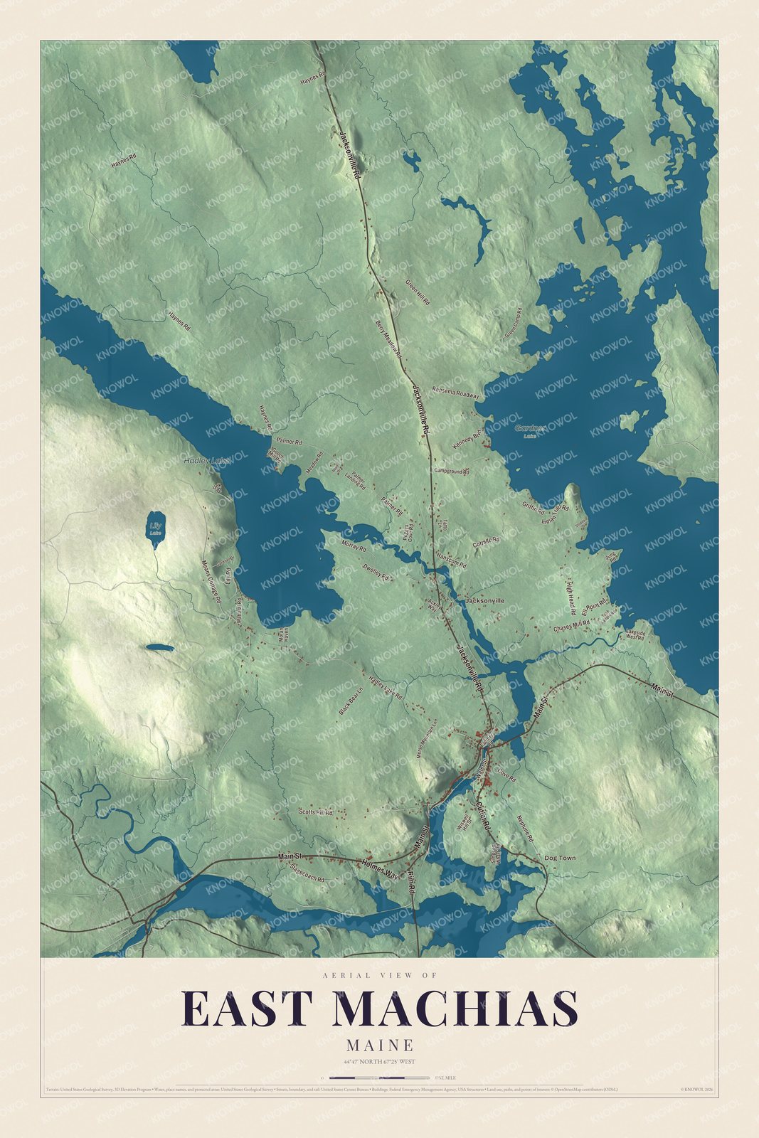
Click to explore a larger preview. The digital watermark does not appear on printed maps.
Names on this map
These names are printed on this map.
Places: Machias.
Streets and roads: Haynes Rd and Main St.
See it on a wall
The East Machias map as a framed print. Swipe for more.


The Rim
South of the village, the East Machias River bends sharply east and then south to meet the Machias River, and the neck of land in that bend is known locally as The Rim. It looks down the Machias River toward the bay. Machias saw one of the first naval encounters of the Revolutionary War in 1775, when a British Navy sloop was captured, and afterward the townspeople fortified The Rim. A breastwork there turned back an attempted British landing that summer, and in 1776 they built Fort Foster, a larger earthwork with a watch house and barracks, and laid a log boom across the river. The British returned in force in August 1777, in the second Battle of Machias, and landed on The Rim after the fort had been abandoned. The site was cleared for blueberries in the 1920s, when earthworks up to 6 feet high could still be seen, and it’s listed on the National Register.
Around town
Main Street, Cutler Road and Rim Road are printed on the map, along with Holmes Way, Jacksonville Road and Hadley Lake Road. Dog Town and Jacksonville are printed too, and Hadley Lake is labeled on the map. The side roads are drawn in as well. Rim Road shares its name with The Rim, and Cutler Road is also Route 191.
This East Machias map makes a fine addition to an office, library or den, and it can help teach children the geography and history of the area. It’s made for everyone who calls East Machias home, from Main Street to Hadley Lake, as it looks today. Zoom in on the preview above to explore the details, then click here to get your copy of the East Machias, Maine map.

Sources
- East Machias, Maine, Wikipedia
- East Machias Historic District, Wikipedia
- East Machias River, Wikipedia
- James R. Talbot House, Wikipedia
- Washington Academy (Maine), Wikipedia
- Samuel Harris (theologian), Wikipedia
- Austin Cary, Wikipedia
- Martha Seavey Hoyt, Wikipedia
- Anna L. Alline, Wikipedia
- Fort Foster (Washington County, Maine), Wikipedia