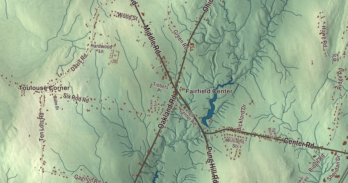
If you know Fairfield, you’ll go straight to Main Street on this map of Fairfield, Maine, and then out to Fairfield Center and Hinckley. Oakland Road, Middle Road, Norridgewock Road and Pung Hill Road are here, along with North Fairfield, Larone, Hoxies, Holway Corner, Nyes Corner and Fish Brook. Click here to purchase a print of this map for your wall.
Fairfield is a town in Somerset County, with 6,484 people at the 2020 census.
KNOWOL made this map in 2026 from public survey data and gave it the look of an old atlas. The Census Bureau measures the town at 54.58 square miles, 0.83 of them water, and its files give the streets and the town line. United States Geological Survey elevation data shades the ground, which has a listed elevation of 223 feet.
A fair aspect
This was the country of the Canibas, an Abenaki people whose village of Taconnet stood downriver where the Sebasticook meets the Kennebec. Fairfield Plantation, named for its fair aspect, was first settled in 1774, and in 1775 Benedict Arnold’s troops rested and took on supplies here on their march up the Kennebec toward Quebec; a stone marker at the north end of Main Street, where it joins Route 201, recalls the camp. After the Revolution the plantation grew hay, grain and potatoes and was known for the number and quality of its cattle. It was incorporated as Fairfield on June 18, 1788, and had 492 people by 1790.
The Kennebec drops 34 feet at Fairfield, and the falls powered a mill town. There were eight sawmills, planing mills, a gristmill, a corn cannery, carriage and sled factories, door and sash shops, a coffin factory, a marble works and a tannery, and the largest of all were the textile mills, Kendall’s Mills and Somerset Mills. Kendall’s Mills was an early name for the village itself. For about 75 years the village ran its own corporation for police, fire and public works, while the outlying areas of Shawmut, Fairfield Center and Hinckley paid no taxes for services they didn’t get, an arrangement that ended in 1929.
Main Street
At 151 to 157 Main Street, the Gerald Hotel of 1899 and 1900 rises four stories over its neighbors, a brick and terracotta Renaissance Revival building designed by William R. Miller for Amos F. Gerald. The town page calls Gerald the builder of the first electric trolley system in Maine, and the hotel’s page credits him with the state’s first electrical power station, in Fairfield. The hotel was topped with a statue of Mercury, the Roman god of speed, and took guests until 1937; it was rehabilitated in 2015 as apartments for seniors. Miller also designed the Lawrence Library, dedicated on July 25, 1901, and Lawrence High School. Near the town center, at 42 High Street, the Queen Anne house that icebox maker Joseph Cotton built in 1890 is now the Fairfield History House, the historical society’s museum.
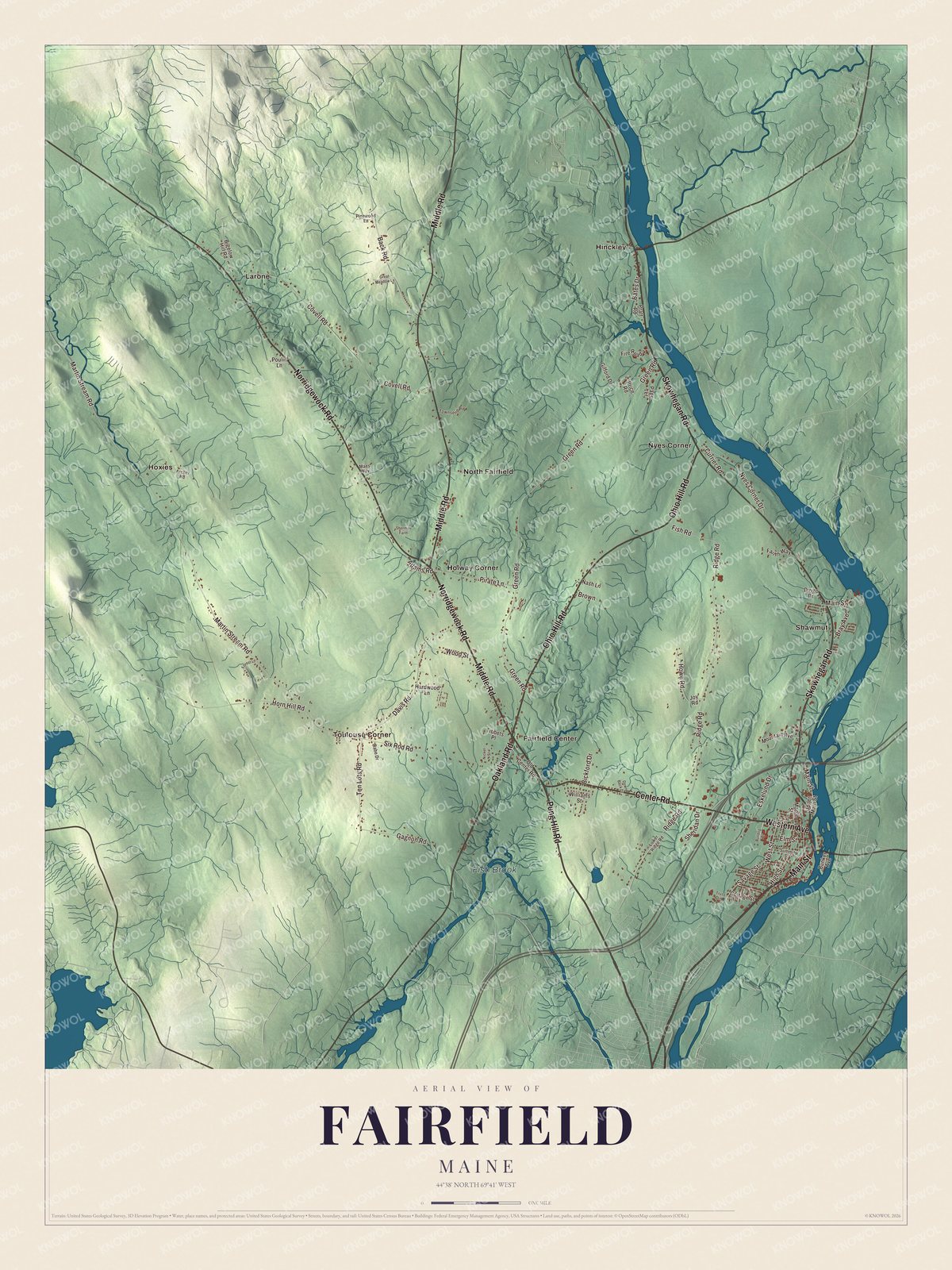
Click to explore a larger preview. The digital watermark does not appear on printed maps.
See it on a wall
The Fairfield map as a framed print. Swipe for more.


Good Will-Hinckley
In 1889 the Reverend George W. Hinckley opened the Good Will Home on a 125-acre farm in the northeast corner of Fairfield, a home and school for children in need. By the time he died in 1950, the campus had grown to 3,000 acres and 45 buildings, and it had served more than 3,000 young people. Its historic core on Route 201, on both sides of Martin Stream, was listed on the National Register of Historic Places in 1987. The campus is home to the Maine Academy of Natural Sciences and the L. C. Bates Museum, which its page counts among the oldest natural history museums in Maine. The museum fills a 1903 Romanesque Revival school building with 32 Maine habitat dioramas whose backgrounds were painted in the 1920s by the Impressionist Charles Daniel Hubbard, and its arboretum, Sun Set Park, was partly designed by the Olmsted Brothers. Out at Fairfield Center, where the Ten Lots neighborhood was settled in 1774, the Asa Bates Memorial Chapel was begun in 1916 and finished two years later by Milton LaForest Williams, who grew up there with his grandfather Asa Bates and gave the brick temple-fronted chapel to the community as a church and meeting hall.
Fairfield’s own
Frank Bunker Gilbreth Sr. was born in Fairfield in 1868 and became a pioneer of time and motion study, and he is the subject of the biographical novel Cheaper by the Dozen. Charles A. Coffin, born in Fairfield, was a cofounder and the first president of General Electric. Ethel Atwood, born here in 1870, spent her first 15 years in Fairfield before moving to Boston, where she and Caroline B. Nichols founded the Fadette Ladies’ Orchestra. Today Fairfield makes wood and paper products, is home to Kennebec Valley Community College, and is largely a bedroom community for Waterville, its neighbor to the south.
Around Fairfield
Main Street is printed on the map, and so are Pung Hill Road, Oakland Road, Middle Road, Ohio Hill Road and Norridgewock Road. Fairfield Center and Hinckley are printed, along with Holway Corner, Hoxies, Larone, North Fairfield and Nyes Corner, and Fish Brook is labeled on the map. Larone, like Fairfield Center, is one of the outlying areas without a post office of its own. The town’s other streets are drawn in as well.
This Fairfield map makes a fine addition to an office, library or den, and it can help teach children the geography and history of the area. It’s made for everyone who calls Fairfield home, from Hinckley to Fairfield Center, as it looks today. Zoom in on the preview above to explore the details, then click here to get your copy of the Fairfield, Maine map.

Sources