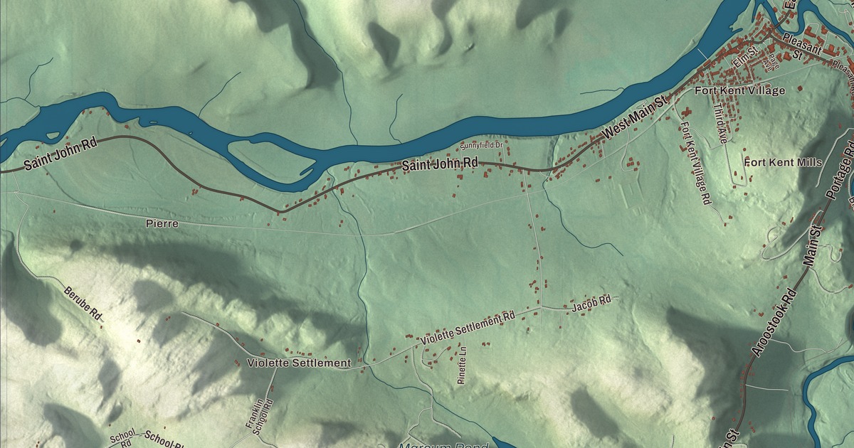
Main Street in Fort Kent is the starting place for the Can-Am sled dog races and the northern end of a much longer road journey. On this map, West Main Street and East Main Street are printed too, along with Caribou Road and Aroostook Road. Click here to purchase a print of this map for your wall.
Fort Kent is a town in Aroostook County, where the Fish River meets the Saint John River at the Canadian border.
The buildings, settlements, ponds and roads appear together within Fort Kent’s town boundary. KNOWOL made this map in 2026 from public survey data and gave it the look of an old atlas. United States Geological Survey elevation data shades the terrain, and Census Bureau files supply the roads and town line. The 2020 census counted 4,067 people in town.
The blockhouse and the town
The border outpost that gave Fort Kent its name was established during the boundary dispute between Maine and New Brunswick in the late 1830s. It was named for Maine governor Edward Kent. The town itself was incorporated in 1869, decades after the fort was built.
The surviving blockhouse stands just west of the Fish River’s mouth. Its cedar walls support an upper floor that projects beyond the lower one, beneath a pyramidal roof. The site is preserved as Fort Kent State Historic Site and was designated a National Historic Landmark in 1973. The border dispute was settled by the Webster-Ashburton Treaty in 1842.
The Saint John later carried logs from upstream forests to mills downriver. Railroads and trucks eventually took over much of that transport. Potato growing, forestry and textiles are other parts of Fort Kent’s economic history.
At the end of Route 1
U.S. Route 1 reaches its northern end in Fort Kent, near the bridge to Clair, New Brunswick. Its other end is in Key West, Florida. Fort Kent is also the ending point of the Northern Forest Canoe Trail, another connection between this border town and a larger journey.
French is part of life on both sides of the Saint John Valley. Fort Kent’s town history describes the local variety as Valley French or Brayon and notes the town’s cultural and economic ties with Clair and Saint-Francois-de-Madawaska across the river. The University of Maine at Fort Kent has its campus here as well.
Winter races
The Can-Am Crown sled dog race began in 1993 with teams from Maine, Ontario, Quebec and New Brunswick. The races start on Main Street, pass beneath the international bridge and head into the western wilderness before returning to Fort Kent. The town has also hosted World Cup biathlon events, including races in 2004 and 2011.
Summer has its own gatherings. The Ploye Festival celebrates the buckwheat pancake of the region, and the International Muskie Fishing Derby began in 2003. These are different parts of the town’s calendar, alongside its schools, university and border traffic.
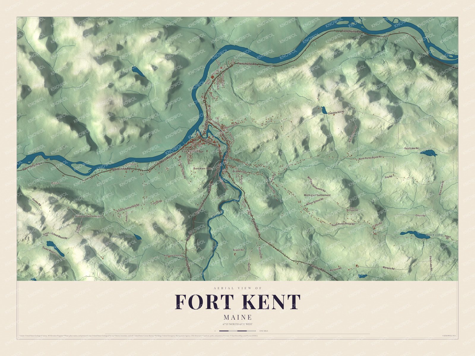
Click to explore a larger preview. The digital watermark does not appear on printed maps.
See it on a wall
The Fort Kent map as a framed print. Swipe for more.


Settlements beyond the village
Pierre and Violette Settlement are printed on the map, together with Fort Kent Mills, Bradburys, Michigan Settlement and Fort Kent Village. Black Lake and Marcum Pond have their own printed names. The artwork brings those places into the same aerial view as the town’s buildings and smaller roads.
Find Caribou Road, Aroostook Road, West Main Street, Main Street, Frenchville Road and East Main Street. Fort Kent borders Frenchville to the east, Wallagrass and New Canada to the south, and St. John Plantation to the west. The Saint John River forms the northern town line and the international boundary.
For those who call Fort Kent home, this map keeps the village and the outlying settlements together as it looks today. It can hang in an office, library or den and help teach children the geography and history of the Saint John Valley. Zoom in on the preview above to explore the details, then click here to get your copy of the Fort Kent, Maine map.

Sources